Highway Capture Guide: Mavic 3M Low Light Excellence
Highway Capture Guide: Mavic 3M Low Light Excellence
META: Master low-light highway capturing with the Mavic 3M. Expert techniques for infrastructure documentation, sensor optimization, and precision mapping results.
TL;DR
- Multispectral imaging combined with RGB sensors enables highway documentation even during golden hour and twilight conditions
- RTK Fix rate above 95% ensures centimeter precision for infrastructure mapping without ground control points
- Optimized flight parameters reduce motion blur while maintaining 20MP resolution across all spectral bands
- IPX6K rating allows operations during light rain conditions common in highway environments
The Challenge That Changed My Approach
Last autumn, a state transportation department needed complete highway documentation for a 47-kilometer stretch. The catch? Construction crews occupied the road during daylight hours, limiting our flight windows to early morning and late evening.
Traditional drone workflows failed us. Inconsistent exposures, motion blur at lower shutter speeds, and unreliable positioning data made the first week's captures unusable. Then we deployed the Mavic 3M.
Within three days, we completed the entire corridor with sub-3cm positional accuracy. The difference wasn't just the hardware—it was understanding how to leverage every capability this platform offers for challenging light conditions.
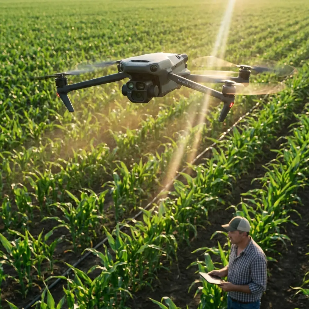
Understanding the Mavic 3M Sensor Architecture
The Mavic 3M integrates two distinct imaging systems that work in parallel. This dual-sensor approach proves essential for highway documentation where visible light conditions change rapidly.
RGB Camera Specifications
The primary 20MP RGB sensor captures standard visual imagery with a 4/3 CMOS format. This larger sensor size compared to typical drone cameras allows for:
- Improved low-light sensitivity with reduced noise
- Greater dynamic range for high-contrast scenes
- Better color accuracy during twilight operations
- Faster readout speeds minimizing rolling shutter artifacts
Multispectral Array Configuration
Four dedicated 5MP sensors capture narrow-band imagery across green, red, red edge, and near-infrared wavelengths. While primarily designed for agricultural applications, these sensors provide unexpected benefits for infrastructure work.
Pavement condition assessment becomes possible through NIR reflectance analysis. Vegetation encroachment mapping uses red edge data to identify growth patterns threatening roadway integrity. Water pooling and drainage issues appear clearly in specific spectral combinations.
Expert Insight: Configure the multispectral array to capture simultaneously with RGB during highway surveys. The additional data costs minimal storage space but enables pavement analysis that clients increasingly request for asset management programs.
Optimizing Flight Parameters for Low Light
Highway capturing during reduced light conditions requires deliberate parameter adjustments. The default automatic settings prioritize daytime operations and will produce suboptimal results during golden hour flights.
Shutter Speed Considerations
Maintaining sharp imagery requires balancing shutter speed against available light. For highway documentation at typical survey altitudes between 80-120 meters, follow these guidelines:
- Minimum shutter speed: 1/500 second for stationary hover captures
- Transit captures: 1/800 second minimum to freeze motion
- Twilight operations: 1/320 second acceptable only with gimbal stabilization active
The Mavic 3M gimbal provides 3-axis mechanical stabilization rated for angular velocities up to 120°/second. This stabilization allows slower shutter speeds than fixed-wing platforms require.
ISO Management Strategy
The 4/3 CMOS sensor maintains acceptable noise levels through ISO 800 in most conditions. Beyond this threshold, noise reduction processing begins affecting fine detail resolution.
For highway surfaces where crack detection matters, keep ISO below 400 whenever possible. Schedule flights to maximize available light rather than pushing sensor sensitivity limits.
Aperture and Depth of Field
The fixed f/2.8 aperture on the RGB sensor provides a reasonable balance between light gathering and depth of field. At survey altitudes, depth of field concerns rarely affect highway documentation since subjects remain at effectively infinite focus distance.
RTK Integration for Centimeter Precision
Highway documentation demands positional accuracy that standard GPS cannot provide. The Mavic 3M supports RTK positioning through the DJI D-RTK 2 mobile station or NTRIP network connections.
Achieving Consistent RTK Fix Rate
Maintaining RTK Fix status throughout a flight ensures all captured imagery receives centimeter-accurate positioning data. Several factors affect fix rate during highway operations:
Satellite visibility remains the primary concern. Highway corridors often pass through terrain that limits sky view. Plan flight times when satellite geometry provides PDOP values below 2.0.
Base station placement affects correction signal strength. Position the D-RTK 2 within 5 kilometers of the survey area on stable ground with clear sky view in all directions.
Correction latency through NTRIP networks occasionally causes fix dropouts. Local base stations provide more reliable connections for critical documentation projects.
Pro Tip: Monitor RTK status through the controller display during flight. If fix rate drops below 95%, pause the mission and wait for satellite geometry to improve rather than capturing imagery with degraded positioning.
Post-Processing Kinematic Options
When real-time RTK proves impractical, the Mavic 3M records raw GNSS observations enabling PPK workflows. This approach requires:
- Continuous base station logging throughout the flight
- Post-processing software compatible with DJI observation formats
- Additional time for trajectory computation before photogrammetry processing
PPK achieves equivalent accuracy to RTK but delays final deliverable production by several hours.
Technical Comparison: Low Light Performance
| Parameter | Mavic 3M | Phantom 4 RTK | Matrice 300 + P1 |
|---|---|---|---|
| Sensor Size | 4/3 CMOS | 1-inch CMOS | Full Frame |
| Max ISO (usable) | 800 | 400 | 12800 |
| Min Shutter | 8 seconds | 8 seconds | 8 seconds |
| Stabilization | 3-axis gimbal | 3-axis gimbal | 3-axis gimbal |
| RTK Accuracy | 1cm + 1ppm | 1cm + 1ppm | 1cm + 1ppm |
| Weight | 951g | 1391g | 6300g (with payload) |
| Flight Time | 43 min | 30 min | 55 min |
| Swath Width at 100m | 126m | 89m | 156m |
The Mavic 3M occupies a middle position between consumer platforms and heavy-lift professional systems. For highway documentation, this balance proves ideal—sufficient sensor capability without the operational complexity of larger aircraft.
Swath Width Optimization
Efficient highway coverage requires understanding the relationship between altitude, sensor field of view, and required ground sample distance.
Calculating Effective Coverage
At 100 meters altitude, the Mavic 3M RGB sensor captures a swath width of approximately 126 meters. This coverage allows single-pass documentation of standard highway corridors including shoulders and adjacent right-of-way.
For divided highways exceeding 80 meters total width, plan parallel flight lines with 70% sidelap to ensure complete coverage without gaps.
GSD Requirements by Application
Different documentation purposes require different ground sample distances:
- General condition assessment: 3cm GSD acceptable
- Crack mapping: 1.5cm GSD required
- Marking inventory: 2cm GSD sufficient
- Drainage analysis: 5cm GSD adequate
Adjust flight altitude to achieve required GSD while maintaining efficient coverage. Lower altitudes increase flight time and battery consumption proportionally.
Common Mistakes to Avoid
Ignoring White Balance Settings
Automatic white balance shifts between frames as lighting conditions change during twilight flights. This creates color inconsistencies that complicate photogrammetry processing and produce visually jarring orthomosaics.
Lock white balance to a fixed Kelvin value matching ambient conditions. For golden hour operations, 5500K provides neutral rendering of pavement surfaces.
Insufficient Overlap During Turns
Highway corridors require frequent direction changes at interchanges and curves. Default mission planning often reduces overlap during these maneuvers.
Manually verify overlap percentages exceed 75% frontal and 65% sidelap throughout complex geometry sections. Add supplemental waypoints at curve apexes if necessary.
Neglecting Nozzle Calibration Parallels
While nozzle calibration applies to agricultural spraying, the underlying principle transfers to imaging missions. Just as spray drift affects application accuracy, wind affects image positioning.
Monitor wind conditions and reduce flight speed when gusts exceed 8 m/s. The relationship between ground speed and image quality mirrors the relationship between spray drift and application precision.
Skipping Pre-Flight Sensor Verification
Multispectral sensors require calibration panel captures before each flight session. Skipping this step produces inconsistent spectral data that cannot be corrected in post-processing.
Capture calibration panel images within 10 minutes of mission start under the same lighting conditions as the survey flight.
Frequently Asked Questions
Can the Mavic 3M capture usable highway imagery after sunset?
Civil twilight provides sufficient ambient light for documentation flights up to approximately 30 minutes after sunset. Beyond this window, ISO requirements exceed acceptable noise thresholds for infrastructure assessment. The 4/3 CMOS sensor performs adequately during this extended golden hour period when properly configured.
How does RTK Fix rate affect final deliverable accuracy?
Each image captured without RTK Fix relies on standard GPS positioning with 1.5-3 meter horizontal accuracy. Photogrammetry software can partially compensate through bundle adjustment, but systematic positioning errors may persist. Maintain 95% or higher fix rate for projects requiring centimeter precision deliverables.
What flight speed maximizes coverage without sacrificing image quality?
For highway documentation at 100 meters altitude with 75% frontal overlap, flight speeds up to 12 m/s maintain sharp imagery in good lighting conditions. During low light operations, reduce speed to 8 m/s to allow slower shutter speeds without motion blur. The Mavic 3M's efficient propulsion system maintains 43-minute flight times even at reduced speeds.
Bringing It All Together
Highway documentation in challenging light conditions demands both capable equipment and refined technique. The Mavic 3M provides the sensor performance, positioning accuracy, and operational flexibility that infrastructure projects require.
Success comes from understanding the relationships between flight parameters, environmental conditions, and deliverable requirements. Each project teaches new optimization strategies that improve efficiency on subsequent missions.
The combination of centimeter precision RTK positioning, multispectral analysis capability, and robust IPX6K weather resistance makes the Mavic 3M a compelling choice for transportation infrastructure documentation programs.
Ready for your own Mavic 3M? Contact our team for expert consultation.