Mavic 3M in the Mountains: A Technical Review for Power
Mavic 3M in the Mountains: A Technical Review for Power Line Capture, Terrain Search, and Smarter Field Data
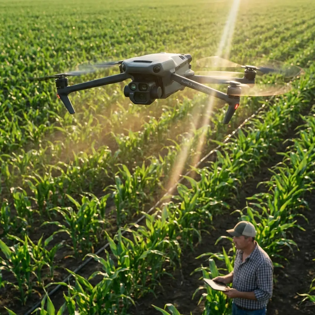
META: A field-focused technical review of the Mavic 3M for mountain power line capture, with practical insight on antenna placement, multispectral relevance, thermal search context, and terrain-driven data quality.
When operators talk about using the Mavic 3M in mountain environments, the conversation usually drifts toward endurance, link stability, and whether RTK can hold through broken terrain. Those are valid concerns. But for teams tasked with capturing power lines across steep slopes and irregular vegetation, the real question is broader: how do you maintain useful, decision-grade data when the landscape keeps working against you?
That is where the Mavic 3M becomes more interesting than a simple “mapping drone” label suggests.
I approach this as a consultant, not as someone reciting a spec sheet. In mountain corridors, aircraft capability matters only when it translates into cleaner line-of-sight management, more reliable positional consistency, and imagery that can still reveal what conventional visual inspection may miss. The Mavic 3M sits in a category where those operational layers start to overlap.
Why mountain power line capture is harder than most teams expect
Power line work in mountains is not just about elevation gain. It is about compounded signal and geometry problems.
The pilot may have a clear takeoff point but poor visibility into the next ridge. A transmission corridor may cut through mixed ground cover, rock, scrub, and cultivated land, creating exposure differences in captured imagery. Wind curls off the slope, changing groundspeed and forcing more manual attention than a flatland mission. Even when the route looks straightforward on a planning screen, the terrain can break radio consistency and reduce the margin for a smooth mapping run.
That is why antenna positioning advice is not a minor footnote. It is central.
For maximum range in mountain work, the operator should not point the antenna tips directly at the aircraft. The flatter face of the antenna pattern needs to be oriented toward the drone’s likely flight sector. In practical terms, if you are standing on a slope launching along a power corridor, adjust your body position and controller angle so the strongest part of the transmission pattern is presented to the aircraft as it moves across and away, rather than assuming “pointing at it” is enough. In mountains, even a good link can degrade quickly once the aircraft drops behind uneven terrain. The best habit is to set up where you preserve line of sight not only at launch, but through the first major terrain transition.
I have seen teams blame aircraft range when the actual problem was operator geometry.
The Mavic 3M’s real advantage: data layers, not just flight convenience
The Mavic 3M draws attention because of its multispectral orientation, and that matters here even for readers focused on power line capture rather than agriculture. The strongest clue comes from hyperspectral and soil sensing research: some ground features that cannot be reliably distinguished through conventional remote sensing become identifiable once you analyze their spectral response more deeply. That principle is operationally significant.
One of the source documents makes this explicit. It notes that objects not distinguishable in conventional remote sensing can be effectively identified in hyperspectral curves, which increases the information available for inversion and interpretation. It also points to a specific soil reflectance behavior: absorption peaks in the 550 to 700 nm range are mainly associated with organic matter. That may sound academic, but it has immediate field relevance.
Why should a mountain utility or infrastructure team care?
Because corridor capture is not only about the wires and towers. Vegetation encroachment, erosion signatures, unstable slope zones, access path condition, and land-use changes around the line are all part of the maintenance picture. A platform with spectral intelligence changes what can be noticed before a problem becomes visible to the naked eye. If a corridor crosses cultivated land, reclaimed slope, or disturbed soil, spectral response can reveal differences in surface condition that ordinary RGB imagery may flatten into a single visual texture.
The source document also highlights a second operational truth: soil spectral models are not universal. Different soils behave differently because of climate, parent material, terrain, biology, age of formation, and human activity. That is critical in mountain work. If your power line route spans valley floor, exposed hillside, and managed agricultural terraces, the same interpretation model should not be blindly applied across the entire corridor. The Mavic 3M is most valuable when the operator respects local variability and calibrates workflow to terrain class rather than treating the mountain as one continuous surface.
That is the difference between collecting imagery and extracting decisions.
What this means for power line capture specifically
For readers searching “Mavic 3M power line inspection in mountain” or similar terms, there is an obvious objection: the Mavic 3M is not primarily a dedicated thermal inspection aircraft. True. But that misses the wider value proposition.
Mountain power line missions often split into three practical objectives:
- Document the physical corridor accurately
- Track vegetation and surface condition trends near the line
- Support targeted follow-up inspection where anomalies are suspected
The Mavic 3M is strongest in the first two tasks. Its role is to produce repeatable corridor data with enough positional discipline and spectral richness to flag where closer inspection is needed. If your workflow already includes another payload type for thermal or close visual diagnosis, the Mavic 3M can serve as the early-stage intelligence platform that narrows where those more specialized flights should go.
That layered workflow is backed indirectly by another reference in the material: a volunteer search team recently adopted a thermal imaging drone to detect heat signatures and improve efforts to find missing dogs. Strip away the emotional context and the technical lesson is straightforward. Thermal data excels when the task depends on detecting heat contrast that a standard visual view cannot reliably surface. In civilian field operations, the best teams do not argue about which sensing mode is universally best. They select the sensing mode that matches the target signature.
For power lines in mountains, that means multispectral data and structured mapping for corridor intelligence; thermal as a separate tool when heat anomalies are the target. Understanding that division prevents poor procurement decisions and weak mission design.
RTK fix rate and centimeter precision matter more in mountains
The Mavic 3M becomes significantly more credible for corridor work when the operator cares about RTK behavior, not just image overlap.
Mountain routes punish sloppy georeferencing. If you are comparing vegetation growth over time, measuring offset from a structure, or rebuilding a corridor model after seasonal change, centimeter precision is not marketing language. It determines whether your “change” is real or just positional drift.
This is where RTK fix rate deserves operator attention. Teams often obsess over battery cycles and overlook GNSS environment. In steep valleys, partial sky obstruction can reduce consistency. A route planned too close to a rock wall or beneath uneven canopy may degrade the solution long before the operator notices obvious flight issues. The operational answer is not complicated, but it does require discipline:
- Start from a launch site with the widest possible sky view.
- Confirm stable RTK behavior before pushing into the corridor.
- Avoid assuming the aircraft will maintain the same fix quality as it transitions from open ridge to constricted saddle.
- Break long corridors into terrain-appropriate segments if necessary.
If a power line crosses alternating open and enclosed terrain, segmented mission planning often produces cleaner outputs than one long “efficient” mission that quietly accumulates positioning inconsistency.
Swath width is useful, but only if you respect terrain relief
A wide swath width can make a mapping platform feel productive. In mountain environments, though, swath width is only truly productive when your effective ground sample and overlap remain consistent across relief changes. On a steep slope, the same nominal flight height does not produce the same capture geometry relative to the surface. That affects detail quality near towers, poles, access roads, and vegetation edges.
With the Mavic 3M, the smarter approach is not to chase maximum area per flight. It is to match mission altitude and overlap to the steepest terrain section that matters operationally. If the reader’s goal is “capturing power lines in mountain,” then the useful dataset is the one that preserves interpretability at the difficult points, not the one that covers the largest map block.
This matters even more if the downstream objective includes vegetation trend analysis. Spectral response becomes less useful when terrain-induced inconsistency introduces noisy comparison conditions.
Multispectral value extends beyond agriculture keywords
Many people encounter the Mavic 3M through agriculture discussions, often linked with spray drift, nozzle calibration, and crop management terms. Those are valid adjacent search themes, but they can obscure the platform’s wider role. The underlying advantage is not limited to farms. It is the ability to capture more than appearance.
That source material on soil organic matter estimation points out that organic matter is a key indicator of soil fertility, and that hyperspectral remote sensing can support management decisions by revealing the state of the soil. Transfer that logic to mountain utility corridors and the message is clear: richer spectral information helps reveal environmental conditions that affect maintenance planning, stability, and access strategy. The exact interpretation model will vary, especially because different soils and terrain histories produce different physical and chemical characteristics, but the operational upside remains.
In other words, the Mavic 3M is not merely flying over the corridor. It is helping characterize the corridor.
Field workflow: how I’d deploy it on a mountain line
If I were structuring a Mavic 3M mission for a mountain power route, I would keep the workflow disciplined:
- Establish a launch point with strong sky view and preserved line of sight into the first terrain break.
- Orient controller antennas for the aircraft’s projected path, not just its current position.
- Use RTK only after confirming stable initialization conditions.
- Divide the route by terrain behavior rather than by arbitrary distance.
- Capture repeated sections where slope, vegetation density, or access condition make interpretation critical.
- Tag areas that may justify thermal or close visual follow-up by another aircraft or another mission profile.
This is also where a practical support link can save time in planning unusual terrain jobs. If you need a second opinion on controller setup, route segmentation, or antenna orientation for mountain range work, send the mission outline here: message Marcus directly.
A note on community knowledge and operator maturity
One of the lesser-discussed source references describes a drone club model built around bringing together people with shared interests, then organizing recurring activities such as group events and DIY sessions. Taken literally, that is a promotional concept. But there is a more useful lesson for professional operators: community accelerates field competence.
Mountain drone work improves fast when pilots compare real antenna positioning experiences, terrain-specific mission plans, and post-processing outcomes. This is especially true with platforms like the Mavic 3M, where success depends not just on flying ability but on interpreting data quality across different surface types. A technically mature operator community reduces trial-and-error and helps teams avoid applying flatland assumptions to mountain corridors.
That may be the most underrated part of Mavic 3M adoption. The aircraft is capable, but the real performance gap often comes from the operator network around it.
Final assessment
For mountain power line capture, the Mavic 3M is at its best when treated as a corridor intelligence platform rather than a one-aircraft answer to every inspection problem. Its value grows when the operator understands three things.
First, mountainous terrain is a link-management problem as much as a flight problem, which makes antenna orientation and launch geometry directly relevant to mission success.
Second, spectral data matters because some surface conditions cannot be cleanly separated by conventional imagery alone. The reference point about 550–700 nm absorption linked to soil organic matter is not just a laboratory detail; it illustrates why richer sensing can expose operationally useful variation along a corridor.
Third, precision and consistency matter more than advertised coverage. In steep terrain, RTK fix rate, segmented mission planning, and realistic swath management are what turn an airborne survey into a dependable maintenance dataset.
That is the lens I would use to evaluate the Mavic 3M for this scenario. Not as a trendy platform. As a tool whose strengths show up when the mountain starts making simple jobs difficult.
Ready for your own Mavic 3M? Contact our team for expert consultation.