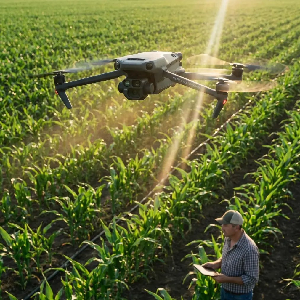
Mavic 3M Mapping in Dusty Construction Conditions
Mavic 3M Mapping in Dusty Construction Conditions: What a 500-Drone Night Show Teaches About Field Discipline
META: Practical Mavic 3M guide for dusty construction mapping, using recent UAV operations news to explain workflow discipline, battery handling, RTK reliability, multispectral data quality, and flight prep.
By Dr. Sarah Chen
A good map is usually mistaken for an easy flight.
That misunderstanding shows up everywhere in UAV work, especially on construction sites where dust, glare, moving equipment, and schedule pressure push crews to cut corners. The latest reporting out of Chongqing offers a useful correction. One recent feature followed a drone light-show team in Shapingba and revealed something most operators already know but too few workflows reflect: a short aerial performance can rest on a surprisingly long chain of preparation. In that case, a 15-minute nightly show involved more than 40 process steps, over 7 hours of preparation, and a fleet of 500 drones.
At first glance, that sounds far removed from a Mavic 3M flying a dusty construction corridor. It is not. The operational lesson is almost identical.
When a professional team puts 500 aircraft into the night sky, the public sees spectacle. The operators see sequencing, calibration, battery staging, airspace discipline, contingency logic, and failure isolation. Construction mapping with the Mavic 3M works the same way, just on a smaller stage and with different sensors. The flight itself is the visible endpoint. Data quality is decided much earlier.
For readers using the Mavic 3M to map construction sites in dusty environments, this matters because poor results are rarely caused by a single dramatic mistake. More often, they come from a stack of small compromises: a hurried lens check, weak RTK initialization, an inconsistent battery temperature profile, or a mission launched after site dust has already thickened in the air. If you want centimeter precision and reliable multispectral consistency, the discipline behind the operation matters as much as the aircraft.
Why this Chongqing drone story matters to Mavic 3M operators
The Shapingba report highlighted two details worth paying attention to. First, each show reportedly required more than 40 steps. Second, a performance lasting only 15 minutes depended on over 7 hours of preparation. Those numbers are operationally significant because they expose a principle many site teams still resist: airborne time is not the true unit of work. Preparation time is.
That principle becomes even more relevant when you are using a Mavic 3M on an active construction site. Unlike a recreational flight, mapping is not just about getting the aircraft up and back safely. You are trying to produce repeatable, defensible spatial data. In dusty conditions, repeatability becomes fragile. Dust changes surface appearance, reduces local contrast, contaminates optics, and can undermine confidence in edge definition around stockpiles, trench lines, haul roads, and temporary structures. If your workflow is loose, the map may still process, but its value to engineering or site management drops fast.
There is also a second news item that reinforces this point from a broader industry angle. Recent reporting on Shaanxi’s push to build out future-industry chains, including drones, photonics, and semiconductors, signals where the Chinese UAV sector is heading: deeper technical integration, not just more aircraft in the air. That matters for Mavic 3M users because multispectral mapping sits right at that intersection. It depends on optical quality, sensor reliability, positioning integrity, and disciplined field method. In other words, the future of drone work is less about flying more and more about measuring better.
Step 1: Treat mission design as the real beginning of mapping
Dusty construction mapping begins before propellers move.
The first decision is timing. If earthworks are active, avoid launch windows immediately after heavy truck movement, grading, or material dumping. Airborne particulates can reduce image clarity in ways that are subtle in the live feed but costly in the dataset. In multispectral work, even a thin haze layer or fine dust on the optics can distort consistency between passes.
My standard field rule is simple: if I can see dust trails hanging behind site traffic for more than a few seconds, I delay the mapping run unless there is a compelling operational reason not to. Waiting 20 minutes often saves hours in rework.
The second decision is route structure. Swath width is not just a coverage metric; it is a quality-control variable. On dusty sites, operators sometimes fly wider and faster to minimize exposure time. That can work for rough progress snapshots, but not when the goal is dependable surface interpretation or consistent orthomosaic quality. Narrowing the effective swath strategy through altitude and overlap choices often gives cleaner reconstruction around disturbed surfaces, exposed aggregates, and irregular cut-fill boundaries.
The Mavic 3M is especially effective when you build the mission around the final decision the map needs to support. Are you documenting drainage changes? Monitoring disturbed soil? Comparing vegetation stress along site perimeters? Verifying grading progress? Each objective may justify different overlap, timing, and revisit cadence.
Step 2: Protect multispectral integrity before you chase speed
The Mavic 3M’s value on a construction site is not limited to standard visual mapping. Its multispectral capability can be useful where site disturbance interacts with runoff control, revegetation zones, sediment barriers, or perimeter land management. But multispectral only helps if the data is consistent.
Dust is the enemy of consistency.
Before launch, inspect the payload area carefully and clean using methods appropriate for optical surfaces. Do not assume a brief wipe is enough. Fine construction dust can cling in a way that looks harmless until you compare band outputs later. If your results suddenly show unexplained variation across a repeat survey, contamination is one of the first suspects.
This is also where workflow discipline from large coordinated drone operations becomes relevant. The Chongqing team’s 40-plus process structure should be read as a model of error prevention. For Mavic 3M work, that translates into a written preflight sequence, not a memory-based one. Include sensor surface inspection, gimbal movement check, RTK status confirmation, mission parameter review, home point validation, and a final horizon scan for suspended dust.
Construction crews tend to respect process when it prevents downtime. Explain that a 3-minute inspection protects the data product that downstream teams will use for measurement, compliance review, and progress decisions. That usually gets buy-in much faster than talking about “best practices” in the abstract.
Step 3: Prioritize RTK fix rate over launch speed
Centimeter precision is one of the reasons professionals use the Mavic 3M for serious site mapping. But on active construction sites, teams often rush the positioning phase because everyone is watching the clock. That is where quality starts to slip.
A weak RTK fix rate or unstable initialization will not always announce itself dramatically. Sometimes the mission completes and the model looks acceptable at first glance. The trouble emerges later, when you try to compare it against prior surveys, tie it into site control, or extract measurements around edges and elevations. Construction clients notice these inconsistencies quickly.
Do not launch simply because satellites are visible. Launch when the positioning solution is stable enough for the job you are actually doing.
If the site has cranes, steel, containers, or partially erected structures, pay extra attention to multipath risk around the takeoff zone. A slightly better launch point can improve data confidence more than a longer flight.
This is where the broader low-altitude economy discussion in recent Chinese policy coverage becomes practical, not theoretical. As low-altitude operations move from buzzword to infrastructure, reliability becomes the dividing line between hobby-grade output and professional-grade deliverables. Strong positioning discipline is part of that shift.
Step 4: Use a battery routine built for dust, not just endurance
Here is the battery management tip I give field teams most often: in dusty construction work, avoid swapping a warm battery straight from storage into an aircraft that has been sitting exposed on a dusty pad while the previous pack cools in open air. That sequence sounds harmless. In practice, it can create two problems at once: inconsistent thermal behavior and more dust intrusion during hurried turnaround.
Instead, create a simple closed-loop battery routine.
Keep fresh packs in a clean, shaded case until just before use. Remove only the next battery in sequence. After landing, place the used battery into a separate return slot immediately rather than setting it on a tailgate, equipment box, or concrete surface. Give the aircraft a quick dust check during the swap, especially around folding joints, vent areas, and payload surfaces. Then install the new pack and confirm cell balance and temperature behavior before relaunch.
On paper, this adds a minute or two. In the field, it reduces three avoidable failures: dust transfer from site surfaces, heat-related performance inconsistency, and human error during rushed rotation. On summer projects or high-reflectance ground, that routine pays for itself quickly.
I have seen teams lose more mapping quality from chaotic battery swaps than from aggressive wind. Batteries are not just energy storage in UAV operations; they are pacing devices. They force the crew to either maintain order or reveal that there never was any.
Step 5: Build around site contamination control, not just aircraft specs
Many operators obsess over ingress ratings and forget the larger issue. An aircraft’s protection level helps, but no spec sheet eliminates bad field habits. Dusty construction mapping is won through contamination management.
That means choosing a takeoff and landing area away from active haul routes when possible. It means using a clean launch surface rather than bare soil. It means keeping propellers, lenses, controller screens, and battery contacts out of direct dust plumes during setup. If your team also runs agricultural drones, some of the mindset carries over from spray drift prevention and nozzle calibration work: small environmental factors, when ignored, can distort outcomes more than major hardware differences.
That crossover is useful because experienced field crews already understand drift, deposition, and contamination in other contexts. Mapping quality has its own version of the same problem. Instead of chemical placement, you are protecting optical and positional integrity. The discipline is similar.
If you need a second opinion on adapting a dusty-site workflow to your fleet, this direct field support channel is a practical place to start the conversation.
Step 6: Match deliverables to what the site can actually trust
One mistake I see often is promising too much from a single Mavic 3M mission in poor site conditions. Multispectral data can be highly valuable, but it should not be oversold where dust, active disturbance, and inconsistent lighting limit interpretability. Be explicit about what the dataset supports.
For example, on a dusty construction site, you may be able to produce:
- repeatable progress mapping for disturbed areas
- perimeter environmental monitoring
- comparative records of site change over time
- support layers for drainage or vegetation management decisions
You may not be able to support every analytical claim equally well on every flight day. Serious operators say that upfront.
The Chongqing light-show team reportedly works through an exacting sequence because a public performance allows little room for visible error. Construction mapping deserves the same seriousness, even if the audience is smaller. A project manager comparing weekly terrain change may not care how elegant your flight looked. They care whether the output is consistent enough to inform a decision.
That is why the real lesson from the recent drone news is not spectacle. It is operational maturity.
The bigger signal for Mavic 3M users
Taken together, the recent reports point to a UAV sector becoming more systematic. One story exposes the hidden labor behind a precisely executed 500-drone public show. Another shows regional policy backing for drones as part of future-industry development. A third ties low-altitude economic growth to national planning and the need for a stronger operational foundation.
For Mavic 3M users, especially in construction, the takeaway is straightforward: better drone work will come less from flying harder and more from building cleaner systems around each flight.
If your site is dusty, your workflow has to be tighter than average. If your client expects centimeter precision, your RTK discipline has to be better than average. If you are using multispectral outputs, your contamination control has to be better than average.
The aircraft can do a lot. The crew still determines whether it does it well.
On a difficult site, I would rather work with a team that respects a 20-step routine than one that claims to be fast. Fast crews often repeat flights. Disciplined crews bring back data that survives scrutiny.
That is the standard worth aiming for. Not because it sounds professional, but because the map has to hold up when someone uses it to make a real-world decision.
Ready for your own Mavic 3M? Contact our team for expert consultation.