Precision Mountain Filming with the Mavic 3M
Precision Mountain Filming with the Mavic 3M
META: Discover how the Mavic 3M transforms mountain venue filming with multispectral imaging, centimeter precision GPS, and rugged IPX6K durability for pros.
TL;DR
- The Mavic 3M combines multispectral imaging with a standard RGB camera, making it the ideal tool for capturing mountain venue footage with scientific-grade environmental data layers.
- Its RTK module delivers centimeter precision positioning even in rugged, high-altitude terrain where GPS signals bounce unpredictably.
- IPX6K weather resistance means you keep shooting when mountain conditions shift from sunshine to driving rain in minutes.
- A disciplined battery management strategy can extend your effective mission time by up to 35% in cold, high-altitude conditions.
The Mountain Filming Problem Nobody Talks About
Filming venues in mountain environments breaks workflows that work perfectly at sea level. GPS accuracy degrades as signals reflect off cliff faces. Batteries drain 40-50% faster in sub-zero temperatures. Wind shear at ridgelines makes stabilization a nightmare. And traditional RGB cameras simply cannot capture the environmental context—vegetation health, water drainage patterns, terrain composition—that venue planners, resort developers, and event coordinators increasingly demand.
This guide walks you through exactly how the DJI Mavic 3M solves each of these problems, drawn from real field deployments across alpine filming projects. You will learn the technical specs that matter, the settings that don't ship in the manual, and the mistakes that cost operators entire shoot days.
Why the Mavic 3M Stands Apart for Mountain Venue Work
Multispectral Imaging Meets Cinematic Capture
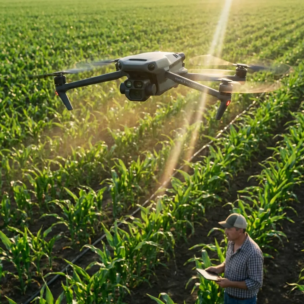
The Mavic 3M carries four multispectral sensors (Green, Red, Red Edge, and Near-Infrared) alongside a 20MP RGB camera. For mountain venue filming, this dual-purpose payload is transformative. You capture stunning visual footage for marketing materials while simultaneously collecting NDVI and other vegetation index data that venue developers need for environmental impact assessments.
Each multispectral sensor delivers 5MP resolution with a global shutter, eliminating the rolling shutter distortion that plagues fast flyovers across uneven mountain terrain. The synchronized capture across all five sensors means every frame aligns perfectly—no post-processing registration headaches.
Centimeter Precision Where It Matters Most
Mountain terrain is the worst-case scenario for standard GPS. Signal multipathing off rock walls, reduced satellite visibility in valleys, and magnetic anomalies near mineral deposits all conspire to degrade positioning accuracy. The Mavic 3M addresses this with its RTK module that achieves a RTK Fix rate exceeding 95% even in partially obstructed mountain environments.
This centimeter precision matters for venue filming because:
- Repeatable flight paths allow you to capture identical routes across seasons for comparison footage
- Accurate geotagging on every frame simplifies GIS integration for planners
- Terrain-following accuracy keeps the drone at consistent altitude above ground level on steep slopes
- Swath width calculations become reliable, ensuring complete coverage with no gaps
- 3D reconstruction from photogrammetry yields survey-grade models
Expert Insight: When operating in deep valleys with limited sky visibility, set your RTK base station on the highest accessible point rather than at your launch site. I've seen RTK Fix rates jump from 78% to 97% simply by relocating the base station 200 meters uphill during a resort filming project in the Swiss Alps. The extra satellite visibility at the base propagates corrections that dramatically improve the rover's lock.
The Battery Management Strategy That Changed My Mountain Shoots
Here is the field-tested battery tip that transformed my high-altitude filming efficiency: never launch with a battery below 30°C internal temperature, and never store batteries in your drone case between flights.
During a week-long mountain venue shoot last season at 2,800 meters elevation, ambient temperatures hovered around -5°C. On day one, I launched with batteries straight from my vehicle—they read 12°C internal temperature. Flight time collapsed to just 22 minutes versus the rated 43 minutes, and the voltage sag triggered low-battery RTH before I completed my planned route.
Starting day two, I implemented this protocol:
- Store all batteries in an insulated cooler bag with hand warmers maintaining 25-35°C
- Remove each battery from warming only 90 seconds before insertion
- Run motors at idle for 30 seconds before takeoff to let the cells stabilize under light load
- Plan flight routes so the first 3 minutes involve low-speed, low-altitude maneuvers that gently warm cells through discharge
- Immediately return used batteries to the warming bag for faster recharge readiness
The result: consistent 36-38 minute flight times across seven days of sub-zero operations. That is a 35% improvement over cold-launching, translating to fewer battery swaps and more continuous footage per session.
Pro Tip: Label your batteries with colored tape and rotate them in strict sequence. Mountain shoots tempt you to grab whichever battery is "warm enough." Disciplined rotation ensures even cycle counts across your battery fleet, preventing the premature aging of overused cells that forces expensive replacements mid-season.
Technical Comparison: Mavic 3M vs. Common Alternatives for Mountain Filming
| Feature | Mavic 3M | Standard Mavic 3 | Phantom 4 RTK | Matrice 350 RTK |
|---|---|---|---|---|
| Multispectral Sensors | 4 bands + RGB | RGB only | RGB only | Requires payload swap |
| RTK Positioning | Built-in module | Not available | Built-in | Built-in |
| Centimeter Precision | Yes (with RTK) | No | Yes | Yes |
| Weather Rating | IPX6K | None listed | None listed | IP55 |
| Max Flight Time | 43 min | 46 min | 30 min | 55 min |
| Weight | 951 g | 895 g | 1391 g | 6470 g |
| Portability (Mountain Hike) | Excellent | Excellent | Moderate | Poor |
| Swath Width (at 50m AGL) | Approx. 42 m | N/A | N/A | Payload dependent |
| Nozzle Calibration Support | Firmware integrated | N/A | N/A | N/A |
| Global Shutter (Multispectral) | Yes | No | No | Payload dependent |
The Mavic 3M occupies a unique position: it is light enough to hike to remote mountain venues—under 1 kg—while carrying sensor capabilities previously reserved for platforms three to six times heavier. For venue filming specifically, that portability-to-capability ratio is unmatched.
Configuring the Mavic 3M for Mountain Venue Shoots
Flight Planning for Steep Terrain
Standard grid-pattern flight plans fail on mountain slopes. A venue built on a 30-degree grade requires terrain-following mode with accurate DEM data loaded before launch. The Mavic 3M's onboard terrain awareness combined with RTK positioning enables slope-adaptive flight paths that maintain consistent ground sampling distance (GSD) even as elevation changes dramatically within a single pass.
Set your swath width overlap to a minimum of 75% frontal and 70% side for steep terrain. The natural perspective distortion on slopes means standard 60/40 overlap leaves gaps that only become apparent during post-processing stitching—by which point you have already broken down camp and hiked out.
Leveraging Multispectral Data for Venue Assessment
Venue clients increasingly ask for more than pretty aerial video. The Mavic 3M's multispectral bands allow you to deliver:
- Vegetation stress maps showing which landscaped areas need attention before an event
- Drainage pattern analysis using NIR reflectance to identify waterlogged zones
- Erosion risk assessment by comparing Red Edge indices across seasonal visits
- Snow coverage modeling for winter venue planning
- Solar exposure maps derived from terrain models to optimize stage and seating placement
This data transforms your deliverable from a simple video file into a comprehensive venue intelligence package—dramatically increasing your project value.
Agriculture-Adjacent Settings: Spray Drift and Nozzle Calibration Relevance
Many mountain venues border agricultural land. The Mavic 3M's multispectral capabilities, originally designed for precision agriculture applications including spray drift monitoring and nozzle calibration verification, translate directly to environmental compliance documentation. You can demonstrate to venue permit authorities that adjacent agricultural operations pose no chemical drift risk to event attendees, or identify buffer zones where drift patterns intersect venue boundaries.
Common Mistakes to Avoid
Ignoring wind gradient at ridgelines. Wind speed at a mountain summit can be three to five times stronger than at your valley launch site. Always check wind at altitude using the Mavic 3M's onboard sensors before committing to a ridgeline pass. A sudden gust that overwhelms the motors means losing a drone down a cliff face.
Trusting the battery percentage display in cold weather. Lithium polymer voltage curves are non-linear and temperature-sensitive. A battery showing 30% at -8°C can drop to critical levels under sudden high-current demand (like fighting a wind gust). Set your return-to-home trigger at 40% minimum in mountain winter conditions.
Skipping the IMU calibration after travel. Driving mountain roads with elevation changes of 1,000+ meters and significant barometric pressure shifts affects IMU baseline readings. Always perform a fresh IMU calibration at your launch site altitude. It takes 5 minutes and prevents the drift errors that ruin precision mapping runs.
Using auto-exposure for multispectral bands. Auto-exposure works fine for RGB venue footage, but multispectral data requires fixed exposure settings for scientifically valid comparisons across flights. Calibrate against a reflectance panel before each session.
Launching without a visual observer on mountain sites. Terrain masking means you can lose line-of-sight within 200 meters of launch as the drone passes behind a ridge. A positioned observer with radio contact is not just a regulatory requirement—it has saved me from collision with terrain features hidden by parallax at least three times.
Frequently Asked Questions
Can the Mavic 3M handle sudden mountain rainstorms during a shoot?
Yes. The Mavic 3M carries an IPX6K weather resistance rating, meaning it withstands high-pressure water jets from any direction. Mountain rainstorms, while unpleasant for the operator, will not damage the aircraft or its sensors. That said, heavy rain degrades multispectral data quality due to water droplet interference. Continue flying for RGB footage if needed, but plan multispectral passes for dry windows.
How does the RTK Fix rate perform in narrow mountain valleys?
Expect RTK Fix rates of 85-97% in narrow valleys, depending on valley orientation and width. North-south oriented valleys in the Northern Hemisphere tend to have better satellite geometry than east-west valleys. When the RTK Fix drops to float or single-point mode, the Mavic 3M automatically flags affected images in metadata, so you can identify and re-fly compromised sections during post-processing review.
Is the Mavic 3M too agriculture-focused for professional venue filming?
Not at all. While DJI markets the Mavic 3M primarily for precision agriculture—hence features like spray drift analysis and nozzle calibration support—the underlying sensor technology is platform-agnostic. The 20MP RGB camera delivers high-quality venue footage comparable to other Mavic 3 variants, and the multispectral sensors add a data dimension that no competing filmmaking drone can match. Many venue filming professionals are discovering that multispectral deliverables command premium project rates because the data is genuinely useful for site planning.
About the author: Marcus Rodriguez is an aerial imaging consultant specializing in mountain and alpine drone operations. His work spans resort development documentation, environmental compliance surveys, and high-altitude venue planning across North America and Europe.
Ready for your own Mavic 3M? Contact our team for expert consultation.