M3M Wildlife Surveying Tips for Extreme Temperatures
M3M Wildlife Surveying Tips for Extreme Temperatures
META: Master Mavic 3M wildlife surveying in extreme temps. Expert tips on battery management, multispectral imaging, and thermal protocols for accurate data collection.
TL;DR
- Battery preheating protocols extend flight time by up to 35% in sub-zero conditions
- Multispectral sensor calibration requires 15-minute thermal stabilization before accurate wildlife detection
- RTK Fix rate drops significantly below -10°C without proper ground station insulation
- Strategic swath width adjustments compensate for reduced flight windows in extreme heat
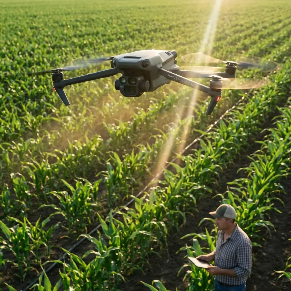
Wildlife surveying pushes drone technology to its limits. The Mavic 3M's multispectral capabilities transform how researchers track animal populations, monitor habitats, and assess ecosystem health—but only when operators understand how temperature extremes affect every component. This technical review breaks down field-tested strategies for maintaining centimeter precision when conditions turn hostile.
Why Temperature Extremes Challenge Multispectral Wildlife Surveys
Standard drone operations assume moderate conditions. Wildlife surveys rarely offer that luxury. Arctic caribou migrations happen in -25°C windchill. Desert tortoise population counts occur when ground temperatures exceed 55°C. The Mavic 3M handles these scenarios, but success depends on understanding thermal physics.
Lithium-polymer batteries lose capacity exponentially as temperatures drop. At -15°C, expect roughly 30% less flight time than manufacturer specifications suggest. Heat creates different problems—accelerated discharge rates and potential thermal runaway if internal temperatures exceed 60°C.
The multispectral sensor array faces its own challenges. Thermal expansion affects lens alignment. Extreme cold can cause sensor condensation during rapid altitude changes. These factors directly impact data quality for vegetation indices and animal detection algorithms.
Battery Management: Field-Tested Protocols
Last winter, surveying elk populations in Montana's Absaroka Range taught me a lesson about battery discipline. Temperatures hovered around -18°C. My first battery lasted exactly 11 minutes—barely enough to complete one transect. By the third day, I'd developed a rotation system that pushed effective flight time to 19 minutes per battery.
Cold Weather Battery Protocol
The key involves maintaining battery core temperature between 20-25°C until launch:
- Store batteries in an insulated cooler with chemical hand warmers
- Rotate warmers every 90 minutes to maintain consistent heat
- Pre-warm batteries using the DJI app's self-heating function for 5 minutes minimum
- Never launch with battery temperature below 15°C
- Keep spare batteries against your body under outer layers
Pro Tip: Invest in a 12V heated battery case that plugs into your vehicle. This eliminates the hand-warmer rotation and provides consistent 22°C storage regardless of ambient conditions. The upfront cost pays for itself in extended flight windows within three survey missions.
Hot Weather Battery Protocol
Desert surveys present opposite challenges. Batteries discharge faster and risk thermal damage:
- Store batteries in a reflective cooler with frozen gel packs
- Never leave batteries in direct sunlight—even briefly
- Allow 10-minute cooldown between flights
- Monitor battery temperature through the app; abort if readings exceed 45°C
- Schedule flights for early morning or late afternoon when possible
Multispectral Sensor Calibration in Extreme Conditions
The Mavic 3M's four-band multispectral sensor plus RGB camera requires precise calibration for wildlife detection. Temperature fluctuations affect this calibration more than most operators realize.
Pre-Flight Thermal Stabilization
Before capturing survey data, the sensor array needs thermal equilibrium:
- Power on the drone 15 minutes before flight in ambient conditions
- Allow the sensor to cycle through self-calibration twice
- Capture calibration panel images only after stabilization
- In cold conditions, keep the drone running between flights to maintain sensor temperature
Reflectance Panel Considerations
Standard calibration panels behave differently at temperature extremes:
| Condition | Panel Issue | Solution |
|---|---|---|
| Below -5°C | Frost accumulation | Use hydrophobic-coated panels; wipe immediately before capture |
| Above 40°C | Thermal distortion | Shade panel for 60 seconds before calibration |
| High humidity | Condensation | Store panels in sealed bags with desiccant |
| Rapid temp change | Reflectance drift | Recalibrate every 30 minutes |
Expert Insight: Wildlife surveys often span dawn-to-dusk operations where temperatures shift 20°C or more. I recalibrate my reflectance panels every 45 minutes during these extended sessions. The extra five minutes per calibration prevents hours of post-processing corrections.
RTK Positioning for Centimeter Precision
Wildlife population counts demand repeatable accuracy. Returning to exact GPS coordinates across seasons allows researchers to track habitat changes and animal movement patterns. The Mavic 3M's RTK capabilities deliver centimeter precision—when properly configured.
Cold Weather RTK Challenges
RTK Fix rate degrades in extreme cold for several reasons:
- Base station batteries lose capacity, reducing broadcast power
- Antenna cables become stiff, potentially affecting connections
- Atmospheric conditions change signal propagation characteristics
Maintain reliable RTK Fix rates below -10°C with these adjustments:
- Insulate the base station with foam padding
- Use lithium primary batteries (not rechargeable) for base station power in extreme cold
- Position the base station in a wind-sheltered location
- Allow 10 extra minutes for satellite acquisition
- Monitor Fix rate continuously; pause operations if it drops below 95%
Heat-Related RTK Considerations
Extreme heat affects RTK differently:
- Electronics can overheat, causing temporary signal loss
- Thermal mirages near ground level can affect low-altitude positioning
- Base station displays may become unreadable in direct sunlight
Shade your base station with a reflective umbrella. This simple step maintains consistent Fix rates even when ambient temperatures exceed 40°C.
Swath Width Optimization for Reduced Flight Windows
Extreme temperatures compress available flight time. Optimizing swath width becomes critical for completing survey coverage.
Calculating Adjusted Swath Parameters
The Mavic 3M's multispectral sensor captures a 12.3mm equivalent focal length. At standard survey altitudes, this translates to specific ground coverage:
| Altitude (m) | Swath Width (m) | GSD (cm/pixel) | Overlap Recommendation |
|---|---|---|---|
| 60 | 52 | 2.5 | 75% front, 70% side |
| 80 | 69 | 3.3 | 75% front, 65% side |
| 100 | 87 | 4.2 | 70% front, 60% side |
| 120 | 104 | 5.0 | 70% front, 60% side |
When flight time drops due to temperature, increase altitude to maximize coverage per battery. Accept slightly reduced resolution in exchange for complete survey area coverage.
Wildlife Detection Trade-offs
Higher altitudes reduce animal detection accuracy for smaller species. Balance these factors:
- Large mammals (elk, caribou, wild horses): 100-120m altitude acceptable
- Medium mammals (deer, coyotes): 60-80m preferred
- Small mammals and birds: 40-60m required for reliable detection
IPX6K Rating: Understanding Weather Limits
The Mavic 3M carries an IPX6K rating, indicating resistance to high-pressure water jets. This doesn't mean unlimited weather operation.
What IPX6K Actually Protects Against
- Heavy rain during flight
- Splashing during takeoff and landing
- High-humidity environments
- Coastal salt spray (with proper post-flight cleaning)
What IPX6K Doesn't Cover
- Submersion (even briefly)
- Freezing rain or ice accumulation
- Sand or dust infiltration
- Sustained operation in driving rain exceeding 30 minutes
Wildlife surveys often encounter unexpected weather. The IPX6K rating provides a safety margin, not an invitation to fly in storms. When precipitation begins, complete your current transect and land.
Common Mistakes to Avoid
Skipping thermal stabilization: Launching immediately after removing the drone from a warm vehicle causes lens fogging and sensor drift. Those 15 minutes of stabilization prevent hours of unusable data.
Ignoring battery temperature warnings: The Mavic 3M provides temperature alerts for good reason. Dismissing them risks permanent battery damage and mid-flight failures.
Using summer flight plans in winter: Copy-pasting mission parameters across seasons ignores reduced flight time. Recalculate coverage areas for each temperature range.
Neglecting base station thermal management: Operators focus on drone temperature while their RTK base station freezes or overheats. Both systems require thermal attention.
Rushing calibration in uncomfortable conditions: When you're cold or hot, the temptation to skip calibration steps increases. Discipline here determines data quality.
Flying at standard altitudes regardless of conditions: Adapting altitude to available flight time maximizes survey efficiency. Rigid adherence to summer parameters wastes winter opportunities.
Frequently Asked Questions
How does extreme cold affect multispectral data accuracy for vegetation indices?
Cold temperatures cause subtle shifts in sensor response curves, particularly in the red-edge band critical for NDVI calculations. Below -10°C, expect up to 3% variance in vegetation index values compared to moderate-temperature baselines. Compensate by including temperature metadata in your processing workflow and applying correction factors during analysis. Most professional photogrammetry software includes temperature compensation algorithms.
Can I use nozzle calibration techniques from agricultural applications for wildlife survey equipment?
While the Mavic 3M supports agricultural configurations including spray systems, wildlife surveys rarely require nozzle calibration. However, the precision principles transfer directly. Just as spray drift affects chemical application accuracy, sensor drift affects wildlife detection reliability. Apply the same methodical calibration discipline—checking equipment before each mission, documenting environmental conditions, and maintaining consistent protocols regardless of conditions.
What RTK Fix rate threshold should trigger mission abort during wildlife surveys?
Maintain minimum 95% RTK Fix rate for population count surveys requiring year-over-year comparison. For habitat mapping where absolute position matters less than relative accuracy, 90% remains acceptable. Below 85%, positional errors exceed the centimeter precision needed for reliable data. If Fix rate drops during flight, note the affected transects for potential re-flight or flag them during analysis.
Extreme temperature wildlife surveying demands preparation, discipline, and equipment understanding. The Mavic 3M delivers professional-grade multispectral data when operators respect thermal limitations and adapt protocols accordingly. Master these techniques, and temperature becomes a manageable variable rather than a mission-ending obstacle.
Ready for your own Mavic 3M? Contact our team for expert consultation.