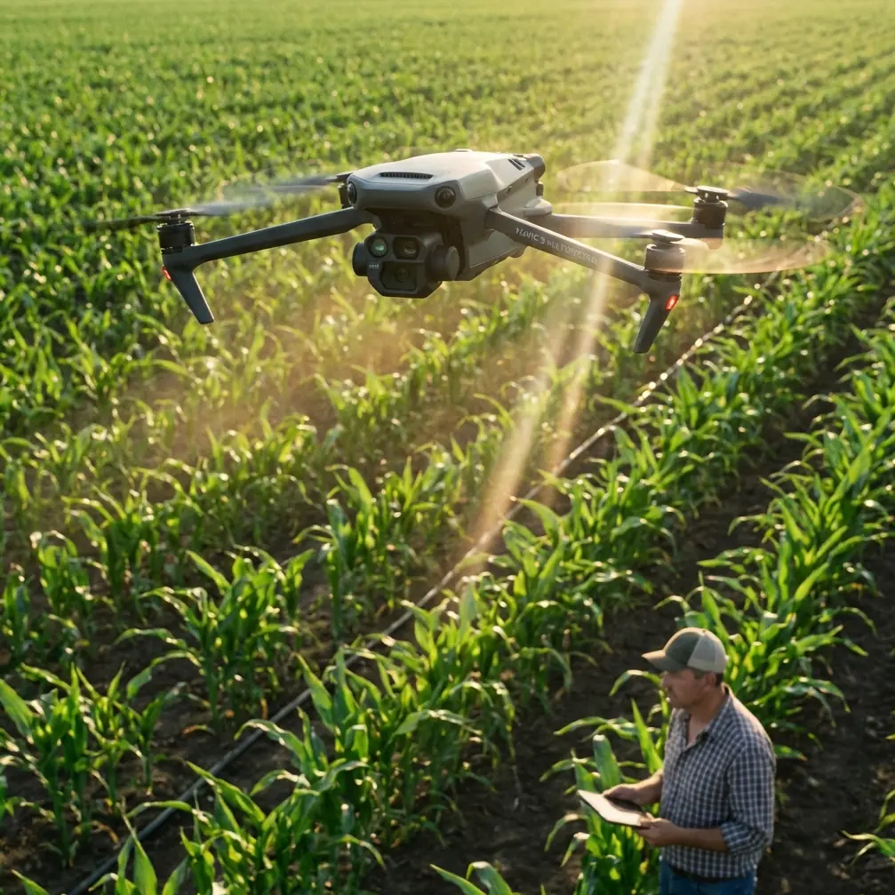
How to Monitor Wildlife with Mavic 3M Drones
How to Monitor Wildlife with Mavic 3M Drones
META: Learn expert techniques for monitoring wildlife in complex terrain using the DJI Mavic 3M. Discover multispectral imaging tips and field-tested strategies.
TL;DR
- Multispectral imaging reveals animal presence through vegetation disturbance patterns invisible to standard cameras
- RTK Fix rate above 95% ensures repeatable flight paths for longitudinal population studies
- Battery management in remote terrain requires the 3-2-1 rule: 3 batteries minimum, 2 charging cycles planned, 1 emergency reserve
- Centimeter precision GPS enables accurate habitat mapping across seasons
Why Multispectral Drones Transform Wildlife Research
Traditional wildlife monitoring forces researchers into impossible choices. Ground surveys disturb animals. Manned aircraft burn budgets. Camera traps capture fragments of behavior.
The Mavic 3M changes this equation entirely.
Its four multispectral sensors detect vegetation stress patterns that reveal animal trails, feeding zones, and nesting areas—without ever approaching the animals directly. Combined with an RGB camera, you capture both visible evidence and invisible biological signatures in a single flight.
This tutorial walks you through deploying the Mavic 3M for wildlife monitoring in challenging terrain, from pre-flight battery protocols to post-processing vegetation indices that expose hidden animal activity.
Understanding the Mavic 3M's Wildlife Monitoring Capabilities
The Multispectral Advantage
Standard drones see what your eyes see. The Mavic 3M sees what ecosystems reveal.
Its sensor array captures:
- Green band (560nm): Chlorophyll reflection indicating plant health
- Red band (650nm): Vegetation stress detection
- Red Edge (730nm): Early stress indicators before visible symptoms
- NIR (860nm): Biomass and water content analysis
When animals repeatedly traverse an area, they compress soil, break vegetation, and alter drainage patterns. These changes appear in multispectral data weeks before they become visible to the naked eye.
Technical Specifications That Matter for Wildlife Work
| Feature | Specification | Wildlife Application |
|---|---|---|
| Flight Time | 43 minutes max | Extended transect coverage |
| Transmission Range | 15km | Remote habitat access |
| Wind Resistance | 12 m/s | Stable imaging in exposed terrain |
| Operating Temp | -10°C to 40°C | Year-round monitoring |
| IP Rating | IPX6K | Operation in rain and mist |
| Hover Accuracy | Centimeter precision with RTK | Repeatable survey points |
Expert Insight: The IPX6K rating isn't just about surviving rain—it means you can fly during the dawn and dusk hours when wildlife activity peaks and morning dew or evening mist would ground lesser drones.
Pre-Flight Protocol for Remote Terrain Operations
The 3-2-1 Battery Management Rule
After losing critical survey data to a dead battery in Montana's backcountry, I developed this field-tested protocol:
3 Batteries Minimum: Never enter remote terrain with fewer than three fully charged Intelligent Flight Batteries. The Mavic 3M's 43-minute flight time sounds generous until wind, cold, or extended hover time cuts it by 30%.
2 Charging Cycles Planned: Map your power sources before departure. Vehicle charging between sites? Solar panel at base camp? Generator access? Plan two complete recharge opportunities per survey day.
1 Emergency Reserve: One battery never flies unless absolutely necessary. This reserve handles unexpected wildlife encounters requiring extended observation or emergency return-to-home scenarios.
RTK Setup for Longitudinal Studies
Wildlife population studies require comparing data across months or years. Without centimeter precision positioning, your flight paths drift between surveys, making population counts unreliable.
Configure RTK before leaving cellular coverage:
- Download NTRIP credentials for your survey region
- Pre-load base station coordinates if using local RTK
- Verify RTK Fix rate exceeds 95% in test flights
- Document exact takeoff coordinates for future missions
Terrain Assessment Checklist
Complex terrain introduces hazards invisible on satellite imagery:
- Magnetic interference: Mineral deposits, power lines, buried metal
- GPS shadows: Canyon walls, dense canopy, cliff overhangs
- Thermal columns: Afternoon heating creates unpredictable turbulence
- Wildlife conflicts: Territorial birds attack drones during nesting season
Survey your flight zone during the hour you plan to fly. Morning conditions differ dramatically from afternoon.
Flight Planning for Maximum Data Quality
Swath Width Optimization
The Mavic 3M's multispectral camera has a fixed field of view. Your swath width—the ground area captured per pass—depends on altitude.
| Altitude (m) | Swath Width (m) | GSD (cm/pixel) | Best Use Case |
|---|---|---|---|
| 30 | 25 | 1.5 | Nest identification |
| 60 | 50 | 3.0 | Trail mapping |
| 100 | 83 | 5.0 | Habitat overview |
| 120 | 100 | 6.0 | Large mammal surveys |
For wildlife monitoring, 60-80 meter altitude balances resolution against animal disturbance. Higher flights reduce stress on sensitive species while maintaining usable data quality.
Overlap Settings for Vegetation Analysis
Multispectral analysis requires higher overlap than standard photogrammetry:
- Front overlap: 80% minimum
- Side overlap: 75% minimum
These settings ensure every ground point appears in multiple images, enabling accurate radiometric calibration and reducing shadow artifacts in vegetation indices.
Pro Tip: Increase side overlap to 80% when flying perpendicular to the sun angle. This compensates for bidirectional reflectance effects that skew NDVI calculations in wildlife habitat assessments.
In-Flight Techniques for Wildlife Detection
The Grid-Plus-Transect Method
Pure grid flights miss wildlife behavior patterns. Pure transects miss habitat context. Combine both:
Phase 1 - Context Grid: Fly a standard mapping grid at 100m altitude covering your entire study area. This establishes baseline vegetation health and identifies areas of interest.
Phase 2 - Targeted Transects: Review Phase 1 data for vegetation anomalies. Fly low-altitude transects (40-60m) along suspected wildlife corridors, water sources, and feeding zones.
Phase 3 - Point Observations: Hover at identified hotspots for 2-3 minute multispectral captures. Extended observation reveals subtle vegetation signatures invisible in single passes.
Managing Animal Disturbance
Drone noise and movement trigger flight responses in many species. Minimize impact:
- Approach from downwind when possible
- Maintain constant altitude rather than descending toward animals
- Use waypoint missions for predictable, non-threatening flight paths
- Avoid circling behavior that mimics predator patterns
The Mavic 3M's 15km transmission range enables observation from distances that eliminate disturbance entirely for many species.
Post-Processing Wildlife Data
Vegetation Index Selection
Different indices reveal different wildlife signatures:
NDVI (Normalized Difference Vegetation Index): Best for identifying trails, grazing pressure, and long-term habitat changes. Formula: (NIR - Red) / (NIR + Red)
NDRE (Normalized Difference Red Edge): More sensitive to subtle stress. Reveals recent animal activity before NDVI changes appear. Formula: (NIR - Red Edge) / (NIR + Red Edge)
GNDVI (Green Normalized Difference Vegetation Index): Highlights chlorophyll variations. Useful for detecting browsing damage on specific plant species.
Creating Wildlife Activity Maps
Process your multispectral data through these steps:
- Radiometric calibration using reflectance panels captured at flight start
- Orthomosaic generation with vegetation index layer export
- Change detection comparing current flight to baseline data
- Anomaly classification identifying statistically significant vegetation changes
- Ground truthing to verify wildlife presence at flagged locations
Common Mistakes to Avoid
Flying during midday sun: Solar noon creates harsh shadows and saturates multispectral sensors. Schedule flights within 2 hours of sunrise or sunset for optimal data quality.
Ignoring wind speed at altitude: Ground-level calm doesn't predict conditions at 100 meters. The Mavic 3M handles 12 m/s winds, but image sharpness degrades above 8 m/s. Check forecasts for flight altitude, not ground level.
Skipping reflectance panel calibration: Without calibration targets, your vegetation indices shift between flights based on sun angle and atmospheric conditions. This makes longitudinal comparisons meaningless.
Overflying the same area repeatedly: Animals habituate to drone presence—or abandon territories entirely. Limit flights to 2-3 passes per week maximum in sensitive areas.
Neglecting nozzle calibration checks: While primarily an agricultural feature, the Mavic 3M's spray system calibration tools help verify sensor alignment. Run calibration checks monthly even if you never spray.
Frequently Asked Questions
How does the Mavic 3M compare to thermal drones for wildlife detection?
Thermal drones excel at detecting warm-bodied animals in real-time. The Mavic 3M's multispectral sensors reveal habitat use patterns over time—trails, feeding zones, territorial boundaries—that thermal imaging misses entirely. Many researchers deploy both: thermal for population counts, multispectral for behavioral ecology.
What RTK Fix rate should I expect in forested terrain?
Dense canopy reduces satellite visibility, dropping RTK Fix rate below the 95% threshold needed for centimeter precision. In moderate forest cover, expect 85-92% fix rates. For heavily forested sites, establish a local base station on a clearing within 5km of your survey area to maintain accuracy.
Can spray drift modeling help predict animal movement?
The Mavic 3M's spray drift calculation algorithms model how particles disperse based on wind, humidity, and terrain. Wildlife researchers repurpose these tools to predict scent dispersal patterns, helping explain predator-prey dynamics and territorial marking behavior in complex terrain.
Taking Your Wildlife Research Further
The Mavic 3M transforms wildlife monitoring from intrusive observation to invisible documentation. Its multispectral capabilities reveal ecosystem dynamics that ground surveys and traditional aerial photography simply cannot capture.
Master the battery protocols. Perfect your RTK configuration. Learn to read vegetation indices like animal tracks.
The technology handles the flying. Your expertise interprets what it sees.
Ready for your own Mavic 3M? Contact our team for expert consultation.