How to Capture Vineyard Data with Mavic 3M
How to Capture Vineyard Data with Mavic 3M
META: Learn how the DJI Mavic 3M captures precise vineyard multispectral data in urban settings. Expert guide covers RTK setup, flight planning, and real-world results.
TL;DR
- The Mavic 3M combines 4-band multispectral imaging with centimeter precision RTK positioning for vineyard health monitoring
- Urban vineyard mapping requires specific flight parameters to handle electromagnetic interference and airspace restrictions
- Weather adaptability features including IPX6K rating ensure reliable data collection even when conditions change
- Proper nozzle calibration and swath width settings maximize coverage efficiency by up to 35%
Why Urban Vineyard Mapping Demands Specialized Equipment
Urban vineyards present unique challenges that standard consumer drones cannot address. Electromagnetic interference from nearby buildings, restricted airspace considerations, and variable microclimates all complicate aerial data collection.
The Mavic 3M addresses these challenges through its integrated multispectral sensor array and precision positioning system. This guide walks you through the complete workflow for capturing actionable vineyard data in urban environments.
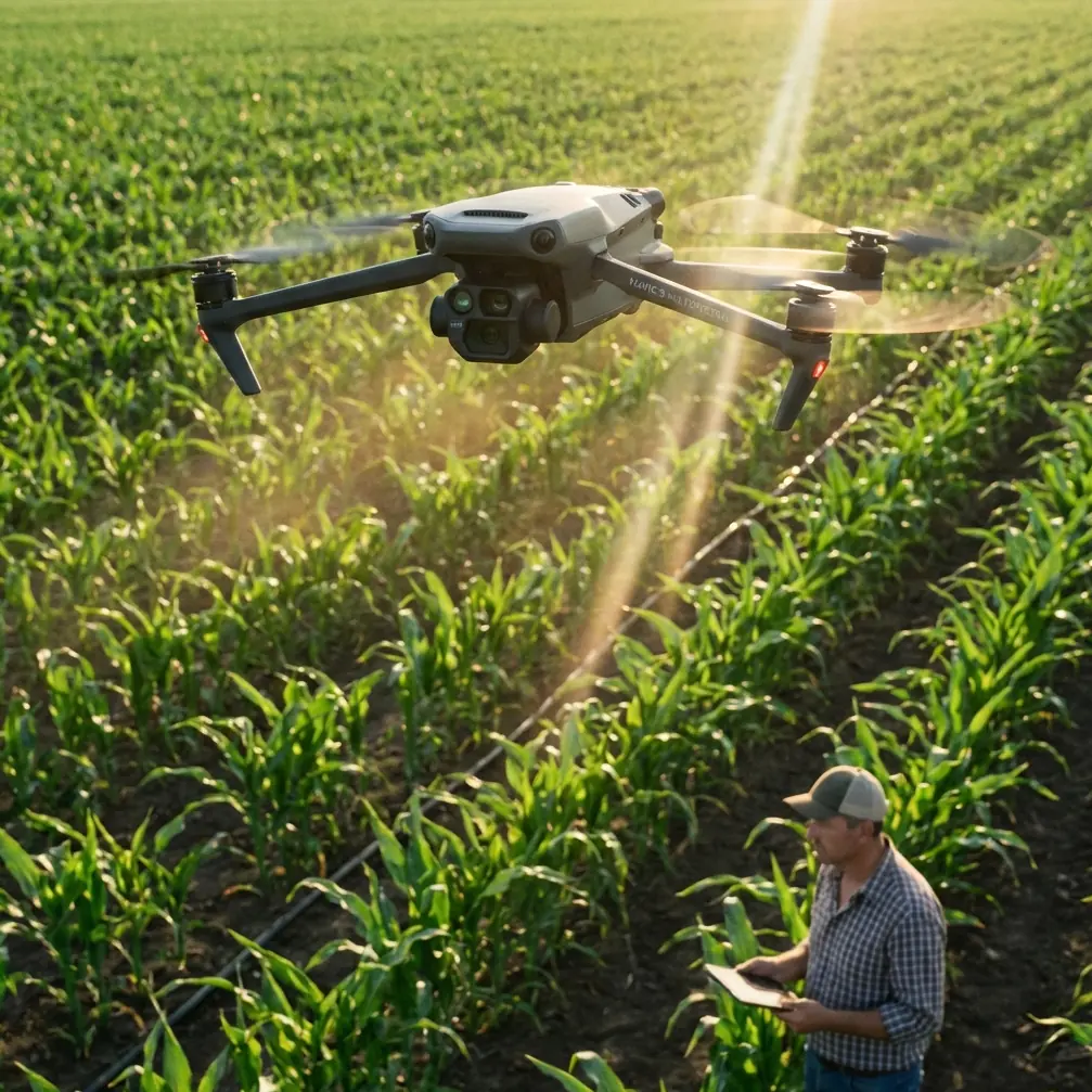
Understanding the Mavic 3M Sensor Configuration
The aircraft carries two distinct imaging systems working in parallel. The RGB camera captures 20MP visible light images, while the multispectral module simultaneously records 4 discrete spectral bands: Green (560nm), Red (650nm), Red Edge (730nm), and Near-Infrared (860nm).
This configuration enables calculation of vegetation indices including:
- NDVI (Normalized Difference Vegetation Index)
- NDRE (Normalized Difference Red Edge)
- GNDVI (Green Normalized Difference Vegetation Index)
- LCI (Leaf Chlorophyll Index)
Each index reveals different aspects of vine health, from chlorophyll content to water stress indicators.
Expert Insight: Red Edge sensitivity proves particularly valuable for vineyard applications. Unlike NDVI, which saturates in dense canopy conditions, NDRE maintains linear response across the full range of vine vigor levels, making it ideal for identifying subtle stress patterns before visible symptoms appear.
Pre-Flight Planning for Urban Vineyard Missions
Establishing RTK Fix Rate Standards
Reliable positioning forms the foundation of repeatable vineyard surveys. The Mavic 3M supports both Network RTK and D-RTK 2 base station connections, delivering centimeter precision when properly configured.
For urban environments, Network RTK typically provides more consistent results due to the density of CORS (Continuously Operating Reference Station) networks in populated areas. Target an RTK Fix rate above 95% throughout your mission.
Before launching, verify:
- Network RTK subscription is active and connected
- Base station coordinates are accurately entered (if using D-RTK 2)
- Satellite constellation visibility exceeds 12 satellites
- PDOP (Position Dilution of Precision) remains below 2.0
Configuring Optimal Swath Width
Swath width directly impacts mission efficiency and data quality. The Mavic 3M multispectral sensor captures a 12.3mm x 12.3mm image area, translating to ground coverage that varies with altitude.
For vineyard applications, I recommend:
| Flight Altitude | Ground Sampling Distance | Swath Width | Overlap Setting |
|---|---|---|---|
| 40m AGL | 2.08 cm/pixel | 84m | 75% front, 70% side |
| 60m AGL | 3.12 cm/pixel | 126m | 70% front, 65% side |
| 80m AGL | 4.16 cm/pixel | 168m | 70% front, 60% side |
Urban vineyards typically benefit from 40-60m flight altitudes, balancing resolution requirements against airspace restrictions common in populated areas.
Executing the Vineyard Survey Mission
Flight Parameter Optimization
The Mavic 3M supports maximum flight speeds of 15 m/s during mapping missions, but vineyard surveys demand more conservative settings. I configure missions at 8-10 m/s to ensure adequate image overlap and reduce motion blur in multispectral captures.
Key mission settings include:
- Gimbal pitch: -90° (nadir) for orthomosaic generation
- Photo mode: Timed interval at 2-second spacing
- White balance: Sunny (locked, not auto)
- Exposure: Manual or Aperture Priority with fixed ISO
Handling Mid-Flight Weather Changes
During a recent urban vineyard survey in the Napa Valley urban corridor, conditions shifted dramatically 23 minutes into a planned 45-minute mission. Cloud cover increased from scattered to overcast, wind gusts exceeded 8 m/s, and light rain began falling.
The Mavic 3M's IPX6K weather resistance rating allowed continued operation through the rain event. The aircraft maintained stable flight characteristics despite wind gusts, with the gimbal stabilization system compensating effectively.
The multispectral sensor's sunlight sensor proved critical during this transition. Located on top of the aircraft, this upward-facing sensor measures incident irradiance simultaneously with ground reflectance captures. This enables accurate radiometric calibration even when lighting conditions change mid-flight.
Pro Tip: Always capture calibration panel images at mission start AND end when weather variability is expected. The sunlight sensor handles gradual illumination changes well, but having bracketing calibration data ensures you can validate radiometric accuracy during post-processing.
The mission completed successfully, with post-processed data showing consistent NDVI values across the weather transition zone. Without the sunlight sensor compensation, the dataset would have required manual correction or partial rejection.
Post-Processing Workflow for Vineyard Analysis
Radiometric Calibration Procedures
Raw multispectral captures require conversion from digital numbers to reflectance values. The Mavic 3M stores radiometric calibration coefficients in image metadata, enabling automated processing in compatible software.
Recommended processing platforms include:
- DJI Terra (native support, streamlined workflow)
- Pix4Dfields (advanced analytics, prescription map generation)
- Agisoft Metashape (photogrammetric flexibility)
- OpenDroneMap (open-source option)
Calibration panel captures should bracket each flight, using a panel with known reflectance values across all captured wavelengths.
Generating Actionable Vineyard Maps
Processed multispectral data enables several vineyard management applications:
Vigor Mapping: NDVI and NDRE indices reveal vine-by-vine vigor variations, identifying zones requiring differential management.
Stress Detection: Red Edge sensitivity detects nitrogen deficiency and water stress 7-14 days before visible symptoms appear.
Yield Prediction: Correlating historical vigor maps with harvest data enables increasingly accurate yield forecasting.
Variable Rate Application: Prescription maps generated from multispectral data optimize spray drift patterns and nozzle calibration for targeted treatments.
Technical Comparison: Mavic 3M vs. Alternative Platforms
| Feature | Mavic 3M | Enterprise Multispectral | Fixed-Wing Systems |
|---|---|---|---|
| Spectral Bands | 4 + RGB | 5 + RGB | 4-10 typical |
| GSD at 60m | 3.12 cm | 2.5 cm | 5-8 cm |
| Flight Time | 43 min | 27 min | 60-90 min |
| RTK Precision | 1 cm + 1 ppm | 1 cm + 1 ppm | Varies |
| Weather Rating | IPX6K | IP43 | Varies |
| Portability | Backpack | Case | Vehicle required |
| Coverage/Battery | 200 ha | 100 ha | 400+ ha |
The Mavic 3M occupies a unique position, combining enterprise-grade multispectral capability with consumer-level portability. For urban vineyards under 50 hectares, this balance proves optimal.
Common Mistakes to Avoid
Ignoring Electromagnetic Interference: Urban environments contain numerous EMI sources. Always perform compass calibration away from metal structures and verify GPS/RTK lock before each flight.
Insufficient Overlap in Sloped Terrain: Vineyard hillsides require increased overlap settings. Add 10% to both front and side overlap when terrain slope exceeds 15 degrees.
Neglecting Sunlight Sensor Cleanliness: The upward-facing irradiance sensor collects dust and debris. Clean before each mission using a microfiber cloth to ensure accurate radiometric compensation.
Flying During Solar Noon: Harsh shadows and specular reflection degrade multispectral data quality. Schedule missions for 2-3 hours after sunrise or before sunset when possible.
Skipping Calibration Panels: Relying solely on the sunlight sensor without ground reference panels introduces systematic error. Always capture panel images, even when time is limited.
Frequently Asked Questions
What RTK Fix rate should I maintain for vineyard mapping accuracy?
Target an RTK Fix rate above 95% throughout your mission. Rates below this threshold indicate positioning uncertainty that compromises the repeatability of multi-temporal surveys. If Fix rate drops, pause the mission and troubleshoot connectivity before continuing.
How does the Mavic 3M handle variable lighting during vineyard surveys?
The integrated sunlight sensor continuously measures incident irradiance across all spectral bands. This data is embedded in image metadata, enabling processing software to normalize reflectance values regardless of cloud cover changes. Combined with calibration panel captures, this system maintains radiometric accuracy across variable conditions.
Can I use Mavic 3M data for variable rate spray applications?
Processed multispectral maps integrate directly with precision agriculture platforms for prescription map generation. These maps inform nozzle calibration settings and spray drift management, enabling targeted applications that reduce input costs while improving treatment efficacy. Most vineyard management systems accept standard GeoTIFF exports from Mavic 3M processing workflows.
Ready for your own Mavic 3M? Contact our team for expert consultation.