Mavic 3M: Urban Venue Inspection Made Precise
Mavic 3M: Urban Venue Inspection Made Precise
META: Master urban venue inspections with the Mavic 3M drone. Learn expert techniques for multispectral imaging, RTK positioning, and efficient workflows.
TL;DR
- Centimeter precision RTK positioning enables accurate structural assessments in congested urban environments
- Multispectral imaging reveals hidden venue defects invisible to standard RGB cameras
- Third-party ND filter kits dramatically improve data quality in challenging lighting conditions
- Proper flight planning reduces inspection time by up to 60% compared to manual methods
Why Urban Venue Inspections Demand Specialized Tools
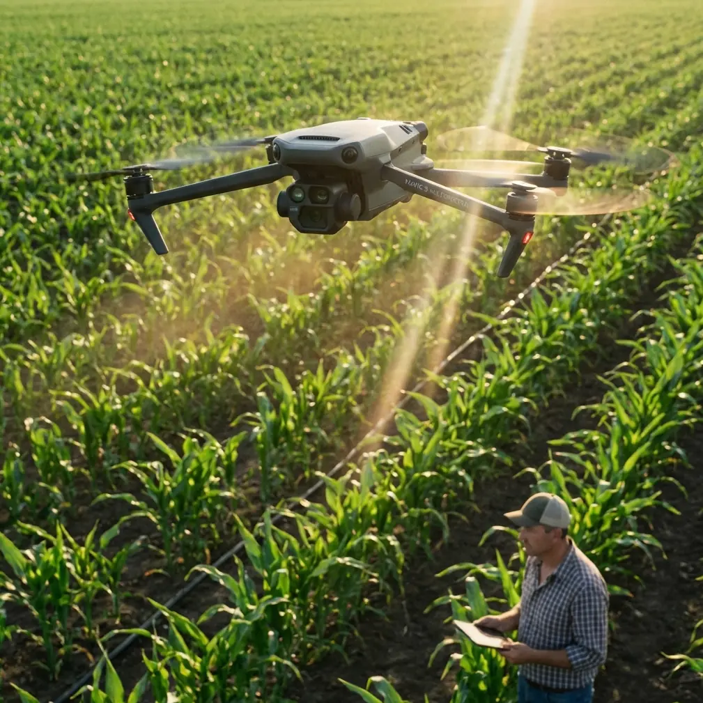
Urban venue inspections present unique challenges that standard consumer drones simply cannot address. The Mavic 3M combines agricultural-grade multispectral sensors with enterprise-level positioning accuracy, creating an unexpected powerhouse for structural and environmental assessments.
Stadium rooftops, concert halls, convention centers, and outdoor amphitheaters require detailed documentation that goes beyond visual photography. Moisture intrusion, thermal anomalies, and vegetation health on green roofs all demand spectral analysis capabilities.
The Mavic 3M's four multispectral bands (Green, Red, Red Edge, and Near-Infrared) plus its RGB camera capture data that reveals problems weeks before they become visible to the naked eye.
Understanding the Mavic 3M's Core Capabilities
Multispectral Imaging for Structural Assessment
The multispectral sensor array operates independently from the main RGB camera, capturing synchronized imagery across five spectral bands simultaneously. This parallel capture ensures pixel-perfect alignment for accurate index calculations.
For venue inspections, the Near-Infrared band proves particularly valuable. Water-damaged materials reflect NIR light differently than dry surfaces, allowing inspectors to map moisture intrusion patterns across large roof areas in a single flight.
Expert Insight: When inspecting green roof installations, calculate NDVI (Normalized Difference Vegetation Index) to identify stressed vegetation zones. Irrigation system failures often appear as NDVI anomalies 2-3 weeks before visual symptoms develop.
RTK Positioning and Fix Rate Optimization
Achieving consistent RTK Fix rate above 95% requires understanding urban signal challenges. Tall buildings create multipath interference where GPS signals bounce off reflective surfaces before reaching the drone's antenna.
The Mavic 3M supports network RTK through cellular connections, eliminating the need for ground base stations in most urban environments. This capability proves essential when inspecting venues surrounded by high-rise structures.
Key factors affecting RTK performance in urban settings:
- Building height relative to flight altitude
- Reflective surface materials (glass, metal cladding)
- Distance from cellular network RTK base stations
- Time of day (satellite geometry changes hourly)
- Weather conditions affecting signal propagation
Centimeter Precision in Practice
True centimeter precision positioning transforms inspection workflows. Repeat flights follow identical paths within 2-3 centimeters, enabling accurate change detection between inspection cycles.
This precision matters when documenting:
- Crack propagation in concrete structures
- Membrane seam separation on flat roofs
- Settlement or heaving in plaza surfaces
- Drainage pattern changes over time
Step-by-Step Urban Venue Inspection Workflow
Phase 1: Pre-Flight Planning and Preparation
Begin every inspection with thorough airspace research. Urban venues often fall within controlled airspace near airports or within temporary flight restrictions for events.
Document the following before arriving on-site:
- Airspace classification and authorization requirements
- Venue operating schedule and event calendar
- Emergency contact information for venue management
- Nearest hospitals and emergency services
- Weather forecast including wind patterns between buildings
Configure the Mavic 3M's RTK settings before departure. Network RTK credentials should be verified and connection tested in an area with known good cellular coverage.
Phase 2: Equipment Setup and Calibration
On-site preparation determines data quality. The multispectral sensors require calibration against a reflectance panel before each flight session. This step cannot be skipped without compromising spectral accuracy.
The Freewell ND filter kit for the Mavic 3M has become my essential third-party accessory for urban inspections. Standard ND8 and ND16 filters control exposure when inspecting highly reflective surfaces like white membrane roofing or glass atriums.
Pro Tip: Calibrate the multispectral sensors in open shade rather than direct sunlight. This reduces calibration panel hotspots and improves consistency across varying lighting conditions throughout the inspection.
Verify RTK Fix status before takeoff. The status indicator should show "FIX" rather than "FLOAT" for maximum positioning accuracy. If Fix status proves elusive, relocate the takeoff point away from tall structures.
Phase 3: Flight Execution Techniques
Urban venue inspections typically require multiple flight patterns:
Grid Pattern for Roof Surfaces
- Set swath width overlap at 75% minimum for multispectral data
- Maintain consistent altitude above the highest roof obstruction
- Flight speed should not exceed 5 m/s for sharp multispectral imagery
Orbital Pattern for Facades
- Circle the structure at multiple altitudes
- Capture oblique imagery at 45-degree angles
- Document all four cardinal orientations
Manual Investigation Flights
- Follow up on anomalies detected in grid data
- Capture detailed imagery of specific problem areas
- Record video documentation for client reports
Phase 4: Data Processing and Analysis
Post-flight processing transforms raw imagery into actionable intelligence. The multispectral bands require radiometric calibration using the pre-flight panel images.
Generate these standard outputs for venue inspections:
- Orthomosaic RGB map for visual reference
- NDVI map for vegetated areas
- NIR reflectance map for moisture detection
- 3D point cloud for volumetric measurements
- Thermal anomaly overlay (if thermal sensor equipped)
Technical Comparison: Mavic 3M vs. Alternative Platforms
| Feature | Mavic 3M | Enterprise Thermal | Agricultural Sprayers |
|---|---|---|---|
| Multispectral Bands | 5 bands | 1 band (thermal) | 0 bands |
| RTK Positioning | Yes | Yes | Yes |
| Centimeter Precision | Yes | Yes | Yes |
| Flight Time | 43 minutes | 45 minutes | 15-20 minutes |
| Portability | Excellent | Good | Poor |
| Weather Resistance | IPX6K | IP45 | Varies |
| Swath Width Mapping | Native support | Limited | N/A |
| Nozzle Calibration | N/A | N/A | Required |
| Spray Drift Concerns | None | None | Significant |
The Mavic 3M's IPX6K rating deserves attention for urban work. This certification means the drone withstands high-pressure water jets, allowing operations during light rain or immediately after storms when moisture damage assessment proves most valuable.
Optimizing Data Quality in Challenging Conditions
Lighting Challenges Between Buildings
Urban canyons create extreme contrast ratios. Shadows from adjacent buildings can span entire venue rooftops while sunlit areas cause sensor saturation.
Combat this by:
- Scheduling flights during overcast conditions when possible
- Using ND filters to reduce dynamic range requirements
- Flying multiple passes at different times to capture shadowed areas in sunlight
- Adjusting exposure compensation based on dominant surface reflectance
Wind Patterns and Turbulence
Buildings create unpredictable wind acceleration and turbulence. Wind speeds at rooftop level often exceed ground measurements by 40-60%.
The Mavic 3M handles gusts up to 12 m/s, but image quality degrades significantly above 8 m/s. Monitor real-time wind data during flights and pause operations when gusts exceed acceptable thresholds.
Signal Interference Management
Dense urban environments contain numerous RF interference sources. Cellular towers, broadcast antennas, and building wireless systems can affect both control links and RTK corrections.
Maintain visual line of sight at all times. The Mavic 3M's OcuSync transmission handles interference well, but signal quality indicators should be monitored throughout each flight.
Common Mistakes to Avoid
Skipping Multispectral Calibration Every flight session requires fresh calibration panel imagery. Environmental lighting changes throughout the day invalidate earlier calibrations, producing inconsistent spectral data.
Insufficient Overlap Settings Urban structures contain complex geometry that demands higher overlap than flat agricultural fields. The default 70% overlap often proves inadequate—increase to 80% for reliable 3D reconstruction.
Ignoring RTK Float Warnings Flying with Float status rather than Fix status introduces positioning errors of 30-50 centimeters. This error compounds across large venues, making change detection between inspection cycles unreliable.
Forgetting Battery Temperature Management Cold weather reduces battery capacity significantly. In winter inspections, keep spare batteries warm until needed. The Mavic 3M's battery heater activates automatically but requires several minutes to reach optimal temperature.
Neglecting Airspace Authorization Urban venues frequently fall within LAANC-controlled airspace. Attempting to fly without proper authorization risks enforcement action and damages the professional reputation of the entire inspection industry.
Frequently Asked Questions
Can the Mavic 3M detect water leaks in flat roofs?
Yes, the Near-Infrared band reveals moisture content differences in roofing materials. Wet areas absorb NIR light differently than dry surfaces, appearing as distinct anomalies in processed imagery. For best results, fly inspections 24-48 hours after rainfall when moisture has penetrated but not fully evaporated.
What RTK network services work with the Mavic 3M for urban inspections?
The Mavic 3M supports NTRIP protocol connections to most commercial RTK networks. Services like Trimble RTX, Swift Navigation Skylark, and regional DOT CORS networks all provide compatible corrections. Verify coverage in your specific urban area before committing to a subscription.
How does wind affect multispectral data quality differently than RGB imagery?
Multispectral sensors require longer exposure times than RGB cameras, making them more susceptible to motion blur from wind-induced movement. The Mavic 3M's mechanical shutter on the RGB camera handles motion better than the rolling shutters on multispectral sensors. Reduce flight speed in windy conditions to compensate.
Transform Your Venue Inspection Capabilities
Urban venue inspections demand tools that match the complexity of modern structures. The Mavic 3M delivers multispectral intelligence, centimeter-accurate positioning, and robust construction that handles demanding urban environments.
The combination of agricultural imaging technology with enterprise positioning creates inspection capabilities that dedicated enterprise platforms struggle to match at any price point.
Ready for your own Mavic 3M? Contact our team for expert consultation.