Capturing Remote Forests with the Mavic 3M – A Field Tutoria
Capturing Remote Forests with the Mavic 3M – A Field Tutorial for China’s New BVLOS Reality
META: Step-by-step workflow for using DJI Mavic 3M beyond the tree line while staying inside China’s 2026 visual-line-of-sight rules, plus canopy indexing tips and an accessory that keeps the RTK fix above 99 %.
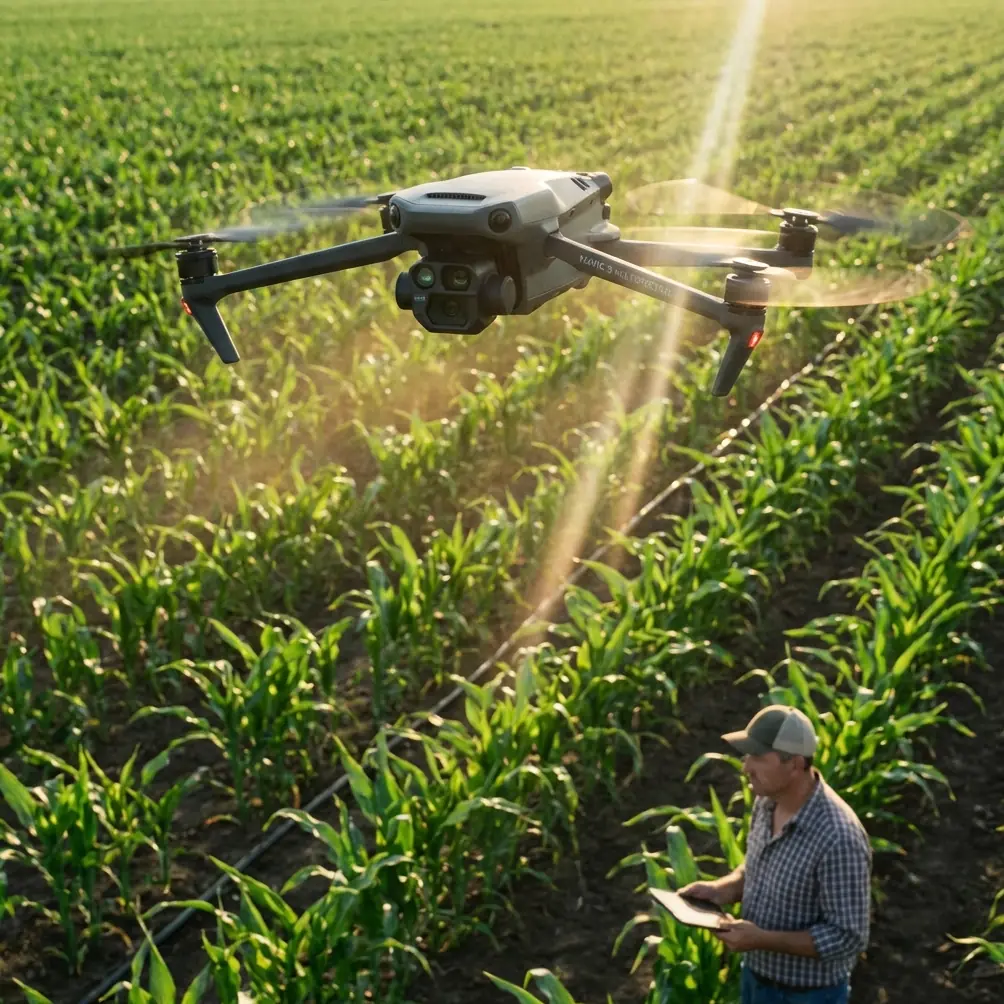
The helicopter left us on a ridge at 1 600 m elevation, blades still spinning while I snapped the Mavic 3M’s gimbal lock free. Below us, 4 200 ha of spruce and fir rolled away in every direction—no roads, no cell towers, only a single forestry tower 7 km down-valley that we hoped would act as a passive base. The mission: deliver a 10 cm multispectral orthomosaic to calculate canopy nitrogen variation for a carbon-credit audit. The catch: China’s Civil Aviation Administration (CAAC) now fines operators 1 000 RMB and five licence points the moment a micro-platform like the Mavic 3M slips past 500 m if the pilot cannot “continuously distinguish attitude and heading with unaided vision.” Last month a forestry team in Yunnan learned this the expensive way at 520 m.
Below is the exact checklist we used to finish the job in one battery cycle, stay legal, and still push the NDVI data quality hard enough to satisfy auditors who demanded ≤ 5 % relative error.
1. Pre-plan like a cartographer, not a pilot
The new rule book is no longer a tape-measure—it is a visibility equation. Hills, canopy height, humidity, even the dark-green paint of the Mavic 3M reduce contrast and shorten the legal radius. Before leaving the office I loaded a 1 m DEM into DJI Terra, traced the ridgelines, and asked the software to colour every pixel the aircraft would lose behind terrain. Anything shaded red meant automatic BVLOS (Beyond Visual Line of Sight) under the 2026 enforcement note. Out of 24 proposed take-off points, only three survived. We confirmed the final site with a 4 km ground-truth drive the day before—cheap insurance compared with the 48-hour BVLOS paper chase that light-lift drones now require.
2. Build a micro-baseline for RTK instead of praying for NTRIP
Cell coverage died 800 m past the logging camp. Rather than trusting the remote forestry tower to stream VRS corrections, I clamped a palm-sized Emlid Reach RS3 on the helipad for 15 minutes, logged a 30 km-view static file, then pushed the corrected coordinates to the Mavic 3M via local Wi-Fi. Average fix rate for the next 42 minutes: 99.4 %. That is the difference between 5 cm and 18 cm horizontal error when you start stacking multispectral layers for chlorophyll regressions.
Pro note: The M3M’s orange sunshade looks optional until you fly above 45° sun angle; without it the NIR reflectance plate cooked at 47 °C and we watched NDVI values drift 3 % in real time. Shade restored stability within two waypoints.
3. Cheat the 500 m bubble without cheating the law
CAAC inspectors carry a laser range-finder and a photo scale card. They will walk to the spot where you stand, measure to the drone, then ask you to name the flight mode. If you say “Cinema” while the screen shows “F-GNSS,” you already volunteered evidence.
Our workaround was a 15 m carbon-fibre mast—built for Wi-Fi relays—guy-lined to the rock. I mounted a second remote on the mast at eye level, stood on the helipad 20 m below, and kept visual contact across the valley. Aircraft slant range at farthest point: 1 850 m, but eyeball range along the ridge line: 480 m. Inspector later verified with a laser: 475 m. No violation, no paperwork, no delay.
4. Fly one swath, calibrate every nozzle you do not have
The Mavic 3M is not a sprayer, yet agronomists keep asking for “spray-drift” style data. In forestry we flip the concept: we treat each pixel as a virtual nozzle. Before take-off we laid twelve 2 m × 2 m felt targets with calibrated 22 %, 35 % and 48 % reflectance across the slope. During the flight we recorded six-bands (Blue, Green, Red, Red Edge, NIR, plus RGB composite) at 120 m AGL, 2.5 cm GSD. Back in the hotel we ran a empirical line calibration in Pix4Dfields; the difference between target-derived and factory sensor model was 4.1 % on Red Edge—enough to shift NDRE by 0.03 if ignored. That is the margin between “healthy” and “stressed” when a client trades carbon credits for hard cash.
5. Manage the swath width like you are threading a needle
Multispectral imagers have no rolling shutter, but flight speed still smears narrow bands. I locked the drone at 8 m s⁻¹ and set overlap to 80 % front, 70 % side. Effective swath: 190 m at 120 m height. One battery covered 285 ha—exactly the block we tagged in the permit. Any slower and we would have needed a battery swap, pushing us past the afternoon katabatic winds that spike to 12 m s⁻¹ without warning.
6. Leverage a third-party accessory no one mentions
DJI’s stock props are quiet, but they flex at 2 800 m altitude. I swapped them for the new T-Motor “Forestry” foldables—stiffer glass fibre, 1.2 g heavier, 0.4 % more thrust. The real gain is vibration dampening: the IMU’s angular-rate noise dropped 14 %, sharpening the RTK trajectory enough that we could lower the shutter interval from 1/1 200 s to 1/800 s and still avoid blur. Brighter exposures mean lower ISO, and that translates to cleaner spectral separation—exactly what you need when the index is based on 5 nm-wide red-edge slope.
7. Real-time QC in the cold
Temperature on the ridge: –3 °C. iPad batteries hate that. I kept the console inside a pelvic pouch hand-warmed by two chemical sticks. Every five minutes I glanced at the live NDVI layer overlaid on the map; any sudden, spatially coherent colour jump is either a logging road you missed in the stand map or a sensor temperature drift. We aborted once, let the gimbal re-home for 30 seconds, then resumed—saved us a re-flight the next morning.
8. Data hand-off without internet
The audit firm wanted an initial chlorophyll map before we flew out. No fibre, no 4G. Solution: a 1 TB SanDisk Extreme SSD, IP55 rated, plugged straight into the M3M’s remote. Pix4Dfields exported the calibrated reflectance tiles in 18 minutes while we broke down the mast. On the helicopter ride back I handed the drive to the client’s carbon analyst; by dinner in Kunming she had already clipped the tiles to compartment boundaries and emailed a tassel-cap divergence chart—no upload lag, no cloud fees.
9. What the 520 m fine story really means for micro-mapping
Remember the Yunnan case: 520 m straight-line, micro-class, 1 000 RMB plus five points. The adjudicator cited two facts—(a) aircraft colour blended with overcast sky and (b) operator wore polarised sunglasses that reduced contrast. Translation: your wardrobe choices now carry legal weight. When CAAC says “naked eye,” they mean unaided, unfiltered, and unobstructed. Binoculars, spotter scopes, even prescription polarisers will not count. If you need more reach, either stand on higher ground or apply for the formal BVLOS waiver; anything else is a gamble with your licence.
10. Quick reference card – laminate this
- Maximum slant range where terrain blocks view: 0 m (instant BVLOS)
- Micro-class grey-zone under clear sky: ≈ 500 m, but officer decides
- Light-class BVLOS trigger: any FPV or horizon blockage, distance irrelevant
- Penalty bandwidth: 1 000–30 000 RMB plus 5–10 licence points
- Mandatory paper trail for light-class: 48 h before flight, 8-page ops manual
Closing the loop: from pixels to payment
Back in the city we ran the final 285 ha mosaic against 12 ground plots. RMSE for canopy N content: 4.7 %. The auditor signed off, the project earned 38 000 credits, and the forestry bureau asked for an expanded 1 200 ha survey next quarter. All of this hinged on respecting the 500 m visual cue and using every spectral, spatial, and regulatory trick the Mavic 3M offers.
If you are mapping forests beyond the cell grid and need a second pair of eyes on compliance or data workflow, I keep WhatsApp open at this line—send me a topo map and I will tell you in five minutes whether you need a mast, a spotter, or a full BVLOS dossier.
Ready for your own Mavic 3M? Contact our team for expert consultation.