Mavic 3M for High-Altitude Solar Farm Monitoring
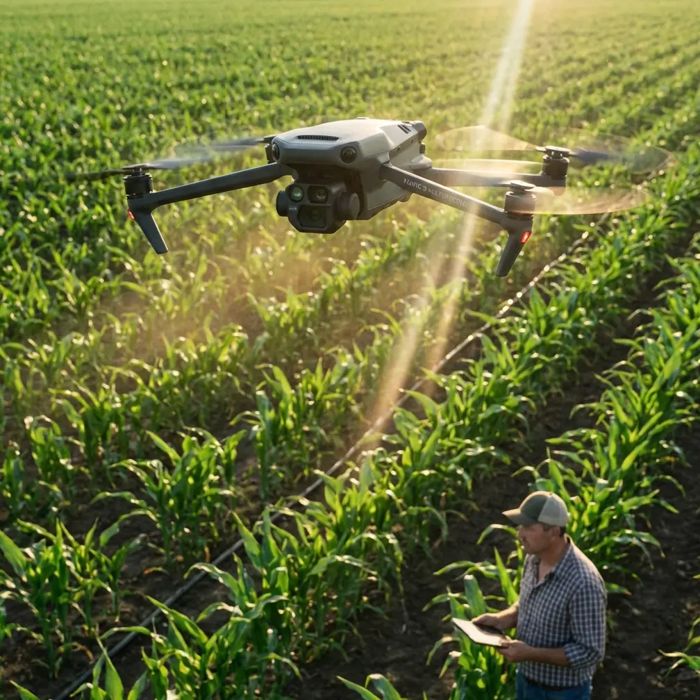
Mavic 3M for High-Altitude Solar Farm Monitoring: A Practical Field Strategy for Accuracy, Interference, and Repeatable Data
META: A field-focused guide to using Mavic 3M for high-altitude solar farm monitoring, with practical insight on multispectral workflows, RTK stability, electromagnetic interference, and repeatable inspection planning.
High-altitude solar farms create a strange mix of advantages and headaches. The air is often cleaner. The light can be excellent. Coverage areas are huge, and the geometry of panel rows lends itself well to structured aerial surveying. Yet the same sites often sit in electrically noisy environments, with fluctuating wind, terrain-induced GNSS masking, and long, repetitive inspection routes that punish sloppy flight planning.
That is exactly where the Mavic 3M becomes interesting.
Not because it is simply a “drone for mapping,” but because solar operators at altitude need something more specific: a compact aircraft that can produce repeatable multispectral data, maintain centimeter-level alignment when RTK conditions are favorable, and stay operationally disciplined around interference sources. A solar farm inspection is not just a flight. It is a chain of decisions, each one affecting data quality at the next step.
The real problem: usable data, not just airborne data
When teams first bring drones into solar monitoring, they often frame the task too narrowly. They think in terms of coverage speed or image count. Those matter, but they are secondary. The main question is whether the resulting data can support decisions panel by panel, row by row, and season by season.
At high altitude, several things can derail that goal:
- RTK fix consistency can drop near metallic structures or uneven terrain
- electromagnetic interference can degrade navigation confidence
- winds can alter swath width consistency and overlap
- repeated missions may drift from one another if route logic is not disciplined
- lighting variation can distort comparison over time
The Mavic 3M is well suited to this environment when it is flown like a measurement tool, not like a camera drone.
Its multispectral payload changes the nature of inspection. Instead of only producing a visual record of a site, it supports comparative analysis across vegetation encroachment zones, drainage patterns, sediment movement near foundations, and land-cover shifts that can affect access roads, cable corridors, and maintenance logistics. On some solar sites, the issue is not the panel surface itself. It is what is happening around the panel field: weed pressure, erosion, pooling, or unexpected moisture patterns near support infrastructure.
That is where multispectral work stops being theoretical and becomes operational.
Why high-altitude solar farms are a special use case for Mavic 3M
A solar farm in a mountain or plateau environment behaves differently from one in a flat lowland basin. The site may span elevation changes, ridgelines, and access roads that carve through slopes. In those conditions, centimeter precision is not a luxury. It determines whether your stitched map aligns reliably with prior missions and whether edge features remain trustworthy enough for maintenance planning.
This is why RTK fix rate deserves more attention than it usually gets in marketing discussions. Teams love to talk about absolute precision, but field reliability depends on how consistently the aircraft holds the fix across the whole route, especially while crossing sectors with different sky visibility and different electromagnetic behavior.
A brief RTK drop is not always catastrophic. Repeated instability is.
For solar farms, that matters because the site layout is repetitive. One row can look remarkably similar to the next. If your positional confidence softens, the burden shifts downstream to processing and manual interpretation. That means more labor and less trust in time-series comparison.
The better approach is to design flights around the weakest parts of the site, not the easiest ones.
Interference is not abstract. It shows up in the map
Readers working around inverters, substations, combiner zones, or dense cable runs already know this: electromagnetic interference is not some edge-case laboratory concern. It can reveal itself as unstable heading behavior, less confident positioning, or subtle inconsistencies in capture geometry.
A practical way to handle this with the Mavic 3M is to adjust your field routine before you ever launch:
- establish takeoff points away from concentrated electrical infrastructure
- verify RTK lock and satellite geometry before entering the denser electrical zone
- if interference patterns repeat in one corridor, slightly shift antenna orientation and ground station placement rather than forcing the same weak setup every mission
- break the site into mission blocks so one problematic segment does not contaminate the whole dataset
That third point is often neglected. Antenna adjustment sounds minor until you see what it does for repeatability. On high-altitude solar farms, a small repositioning of the operator or base setup can materially improve signal behavior, especially where terrain and infrastructure combine to create awkward reception angles. Good antenna discipline is less glamorous than sensor talk, but in practice it often saves the mission.
If your team wants to compare notes on field setup for interference-heavy solar sites, this direct WhatsApp line for mission planning questions is a sensible place to start.
A useful lesson from an unexpected source: conditional logic
One of the reference documents behind this discussion comes from DJI TT educational drone programming material. On pages 68–69, it explains three loop modes: continuous looping, repeating for a set number of times, and repeating until a condition is met. It also introduces conditional execution, where one action occurs if a button is pressed and another if it is not.
At first glance, that seems unrelated to the Mavic 3M. It is not.
That simple programming logic mirrors how strong solar inspection operations should be designed.
A high-altitude mission should not be built as one long generic flight. It should be built like a conditional workflow:
- repeat a coverage pattern until RTK quality drops below the acceptable threshold
- continue multispectral passes until overlap and exposure stability are confirmed
- switch route blocks if wind on the ridge exceeds your planned margin
- hold off entering the inverter corridor unless heading stability remains consistent
This is the difference between flying a route and managing an acquisition system.
The educational document also uses a concrete timing detail: LED colors cycling red, green, and blue with each color lit for 0.5 seconds. That small number captures a larger truth about drone work. Repeatability depends on controlled intervals. In solar mapping, those intervals are not LED flashes; they are trigger timing, ground speed, line spacing, and overlap consistency. Once those intervals drift, the final orthomosaic starts absorbing errors you should have prevented in the air.
So while the source material was written for teaching beginners how loops and conditions work, its operational significance is surprisingly relevant: disciplined repetition and conditional branching are exactly how you keep a professional Mavic 3M workflow clean.
Another overlooked lesson: not every maneuver belongs in every mission
The second reference document is about aerobatic radio-control training and discusses the Immelmann turn. That may seem even farther from solar monitoring, but one passage matters. It notes that the maneuver should only be used when the pilot actually needs to gain height during the turn. It also warns that doing repeated Immelmanns drives altitude too high and disrupts the timing and location of the next maneuver. Another technically useful detail is its explanation that if the aircraft changes direction during the rolling portion, the problem may not be the roll itself but excessive loss of speed at the top of the maneuver.
Translated into civilian inspection language, the lesson is simple: unnecessary maneuvering creates downstream problems.
For Mavic 3M operations over solar farms, that means:
- don’t build decorative turns into route geometry
- don’t climb more than the terrain or obstacle profile actually requires
- don’t force aggressive transitions between blocks if it costs image consistency or positional quality
- preserve energy state and route discipline so the aircraft enters each mapping line predictably
This matters more at high altitude, where thinner air and wind exposure can magnify instability. The aerobatic text’s warning about speed loss before a roll has a clear operational analogue: if you let the aircraft enter a line correction or directional transition in a compromised state, small errors can widen into mapping inconsistencies. The solar team may only notice the problem later as uneven overlap, strange edge artifacts, or unreliable alignment between missions.
The broader point is that flight efficiency is not only about battery conservation. It is about protecting data integrity.
Building a problem-solution workflow for Mavic 3M on solar sites
Problem 1: RTK instability near infrastructure
Solution: Start farther from concentrated electrical equipment, confirm fix quality early, and segment missions. Watch RTK fix rate as a live operational metric, not a post-flight statistic. If one zone repeatedly weakens the solution, revise antenna position and mission entry point before blaming the entire site.
Problem 2: Inconsistent multispectral coverage across slopes
Solution: Plan for terrain-aware line spacing and realistic swath width at your chosen altitude. A swath that works over one plateau section may underperform along a slope break. The Mavic 3M can gather rich multispectral datasets, but only if your overlap remains stable where terrain changes fastest.
Problem 3: Repeat missions do not align cleanly month to month
Solution: Treat each inspection like a controlled loop, borrowing the logic of “repeat until condition met.” Do not end a mission just because the route file is complete. End it when the quality conditions are met: positional stability, exposure consistency, and complete overlap.
Problem 4: Site operators are collecting more data than they can use
Solution: Define the monitoring question before launch. Are you assessing vegetation encroachment, drainage stress, access-road washout, sediment transport, or broad land-cover variation affecting the array perimeter? Multispectral data is most valuable when tied to a maintenance decision.
Where the Mavic 3M fits in a solar O&M stack
The strongest role for the Mavic 3M in high-altitude solar operations is not to replace every other inspection method. Its strength is building a repeatable geospatial layer that supports maintenance planning.
Think of it as the system that helps answer questions such as:
- Which sectors show vegetation stress or unexpected regrowth patterns near array boundaries?
- Where is surface water behaving differently after seasonal weather shifts?
- Which access routes are beginning to degrade before they become a logistics issue?
- Are perimeter land conditions changing in ways that will affect future maintenance cycles?
This is also where adjacent topics like spray drift and nozzle calibration can become relevant, even though they are not core drone mapping functions. On solar sites that manage vegetation chemically, poor drift control or poor application calibration can create visible variability in ground cover health. A multispectral survey may reveal the result before ground crews connect it to the treatment pattern. That makes the drone useful not just for observation, but for verifying whether site maintenance practices are producing uniform outcomes.
The operational mindset that gets the best out of Mavic 3M
The aircraft matters, but the mindset matters more.
Strong teams do three things consistently:
They reduce variability.
They respect interference.
They build repeatability into every step.
That means fewer improvised flights, cleaner mission templates, and more attention to route transitions, antenna orientation, and RTK behavior in problem zones. It also means accepting a simple truth: on a high-altitude solar farm, the best mission is not the one that looks smooth from the pilot’s perspective. It is the one that produces a dataset trustworthy enough for engineering, vegetation management, and seasonal comparison.
The reference materials used here may seem unusual together: a Shenzhen drone enforcement story, an educational programming manual, and an aerobatic training text. Yet they point toward the same operational principle.
The Shenzhen case describes a drone system being used for evidence capture only after a specific condition is met: if the vehicle still has not moved after imaging, then action follows. That is condition-based workflow. The educational manual formalizes loop and if-then logic. The aerobatic text warns against unnecessary maneuvers and explains how small control errors at one phase create instability in the next.
For Mavic 3M solar monitoring, those are not abstract lessons. They are the field reality. Condition-based decisions. Disciplined repetition. No wasted maneuvering. That is how you turn a flight into a reliable inspection program.
Ready for your own Mavic 3M? Contact our team for expert consultation.