Mavic 3M in Coastal Forest Monitoring: What a New Hybrid
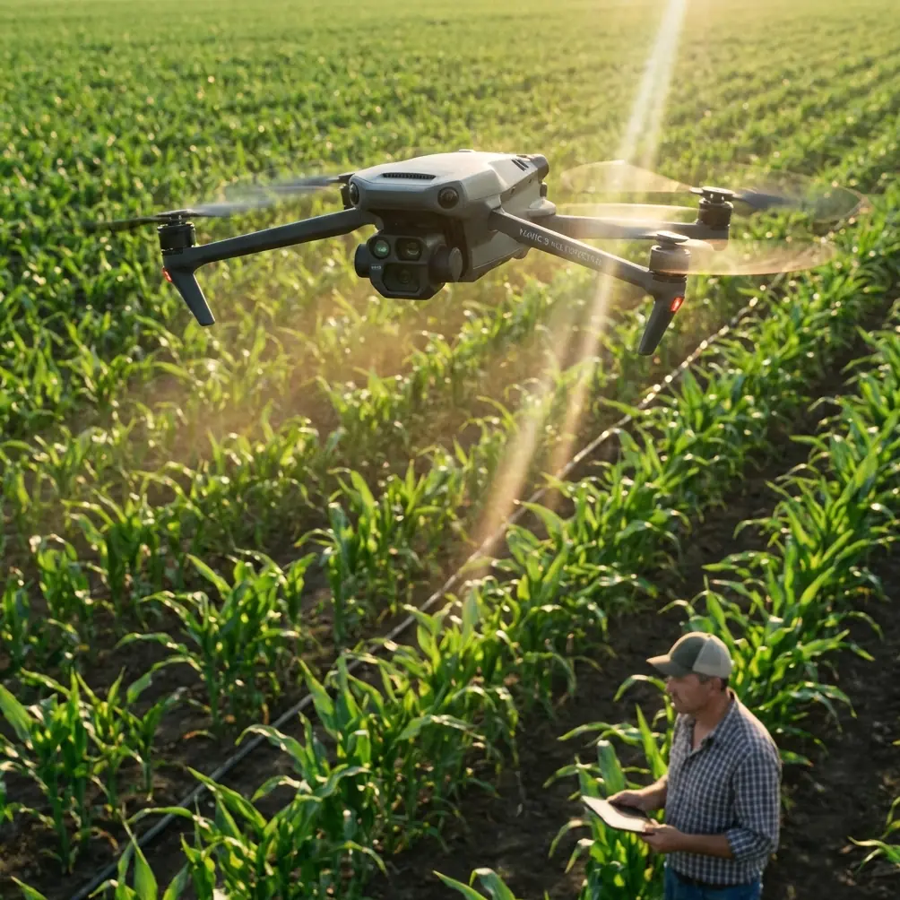
Mavic 3M in Coastal Forest Monitoring: What a New Hybrid UAV Certification Really Signals
META: Expert analysis of what China’s new E40H type certification means for Mavic 3M coastal forest monitoring, multispectral workflows, RTK precision, and real-world field operations.
Coastal forest monitoring rarely fails because the drone cannot fly. It fails because the data chain breaks under field pressure.
Salt haze softens contrast. Wind pushes canopies into motion. Wet ground limits where crews can safely launch. Tidal timing compresses the inspection window. And if the mission objective is ecological rather than cinematic, every weak link shows up fast: patchy georeferencing, inconsistent overlap, delayed interpretation, and too much time spent reconciling field notes with imagery back at the office.
That is the lens through which I read the latest aviation news out of China. On December 30, 2025, the E40H civil unmanned aircraft system received a type certificate from the Civil Aviation Administration of China’s Central South Regional Administration, under certificate number TC0105A-ZN. According to the report, it is the first certified product globally in the medium composite-wing and hybrid-power unmanned category to satisfy the regulator’s airworthiness requirements. The same report also notes that China has so far granted type certificates to 19 civil unmanned aircraft models from 10 companies, with 9 of those models coming from DJI.
At first glance, that story seems far removed from a Mavic 3M operator mapping mangrove edges or coastal shelterbelts. It is not. For anyone running Mavic 3M missions in forests near shorelines, this certification milestone matters because it confirms where the unmanned sector is heading: toward more formal, airworthiness-centered operations, broader mission categories, and higher expectations for documented safety and data reliability. The Mavic 3M sits in a smaller class, but it works inside that same maturing ecosystem.
I have seen the shift firsthand. A few years ago, one of the hardest coastal projects I worked on involved monitoring tree stress along a wind-exposed littoral corridor where drainage channels, salt intrusion, and fragmented access roads made ground inspection slow and incomplete. We could fly, but the real challenge was repeatability. The vegetation signatures looked different depending on time of day, wind speed, and how well the pilot maintained line spacing over uneven canopy. On paper, the job was simple. In practice, it was messy.
That is exactly where the Mavic 3M has become useful.
Why this certification news matters to Mavic 3M users
The E40H story is not about replacing compact multispectral platforms. It is about regulatory direction. When an aircraft like the E40H becomes the first in its class to clear type certification, it signals that authorities and operators are moving beyond “can it fly?” toward “can it be trusted, repeatedly, in real operations?” That distinction matters for environmental monitoring teams, including those using the Mavic 3M in coastal forests.
The report’s two most significant details are not just administrative markers. First, the E40H earned a formal type certificate on 2025-12-30, which means its design safety met a regulator’s acceptance threshold rather than simply being marketed as mission-capable. Second, among 19 certified civil unmanned aircraft models in China, the article says 9 are from DJI, largely in sectors such as emergency response, agriculture, and transport. Operationally, that tells us two things.
One, regulators are no longer treating advanced UAV work as a fringe activity. Two, DJI already occupies a major part of the certified ecosystem, which strengthens confidence in the surrounding software, mission planning habits, pilot training expectations, and documentation culture that Mavic 3M users increasingly depend on.
If you monitor coastal forests, this does not mean the Mavic 3M suddenly inherits the E40H’s certification status or mission envelope. It means your platform now exists in a market that is being pulled toward more disciplined workflows. That raises the value of using the Mavic 3M as more than a camera drone. It needs to be treated like a measurement tool.
The coastal forest problem the Mavic 3M actually solves
The Mavic 3M earns its place when the mission is diagnostic rather than purely visual.
In coastal forestry, the question is often not whether a stand looks green from above. The real question is whether that green is stable, declining, salt-stressed, waterlogged, disease-affected, or simply delayed by seasonal variation. Standard RGB imagery helps with crown shape, damage visibility, and obvious mortality. Multispectral data is what helps separate visual appearance from plant condition.
That is where the platform’s multispectral capability becomes operationally significant. A coastal corridor can hide stress patterns that are too subtle for normal visual review but clear enough in a repeatable multispectral workflow. A Mavic 3M pass over shelter forests, estuarine edges, or replanting zones can reveal uneven vigor bands that often trace back to salinity exposure, drainage failure, root suffocation, or pest concentration.
The difference in the field is speed. Instead of walking fragmented terrain and sampling only accessible plots, teams can build a consistent surface model of canopy response across the full management unit. If you are working with irregular coastlines, that matters even more because the transitions are where the ecological signals often appear first.
I would argue that the bigger advantage is not only detection. It is prioritization. Coastal forest managers do not need another map for the archive. They need a map that tells them where crews should go tomorrow morning.
RTK discipline matters more near the coast
One of the quiet reasons Mavic 3M workflows improve coastal monitoring is position consistency. This is where RTK Fix rate and centimeter-level repeatability stop being technical trivia and become practical decision support.
Near the coast, visual features can be deceptive. Mud flats change. Tidal debris shifts. Tracks disappear after rain. If you are revisiting the same forest blocks to compare plant response over time, small geolocation errors can create false change or hide real decline. A reliable RTK workflow gives each mission a better chance of aligning with previous datasets, which is essential when you are trying to confirm whether canopy thinning is spreading inland or staying near exposed margins.
That consistency also reduces field friction. In the older project I mentioned, we lost time reconciling image layers because the control strategy was too loose for the environment. We had decent imagery but weak confidence in edge-to-edge comparison. With the Mavic 3M, when crews maintain a strong RTK lock and disciplined flight geometry, the resulting mosaics are much more useful for temporal analysis.
For coastal forest monitoring, that often matters more than raw flight drama. You do not need spectacle. You need confidence that a stressed patch mapped this month is the same patch you observed six weeks ago.
Swath width, overlap, and wind are not minor settings
A lot of failed forestry missions come down to operators treating mission parameters as defaults. Coastal forests punish that habit.
Swath width has to be chosen with the canopy and the wind in mind, not just battery convenience. Push the line spacing too aggressively and you may still produce a map, but not one robust enough for vegetation interpretation. Wind movement in crowns creates blur and inconsistency, especially over mixed-height stands. In practical terms, a narrower effective swath and stronger overlap discipline often produce better downstream analysis than trying to maximize hectares per sortie.
This is one of the Mavic 3M’s strengths when used properly. Its compact deployment makes it easier to launch within short weather windows, but its real value appears when teams use that flexibility to refine mission design rather than rush data capture. Coastal operations are often about timing the right 30 to 40 minutes, not filling the sky for as long as possible.
Why agriculture terms still belong in this discussion
Some readers will notice terms like Spray drift and Nozzle calibration in conversations around drones and assume they are irrelevant to forest monitoring. I disagree. Coastal forest teams often work adjacent to managed land, restoration zones, invasive control operations, or areas where aerial application is part of the broader landscape management picture.
Understanding spray drift matters because it can explain plant stress signatures at forest edges. If a multispectral survey shows irregular decline along boundaries near treated land, drift becomes a plausible operational variable rather than an abstract environmental concern. Nozzle calibration may sound far from a Mavic 3M review, but it belongs in the same decision ecosystem: poor application quality upstream can become a mapping anomaly downstream.
The Mavic 3M does not spray. That is not the point. It helps reveal where application effects, salt impact, hydrological changes, or disease pressure may be expressing themselves in the canopy. In that sense, it is often the platform that turns suspicion into inspectable evidence.
Weather resistance and field realism
Coastal drone work is hard on equipment. Salt-laden moisture, intermittent spray, sandy launch points, and abrupt weather changes are normal. That is why specs like IPX6K matter in field planning conversations even when the day begins with decent conditions. Not every mission fails because of rain; many degrade because the environment steadily erodes reliability.
The Mavic 3M’s appeal in this context is not that it turns hostile conditions into easy ones. It is that a well-designed compact system reduces setup complexity and shortens exposure time. For ecological teams working from levees, embankments, or narrow access tracks, that operational simplicity can be the difference between collecting usable data and aborting with half a dataset.
If your workflow still depends on long setup cycles and improvised launch positions, coastal conditions will eventually expose the weakness. Smaller, faster-deploying systems tend to outperform on mission completion rate, especially when paired with disciplined route design and quick validation checks in the field.
The bigger lesson from the E40H milestone
The E40H receiving type certification is not just a headline for large-aircraft operators. It is a signal that the unmanned industry is entering a stricter phase where design assurance, flight reliability, and mission accountability are becoming central. The article’s reference to 19 certified civil UAV models across 10 companies shows a regulated market forming around operational legitimacy, not just innovation claims. The fact that 9 of those models are from DJI reinforces how much influence DJI platforms have in shaping expectations across different mission classes.
For Mavic 3M users, especially those in coastal forest monitoring, that changes the standard. It is no longer enough to produce attractive maps. Operators need repeatable collection methods, defensible geospatial accuracy, and a workflow that can withstand scrutiny from clients, regulators, and internal stakeholders.
That is the direction of travel. And honestly, it is overdue.
The strongest Mavic 3M programs I have seen are not built around hardware obsession. They are built around operational discipline: defined flight timing, known RTK procedures, consistent overlap, environmental notes captured on site, and post-processing tuned for vegetation decision-making rather than presentation slides. If you want help pressure-testing that workflow against your own coastal monitoring environment, this field planning channel is a practical place to start: https://wa.me/example
My take after years in the field
The Mavic 3M makes coastal forest monitoring easier not because it removes complexity, but because it compresses the distance between collection and interpretation. That is valuable when the forest edge is changing faster than field crews can walk it.
The news about the E40H matters because it shows the UAV sector is maturing into a world where reliability and validated design increasingly define credibility. That has implications all the way down to compact platforms used for environmental intelligence. As regulation becomes more structured and operators face greater expectations, the Mavic 3M’s role becomes clearer: not as a catch-all drone, but as a precise, multispectral field instrument that can help coastal forestry teams see emerging stress early, revisit it accurately, and act before visible decline spreads.
That is the shift I care about. Better drones are useful. Better decisions, made sooner, are what actually protect the forest.
Ready for your own Mavic 3M? Contact our team for expert consultation.