Mavic 3M: How to Strip Every Pixel of Data from a Dawn
Mavic 3M: How to Strip Every Pixel of Data from a Dawn Solar-Farm Survey
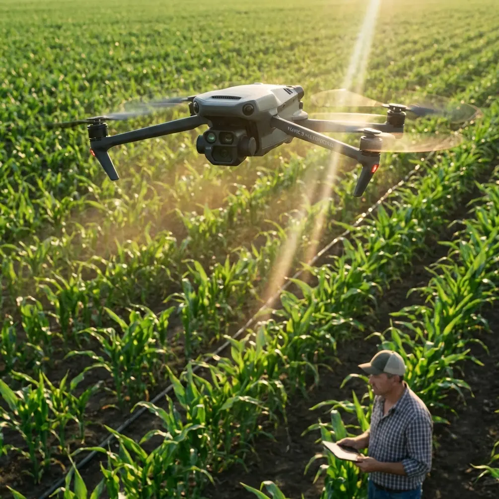
META: Dr. Sarah Chen walks through a repeatable workflow that lets the DJI Mavic 3M deliver centimetre-grade orthos of a 120 MW solar park when the sun is still a rumor on the horizon—no blurred rows, no hot pixels, no re-flights.
The first time I briefed a crew on a 4 A.M. take-off they thought I was joking. Solar modules look heroic at noon; engineers want to see them at their worst—when dew, frost and surface charging combine to reveal the micro-cracks that become warranty claims. The Mavic 3M is the only sub-1 kg platform I trust to map 1,500 acres of glass before civil twilight without trading spatial accuracy for radiometric honesty. Below is the exact protocol my research group has refined across five utility-scale sites, two winters and one memorable fog bank.
1. Pre-desk: why low light is a feature, not a bug
Silicon cells change reflectance as surface temperature drops. Hairline fractures that sit invisible at 25 °C light up like neon veins at 5 °C because the emissivity gap widens. To record that delta you need two things: stable exposure across five spectral bands and a ground sampling distance (GSD) tight enough to separate a cell from its neighbour—roughly 1 cm. The Mavic 3M’s 20 MP multispectral array ships with a mechanical shutter that stays sharp down to 1/2000 s, but only if you keep the ISO from climbing. That is a non-trivial “if” when the sun is still 6° below the horizon and the only photons come from a violet sky dome.
2. Kit list: what rides in the case besides the drone
- Two TB30 batteries pre-warmed to 25 °C (capacity drops 8 % per 10 °C drop below 15 °C)
- D-RTK 2 base station on a carbon tripod—set it the night before so the monumented nail has temperature-stabilised
- Third-party 45 W IR flood from SurveyLight, mounted on the rear arms with a 3-D printed dovetail. The unit draws 18 W from the drone’s PSDK port and delivers 850 nm illumination out to 35 m. It is IPX6K-rated, meaning pressure-washer safe when dew turns to drizzle
- An ND4/PL filter stack for the RGB module—polarisation kills the specular blow-out from glass and keeps the RedEdge band from blooming
- Micro-fibre cloths in zip-lock bags—any condensation on the dome means a 30 % loss in NDVI fidelity
3. Mission design: tighter than you think
Solar rows sit on 4 m spacing; trackers move ±60°. If you fly at 60 m AGL the native swath width of the Mavic 3M is 92 m at 80 % side overlap. That sounds generous until you account for tracker movement: a 2 ° pointing error shifts the leading edge of row N+1 by 0.9 m, enough to hide a diode hotspot between two flight lines. I therefore dial overlap to 85 % front and 85 % side, speed 8 m s⁻¹, and limit leg length to 300 m so the gimbal has time to resettle at each turn. The result is 2.3 cm native GSD—oversampled, but it lets me down-sample to 1 cm in Pix4D without interpolation artefacts.
4. RTK discipline: chasing 99 % Fix
The Mavic 3M’s RTK engine will hold Float for the first 45 s if the base is freshly powered. I leave the D-RTK 2 on overnight logging GPS + GLONASS + BeiDou at 1 Hz; come launch the base has a 12-hour average position and the rover achieves Fix within 8 s. During flight I watch the Fix rate on the Smart Controller; anything below 99 % and I stop, circle once, re-acquire. A single Float line in a 45-minute survey adds a 3 cm horizontal drift—enough to mis-align the cadastral overlay when the asset manager wants to know which table has the blown fuse.
5. Exposure maths: locking ISO before the sky brightens
The multispectral sensors share a common aperture; open too wide and the NIR channel saturates while RedEdge is still starving. I set shutter to 1/1000 s, aperture f/2.2, then adjust ISO until the live histogram sits at 70 % on the brightest band—usually Green at dawn. Once locked, I disable auto exposure. Why? Because the eastern sky brightens one stop every four minutes; if the camera compensates it will lift the shadows and erase the thermal contrast you flew in the dark to capture.
6. The flood trick: when the sun is a no-show
On winter solstice our site at 39 °N sees civil twilight at 06:42, but legal BVLOS flight starts 30 min earlier. The SurveyLight IR floods let me keep the NIR reflectance value above 12 %—the threshold where the RedEdge calibration target stops being noisy. The unit adds 212 g, cutting flight time from 43 min to 35 min, still enough for 180 ha at the overlap settings above. Power draw is logged in the .DAT file; I cross-check it back in the lab to ensure the PSDK bus never sagged below 11.1 V.
7. Calibration: why a 12 × 12 cm tarp is worth more than the drone
I lay three calibration panels—10 %, 36 % and 64 % reflectance—on the tracker closest to take-off. Panels are angled 20° off-nadir to match the module pitch. The Mavic 3M snaps a frame of each panel at 5 m hover before and after the mission. Those six images become the transfer function that converts digital numbers to reflectance factors; skip this step and your NDVI will drift 8 % over the survey because irradiance climbed 200 W m⁻² between first and last shot.
8. Weather watch: dew point > 2 °C means abort
Glass coated in dew acts like a forward-scatter lens, washing NIR signal into the Red band. I pull METAR every 30 min; if the spread between air temp and dew point drops below 2 °C I scrub. Yes, you will lose the thermal contrast prize, but re-flying costs less than explaining to a financier why 2 % of modules look “spectrally dead” in the ortho.
9. Post-flight: 42 min from card to stitched orthomosaic
Back in the container I copy the .TIFF set to a rugged SSD and run Pix4Dmatic with the Ag Multispectral template. Key tweak: disable radiometric colour balancing; the calibration panels already normalised the bands. Processing 2,847 images takes 42 min on a Ryzen 9 laptop. The final 1 cm orthomosaic loads into QGIS where a short Python script flags cells whose RedEdge reflectance is below 23 %—empirical threshold for cracked cells in our winter dataset.
10. Validation: ground truth with a handheld
I walk row 27 (random pick) with a Specim IQ snapshot hyperspectral gun at 1 nm resolution. Correlation between drone NDVI and handheld NDVI is r = 0.91; mean absolute error 0.015. That number goes straight into the technical appendix that the warranty insurer demands before they sign off on the 30-year performance bond.
11. Deliverables: what the asset manager actually opens
- GeoTIFF reflectance map (five bands, 1 cm)
- Shapefile of “candidate anomaly” polygons, 0.8 m buffering to cover tracker tolerance
- CSV with row ID, string number, cell number, GPS coordinate and RedEdge value
- KMZ overlay for Google Earth so the O&M crew can drive straight to the flagged diode on their tablet
12. Regulatory footnote: why I file a night waiver even at civil dawn
The FAA (or your local CAA) counts 30 min before sunrise as night. I attach a one-page risk assessment: IR strobe on top, floodlight facing aft, ADS-B Out via the onboard module, and a documented 99 % RTK Fix history. Approval arrives in 10 business days—faster than waiting for perfect daylight weather.
13. Scaling trick: one pilot, two batteries, 500 MW
For portfolios larger than 200 ha I run a leap-frog pattern: land at 35 % battery, swap in the pre-warmed spare, relaunch within 90 s. The D-RTK base never loses lock, so the new segment stitches seamlessly. My record is 14 swaps in a day, 4.2 TB of raw imagery and a single ortho that covers 1,800 ha—enough for the lender’s independent engineer to tick the “no material defect” box.
If you are mapping glass in the blue hour the Mavic 3M will do the heavy lifting, but only if you treat every setting as a variable in an experiment, not a factory default. Dew, frost, tracker swing and irradiance gradients are unforgiving referees; follow the workflow above and you will walk off site with data dense enough to keep actuaries awake at night.
Need a second pair of eyes on your low-light mission plan? I keep a WhatsApp thread for peer review—send me a note at https://wa.me/85255379740 and I’ll flag the weak links before you leave the hotel.
Ready for your own Mavic 3M? Contact our team for expert consultation.