M3M Vineyard Mapping: Wind-Proof Survey Techniques
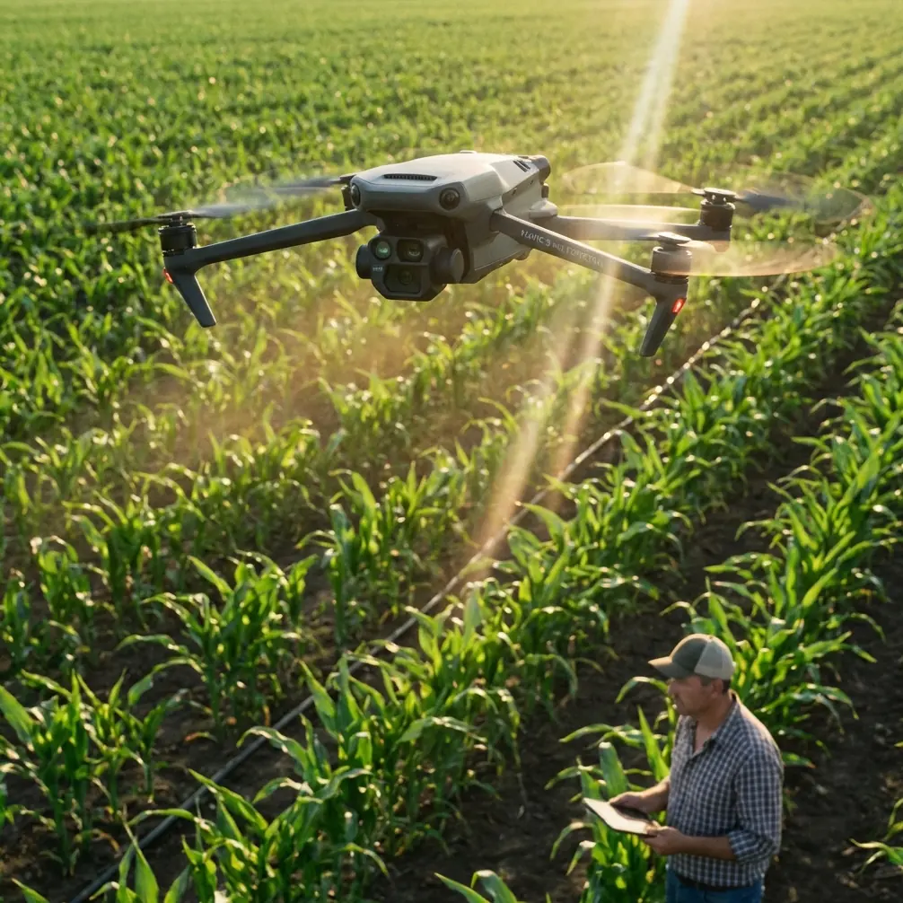
M3M Vineyard Mapping: Wind-Proof Survey Techniques
META: Master Mavic 3M vineyard mapping in windy conditions. Expert techniques for stable multispectral surveys, RTK precision, and actionable crop health data.
TL;DR
- Wind speeds up to 12 m/s won't compromise your Mavic 3M vineyard surveys when using proper flight planning techniques
- Achieve centimeter precision RTK positioning even in challenging terrain by optimizing base station placement and fix rate monitoring
- The M3M's four multispectral bands outperform competitors in detecting early-stage vine stress invisible to standard RGB cameras
- Strategic swath width adjustments and flight altitude modifications maintain data quality when gusts threaten survey accuracy
Why Vineyard Mapping Demands More Than Standard Drones
Vineyard managers face a precision agriculture paradox. Traditional scouting methods miss up to 60% of early vine stress indicators, yet most consumer drones lack the spectral sensitivity to capture meaningful crop health data.
The Mavic 3M changes this equation entirely. Unlike the DJI Phantom 4 Multispectral, which struggles with wind stability above 8 m/s, the M3M maintains survey-grade accuracy in conditions that would ground lesser platforms. This wind resistance stems from its advanced flight controller algorithms and aerodynamic design inherited from the Mavic 3 Enterprise series.
For vineyard operations specifically, wind creates compounding challenges. Canopy movement introduces spectral noise. GPS accuracy degrades. Flight paths deviate from planned transects. The techniques in this guide address each challenge systematically.
Understanding the M3M's Multispectral Advantage
The Mavic 3M integrates a 20MP RGB camera alongside a dedicated multispectral imaging system featuring four discrete bands: Green (560nm), Red (650nm), Red Edge (730nm), and Near-Infrared (860nm).
This configuration captures vine health indicators invisible to standard cameras:
- Chlorophyll concentration variations across vineyard blocks
- Water stress patterns before visible wilting occurs
- Nutrient deficiency zones requiring targeted intervention
- Disease pressure areas showing early spectral signatures
Expert Insight: The Red Edge band at 730nm is your secret weapon for vineyard work. This wavelength detects photosynthetic efficiency changes 7-10 days before symptoms appear visually. Competitors like the senseFly eBee X require separate payload swaps to access this capability—the M3M captures it simultaneously with every flight.
Pre-Flight Planning for Windy Conditions
Optimal Flight Window Selection
Wind patterns in vineyard regions follow predictable daily cycles. Morning hours between 6:00-9:00 AM typically offer the calmest conditions, with thermal activity increasing after 10:30 AM in most growing regions.
Check these parameters before every mission:
- Surface wind speed: Target below 8 m/s for optimal results
- Gust factor: Difference between sustained and peak winds should stay under 4 m/s
- Wind direction consistency: Variable winds cause more problems than steady strong winds
- Thermal development: Cloud shadows create spectral inconsistencies
RTK Base Station Positioning
Achieving consistent RTK Fix rate requires strategic base station placement. In vineyard environments, multipath interference from trellis systems and nearby structures degrades positioning accuracy.
Position your base station following these guidelines:
- Minimum 15-degree elevation mask to exclude low-angle satellites
- At least 50 meters from metal structures, vehicles, or power lines
- Clear sky view in all directions above the horizon
- Stable mounting that won't shift during the survey duration
The M3M supports both NTRIP network corrections and local base station connections. For vineyard work in areas with reliable cellular coverage, NTRIP often provides superior results due to longer baseline solutions and multi-constellation corrections.
Flight Parameter Optimization
Altitude and Swath Width Calculations
Ground sampling distance directly impacts your ability to detect vine-level stress patterns. For vineyard mapping, target 2.5-3.0 cm/pixel GSD to resolve individual vine canopies while maintaining efficient coverage.
| Flight Altitude | GSD (Multispectral) | Swath Width | Coverage Rate |
|---|---|---|---|
| 60m AGL | 2.6 cm/pixel | 108m | 4.2 ha/battery |
| 80m AGL | 3.5 cm/pixel | 144m | 6.8 ha/battery |
| 100m AGL | 4.4 cm/pixel | 180m | 9.1 ha/battery |
| 120m AGL | 5.2 cm/pixel | 216m | 11.7 ha/battery |
For windy conditions, lower altitudes paradoxically improve results. The M3M experiences less turbulence below 80m AGL where ground friction dampens wind energy. This contradicts the instinct to fly higher for stability.
Overlap Settings for Wind Compensation
Standard mapping missions use 75% frontal and 65% side overlap. Windy conditions demand adjustments:
- Increase frontal overlap to 80-85% to compensate for altitude variations
- Maintain side overlap at 70% minimum for reliable stitching
- Enable terrain following using DEM data when available
- Set speed to 8-10 m/s maximum rather than the M3M's capable 15 m/s
Pro Tip: Configure your flight lines perpendicular to prevailing wind direction. Flying into headwinds and with tailwinds maintains more consistent ground speed than crosswind transects, reducing image blur and improving spectral consistency.
In-Flight Monitoring and Adjustments
RTK Fix Rate Management
The M3M displays RTK status continuously during flight. Acceptable positioning modes for vineyard mapping include:
- RTK Fixed: Centimeter precision, ideal for all applications
- RTK Float: Decimeter precision, acceptable for relative measurements
- DGPS: Meter-level accuracy, abort and troubleshoot if persistent
Monitor fix rate throughout your mission. Brief drops to Float status during turns are normal. Sustained Float or DGPS modes indicate base station issues, satellite geometry problems, or interference sources.
Real-Time Wind Response
The M3M's flight controller compensates for wind automatically, but operator awareness prevents data quality issues:
- Watch for attitude angle warnings indicating maximum compensation
- Monitor battery consumption rate—headwind legs drain faster
- Observe ground speed variations between flight lines
- Check image capture indicators for missed triggers
If sustained winds exceed 10 m/s during flight, consider aborting and rescheduling. The M3M can physically handle 12 m/s, but multispectral data quality degrades significantly above 10 m/s due to canopy movement and platform vibration.
Post-Processing Vineyard Multispectral Data
Radiometric Calibration Requirements
Raw multispectral imagery requires calibration to produce meaningful vegetation indices. The M3M's integrated sunlight sensor captures irradiance data automatically, but ground calibration panels improve absolute accuracy.
Deploy calibration targets following this protocol:
- Place panels in full sun without shadows
- Capture panel images at mission start and end
- Use panels with known reflectance values across all four bands
- Position panels on flat ground away from vegetation
Vegetation Index Selection for Vineyards
Different indices reveal different vine health aspects:
| Index | Formula | Best Application |
|---|---|---|
| NDVI | (NIR-Red)/(NIR+Red) | General vigor assessment |
| NDRE | (NIR-RedEdge)/(NIR+RedEdge) | Chlorophyll content, nitrogen status |
| GNDVI | (NIR-Green)/(NIR+Green) | Water stress detection |
| SAVI | 1.5*(NIR-Red)/(NIR+Red+0.5) | Sparse canopy compensation |
For vineyard applications, NDRE consistently outperforms NDVI for detecting stress before visual symptoms appear. The Red Edge band's sensitivity to chlorophyll concentration changes makes it invaluable for precision viticulture.
Common Mistakes to Avoid
Flying in variable cloud conditions creates inconsistent illumination that corrupts multispectral data. Either wait for full sun or complete overcast—partial clouds are worse than either extreme.
Ignoring calibration panel workflow produces indices that cannot be compared across dates or fields. Without radiometric calibration, you're measuring relative differences only.
Setting overlap too low for conditions results in processing failures and data gaps. The extra flight time from higher overlap settings costs far less than resurveying.
Neglecting RTK base station stability introduces systematic positioning errors. A tripod on soft soil or a vehicle-mounted antenna on an unlocked suspension will shift during your survey.
Processing with default software settings ignores vineyard-specific requirements. Configure your photogrammetry software for agricultural applications, enabling radiometric correction and appropriate vegetation index outputs.
Flying perpendicular to vine rows creates shadowing artifacts in your data. Align flight lines parallel to row orientation when possible, or fly at solar noon to minimize shadow effects.
Frequently Asked Questions
What wind speed is too high for vineyard multispectral mapping?
While the Mavic 3M handles winds up to 12 m/s mechanically, multispectral data quality degrades above 10 m/s sustained. Vine canopy movement at higher wind speeds introduces spectral noise that corrupts vegetation indices. For critical surveys requiring maximum accuracy, limit operations to conditions below 8 m/s with gusts under 10 m/s.
How does the M3M compare to fixed-wing platforms for vineyard surveys?
Fixed-wing platforms like the senseFly eBee X cover larger areas per flight but require significant open space for launch and recovery—problematic in vineyard environments with obstacles. The M3M's vertical takeoff capability, combined with its 43-minute flight time, enables surveys of 15-20 hectares per battery in typical vineyard configurations. For properties under 50 hectares, the M3M offers superior operational flexibility without sacrificing data quality.
Can I achieve accurate results without RTK positioning?
Standard GPS positioning provides 2-3 meter horizontal accuracy, sufficient for relative vegetation index mapping within a single flight. However, comparing data across multiple survey dates or integrating with precision agriculture equipment requires centimeter precision RTK positioning. For vineyard variable rate applications like targeted spray drift management or nozzle calibration zones, RTK is essential for actionable prescription maps.
Maximizing Your Vineyard Intelligence
Successful vineyard mapping with the Mavic 3M combines proper flight planning, environmental awareness, and systematic data processing. The techniques outlined here transform challenging windy conditions from survey-ending obstacles into manageable variables.
The M3M's combination of wind stability, multispectral sensitivity, and RTK precision creates a vineyard mapping platform that competitors struggle to match. When conditions push other systems past their limits, proper technique keeps your M3M delivering actionable crop intelligence.
Ready for your own Mavic 3M? Contact our team for expert consultation.