Mavic 3M in Extreme Temperatures: Why Guangdong’s New Low
Mavic 3M in Extreme Temperatures: Why Guangdong’s New Low-Altitude Test Zones Matter for Real Solar Farm Operations
META: Guangdong’s new low-altitude economy test zones could accelerate practical deployment for Mavic 3M missions in solar farm scouting, especially where multispectral accuracy, airspace policy, and field reliability matter.
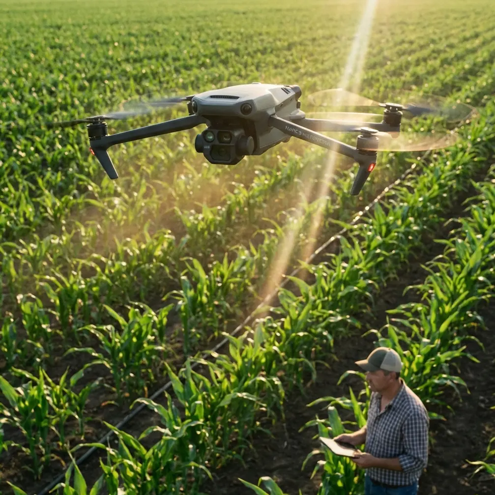
If you work around utility-scale solar, you already know the real bottleneck is rarely the aircraft alone. It is the gap between what a platform can do on paper and what operators are actually allowed, trained, and equipped to do in the field. That is why the latest policy move in Guangdong deserves close attention from anyone using or evaluating the Mavic 3M for solar farm scouting in punishing conditions.
Guangdong has formally released an application-scenario innovation plan alongside a detailed list of priority sectors. The headline point is easy to miss if you read it too quickly: the province is not just endorsing drone development in theory. It is building a framework of experimental zones across five areas, with the low-altitude economy placed first. The other four are marine economy, intelligent manufacturing, smart agriculture, and urban governance. That ordering matters.
For Mavic 3M operators, especially those inspecting large solar assets in heat, dust, reflective glare, and electrically noisy environments, this is the difference between “promising technology” and repeatable deployment.
Policy is finally moving closer to field reality
The most operationally significant detail in the Guangdong announcement is not the broad support language. It is the stated push to move technology from the laboratory into application settings. In drone operations, that phrase has teeth.
A multispectral aircraft like the Mavic 3M is only as valuable as the workflow around it. On a solar farm, you are not flying for pretty maps. You are trying to isolate anomalies fast enough to matter, preserve geospatial consistency across repeated missions, and gather evidence that technical teams can trust when they decide whether to dispatch crews. That takes more than a capable payload. It takes airspace access, predictable procedures, validated operating areas, and institutions willing to let new methods prove themselves under real constraints.
Guangdong’s plan to create application-scenario innovation test zones directly addresses that missing layer. If low-altitude operations are granted room for policy trial runs, airspace management experiments, and practical deployment support, platforms such as the Mavic 3M stand to benefit in a very concrete way: less time trapped in pilot projects, more time delivering measurable field value.
For consultants and enterprise operators, that shift can change procurement logic. The question stops being “Can this aircraft capture useful data?” and becomes “Can this workflow be repeated legally, safely, and at scale across multiple sites?”
That is the question that decides whether a drone remains a demo unit or becomes an operational tool.
Why this matters specifically for solar farm scouting
Extreme-temperature solar inspections are not forgiving. Midday heat can degrade team endurance, distort visual interpretation, and compress your useful operating window. Add long rows of panels, metallic infrastructure, inverter stations, and possible electromagnetic interference, and the mission becomes less about simple route planning and more about disciplined data capture.
The Mavic 3M earns attention here because multispectral collection can support vegetation assessment around array perimeters, drainage patterns, access-route monitoring, and land-condition analysis around solar assets. In many solar projects, that broader environmental picture is not secondary. Overgrowth, erosion, and water movement can affect maintenance access, shading risk, and long-term site stability.
But field teams know the harder truth: sensor capability is only one slice of the problem. Precision and consistency matter more.
That is where Guangdong’s emphasis on application scenarios becomes strategically useful. A region willing to prioritize low-altitude operations inside structured test environments is also creating the conditions for repeated validation. For Mavic 3M missions, that can mean better-defined operating practices around route planning, swath width selection, multispectral repeatability, and georeferencing under real environmental stress.
If you are scouting a solar farm in extreme heat, a few operational variables decide whether your dataset is actionable:
- RTK fix rate stability across the mission
- Repeatable overlap and swath width over long linear sections
- Reliable control link behavior near electrical infrastructure
- Consistent sensor performance during temperature swings
- Safe handling of interference and reflective surfaces
These are not marketing checklist items. They are what separate a clean comparison map from a dataset your analyst quietly refuses to trust.
The hidden significance of “policy first, airspace first”
The original Guangdong material also points to support for experimental work around low-altitude airspace management. This may sound administrative, but for professional operators it is probably the most meaningful line in the entire development.
Airspace friction has a way of killing otherwise excellent drone programs. A utility may have a strong technical team, a proven aircraft, and a compelling use case, yet still lose momentum because flight approvals, route boundaries, and operating protocols remain inconsistent from site to site.
When a province treats low-altitude management as a field for early policy experimentation, it creates a bridge between aircraft capability and operational continuity. That is precisely what enterprise drone users have been asking for. Not slogans. Process.
For Mavic 3M deployments, better airspace clarity can improve three things at once:
First, mission planning becomes less reactive. Teams can build repeatable inspection templates rather than redesigning every sortie around uncertainty.
Second, training quality rises. Pilots can rehearse the same procedures in environments closer to actual operating conditions, which is where good habits are formed.
Third, datasets improve over time. Repeat access to structured sites allows operators to compare seasonal or event-driven changes with higher confidence.
This is where the Guangdong story becomes bigger than a regional policy update. It points to a maturing operational ecosystem for drones that need to do real work.
Extreme temperatures expose weak workflows fast
A lot of drone content talks about “challenging environments” as if that phrase alone explains something. It does not. Heat changes the way missions fail.
On solar sites, extreme temperatures affect people first. Fatigue increases. Decision speed can drop. Setup discipline slips. Then the technical issues start stacking: batteries need tighter handling discipline, glare complicates visual confirmation, and control behavior near dense infrastructure may become less predictable than in open test fields.
This is exactly why Mavic 3M operations benefit from environments where application-led validation is encouraged. You do not solve extreme-temperature performance by quoting specifications. You solve it by tightening the entire chain: preflight checks, RTK confirmation, antenna orientation, route design, safe battery rotation, landing-zone selection, and post-flight review.
Electromagnetic interference deserves special attention on solar farms because it is often underestimated until it affects a mission. Around inverter blocks or communications hardware, I have seen operators blame the aircraft when the real issue was poor antenna alignment and unnecessary link obstruction. A small adjustment in pilot stance and antenna angle can materially improve signal resilience. That sounds minor until you are midway through a long mapping run and trying to preserve centimeter precision on a repeat mission.
When interference risk rises, I usually want pilots to stop treating antenna position as an afterthought. Face the aircraft path more squarely when possible. Avoid shielding your own controller with vehicles or metal structures. Reassess takeoff position if nearby equipment creates a noisy RF pocket. Those habits are mundane, but on a high-value solar survey they can save the mission.
If your team is refining those field procedures, it often helps to compare notes with operators who are already running utility inspections in harsh climates. I keep that conversation open through direct field planning support when a site has unusual interference or thermal constraints.
Multispectral value depends on discipline, not buzzwords
The second reference item in the news set was nominally about focus in photography, but the underlying lesson translates cleanly to Mavic 3M operations: sharp results do not happen because the device is expensive. They happen because the operator understands what needs to be in focus and why.
In the article’s examples, focusing on the wrong plane ruins the image even if the camera itself is good. On a solar farm mission, the equivalent mistake is collecting data with poor mission intent. You can fly a neat grid, log every waypoint, and still return with output that does not answer the maintenance question.
For Mavic 3M users, that means deciding before takeoff what the story of the mission is.
Are you tracking vegetation encroachment near fence lines? Monitoring drainage stress after a weather event? Comparing sections of the site where performance anomalies might correlate with terrain or plant growth? Each objective changes how you think about altitude, overlap, swath width, and revisit cadence.
This is also where some crossover terms from spraying and agricultural operations unexpectedly become useful, even on energy sites. Operators with a background in spray drift management and nozzle calibration tend to think in terms of environmental variables, edge effects, and repeatability. That mindset helps. You start asking better questions: how stable is my route geometry, what will wind do to consistency at the margins, and how much deviation can I accept before change detection becomes noisy?
That level of discipline matters more than enthusiasm. A Mavic 3M can produce valuable multispectral intelligence, but only if the operator treats every flight as a measurement exercise rather than a simple capture run.
Why Guangdong’s five-zone approach could shape adoption beyond China
One of the strongest signals in the Guangdong plan is its breadth. The province is not isolating drones as a niche tech category. It is embedding low-altitude operations into a wider framework that also includes smart agriculture, intelligent manufacturing, marine economy, and urban governance. That cross-sector design is smart.
Why? Because drone infrastructure becomes more useful when multiple industries push on the same operating constraints. Airspace policy, pilot training, application validation, and data governance all improve faster when they are exercised by different mission types instead of one isolated use case.
For Mavic 3M, this matters because the aircraft often sits at the intersection of sectors. A single operator might support agricultural land assessment one week and infrastructure or utility corridor work the next. A broader low-altitude ecosystem means more pressure to standardize good practices and fewer excuses for keeping drone operations stuck in a semi-experimental state.
The phrase “preferred carrier” in the Guangdong coverage is revealing. It suggests the province wants these trial zones to become the go-to vehicle for turning innovation into field use. That language is not just optimistic branding. It signals intent to make deployment pathways smoother for technologies that already have practical value but need institutional backing to scale.
That is exactly the kind of environment in which the Mavic 3M becomes more than a capable aircraft. It becomes part of a validated operational stack.
What Mavic 3M teams should watch next
If you are responsible for scouting solar farms in extreme temperatures, this Guangdong development is worth tracking for three reasons.
First, it may accelerate the normalization of low-altitude application testing in real operating environments. That benefits enterprise missions far more than isolated demos ever could.
Second, the explicit focus on airspace-management experimentation addresses one of the most stubborn barriers to repeat drone operations. For Mavic 3M users, that could eventually translate into cleaner planning, better training, and stronger data continuity.
Third, the multi-sector structure of the test zones increases the odds that drone workflows will be refined under practical pressure rather than polished for presentations. Field users should welcome that.
The drone sector does not need more abstract praise for innovation. It needs places where missions can be flown, evaluated, repeated, and improved under the conditions that actually break weak systems. Heat, glare, interference, terrain, timing, and compliance pressure do not care how elegant a product launch sounded.
They do care whether the operator has stable RTK performance, a sensible swath plan, disciplined antenna management, and a workflow that survives contact with the real site.
That is why this policy story matters to Mavic 3M users. Guangdong is not merely cheering for drones. It is trying to create the operational proving grounds that serious drone work has lacked for years. For solar-farm scouting teams, especially those working in extreme temperatures, that is the kind of development worth watching closely.
Ready for your own Mavic 3M? Contact our team for expert consultation.