Mavic 3M for Mountain Highway Inspection
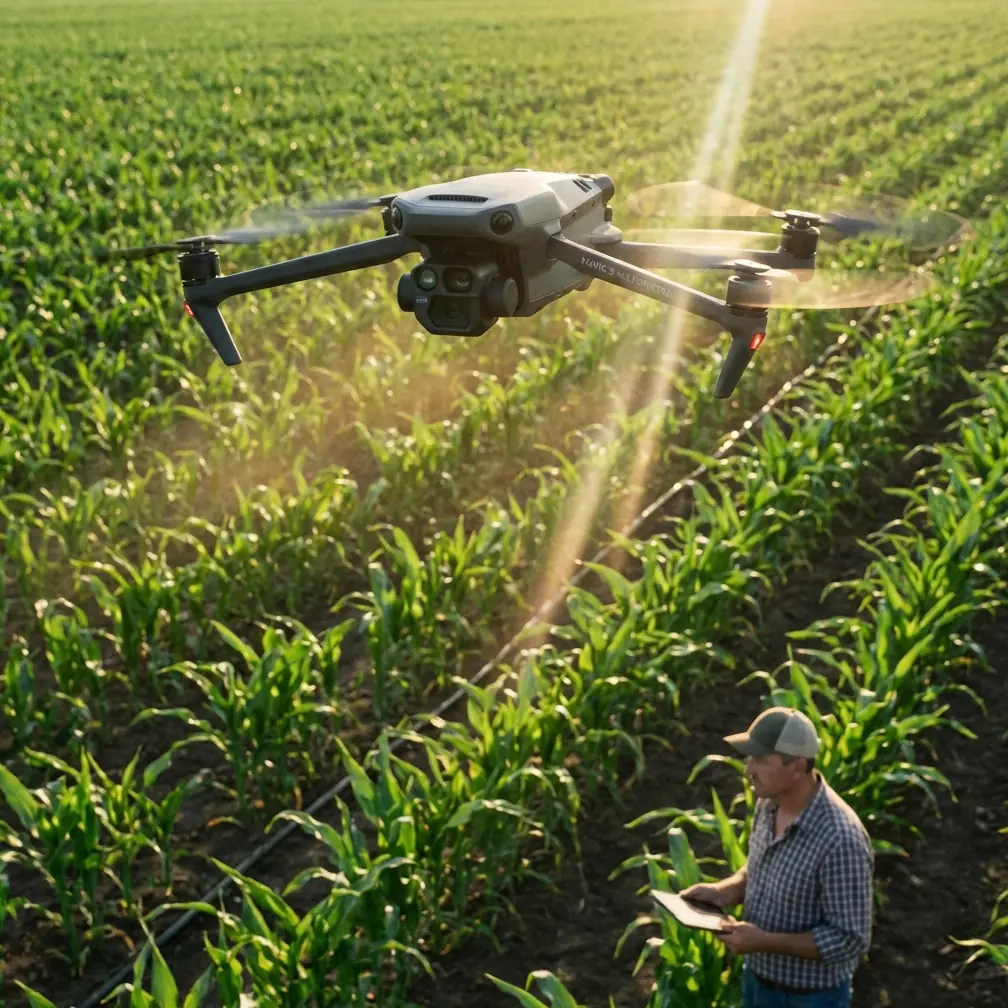
Mavic 3M for Mountain Highway Inspection: What Actually Matters in the Field
META: A technical review of using the DJI Mavic 3M for mountain highway inspection, with practical insight on coordinate logic, failsafe thinking, multispectral relevance, and precision operations.
Highway inspection in mountain terrain exposes the difference between a drone that merely flies and a drone operation that can produce repeatable, defensible data. That distinction matters more with the Mavic 3M than many buyers expect.
The Mavic 3M is usually discussed through an agriculture lens because of its multispectral payload. That framing is too narrow. In mountain highway work, especially where slope stability, drainage performance, vegetation encroachment, and corridor change detection all intersect, the aircraft becomes useful for a different reason: it sits at the meeting point of precise navigation, efficient coverage, and richer surface interpretation than a standard RGB-only workflow can provide.
That is the real story.
Why the current drone climate changes the case for Mavic 3M
Recent industry signals point to a broader structural shift, not just another hardware cycle. One weekly industry roundup noted that China has placed the low-altitude economy into a strategic emerging development plan. Whether you operate in Asia or simply track where commercial drone infrastructure is maturing fastest, that matters. It means more institutional attention on practical drone deployments, more standardization pressure, and more demand for workflows that can be repeated across infrastructure corridors rather than improvised mission by mission.
The same roundup also highlighted a striking attendance figure at the fifth Yangtze River Delta international emergency expo: 80,202 professional visitors. That number is worth pausing on. It suggests that the audience around UAV-enabled infrastructure and emergency readiness is no longer niche. For mountain highways, where inspections often overlap with landslide risk assessment, blocked drainage checks, post-storm verification, and access-limited asset review, this scale of professional attention reflects a market moving toward operational maturity.
The Mavic 3M fits neatly into that transition because it is not just a camera platform. It is a compact survey instrument with enough intelligence to support corridor work in difficult topography.
Mountain highways are a navigation problem before they are an imaging problem
Operators often focus first on sensor output. In practice, the harder problem is positional discipline.
A training document for DJI’s TT educational drone illustrates this cleanly through a simple exercise: start at one point, fly forward 60 centimeters, then right 80 centimeters, and then return to the original point without changing the aircraft’s heading. At first glance, that sounds like a classroom problem. In mountain inspection, it is not. It is the foundation of useful flight planning.
Why? Because mountain highways force you to think in vectors, not just waypoints.
When you inspect a cut slope above a road, a retaining wall below it, a drainage line crossing diagonally through the corridor, and vegetation advancing from one shoulder, every useful movement is relative to terrain and asset geometry. If the aircraft can hold orientation while translating laterally or diagonally across a subject, the resulting imagery is easier to compare across repeated missions. That makes defect progression, moisture signatures, erosion spread, and vegetation stress far easier to interpret over time.
The TT training material goes further by grounding motion in a three-dimensional Cartesian coordinate system with x, y, and z axes. Again, that may sound elementary. It is not. In mountain highway inspection, the operational significance is enormous:
- x and y control corridor position along and across the roadway.
- z control becomes critical when road elevation changes quickly, especially around switchbacks, bridge transitions, and steep embankments.
- Stable use of coordinates improves repeated flight lines, which improves temporal comparison.
A lot of poor infrastructure drone work comes from treating the airspace like an open field. Mountain roads are not open fields. They are constrained 3D corridors, often with inconsistent GNSS visibility, changing wind behavior, and sudden vertical surfaces. The more the operator thinks in coordinate logic rather than casual manual steering, the more value the Mavic 3M can deliver.
What the Mavic 3M adds beyond ordinary visual inspection
For highway agencies and engineering teams, the strongest reason to consider the Mavic 3M is not novelty. It is layered interpretation.
RGB footage can show cracking, blocked culverts, rockfall debris, guardrail damage, shoulder collapse, or washout. Multispectral data adds a different category of evidence. It can reveal vegetation stress patterns on cut slopes, wetness-related changes near drainage structures, and early signs of unstable growth or dieback that may correlate with runoff issues or subsurface moisture problems.
This is where people who only associate “multispectral” with farming miss the opportunity.
On mountain highways, the surrounding vegetation is often part of the infrastructure story. Encroaching roots can undermine drainage channels. Uneven plant vigor along a slope can point to water concentration. Seasonal stress signatures can flag areas worth closer geotechnical attention. If you are monitoring long corridors, this helps prioritize where crews should go on foot.
The Mavic 3M also makes sense when access is limited. A shoulder closure on a narrow mountain road is expensive in time and disruptive in traffic terms. A compact aircraft that can rapidly collect repeatable datasets with centimeter-level intent reduces the amount of guesswork before sending people into exposed zones.
Precision is not a slogan; it is a workflow discipline
The context around this assignment mentions RTK fix rate and centimeter precision. Those are not decorative terms. On mountain roads, they are the dividing line between documentation and measurement.
If your inspection program is intended to compare surface conditions month over month, or before and after heavy rain, positional consistency matters. Centimeter-grade repeatability supports cleaner overlays, better orthomosaics, and more trustworthy change detection. It helps when you are mapping slope movement indicators, shoulder deformation, drainage path shifts, or vegetation patterns along a linear asset.
But precision is never just about the aircraft. It is also about how the crew handles home points, signal logic, and failsafes.
A separate parameter document in the reference set, although not specific to the Mavic 3M, is useful because it exposes the kind of thinking serious operators need. It includes settings such as a 10-second datalink loss threshold, a 5.00-meter horizontal home set threshold, and a 10.00-meter vertical home set threshold. Those values are not random trivia. In mountain inspection, they speak directly to mission resilience.
Operationally, their significance looks like this:
- A 10-second datalink loss threshold reminds you that link interruptions in mountain terrain are not hypothetical. Ridge lines, cut rock faces, and road curvature can all interfere with clean communication.
- A 5-meter horizontal and 10-meter vertical threshold for home-point logic highlight how sensitive return behavior can be in steep terrain, where the “safe way back” may not resemble a flat-land operation.
- Battery failsafe behavior, also referenced in that parameter set, is especially critical when headwinds develop inside valleys or near exposed ridges.
Even if your exact Mavic 3M interface does not expose these values in the same way, the principle holds: mountain corridor inspection requires deliberate failsafe design, not default assumptions.
A field moment that says more than a brochure can
One of the clearest reminders that mountain highway inspection is a live environment came during a slope and drainage review after light rain. The mission objective was routine: document runoff channels above a retaining section, confirm vegetation stress near a culvert outlet, and build a repeatable corridor strip for later comparison.
Halfway through the flight, a small group of macaques emerged near the road edge from scrub on the downhill side. That changed the operation instantly. Not because the Mavic 3M was in danger, but because wildlife movement around a mountain corridor can affect both aircraft positioning and visual interpretation. The crew widened standoff distance, held heading stable, and shifted the path laterally rather than rotating aggressively over the area.
That was a sensor-and-navigation test, not a dramatic story.
The useful takeaway is this: stable translation matters. When an aircraft can maintain observational discipline while the operator adjusts spacing, you preserve image consistency and avoid turning a technical inspection into a disturbance event. In mountain work, that kind of judgment is as valuable as any camera specification.
Swath width, coverage efficiency, and the hidden economics of corridor work
Although “swath width” is usually discussed in relation to field operations, the concept still matters in road inspection. A mountain highway is a long, narrow asset with adjacent zones that can be operationally relevant: upper slope, lower slope, drainage lines, barriers, shoulders, tree lines, and emergency access points.
The Mavic 3M’s advantage is that it can be planned to capture more than the pavement itself. Instead of producing a thin visual strip over the roadway, teams can define a corridor that includes hazard-generating terrain. That changes the inspection result from simple road imagery into environmental context.
Coverage efficiency matters because mountain jobs rarely happen under perfect conditions. Wind windows may be short. Traffic coordination can be limited. Crew access points may be sparse. A workflow that balances corridor width, overlap, and positional reliability gives engineering teams more value per launch.
This is also where old habits from agriculture can unexpectedly help. Terms like nozzle calibration and spray drift may seem unrelated to a highway mission, but they reflect a deeper operational culture: disciplined setup, environmental awareness, and respect for crosswind effects. Even though the Mavic 3M is not being used for spraying here, the same thinking improves inspection quality. If you would never accept drift in an application mission, you should not accept lazy lateral deviation in a mapping corridor either.
Where Mavic 3M is strong, and where teams should be realistic
The Mavic 3M is especially strong when a highway operator needs:
- repeatable corridor mapping
- vegetation and moisture-related context beyond RGB imagery
- compact deployment in difficult access areas
- data capture that supports engineering review, not just visual storytelling
It is less magical than some people hope in one respect: it will not replace field judgment. Multispectral anomalies still need interpretation. A stressed patch of vegetation may indicate water concentration, root disturbance, poor soil retention, or simply seasonal variability. The aircraft shortens the search and sharpens the map. It does not eliminate the need for domain expertise.
That is why the best Mavic 3M inspection programs are built by mixed teams: UAV specialists, infrastructure engineers, and asset managers who know what decisions the data must support.
Practical setup thinking for mountain inspection teams
If you are evaluating whether the Mavic 3M belongs in a mountain highway workflow, the right question is not “Can it fly there?” The right question is “Can it produce repeatable, interpretable evidence under corridor constraints?”
A useful planning checklist includes:
- Define the inspection corridor in 3D, not as a flat route.
- Decide whether the mission is visual verification, change detection, or environmental correlation.
- Prioritize RTK stability and repeat flight geometry.
- Set conservative link and battery decision rules for terrain-shadowed segments.
- Capture enough lateral context to understand drainage and slope relationships, not just road surface condition.
- Treat multispectral output as a diagnostic layer that guides human investigation.
For teams building those workflows now, direct field discussion often beats generic product pages. If you need to compare setup options for mountain corridor jobs, this Mavic 3M planning channel is a practical place to start.
The larger takeaway
The most interesting thing about the Mavic 3M in mountain highway inspection is not that it carries multispectral sensors. It is that the aircraft rewards disciplined operators who think in coordinates, not camera moves.
That lesson appears indirectly in the reference materials. The TT training document’s simple x-y-z framing and return-path exercise point to the core skill behind repeatable aerial inspection. The parameter document’s datalink, home-threshold, and failsafe values point to the seriousness of flight-state management. The industry roundup’s strategic policy shift and 80,202-visitor expo attendance show a sector moving toward larger-scale, more standardized deployment.
Put those threads together and the Mavic 3M becomes easier to understand. It is not just a drone for collecting attractive images over difficult terrain. It is a compact data platform for teams that need to inspect mountain highways with precision, context, and repeatability.
That is a much more valuable role.
Ready for your own Mavic 3M? Contact our team for expert consultation.