Mavic 3M for Coastal Highway Scouting: Why Exposure Control
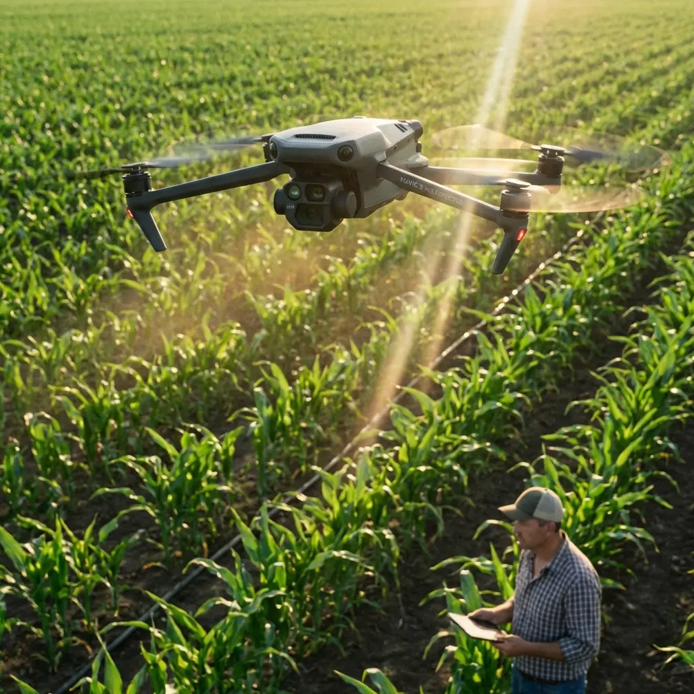
Mavic 3M for Coastal Highway Scouting: Why Exposure Control Suddenly Matters More Than Ever
META: An expert analysis of what new exposure guidance, China’s low-altitude policy push, and rising drone security pressure mean for Mavic 3M highway scouting in coastal environments.
Coastal highway inspection looks straightforward on paper. Long corridors, repeatable routes, clear assets. In practice, it is one of the easiest places to ruin a useful dataset with a perfectly legal flight and a badly managed camera.
That is why a recent Chinese photography tutorial about exposure control deserves more attention from Mavic 3M operators than its simple framing suggests. The core message was direct: exposure is fundamentally about three variables—shutter speed, aperture, and ISO. On a consumer level, that sounds basic. On an operational level, especially for corridor mapping and scouting with the DJI Mavic 3M, it is a reminder of where data quality is won or lost before any multispectral analysis begins.
For teams scouting highways in coastal regions, that timing also intersects with two larger forces. First, China’s policy stance on the low-altitude economy has clearly moved upward in priority, with the term written into the government work report for a third straight year and upgraded from a “new growth engine” in 2024 to a “new pillar industry” in 2026. Second, counter-drone patent activity is accelerating, with growing emphasis on jamming, laser, and microwave systems. Together, those signals matter. They point to a market where more drone operations will happen, but scrutiny, operational discipline, and resilience will matter more than before.
For Mavic 3M users, this is not abstract industry background. It changes how serious teams should approach missions along coastal highways, where glare, sea haze, moving traffic, reflective paint, wind-driven instability, and patchy GNSS conditions can all undermine a survey if camera settings are treated as an afterthought.
The real problem: coastal highway data is easy to collect and hard to trust
Most failed highway scouting missions do not look like failures in the field. The aircraft launches, the route completes, the SD card fills, and the pilot comes home with confidence. The problem only appears later, when the imagery is stitched, reviewed, or compared against previous runs.
On coastal routes, the failure modes are predictable:
- Sunlight bouncing off water, metal barriers, and vehicle roofs creates unstable highlights.
- Sea mist reduces local contrast and can flatten road-edge definition.
- Wind pushes the aircraft enough to introduce subtle motion blur.
- Dark asphalt and bright lane markings sit in the same frame, challenging exposure balance.
- Bridges, embankments, signs, and drainage structures create fast-changing lighting as the aircraft moves.
For a platform like the Mavic 3M, built to support multispectral and RGB workflows, those conditions are not just cosmetic. They influence whether your output can support vegetation encroachment assessment, drainage pattern review, slope monitoring, shoulder-condition checks, and repeatable corridor comparisons over time.
The recent tutorial’s emphasis on shutter speed, aperture, and ISO lands squarely on this issue. Even though the article presents the concept in general photographic terms, its operational significance for Mavic 3M users is immediate: if the exposure triangle is not controlled intentionally, corridor intelligence degrades fast.
Why the exposure triangle matters on the Mavic 3M
The three exposure variables are often taught as photography basics. For scouting missions, they are closer to mission integrity controls.
Shutter speed determines how long light reaches the sensor. The photography tutorial specifically described shutter as the mechanism controlling the time light enters the camera, and that detail is crucial for highway work. Coastal scouting involves movement from two directions at once: the aircraft is moving, and the scene may include moving vehicles, waving vegetation, and wind-driven vibration. If shutter speed drops too low, sharpness suffers. That makes lane-edge inspection, crack visibility, culvert outlines, and embankment transitions less reliable.
Aperture affects both exposure and the optical rendering of the scene. In inspection-style work, aperture decisions can influence edge clarity and consistency across the frame. For corridor mapping, that consistency matters more than cinematic look.
ISO controls sensor sensitivity. Raising it can rescue exposure in dim or hazy conditions, but it also raises noise. In RGB imagery that is annoying; in analytical workflows it can become expensive. Noise can interfere with fine visual interpretation and reduce confidence when comparing one mission against another.
The point is not that operators need to become artists. It is that exposure discipline is part of measurement discipline.
The hidden coastal penalty: bad exposure corrupts repeatability
Highway scouting in coastal areas is rarely a one-off mission. Teams come back. They compare. They monitor change. They look for progression in erosion, vegetation growth, drainage obstruction, pavement edge wear, and right-of-way conditions.
That is where exposure mistakes become dangerous. A single overbright or noisy flight can distort trend interpretation. A shoulder may appear cleaner or more degraded than it really is. Vegetation vigor near drainage channels may look stronger or weaker based on capture inconsistency rather than actual field conditions.
This is especially relevant for a multispectral platform like the Mavic 3M. If the mission objective includes vegetative encroachment or environmental monitoring near roadside infrastructure, consistent image capture is not optional. Coastal roads often sit in ecologically sensitive corridors where salt tolerance, runoff patterns, and seasonal growth interact. The Mavic 3M is valuable precisely because it can see more than a standard RGB aircraft. That value drops if acquisition discipline is loose.
The solution: treat camera settings as part of survey planning, not pilot improvisation
The strongest teams do not wait until takeoff to “see how it looks.” They build exposure strategy into preflight planning.
For coastal highway scouting with the Mavic 3M, that means a few practical shifts.
First, start with the scene, not the default settings. Ask what will challenge the sensor today: water glare, overcast haze, low-angle sun, bright lane markings, moving traffic, or strong wind. The answer should guide shutter and ISO priorities before the first waypoint runs.
Second, preserve sharpness aggressively. Coastal wind is not theoretical. Even small aircraft movements can reduce image quality, especially on repeat corridor missions. A faster shutter is often worth the trade if the mission depends on fine visual detail.
Third, keep ISO disciplined. If the environment is dim, it may be tempting to let sensitivity climb freely. That can make field monitoring feel easier while quietly degrading analysis quality later.
Fourth, normalize conditions across repeat flights whenever possible. Similar time windows, similar sun angles, and similar exposure logic make the data more defensible.
These are not glamorous adjustments. They are the difference between imagery that looks acceptable and imagery that supports operational decisions.
A third-party accessory can quietly improve results
One of the most useful upgrades I have seen for coastal corridor work is a high-quality third-party anti-glare filter system. Not a cosmetic add-on. A serious optical accessory selected to reduce harsh reflections from water, guardrails, wet pavement, and vehicle surfaces.
Used correctly, it can stabilize highlights enough to make exposure management more consistent across a route. That does not replace good settings. It gives the pilot a wider margin in ugly light.
For Mavic 3M users working near the coast, this matters because reflective surfaces can trick even experienced operators into compromising the whole frame to protect only the brightest areas. An external filter can reduce that pressure and preserve usable detail where it counts. If your team is sorting through filter options or corridor setup choices, it helps to compare mission profiles with an advisor who understands data quality as well as flight ops—this is the kind of field question we discuss through our direct project channel at highway scouting support.
The key is restraint. Accessories should support the mission, not complicate it. If an add-on creates color inconsistency, mounting instability, or calibration uncertainty, it can become a net negative. Choose tools that improve repeatability.
Why policy momentum around the low-altitude economy matters to Mavic 3M operators
The policy backdrop from China is not just national economic theater. It is a signal about scale.
When the low-altitude economy appears in the government work report for three consecutive years, and its role progresses from “new growth engine” in 2024 to “new pillar industry” in 2026, that tells operators something practical: drone use is moving deeper into formal infrastructure workflows. Coastal highways are exactly the kind of assets that fit this trend. They need recurrent observation, standardized data capture, and efficient coverage of long linear corridors.
For Mavic 3M users, that expands the relevance of disciplined operations. More missions mean more demand for standardized outputs. More institutional use means less tolerance for ad hoc flying habits. If infrastructure owners and service providers are scaling UAV deployment, they will prioritize workflows that can be repeated, audited, and defended.
That is another reason the exposure tutorial matters. Simple camera fundamentals become strategic when drone operations mature from occasional flights into routine infrastructure programs.
The other pressure point: security awareness is rising with the market
The counter-drone story is easy to dismiss if your focus is mapping or inspection. That would be a mistake.
Recent reporting pointed to stronger investment in counter-drone systems, including jamming, laser, and microwave approaches, tied to increased small UAS activity and the need for scalable defense solutions. Whether or not a highway scouting crew directly encounters those systems, the broader implication is clear: the airspace environment is becoming more security-conscious.
For infrastructure-adjacent flights, especially around transport corridors, ports, industrial zones, bridges, or sensitive utilities near coastal highways, operators should assume that compliance, identification, and mission legitimacy matter more now than they did a few years ago.
That changes operational culture in three ways:
- Mission planning needs cleaner documentation.
- Flight profiles need to be more predictable and justifiable.
- Data capture has to succeed on the scheduled sortie, because re-flying sensitive areas may become harder.
When reflight opportunities narrow, first-pass image quality becomes more valuable. Again, exposure control moves from camera trivia to operational risk management.
What this means specifically for Mavic 3M highway scouting
The Mavic 3M sits in an interesting position. It is portable enough for rapid deployment, yet capable enough to support serious corridor intelligence when used properly. In coastal highway scouting, that blend is attractive because teams often need to move quickly between road segments, bridges, slopes, drainage points, and vegetative buffers.
But the aircraft’s strengths only show up when the workflow around it is disciplined.
If your mission includes vegetation monitoring, multispectral capture benefits from consistency in lighting and flight planning. If your goal is visible-condition review, shutter management becomes critical when traffic and wind are present. If your corridor includes reflective or wet surfaces, anti-glare accessories may help preserve usable imagery. If your operating environment is becoming more regulated or security-sensitive, every sortie needs to produce clean, dependable outputs without relying on repeated attempts.
This is where many teams misread the platform. They focus on the sensor package and overlook the capture method. The hardware is only half the job.
A field-ready framework for coastal operators
Here is the simplest way I would frame it for a highway team deploying the Mavic 3M near the coast:
The problem is not getting airborne. The problem is collecting imagery that remains trustworthy after the mission, under changing light, wind, glare, and policy pressure.
The solution is to make camera discipline part of mission design.
That starts with the exposure triangle the recent tutorial highlighted: shutter speed, aperture, and ISO. It continues with environment-aware route planning. It improves with carefully chosen accessories, especially anti-glare solutions when reflections are intense. And it becomes non-negotiable as low-altitude operations scale and security sensitivity rises.
For readers tracking the Mavic 3M specifically, that is the news hidden inside these recent developments. A basic exposure lesson, a stronger national push behind low-altitude operations, and a surge in counter-drone innovation are all pointing in the same direction. UAV work is becoming more consequential. Coastal highway scouting is a good example of that shift because it combines infrastructure value, environmental complexity, and operational visibility.
The teams that adapt will not simply fly more. They will capture better data, defend their methods more easily, and make the Mavic 3M perform like a professional instrument rather than a convenient camera in the sky.
Ready for your own Mavic 3M? Contact our team for expert consultation.