Mavic 3M for High-Altitude Fields: A Practical Expert Guide
Mavic 3M for High-Altitude Fields: A Practical Expert Guide to Weather, Flight Discipline, and Better Multispectral Results
META: Learn how to use the Mavic 3M effectively in high-altitude agricultural fields with practical guidance on wind, visibility, flight control habits, battery margins, and multispectral mapping accuracy.
High-altitude field work exposes every weak point in a drone operation. Air density changes. Wind becomes less forgiving. Visibility can shift fast. And in agriculture, small data errors do not stay small for long. They show up later as poor prescription maps, uneven input decisions, or missed stress signals in the crop.
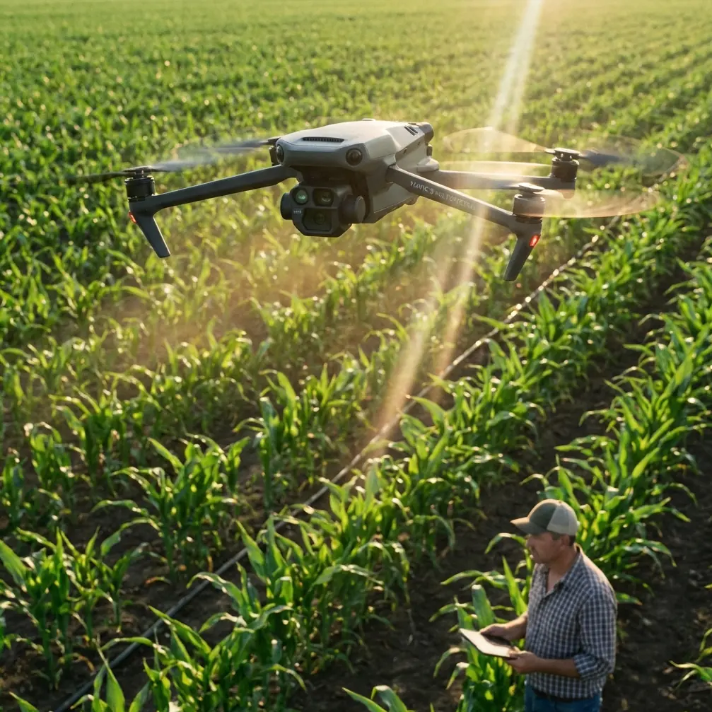
That is exactly why the Mavic 3M deserves to be discussed in operational terms rather than as a spec-sheet object. For growers, agronomists, research teams, and service providers surveying fields in upland terrain, the value of this platform is not just that it carries a multispectral payload. The real advantage is that it can fit into a disciplined workflow where aircraft behavior, weather judgment, and pilot input all support reliable data capture.
This guide focuses on that workflow.
Why high-altitude field mapping punishes sloppy habits
In lower, calmer farmland, pilots can sometimes get away with uneven preflight routines. In mountain basins or elevated terraces, that stops working. A field may look manageable from the road and still produce unstable flight lines once the aircraft climbs into a moving air layer. Wind over ridges, dust off dry ground, and fast-changing visibility all affect the mission.
The reference meteorology data makes this plain. At 10 meters above ground, a level 4 wind is defined as 20 to 28 km/h, with ground signs like blowing dust. By level 5, 29 to 38 km/h, small trees begin to sway. For a multispectral mapping mission, that difference matters. A field technician may still feel comfortable standing on the edge of the plot, but the drone’s ability to hold smooth overlap and consistent image geometry is already being tested.
For the Mavic 3M, this matters more than many first-time users expect. Multispectral work is not just about getting airborne and seeing crop color differences. It is about producing spatially consistent imagery that supports decisions. In high-altitude conditions, wind is often the first thing that degrades that consistency.
Start with weather thresholds, not optimism
One of the simplest ways to improve Mavic 3M results is to set your own weather go/no-go limits before arriving on site.
The aviation weather reference also gives a useful visibility framework. Visibility in the 20 to 30 km range is considered very good, while 5 to 15 km is already categorized as poor, and 1 to 10 km corresponds to light fog and reduced clarity. Those categories are not abstract. In field mapping, reduced visibility creates three problems at once:
- It makes obstacle assessment less reliable.
- It increases the odds of uneven illumination across the mission.
- It weakens the pilot’s situational awareness during takeoff, transit, and recovery.
For high-altitude agricultural surveys, I advise treating visibility as a data-quality parameter, not just a safety parameter. If the valley floor is hazy or the opposite edge of the survey block lacks crisp definition, the mission may still be technically flyable, but the output may no longer be worth the battery cycle.
This is one place where the Mavic 3M can outperform less agriculture-focused alternatives: it is built for mapping outcomes, not casual image capture. But even the best platform cannot rescue a mission flown in poor atmospheric conditions.
The hidden advantage of disciplined control inputs
Most articles about the Mavic 3M spend too much time on sensors and not enough on hands. Pilot behavior still matters, especially in high-altitude fields where wind shear and terrain-induced drift can magnify overcorrections.
The drone training reference includes a useful observation about stick modes: many pilots prefer the so-called “American” mode because it aligns better with common control habits, while “Japanese” mode is sometimes favored for precision route control after training. The operational lesson is not that one mode is universally better. It is that consistent control logic improves flight precision.
Why does that matter for a Mavic 3M user? Because agricultural mapping is often repetitive, and repetitive work rewards standardization. If you switch control habits from job to job, your takeoffs, manual positioning, emergency corrections, and landing approach become less predictable. In high-altitude fields, where you may be launching from uneven ground near irrigation channels or stone terraces, predictability saves time and reduces error.
I tell teams to lock in one control mode and train until every manual action is boringly consistent. The Mavic 3M shines when the pilot treats manual handling as part of the data pipeline.
Battery reserve is not just about endurance
A small detail from the training document deserves more attention than it usually gets: when using certain intelligent flight modes, battery level should be above 50%. That rule came from an education drone context, but the principle is highly relevant to real field operations.
In high-altitude agricultural mapping, battery planning should be conservative for three reasons:
- Climb segments can consume more energy than expected.
- Headwinds on return legs can erase comfortable margins.
- Cold morning conditions at elevation can distort a pilot’s intuition about usable reserve.
On the Mavic 3M, this means resisting the temptation to squeeze in one last partial block when the battery is already low. For mapping teams, the wrong habit is “we only have a little left to cover.” The better habit is “we launch only when the reserve still protects image consistency and recovery options.”
This is especially true when your workflow depends on strong RTK fix rate and repeatable flight geometry. Centimeter precision only matters if the aircraft can complete the mission cleanly.
High-altitude takeoff and landing: where small mistakes compound
Many field operators obsess over in-air performance and neglect launch and recovery discipline. That is backwards. The mission starts and ends where the crop, dust, slope, and pilot all meet.
The training material mentions a “bounce” mode in which a drone automatically moves up and down between 50 and 120 centimeters above the takeoff surface. It also notes that if an object is sensed 30 centimeters below, the aircraft rises slightly before continuing. The Mavic 3M is not an education toy, but the underlying lesson is excellent: near-ground sensing and height behavior deserve respect.
In high-altitude field work, launch zones are often improvised. You may be taking off from a rough path, a patch of plastic mulch, a terrace edge, or a vehicle tailgate setup. Downward sensing can be affected by texture, slope, and loose debris. That means you should do three things before every Mavic 3M sortie:
- Choose a stable, visually distinct launch point.
- Keep loose plant matter and dust away from the aircraft.
- Avoid rushed hand movements under the drone after startup.
These steps sound basic because they are basic. They also prevent the kind of avoidable takeoff instability that later gets blamed on “mountain wind.”
Why Mavic 3M stands out for field surveys, not just field pictures
The Mavic 3M’s real strength in agriculture is that it is designed to translate flight into agronomic insight. That separates it from platforms aimed mainly at visual imaging.
For high-altitude field surveys, the combination of multispectral capture and centimeter-oriented positioning gives this aircraft an edge over general-purpose drones used as improvised crop tools. A standard camera drone may produce attractive top-down imagery, but attractive imagery is not the same as actionable crop intelligence. The Mavic 3M is built for plot comparison, vigor assessment, stand evaluation, drainage pattern recognition, and treatment planning.
This becomes even more relevant when field conditions are uneven. In mountain agriculture, swath width can vary in practical value depending on terrain shape, access paths, and fragmented parcels. A drone that can maintain reliable mapping structure across awkward field geometry is worth more than one that merely promises broad coverage.
And this is where competitors often fall short. Some can fly the mission. Fewer can do it while supporting repeatable multispectral outputs that agronomy teams trust from block to block.
Don’t confuse mapping with spraying decisions
Readers dealing with high-altitude fields often work across both mapping and application operations, so it is worth drawing a clean line here.
The Mavic 3M is a survey and analysis asset. It helps identify variability, stress zones, drainage issues, or stand irregularities. It does not replace the discipline required for spray drift control or nozzle calibration on an application platform. In fact, one of the best uses of Mavic 3M data is to improve how spraying is planned later: reducing unnecessary passes, targeting problem areas, and checking whether terrain or wind exposure may affect application timing.
This is where a well-run drone program becomes more than a collection of flights. Mapping informs treatment. Treatment outcomes inform future mapping. The aircraft becomes part of a loop.
A practical field workflow for the Mavic 3M in upland agriculture
Here is the workflow I recommend for teams mapping elevated crop areas:
1. Assess weather at field level, not just from an app
If local signs point toward level 4 wind conditions—dust lifting, flags extending, vegetation moving steadily—you are already in a range where overlap quality may start to suffer. If conditions look closer to level 5, reconsider the mission.
2. Judge visibility with discipline
If visibility is slipping toward the 5 to 15 km band, expect lower confidence in terrain reading and less stable lighting. That may be enough reason to delay.
3. Standardize control mode across the team
Choose one stick layout and train around it. Precision grows from repetition, not novelty.
4. Protect battery margin
Treat 50% as a meaningful planning threshold, especially when using automated mission logic or working far from the recovery point.
5. Build a clean launch routine
High-altitude fields often mean improvised pads. Make launch surfaces deliberate, not convenient.
6. Use the data to guide agronomy, not just generate maps
Multispectral outputs should feed prescription thinking, scouting priorities, drainage review, and seasonal comparison.
If your operation needs help setting up those workflows around Mavic 3M missions, a direct WhatsApp line for field planning questions is here: message a Mavic 3M specialist.
What experienced operators do differently
The best Mavic 3M users are rarely the ones talking most about hardware. They are the ones who build stable operating conditions around the aircraft.
They know that a strong RTK fix rate is only useful when the flight itself is orderly. They understand that centimeter precision is only meaningful if wind, visibility, and battery decisions support it. They do not treat high-altitude farmland as a scenic backdrop. They treat it as an operational environment with its own rules.
That mindset is why the Mavic 3M performs so well in serious agricultural work. Not because it erases field challenges, but because it rewards disciplined users with data that stands up to real agronomic scrutiny.
And that is the right standard. A field survey platform should not be judged by how dramatic its flights look. It should be judged by whether the output helps you make better decisions on difficult ground.
Ready for your own Mavic 3M? Contact our team for expert consultation.