Mavic 3M for Wildlife in Dusty Conditions
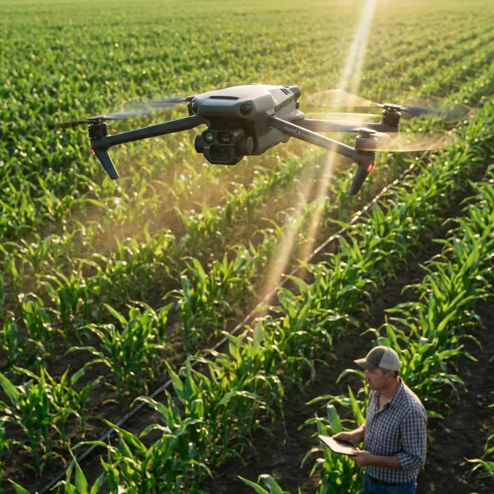
Mavic 3M for Wildlife in Dusty Conditions: A Field Report on What the Camera Should Actually Be Doing
META: An expert field report on using the Mavic 3M for wildlife monitoring in dusty environments, with practical insight on flight altitude, multispectral capture, RTK stability, and why image processing choices matter.
When teams discuss the Mavic 3M, the conversation often jumps straight to sensors, RTK, or multispectral outputs. Those matter. But in dusty wildlife environments, the first mistake usually happens earlier, at the level of image logic.
I want to frame this the way I would in a field briefing. The issue is not just whether the aircraft can collect imagery. It is whether the imagery reflects the site as it is, or as software wants it to look.
A recent camera-industry observation, although made about phones rather than drones, captures the problem with surprising accuracy. Across major brands such as Huawei, vivo, Xiaomi, OPPO, and Apple, the underlying photo logic is now broadly similar: manufacturers tend to present two capture paths. One is built for quick, everyday shooting. The other is aimed at users who want tighter control over the image. The same source makes a sharper point: automatic mode is no longer simple recording. The device captures the scene and then AI immediately reshapes it.
That distinction matters more for the Mavic 3M than many operators realize.
Why this phone-camera lesson applies to the Mavic 3M
Wildlife monitoring in dusty terrain is not a beauty exercise. It is evidence gathering. If you are documenting herd movement, watering-point pressure, habitat disturbance, or vegetation stress around migration corridors, image interpretation depends on consistency. Dust already reduces contrast, flattens distant detail, and can produce a pale atmospheric veil over the scene. Any extra automatic enhancement layered on top of that can bend the image away from field truth.
This is where the lesson from mainstream phone photography becomes operationally useful. When manufacturers separate “everyday convenience” from “serious image control,” they are acknowledging a tradeoff: speed versus fidelity. The source article states that auto mode effectively gives the user an instantly retouched result. That may be welcome for portraits. It is less welcome when you are comparing edge definition on game trails across different flights, or checking whether a change in ground tone is actual disturbance or just algorithmic contrast lifting.
The Mavic 3M sits in a different class from a phone, of course. It is built for professional aerial work, not casual snapshots. Yet the broader principle still stands: for scientific or operational monitoring, you want the aircraft and its imaging workflow to preserve information, not decorate it.
In dusty wildlife work, that means resisting the temptation to judge success by how dramatic an image looks on-screen in the field. A harsher, flatter, more neutral frame can be the better frame if it keeps the dataset comparable across dates, seasons, and weather windows.
Dust changes the meaning of altitude
The scenario here is specific: monitoring wildlife in dusty conditions. That detail changes how I would set up a Mavic 3M mission.
Operators often ask for a single “best altitude.” There isn’t one. There is, however, a practical band that balances disturbance, clarity, and interpretability. In dusty habitats, I typically advise starting with an altitude high enough to avoid pushing animals or creating rotor-driven visual disturbance, but low enough that the atmospheric layer between lens and subject does not wash out fine scene separation. For many wildlife observation and habitat-review missions, that means testing around 60 to 90 meters AGL first, then adjusting based on species sensitivity, terrain texture, and the thickness of suspended dust.
Why this range? Go too low and you increase the chance of behavioral influence, especially around nervous species or fragmented groups. You also risk collecting imagery with exaggerated local motion, steep perspective distortion, and unnecessary subject stress. Go too high in dusty air and the haze column between the sensor and the ground becomes part of the image. Tracks soften. Small animals merge into the background. Edge discrimination between bare soil, trampled vegetation, and low scrub becomes weaker.
The Mavic 3M’s value is not just that it sees from above. It is that it can generate repeatable, interpretable records. Dust makes repeatability harder because visibility is unstable. A moderate altitude often gives the cleanest compromise.
If I were writing the flight card for a team in arid rangeland, I would note it like this: begin near 70 meters AGL for broad reconnaissance, evaluate subject response and contrast in the first pass, then step lower only if detail is insufficient and the animals remain unaffected. That is a field habit, not a hard rule, but it prevents a lot of bad data collection.
Multispectral is useful, but only if the visual workflow is disciplined
The Mavic 3M attracts attention because of its multispectral capability, and rightly so. In wildlife and habitat monitoring, multispectral data can reveal patterns the visible image alone may miss: patchy plant stress around overused corridors, moisture variation near water access points, or vegetation recovery after seasonal pressure. Those layers are valuable because wildlife behavior is tied to habitat condition, not just animal location.
But multispectral interpretation becomes less reliable if the visible dataset used to contextualize it has been shaped too aggressively by automatic processing. This is one of the most overlooked workflow problems in mixed-sensor operations.
A visually appealing RGB image can fool the operator into trusting a weak acquisition. Auto enhancement may brighten shadow, increase local contrast, or smooth tonal transitions in a way that looks “clearer” on a display. The source article’s central point is that this kind of automatic mode is not neutral capture. It is immediate AI-led image treatment. Once you accept that, the implication for Mavic 3M work becomes obvious: any field workflow that hides what dust is actually doing to the image can corrupt how you interpret multispectral outputs beside it.
Suppose you are assessing a dusty wildlife reserve margin where grazing intensity is increasing. If the visible layer is artificially cleaned up, sparse vegetation may appear more robust than it is, or dusty bare patches may seem less extensive. Then the multispectral map appears to “disagree,” when in fact the inconsistency comes from the visual rendering, not the landscape.
This is why I prefer a controlled capture style for habitat missions: neutral exposure decisions, careful white balance consistency where possible, and review habits that favor comparability over immediate prettiness.
RTK fix rate matters more than people think in wildlife corridors
The reader context includes RTK fix rate and centimeter precision, and those are not decorative technical terms. In wildlife work, especially when revisiting the same corridor, nesting zone, or water-edge approach path, positional consistency is part of the science.
If the aircraft maintains a strong RTK fix, repeated datasets line up more cleanly. That lets a team compare vegetation thinning, track expansion, or encroachment patterns with far more confidence. In dusty environments, that precision becomes even more valuable because the image itself may already be visually compromised by airborne particulates. Good geospatial reliability compensates for some of the ambiguity in the visual scene.
This is where the Mavic 3M earns its place. Centimeter-level positioning is not just a mapping luxury. It reduces interpretive drift. If a trail edge appears to have shifted, you want to know whether that shift happened on the ground or inside your data alignment.
For wildlife monitoring, I advise crews to log RTK status rigorously alongside weather, dust density, and approximate visibility. That sounds academic, but it pays off quickly. A flight from one dry morning with a clean fix is not directly equivalent to a flight from a later afternoon with suspended dust and weaker positioning confidence. Without those notes, teams end up comparing outputs as if they were interchangeable.
Dust is a hardware problem too, not only an image problem
In dusty operations, people focus on what the camera sees and forget what the aircraft is enduring. That is a mistake, especially for repeated field deployments.
The mention of IPX6K in the operational context is telling. A protection rating at that level speaks to resilience against demanding environmental exposure, which matters when takeoff and recovery zones are gritty, dry, and abrasive. Wildlife teams do not always launch from ideal surfaces. They launch from tracks, staging areas, and rough field edges. Dust infiltrates habits before it infiltrates hardware: careless bag handling, hurried battery swaps, lens cleaning done with the wrong cloth, poorly chosen landing spots.
An aircraft intended for professional fieldwork should be treated like a measurement instrument. That means selecting launch pads, minimizing low-hover dust blowback, and planning efficient sorties instead of repeated unnecessary lifts. Even when a platform is built for tougher environments, dust still attacks reliability over time.
The practical takeaway is simple: the more you preserve the aircraft physically, the more trustworthy your long-run dataset becomes. A wildlife monitoring program depends on continuity. One compromised lens surface or sensor window can undermine weeks of comparison work.
Why “auto-looking” images can mislead field teams
There is a human factor here that deserves attention. Teams often review imagery quickly, on mobile screens, under bright sunlight, while also managing logistics and animal movement. In that moment, images that have been made punchier or cleaner by automated logic are easy to prefer.
But preference is not the same as validity.
The phone-camera source highlights two capture pathways: one for casual use, one for users who want to photograph more seriously. That distinction is actually a useful training model for Mavic 3M crews. A field team should be taught that there is “review imagery” and there is “analysis imagery.” Those are not always the same thing.
Review imagery helps the crew decide whether the mission covered the right area. Analysis imagery supports later interpretation and reporting. If your process collapses those two functions into one heavily processed visual feed, you risk making operational decisions from images optimized for instant satisfaction rather than for stable evidence.
For researchers, reserve managers, and environmental consultants, this is not a minor detail. It affects confidence in habitat change detection, counts near dust-prone routes, and the credibility of client-facing reports.
A field workflow that works better
For dusty wildlife missions with the Mavic 3M, I recommend a workflow built around restraint:
- Start with a moderate altitude, commonly around 60 to 90 meters AGL, and adjust only after checking both animal response and scene contrast.
- Favor image settings and review practices that preserve scene truth rather than trying to compensate visually for dust.
- Track RTK fix quality in the mission log because spatial consistency often carries the interpretation when image clarity is variable.
- Use multispectral layers as part of a habitat story, not as a substitute for disciplined visible-image capture.
- Treat dust as a systems issue that affects launch protocol, lens hygiene, landing choices, and long-term fleet reliability.
This is not glamorous advice. It is the sort of discipline that separates a pretty aerial collection from a defensible monitoring record.
If your team is refining a dusty-environment workflow for habitat observation or reserve reporting, it helps to compare mission profiles before the next field day. I usually suggest discussing target altitude, visibility thresholds, and RTK logging standards in advance; if helpful, you can send those field questions directly through this quick planning link: https://wa.me/85255379740
The larger point
The most useful insight in the reference material is not about phones at all. It is about intent. Modern imaging systems often assume the user wants help producing a better-looking result. In everyday life, that assumption is usually harmless. In Mavic 3M wildlife work, it can distort what matters.
Dusty environments demand honesty from the camera system. They punish overconfidence. They also punish workflows designed around immediate visual appeal.
So when you deploy a Mavic 3M for wildlife monitoring, think less about whether the image looks polished and more about whether it remains trustworthy across time. The aircraft’s multispectral capability, RTK-backed positioning, and field-ready design are all genuine strengths. But those strengths only deliver full value when the operator avoids the trap that consumer imaging has normalized: confusing processed output with accurate observation.
That is the operational difference between collecting aerial pictures and building usable environmental evidence.
Ready for your own Mavic 3M? Contact our team for expert consultation.