Mavic 3M in Urban Vineyards: What This Week’s Drone News
Mavic 3M in Urban Vineyards: What This Week’s Drone News Really Means for Better Field Imaging
META: A practical case-study style analysis of how recent drone news on photographic technique and ocean-current mapping sharpens real-world Mavic 3M workflows for urban vineyard surveying.
Urban vineyard work is rarely forgiving. Blocks are tighter, reflective surfaces are everywhere, tree lines interrupt signal paths, and the margin for error in crop diagnosis is narrow. That is why this week’s news matters more to Mavic 3M operators than it might appear at first glance.
At first glance, the two stories seem to live in different worlds. One is a Chinese piece on advanced photography, published on 2026-03-24, arguing that strong images come from the fusion of technique and art, with a particular emphasis on freezing fleeting reality through disciplined concentration. The other, published by DroneLife on 2026-03-23, reports that a Texas A&M team is using drones to map ocean currents so response crews can react faster after offshore spills. One story speaks the language of visual craft. The other is about scientific mapping under operational pressure.
For Mavic 3M users surveying vineyards in urban environments, those are not separate conversations. They describe the same truth from opposite ends: aerial data only becomes useful when collection discipline meets environmental awareness.
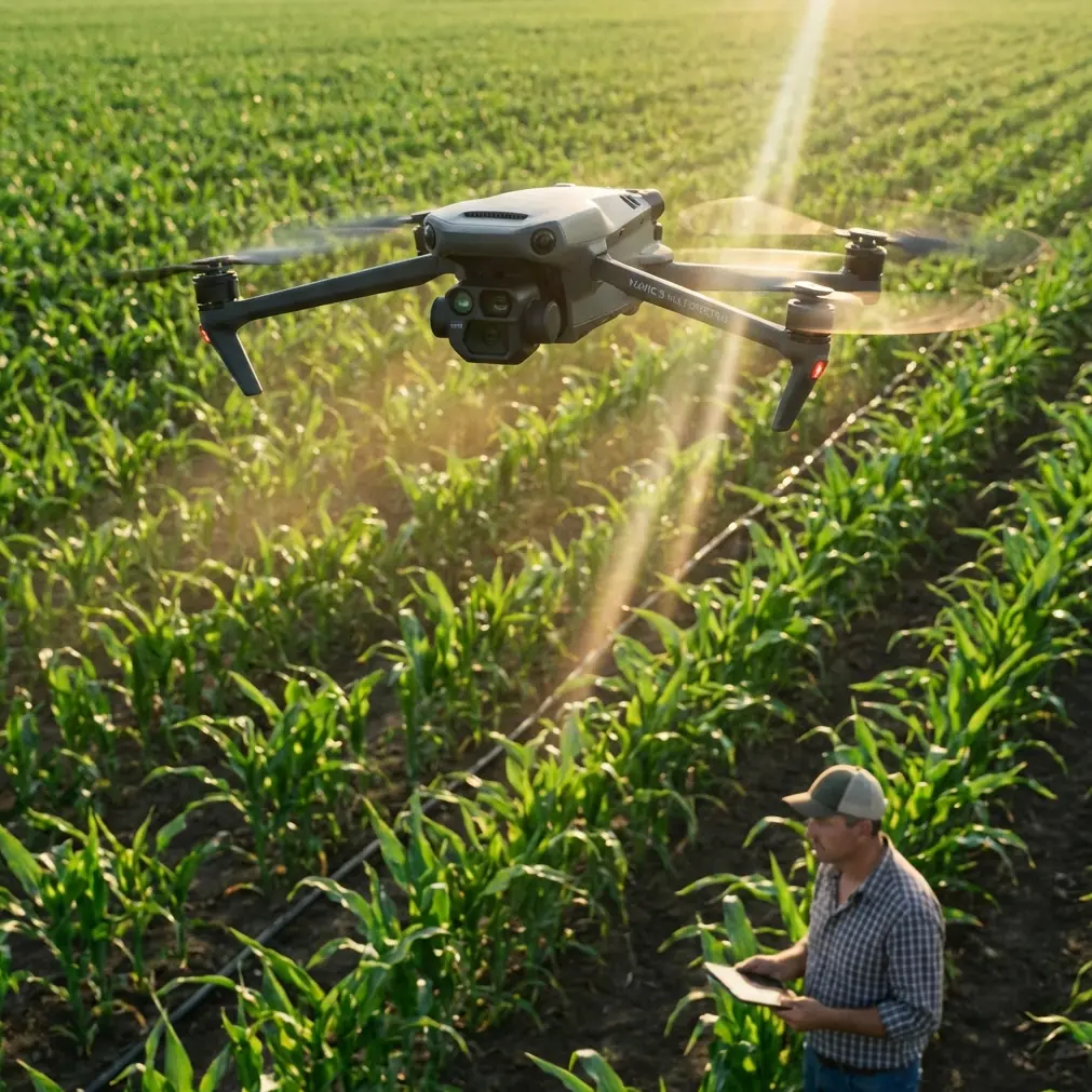
As a consultant, I see this gap all the time. Operators buy a capable multispectral platform, launch over a vineyard, collect a map, and assume the software will rescue weak field practice. It won’t. The Mavic 3M is excellent, but it rewards precision. That includes flight geometry, antenna placement, light management, and an understanding of how motion in the environment affects what the aircraft is actually recording.
The hidden link between photography and multispectral vineyard work
The photography article makes a deceptively simple point: a photograph is not just a technical capture. It is the result of knowledge, judgment, and the ability to focus everything on a single moment. That idea has direct operational significance for the Mavic 3M.
Many pilots still treat multispectral missions as if they are immune to photographic fundamentals. They are not. Even though the output is analytical rather than artistic, the aircraft is still collecting image-based information shaped by light angle, shadow behavior, texture, and the timing of the capture. In vineyards, especially urban ones, those factors can distort plant stress interpretation if ignored.
Take the article’s emphasis on light and shadow as the soul of imaging. In a vineyard bordered by buildings, walls, parked vehicles, or mixed-height infrastructure, side light can exaggerate canopy structure while long shadows can create false variability between rows. A multispectral sensor can quantify reflected light, but it cannot magically remove bad mission timing. If you fly too early or too late, your map may show vigor differences that are really just directional shading.
That is where the “technique and art” idea becomes operational, not philosophical. Technique is your mission setup: altitude, swath width, overlap, speed, RTK status, and exposure consistency. Art, in a professional drone sense, is the judgment to know whether the scene is actually ready to be measured.
In other words, a clean map starts before takeoff.
What the Texas A&M ocean-current story tells vineyard operators
The second news item is even more revealing. Texas A&M’s drone work on ocean-current mapping is built around a simple mission need: when a spill happens across a large water surface, cleanup teams need current data fast. The article notes that this kind of data was historically difficult and expensive to collect. That matters because it highlights what drones do best: capture dynamic environmental patterns quickly enough to support action.
For a Mavic 3M operator in a vineyard, the environmental variable is not ocean current. It is micro-movement in air, heat, and canopy response.
Urban vineyards experience localized airflow disruptions that many rural operators never have to think about. Buildings can channel wind. Road corridors can create thermal variation. Fences, retaining walls, and surrounding structures alter turbulence over surprisingly short distances. If you are using the Mavic 3M to identify stress, irrigation irregularities, disease zones, or canopy inconsistency, those environmental effects can shape what the sensor sees on a row-by-row basis.
This is where the ocean-current story becomes practical. The lesson is not “use drones over water.” The lesson is that drones are valuable because they reveal moving systems that standard field observation struggles to capture economically. In vineyard management, that means spotting patterns produced by airflow, heat load, variable moisture retention, or chemical distribution. It also means acknowledging that those patterns change.
That is especially relevant when your reader scenario includes spray drift and nozzle calibration. If a block sits beside urban hardscape, spray behavior can become inconsistent. Drift may not follow the simple assumptions you would use in an open agricultural field. A multispectral mission flown after treatment can reveal uneven crop response, but only if the operator understands that the pattern may reflect drift and deposition behavior, not purely plant health. This is why pairing imagery with calibration notes and recent application records produces better decisions than imagery alone.
A real vineyard case-study frame for the Mavic 3M
Let’s put this into a practical case-study style scenario.
An urban vineyard manager notices inconsistent vine vigor along two edge blocks. The team suspects irrigation imbalance, but there is also a history of difficult spray conditions because one side of the site faces a road and another borders low-rise buildings. A Mavic 3M mission is scheduled to compare row-to-row performance and isolate the weak zones.
A less experienced pilot might launch as soon as the battery is ready, accept partial GNSS stabilization, stand wherever there is shade, and assume automation covers the rest.
A better operator slows down.
First, they check the light. The photography article’s point about concentrating fully on a single moment matters here. Midday isn’t always perfect, but stable lighting usually beats dramatic low-angle light when the goal is consistent analytical capture. If one side of the vineyard is still influenced by building shadow, the mission waits.
Second, they verify the RTK fix rate before committing the block. Centimeter precision is not marketing fluff in vineyards with narrow row spacing and repeated seasonal comparison. If you want to compare this week’s vigor signature with a prior flight, or align observations to specific rows and irrigation emitters, reliable positioning matters. Without a stable RTK solution, the value of your map for longitudinal analysis drops fast.
Third, they think about swath width in relation to the site’s geometry. Wider isn’t always better in an urban vineyard. A broad pass may look efficient, but if row edges sit beside reflective roofs, walls, or paved strips, you increase the chance that edge contamination complicates interpretation. A slightly more conservative swath width often produces cleaner row-level analytics.
Fourth, they review recent spray records. If nozzle calibration was off or wind shifted during the last application, some “stress signatures” may simply be treatment inconsistency. That is why multispectral results should be read alongside operational logs, not in isolation.
That is the job. The aircraft gathers data, but the operator builds meaning.
Antenna positioning advice that actually improves range and reliability
Because the brief called for range advice, here is the field guidance I give most often, and it matters even more in urban vineyard environments.
Do not point the controller antennas directly at the aircraft like you are aiming a flashlight. For maximum range and stronger link quality, position the flat faces of the antennas toward the drone so the broad side of the signal pattern is presented to the aircraft. In practical terms, that usually means keeping the antennas upright and adjusting the controller so the sides, not the tips, face the Mavic 3M.
That sounds basic, but poor antenna orientation is one of the most common causes of unnecessary signal weakness in constrained environments.
Urban vineyards create line-of-sight problems quickly. You may have trellis infrastructure, utility poles, building edges, parked equipment, and elevation shifts. If the pilot stands too low behind obstructions and also misaligns antennas, the control link degrades far sooner than expected. The result may not be a disconnect, but subtle transmission instability can still affect confidence, route consistency, and mission efficiency.
A few practical habits help:
- Stand where you preserve the cleanest line of sight across the longest block.
- Avoid positioning yourself directly beside metal structures or vehicles.
- Rotate your body with the aircraft during long lateral runs so antenna orientation remains optimized.
- If one block is shadowed by buildings, move your takeoff point rather than forcing the link through an obstruction.
- Confirm a healthy signal before the farthest leg, not after it.
If you want a second opinion on your site layout and controller setup, send your block map through this quick WhatsApp channel: https://wa.me/example
Why the “freeze the moment” idea matters for vine diagnostics
The photography piece describes image-making as stopping time and capturing an instant that would otherwise disappear. That is not poetic excess. It is highly relevant to agricultural drone operations.
A vineyard is never static. Leaves move. Light shifts. Moisture conditions change over hours. Heat stress rises and falls. Human activity alters the site. If your mission timing is inconsistent, the map becomes a comparison of different moments rather than a comparison of plant condition.
That is why repeatability matters so much with the Mavic 3M. The strongest operators do not just collect pretty orthomosaics. They build disciplined capture routines so trend analysis means something. Similar launch windows, similar light conditions, consistent altitude, and a dependable RTK workflow make your maps more trustworthy from one survey to the next.
This also reduces the risk of chasing phantom problems. I have seen managers investigate “weak canopy zones” that were mostly the result of timing differences between flights. In an urban vineyard, where shade and reflected light can change fast, that risk gets bigger.
From ocean currents to spray drift: reading movement instead of fighting it
The Texas A&M story deserves one more look because it underlines a mindset that advanced drone operators share: stop treating environmental movement as background noise. Measure it, interpret it, and use it.
In marine spill response, ocean currents determine where the problem goes next. In vineyards, spray drift, thermal loading, and airflow disruptions influence where agronomic problems show up and how they spread.
That means Mavic 3M data becomes much more valuable when integrated into a movement-aware workflow:
- If a stress zone appears downwind of a known application boundary, investigate drift before assuming disease.
- If edge rows near masonry or asphalt consistently read warmer or weaker, compare with thermal load patterns and irrigation scheduling.
- If one corridor repeatedly underperforms, examine whether building-induced airflow changes evaporation or spray penetration.
- If a treatment appears uneven, inspect nozzle calibration records before redrawing the fertility plan.
This is where multispectral work becomes genuinely strategic. You are no longer just finding red or yellow patches on a map. You are identifying the forces that created them.
The bigger takeaway for Mavic 3M users
These two recent stories, dated just one day apart, point to a mature way of thinking about drone operations.
The March 24 photography piece reminds us that image quality begins with disciplined seeing. The March 23 Texas A&M report reminds us that drone data becomes powerful when it reveals environmental dynamics quickly enough to support action. Put those together, and you get a much better operating philosophy for the Mavic 3M in urban vineyards.
Use the aircraft as a measurement tool, yes. But do not strip imaging of its fundamentals. Light still matters. Timing still matters. Positioning still matters. Environmental movement still matters. And the operator’s judgment still sits at the center of the whole workflow.
That is the difference between merely flying a multispectral drone and building a vineyard intelligence program that can stand up to repeated use across a season.
For teams working in dense or semi-urban vineyard settings, the next performance gains are unlikely to come from pressing the auto-mission button more confidently. They will come from refining field discipline: better mission timing, smarter antenna orientation, stronger RTK habits, tighter spray-log correlation, and more careful reading of how the site itself shapes what the sensor sees.
The Mavic 3M is already capable. The question is whether the workflow around it is equally sharp.
Ready for your own Mavic 3M? Contact our team for expert consultation.