How the Mavic 3M Changes Coastal Venue Monitoring When the S
How the Mavic 3M Changes Coastal Venue Monitoring When the Site Keeps Fighting Back
META: Expert analysis of how the Mavic 3M fits coastal venue monitoring, using lessons from wind turbine drone automation, maze-style autonomy logic, and real-world inspection workflows.
Coastal venues look simple from the road. A waterfront event space, marina-adjacent sports complex, seaside resort, open-air concert ground, or harbor-facing campus can appear flat, open, and easy to inspect. Then you try to monitor it properly.
Salt haze softens contrast. Reflective roofs and water edges confuse visual interpretation. Wind shifts fast between structures. Temporary installations go up overnight. Access routes that seem straightforward on a map become awkward once pedestrian barriers, fencing, parked service vehicles, and maintenance equipment start reshaping the space.
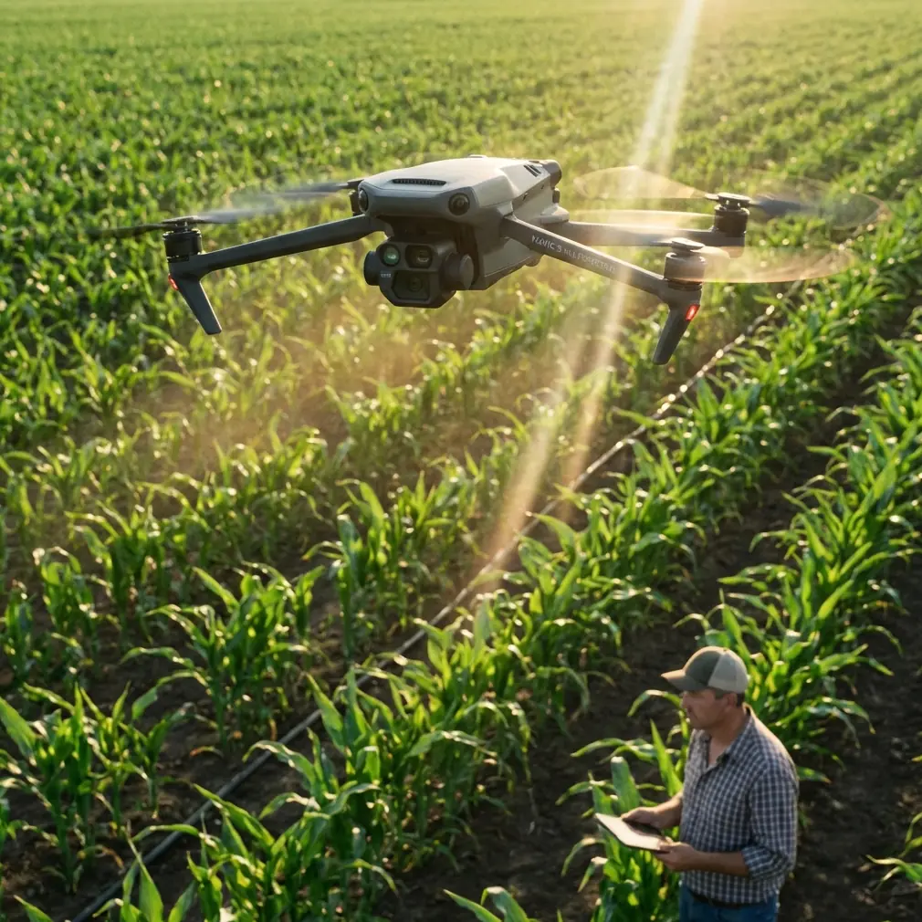
That is where the Mavic 3M starts to matter—not as a generic drone with a nice spec sheet, but as a practical tool for coastal monitoring teams that need repeatability more than drama.
I learned this the hard way on a shoreline venue audit where our biggest problem was not image quality. It was consistency. We could capture the site. What we struggled with was returning to the same corridors, the same drainage edges, the same roof segments, and the same vegetation buffers with enough positional discipline to compare one survey against the next. In coastal environments, tiny changes become expensive problems if they go unnoticed: water pooling near public pathways, turf stress on athletic surfaces, erosion creeping toward utility runs, or temporary structures shifting circulation patterns.
The Mavic 3M is well suited to this kind of work because it sits at the intersection of mapping discipline and operational flexibility. And the references behind this discussion point to something bigger: the UAV market is moving away from “drone as flying camera” and toward “drone as structured sensing system.”
Why this matters now
One recent industry signal came from Perceptual Robotics, which raised fresh funding to expand its autonomous wind turbine inspection platform. The round was led by Loggerhead Ventures, with follow-on participation from One Planet Capital. That may sound far removed from a coastal venue manager deciding whether to fly a Mavic 3M over parking areas, landscaped zones, and public-facing infrastructure.
It is not far removed at all.
Wind turbine inspection is one of the clearest examples of where drone operations have to mature beyond manual piloting. Turbines are repetitive assets. Their value comes from inspection consistency, anomaly detection, and maintenance workflows. Coastal venues are less vertical, but the monitoring logic is similar. You are still dealing with recurring assets, recurring flight paths, recurring documentation, and recurring risk points. The fact that investors are backing AI-powered inspection drones for wind farm maintenance tells us where the operational standard is heading: automation, repeatability, and lower dependence on operator improvisation.
For Mavic 3M users, that shift matters because the aircraft is strongest when used as part of a disciplined monitoring program. Not random flights. Not occasional promotional imagery. A program.
The hidden challenge of coastal venue monitoring
Coastal sites punish inconsistency. A venue can look healthy during a walk-through while already showing subtle signs of stress from moisture, salinity, and traffic. Hardscape joints begin to shift. Drainage routes clog. Edge vegetation weakens. Retention areas stop behaving as designed. Painted wayfinding fades unevenly. Temporary structures create new wear corridors in turf or gravel.
The Mavic 3M becomes useful here because multispectral data can reveal patterns that a visual-only workflow often misses until much later. Readers often associate multispectral with agriculture, and that is understandable. But in coastal venue monitoring, vegetation health is not cosmetic. It can be diagnostic. If turf strips near pedestrian channels start showing stress, the cause may be compaction, poor irrigation coverage, salt exposure, or altered runoff. If buffer plantings along the perimeter begin degrading in irregular bands, the issue may point to drainage imbalance or environmental exposure, not just maintenance timing.
That is one reason the Mavic 3M deserves a place in venue operations discussions rather than being boxed into farm-only conversations.
What a maze-solving training concept teaches us about field monitoring
An unusual but useful reference comes from DJI educational material built around maze exploration. In that exercise, the drone follows a “right-hand rule” to navigate an unknown maze, using a TOF distance sensor to determine whether a wall is present. If the first side is blocked, it rotates and checks the next side, repeating the logic until it finds a valid path. In one challenge sequence, when the aircraft detects a challenge card, it hovers, flashes a blue LED for 3 seconds, and displays the card number on its matrix display.
At first glance, that sounds like classroom robotics, not professional monitoring. But the operational lesson is excellent.
Coastal venues are full of semi-structured uncertainty. Service lanes are blocked for events. Temporary stages alter approach paths. Protective fencing appears and disappears. Access geometry changes week to week. Monitoring teams need workflows that are systematic enough to preserve comparability, yet adaptive enough to handle altered site conditions.
The maze example illustrates two things that matter in real field operations:
Rule-based navigation beats ad hoc flying.
The right-hand rule is simple, but it creates a consistent decision framework in an unknown space. For venue monitoring, the equivalent is a repeatable route logic: perimeter first, drainage lines second, rooftops third, vegetation buffers fourth, temporary structures last. The aircraft does not need to “think” like a maze robot, but the pilot and mission planner should.Detection events must trigger standardized behavior.
In the training example, the drone does not just notice a challenge card and move on. It pauses, signals, and identifies the event. In professional Mavic 3M work, that maps nicely to anomaly workflows: when you detect standing water, vegetation stress, encroachment, blocked egress, or surface discoloration, the next action should also be standardized—hover, capture an orthogonal set, mark coordinates, annotate, and flag for comparison in the next cycle.
That structure is what turns drone data into maintenance intelligence.
The older engineering literature still has something to teach us
A second document reference, from a 2014 Chinese UAV conference paper on engineering construction applications, includes bridge monitoring, 3D reconstruction, deformation comparison, and a cited 2013 paper on UAV photogrammetry in wind farm survey and design.
Those details matter because they remind us that today’s venue monitoring problem is part of a longer arc. Long before current compact enterprise drones became common, practitioners were already using UAVs for civil observation tasks that depended on measurable change over time: bridge monitoring, real-scene 3D reconstruction, and deformation assessment.
That heritage aligns strongly with how the Mavic 3M should be used at coastal venues.
A marina event complex, for example, is not just a set of buildings. It is a changing engineered environment. You may need to compare:
- path settlement after storm seasons
- shoreline edge condition
- roof drainage behavior
- turf vigor across heavy-footfall zones
- perimeter planting stress
- temporary structure placement versus clearance plans
- access route obstruction patterns over time
Bridge monitoring and deformation comparison are not identical to venue oversight, but the core principle is the same: aerial data becomes truly valuable when it supports comparison, not just observation.
Where the Mavic 3M fits better than people expect
The Mavic 3M is especially strong when the site operator needs one aircraft to do three jobs without rebuilding the workflow every time:
- routine visual monitoring
- vegetation condition assessment
- repeatable site mapping for comparison
That matters at coastal venues because problems rarely stay in one category. A stressed lawn may really be a drainage issue. A drainage issue may begin at a hardscape edge. A hardscape issue may connect to altered traffic flow caused by temporary barriers. When one platform can collect aligned data across those layers, the investigation moves faster.
This is also where centimeter precision and RTK fix rate become operational concerns rather than technical jargon. If you are trying to compare the same planting strip after wind exposure, or confirm whether an event compound has crept into a protected buffer, positional consistency is everything. Good repeatability shrinks argument. It reduces the “maybe it just looks different today” problem.
For teams monitoring coastal venues, that can affect how quickly maintenance crews act and how confidently managers document conditions before and after weather events.
A practical problem-solution model for coastal teams
The problem
Most venue drone programs fail quietly. Not because the aircraft is weak, but because the workflow is loose.
Flights happen only after complaints. Different operators choose different altitudes. One month the route starts at the parking apron; next month it starts at the shoreline edge. Visual photos are captured, but no consistent anomaly tags are created. Vegetation issues are noticed late. Surface deterioration is spotted only when it becomes visible to guests.
The solution
Use the Mavic 3M as a scheduled monitoring platform built around repeatability and comparison.
A sound workflow often looks like this:
- establish fixed mission windows around tide, light, and venue occupancy
- maintain recurring route templates by asset type
- use RTK-supported positioning where precision matters most
- capture both visual context and multispectral indicators
- set clear anomaly classes before the flight
- trigger the same response every time an issue is found
- compare against prior data, not memory
This is the part many teams skip. The aircraft alone does not create discipline. The program does.
Why wind matters more than brochure specs
In coastal work, wind is not a headline feature. It is the background condition behind almost every operational compromise. Oblique passes become uneven. Hover time over narrow targets gets shorter. Water-adjacent surfaces produce visual ambiguity. That is why the broader market movement toward automated inspection platforms, like the Perceptual Robotics funding story, is so relevant. The value is not only autonomy in the abstract. It is reducing the performance gap between a perfect mission plan and a windy, changing, real-world site.
For Mavic 3M operators, the lesson is clear: standardization is a force multiplier. If your route logic, capture logic, and anomaly logic are disciplined, you get better outcomes even when conditions are less than ideal.
A note on venue monitoring near water
Near-water venues often have one overlooked requirement: communication between operations, grounds, and facilities teams must be immediate enough to be useful. Drone maps generated days later still matter, but some issues need same-shift action—blocked drainage, damaged fencing, stressed turf in public zones, or unusual surface ponding before a large event.
That is why many professional teams now build direct review loops into their field process. If you are shaping one for your own site, a simple option is to set up a field coordination channel and share it with the responsible crew lead through a direct operations contact such as this WhatsApp line for on-site coordination. Used properly, that shortens the distance between aerial detection and corrective action.
The bigger takeaway
The most useful way to think about the Mavic 3M in coastal venue monitoring is not as a flying sensor package looking for occasional problems. Think of it as a repeatability machine.
The educational maze example shows the power of rule-based navigation in uncertain space. The engineering reference shows the long-standing value of aerial comparison for constructed environments. The Perceptual Robotics funding news shows where the inspection market is placing its confidence: systems that automate recurring observation and support maintenance decisions.
Tie those three threads together and the path is pretty clear.
If you operate a coastal venue, the challenge is rarely capturing one impressive flight. The challenge is building a monitoring rhythm that keeps the site legible despite weather, salt, changing layouts, and public activity. The Mavic 3M makes that easier when you use it to produce comparable, positionally reliable, multi-layer data over time.
That is the difference between flying a drone over a venue and actually understanding what the venue is trying to tell you.
Ready for your own Mavic 3M? Contact our team for expert consultation.