Mavic 3M for Mountain Solar Farms: How Smarter Metering
Mavic 3M for Mountain Solar Farms: How Smarter Metering Decisions Improve Multispectral Mapping
META: Expert tutorial on using Mavic 3M for mountain solar farm mapping, with practical guidance on metering logic, changing weather, RTK stability, and cleaner multispectral data.
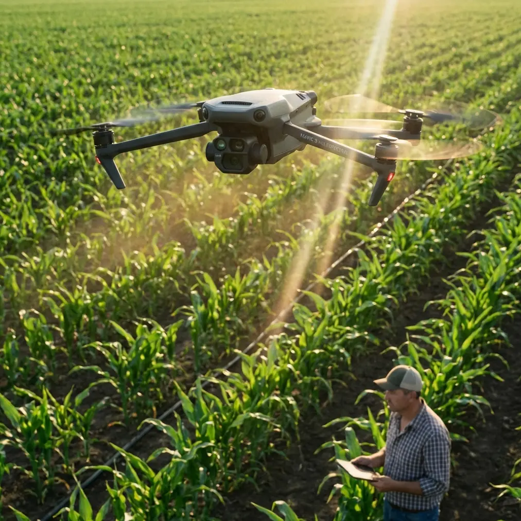
When crews talk about bad mapping output from a Mavic 3M mission, the blame usually lands on flight speed, overlap, wind, or processing settings. Those variables matter. But on mountain solar farms, a quieter problem often sits upstream: exposure control.
That is why a recent discussion around phone camera professional mode is more relevant to Mavic 3M operators than it first appears. The core point is simple. If your image looks wrong, the failure is not always ISO or shutter speed. Often, the real issue is the metering method deciding how the scene should be exposed. The article breaks this into three practical modes—matrix, center-weighted, and spot metering—and frames them as the hidden “light control switch” behind balanced brightness. That idea translates directly to difficult solar mapping work in mountainous terrain, where reflective panels, dark tree lines, haze, and shifting cloud cover can all exist in one flight block.
For operators using the Mavic 3M on solar assets, this matters because multispectral capture is only as useful as the consistency of the source imagery. If the aircraft flies a long corridor over arrays cut into uneven slopes and exposure swings aggressively from one pass to the next, the data becomes harder to trust. Orthomosaics may still stitch. Vegetation indices may still calculate. But interpretation gets messy fast, especially along panel edges, service roads, drainage channels, and vegetated buffer zones where contrast is already high.
I have seen this firsthand on mountain solar sites where weather looked stable at launch, only to break apart twenty minutes later. Sun on one ridge. Thin cloud on the next. Reflected glare off panel rows facing one direction, then a darker section after a contour change. In those moments, the operator who understands metering logic has a real advantage over the operator who keeps chasing exposure with manual tweaks after every turn.
Why this camera lesson actually applies to the Mavic 3M
The news item’s key operational claim is that many exposure problems are misdiagnosed. Pilots often think they need to keep adjusting ISO and shutter, when the larger decision is how the camera evaluates the scene in the first place. It also identifies three metering approaches—matrix, center, and spot—as the real governors of image brightness. Those are not abstract photography terms. They are field decisions.
On a mountain solar farm, the scene is rarely uniform. You may have:
- bright photovoltaic glass reflecting morning light
- shadow bands from passing cloud
- dark soil access roads
- light gravel pads around inverters
- steep slopes changing reflection angle by row
- vegetation around perimeter fencing that you also need to inspect in multispectral output
A broad metering pattern can average those elements into something acceptable, or it can be tricked by a few dominant bright panels. A narrow metering pattern can preserve a target area, or it can create instability if the target shifts constantly during automated route legs.
The practical lesson from the phone-camera piece is not “use one mode always.” It is that exposure consistency starts with choosing the right metering behavior for the scene. That is exactly the kind of decision that separates clean mountain-site datasets from flights that require endless post-processing triage.
The mountain solar problem: panels are not neutral targets
Solar farms are awkward subjects for any camera system because panels are reflective, geometric, and repetitive. In flat terrain, that is already enough to challenge exposure. In mountain terrain, the problem compounds.
Each row can sit at a slightly different angle to the sun. Swath width varies in perceived brightness because the ground itself changes orientation. Midday glare may spike on one section while the next section falls under a ridge shadow. If you are also capturing vegetation health around drainage routes or checking regrowth near the fence line with multispectral data, your mission has mixed targets with very different tonal priorities.
That is where the three metering concepts from the source become useful in mission planning:
- matrix metering evaluates the broader frame and usually works best when lighting is mixed but not extreme
- center-weighted metering prioritizes the middle portion of the image and can help when your main target is the array block centered in the frame
- spot metering reads a small area and is useful when one critical subject must be correctly exposed despite everything around it
The source article makes a strong point that once you understand these “control switches,” you stop blindly changing parameters and start getting balanced brightness without endless rework. In the field, that translates to fewer interrupted missions, cleaner reflectance behavior, and more stable image sets for reconstruction.
My field method for Mavic 3M on mountain sites
When I plan a Mavic 3M mission over a solar installation in mountainous terrain, I do not think about exposure as a camera-only issue. I treat it as a data integrity issue. My checklist looks like this:
1. Start with the site geometry, not the aircraft
Before launch, identify where the biggest brightness conflicts will appear. Usually that means:
- east-facing versus west-facing panel groups
- ridgelines that create moving shadow boundaries
- access roads cutting through dark soil or pale aggregate
- nearby vegetation zones intended for multispectral analysis
This tells you whether a global, centered, or narrow exposure priority makes sense for the first flight.
2. Match metering logic to the mission objective
If the flight is mainly for broad array documentation under moderately even light, matrix-style logic usually makes the most sense. It smooths out the whole frame and reduces overreaction to one bright patch.
If the main deliverable is panel-focused imaging and the rows are consistently centered in the composition, center-weighted logic can be more predictable. That keeps the primary working area from being overridden by bright sky or dark terrain at the edge of the frame.
If the mission is troubleshooting one problematic zone—say a drainage-adjacent string with suspected heat or vegetation interaction—spot-style logic may help, but only if the area of concern stays compositionally stable. Otherwise exposure can oscillate from image to image.
3. Watch the weather like it is part of the payload
Mountain weather almost never changes politely. It rolls in sections. During one recent site survey, the first half of the route was under hard sun and the second half shifted under fast-moving cloud. The Mavic 3M handled the wind and route geometry well, but the real challenge was preserving usable image consistency as illumination changed mid-flight.
That is where disciplined metering strategy matters more than panic-adjusting settings in the air. A pilot who understands how the camera is reading the frame can decide whether to pause, split the mission, or continue with controlled expectations. A pilot who does not will keep chasing exposure symptoms one parameter at a time.
4. Protect RTK quality while managing image quality
Exposure problems and positioning problems are different, but they hit the same output. If your RTK Fix rate drops while lighting is changing and the aircraft is crossing steep terrain, you are stacking uncertainty. The Mavic 3M’s centimeter precision is one of its major advantages for solar mapping, especially on narrow terraces and service corridors. Do not waste that positional accuracy with inconsistent image capture discipline.
5. Verify edges, not just the center
Mountain solar maps often look fine in the middle and fail at the margins. Check panel block edges, fence lines, runoff channels, and vegetated strips. That is where poor metering choices show up first because tonal contrast is highest there.
What changed mid-flight, and how the drone handled it
The scenario most readers care about is the one that happens all the time: launch conditions are stable, then the weather moves.
Imagine a mountain solar farm at late morning. The first mapping legs are clean. Light is strong. The arrays are bright but manageable. Then a cloud bank slips across one ridge while the adjacent sector stays sunlit. Wind picks up through the saddle. Reflections soften in one direction and intensify in another.
This is where the Mavic 3M earns its keep, not because it magically removes all environmental problems, but because it gives you a stable airborne platform for making better decisions under pressure. With RTK holding strong and route execution staying tight, your attention can stay on exposure consistency and data quality. If the aircraft were wandering or fighting to maintain track, you would have no mental bandwidth left for metering judgment.
In practical terms, the drone handled the mid-flight change by maintaining planned lines and preserving reliable capture geometry while conditions deteriorated. The operator’s job was to avoid letting the exposure strategy drift into chaos. On the sun-to-cloud transition, a broad matrix-style approach can often cushion the shift better than a narrow target read that suddenly locks onto a dark patch or a bright reflection. On the other hand, if cloud cover becomes uniform and your real concern is the centered array block, a center-priority approach may become more reliable.
That decision is not academic. It affects whether your final map shows believable tonal continuity or patchwork inconsistency across adjoining strings.
How this helps multispectral interpretation
Many teams hear “multispectral” and assume the analytics layer will compensate for capture weakness. That is optimistic. Good processing can standardize a lot, but poor exposure discipline in variable mountain light still creates friction.
For solar farms, multispectral work often extends beyond the panels themselves. You may be assessing vegetation encroachment, drainage patterns, disturbed soil, or maintenance-access corridors. If one block of imagery is biased by reflective panel dominance and the next is weighted toward dark ground or shadow, interpretation becomes less stable.
This is where the news item’s framing is valuable. It says, in effect, stop obsessing over raw settings first and understand how the system is choosing brightness. That principle matters for every Mavic 3M operator who wants repeatable outputs instead of one-off lucky flights.
If your team is refining flight procedures for complex sites, I often recommend operators document not just shutter and ISO behavior, but the exposure evaluation logic used under specific terrain and weather conditions. That turns metering from guesswork into a repeatable SOP. If you want to compare notes on building that workflow, you can reach me through a direct field planning chat.
A practical tutorial framework for mountain solar missions
Here is the approach I recommend when training crews on Mavic 3M exposure strategy for this exact environment.
Use matrix-style metering when:
- light is mixed across the frame but not violently contrasty
- the mission is broad-area mapping
- panel rows, roads, and vegetation all share the frame
- cloud movement is creating moderate but frequent brightness swings
Operational significance: this mode is often the safest starting point because it reduces the need to constantly intervene. That aligns with the source article’s claim that understanding metering can eliminate repeated parameter adjustments.
Use center-weighted metering when:
- the array block is your primary subject
- the flight plan keeps the target area centered consistently
- sky or dark terrain at the edges would otherwise skew exposure
Operational significance: this can improve consistency on panel-focused missions where edge content is less important than the central swath of rows.
Use spot metering when:
- one specific subject must be exposed correctly
- the target stays stable in the frame
- you are diagnosing a localized anomaly rather than mapping the whole site
Operational significance: this is precise, but risky for broad automated mapping in changing light. On mountain solar farms, spot-based logic can become too reactive unless the mission is highly controlled.
What this means for real field performance
The source article mentions that these metering modes are broadly usable across major phone brands and that even beginners can apply them once the scenarios are explained clearly. That matters because the underlying lesson is not tied to one device family. It is a camera operations principle.
For Mavic 3M users, especially those mapping solar farms in mountains, the implication is straightforward: exposure consistency is a planning skill, not a rescue maneuver. Learn the metering logic before launch, align it with the mission objective, and be ready to adapt when weather shifts mid-flight.
Do that and several other parts of the operation get easier:
- multispectral comparisons hold together better across blocks
- orthomosaic brightness transitions become cleaner
- edge features are easier to inspect
- post-processing time drops
- reflight risk decreases when light changes halfway through the sortie
And yes, it also helps the more traditional drone concerns. Better image consistency supports clearer interpretation of terrain runoff, vegetation intrusion, and surface changes around infrastructure. Even adjacent tasks like spray drift analysis or nozzle calibration planning on nearby agricultural parcels benefit when your baseline maps are exposed consistently and positioned with centimeter precision.
The Mavic 3M is already a strong fit for this kind of work because it combines multispectral capability with survey-grade positioning and a field-ready airframe. In rough weather windows, details like dependable route execution matter. In dirty, wet, or windblown mountain conditions, durability matters too, and many field teams naturally compare platform resilience using standards like IPX6K when evaluating equipment around harsh outdoor operations. But the best aircraft still cannot save a poorly thought-out exposure strategy.
That is the real lesson hidden inside a simple camera article about matrix, center, and spot metering. The operator who understands how brightness is being judged will get more usable data than the operator who just keeps twisting settings and hoping the next leg looks better.
Ready for your own Mavic 3M? Contact our team for expert consultation.