Mavic 3M: Master Wildlife Filming at High Altitude
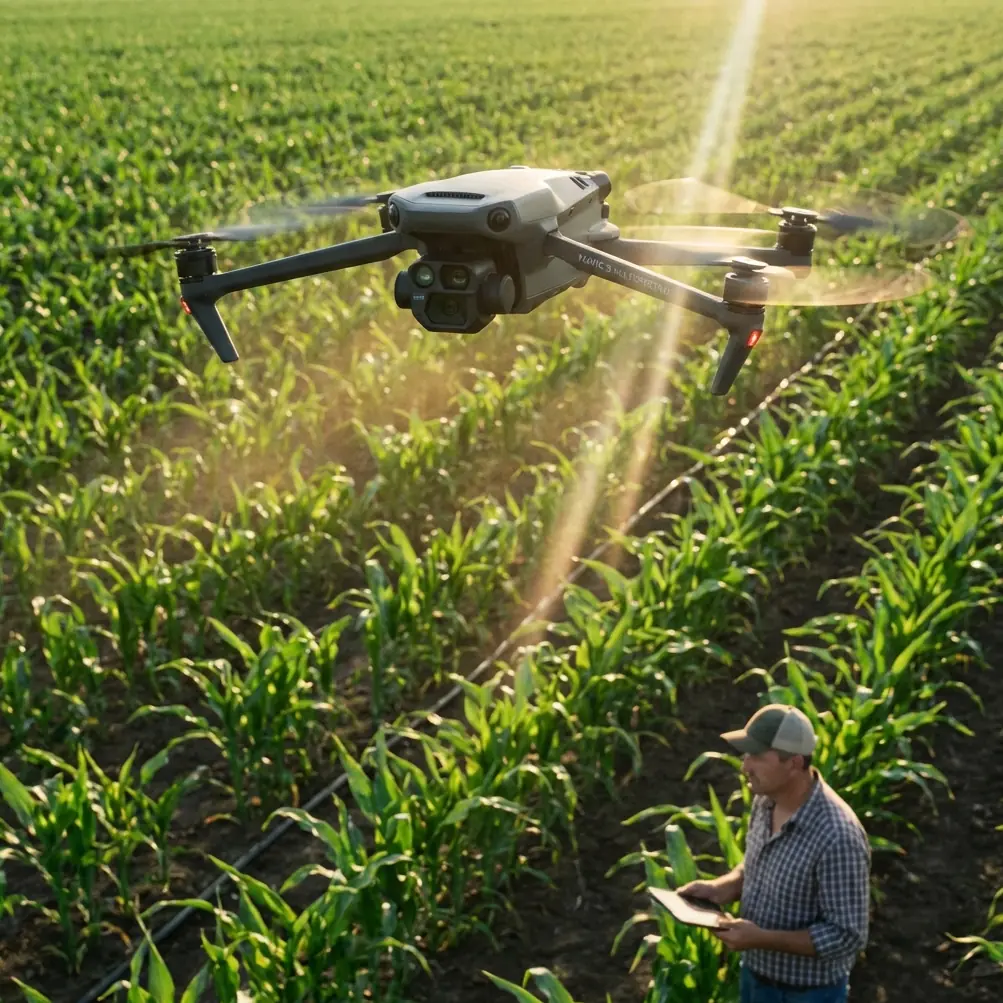
Mavic 3M: Master Wildlife Filming at High Altitude
META: Learn how the DJI Mavic 3M transforms high-altitude wildlife filming with multispectral imaging and precision flight—expert tips from field experience.
TL;DR
- Multispectral sensors capture wildlife behavior invisible to standard cameras, even in thin mountain air
- RTK Fix rate above 95% ensures centimeter precision for repeatable flight paths in challenging terrain
- Battery management at altitude requires specific protocols—expect 20-30% reduced flight time above 3,000 meters
- IPX6K weather resistance handles sudden alpine conditions that would ground lesser drones
High-altitude wildlife filming destroys unprepared equipment. The Mavic 3M's multispectral capabilities and precision positioning system solve the two biggest challenges filmmakers face above the treeline: capturing subjects in harsh light conditions and maintaining stable, repeatable flight paths in thin air. This tutorial breaks down exactly how to configure and operate the Mavic 3M for professional wildlife documentation at elevation.
Understanding the Mavic 3M's High-Altitude Advantage
The Mavic 3M wasn't originally designed for wildlife cinematography—it emerged from agricultural applications where multispectral imaging tracks crop health across vast fields. This origin story matters for wildlife filmmakers because the same technology that measures plant stress reveals animal behavior patterns invisible to conventional cameras.
At high altitude, standard RGB cameras struggle with intense UV radiation and rapidly shifting light conditions. The Mavic 3M's four multispectral sensors (Green, Red, Red Edge, and Near-Infrared) plus its dedicated RGB camera capture data across wavelengths that cut through atmospheric haze.
Key Specifications for Altitude Work
The aircraft maintains stable flight characteristics up to 6,000 meters above sea level, though practical wildlife filming typically occurs between 3,000 and 5,000 meters where most alpine species concentrate.
| Specification | Value | High-Altitude Impact |
|---|---|---|
| Max Service Ceiling | 6,000m | Full operational capability in most mountain ranges |
| Multispectral Resolution | 5MP per sensor | Sufficient detail for species identification |
| RTK Positioning | Centimeter precision | Repeatable transects for population studies |
| Wind Resistance | 12 m/s | Handles typical alpine gusts |
| Operating Temperature | -10°C to 40°C | Covers most filming conditions |
| Weather Rating | IPX6K | Survives sudden mountain weather |
Pre-Flight Battery Protocol: The Field Experience That Changed Everything
During a snow leopard documentation project in the Himalayas, I learned the hard way that altitude destroys battery performance. At 4,200 meters, my first flight lasted just 23 minutes instead of the expected 43 minutes—a 46% reduction that nearly cost irreplaceable footage.
Expert Insight: Always warm batteries to at least 20°C before flight at altitude. I now carry batteries inside my jacket for 30 minutes minimum before each mission. This single habit recovered approximately 8-10 minutes of flight time per battery at 4,000+ meters.
The Altitude Battery Management System
Follow this protocol for consistent performance:
- Pre-warm all batteries to 25°C using body heat or vehicle heating
- Reduce expected flight time by 25% for every 1,500 meters above sea level
- Set return-to-home battery threshold to 35% instead of the default 25%
- Carry 50% more batteries than you'd pack for sea-level operations
- Never charge batteries until they've reached ambient temperature after cold flights
The Mavic 3M's intelligent battery system provides accurate remaining time estimates, but these calculations assume sea-level air density. Thin air forces motors to work harder, draining cells faster than the software predicts during your first flights at a new elevation.
Configuring Multispectral Capture for Wildlife
Wildlife documentation at altitude benefits from multispectral imaging in ways that surprise most filmmakers. The Near-Infrared band reveals animal heat signatures against cold rock, while the Red Edge sensor detects subtle vegetation differences that indicate grazing patterns and territorial boundaries.
Optimal Sensor Settings
For wildlife work, configure the multispectral array differently than agricultural users:
- Capture interval: 0.7 seconds for moving subjects
- Overlap: 75% frontal, 65% side for 3D reconstruction
- Altitude above ground: 80-120 meters balances detail with coverage
- Swath width: Calculate based on your specific altitude for consistent coverage
Pro Tip: The RGB camera and multispectral sensors capture simultaneously but save to different folders. Create a naming convention before your expedition that links corresponding files—I use timestamp matching with a 2-second tolerance to pair images during post-processing.
Nozzle Calibration Principles Applied to Camera Alignment
Agricultural operators obsess over nozzle calibration to ensure even spray drift patterns. Wildlife filmmakers should apply the same precision mindset to camera alignment verification.
Before each expedition:
- Verify gimbal calibration on flat ground at your base camp elevation
- Check multispectral band alignment using a calibration target
- Document any drift between RGB and multispectral frames
- Recalibrate if temperature changes exceed 15°C from your last calibration
Achieving Centimeter Precision with RTK
The Mavic 3M's RTK capabilities transform wildlife research from opportunistic filming to systematic documentation. When you can repeat exact flight paths across days, weeks, or seasons, behavioral patterns emerge that single flights never reveal.
RTK Setup for Remote Locations
Mountain environments challenge RTK systems because satellite geometry suffers when peaks block portions of the sky. Maximize your RTK Fix rate with these techniques:
- Scout your launch site for maximum sky visibility—avoid narrow valleys
- Begin RTK initialization 10 minutes before planned takeoff
- Monitor fix rate continuously—abort if it drops below 95%
- Use network RTK when cellular coverage exists; pack a base station for truly remote work
- Record raw GNSS data as backup for post-processed positioning
The difference between RTK Float and RTK Fix matters enormously. Float accuracy of 0.5-1 meter might seem acceptable, but Fix accuracy of 1-2 centimeters enables you to photograph the same animal den entrance across multiple visits, documenting activity patterns with scientific precision.
Common Mistakes to Avoid
Ignoring propeller efficiency loss: Thin air reduces propeller thrust. The Mavic 3M compensates automatically, but aggressive maneuvers that work at sea level may cause altitude loss or instability above 4,000 meters. Fly smoother than you think necessary.
Trusting automated obstacle avoidance completely: The vision systems work well, but harsh alpine light creates shadows that confuse sensors. Maintain manual awareness, especially during dawn and dusk filming when wildlife activity peaks.
Underestimating weather speed: Mountain weather changes in minutes, not hours. The IPX6K rating protects against rain, but wind gusts that arrive with storms exceed the 12 m/s resistance threshold. Land immediately when you see weather building, even if it looks distant.
Forgetting about wildlife stress: Drones disturb animals. Maintain minimum 100-meter distances from sensitive species, increase altitude rather than proximity for better shots, and cease operations if subjects show stress behaviors. Ethical wildlife filming requires restraint.
Neglecting memory card management: Multispectral capture generates massive files. A single 45-minute mission produces 15-20GB of data. Carry multiple high-speed cards and verify write speeds before critical flights.
Frequently Asked Questions
How does the Mavic 3M's multispectral imaging help identify wildlife at altitude?
The Near-Infrared sensor detects heat differential between warm-blooded animals and cold alpine environments, making subjects visible even when camouflaged against rock or snow. The Red Edge band reveals vegetation disturbance patterns that indicate animal trails, feeding areas, and territorial boundaries invisible to standard cameras. Combined, these capabilities let researchers locate and document wildlife systematically rather than relying on chance encounters.
What RTK Fix rate should I maintain for reliable wildlife transect surveys?
Maintain 95% RTK Fix rate minimum for research-grade repeatability. Below this threshold, position accuracy degrades from centimeter to decimeter level, making it impossible to guarantee you're photographing identical locations across multiple survey flights. If fix rate drops during flight, the data remains usable for general documentation but shouldn't be included in quantitative population or behavioral studies requiring precise spatial correlation.
Can the Mavic 3M operate safely in sudden alpine snowstorms?
The IPX6K rating protects against heavy rain and snow, but visibility loss and wind gusts accompanying storms create unacceptable risk. The aircraft will likely survive brief exposure to precipitation, but you cannot safely navigate or avoid obstacles when visibility drops. Establish firm weather abort criteria before each flight: land immediately if visibility falls below 500 meters or wind exceeds 10 m/s with gusts, regardless of remaining battery or filming objectives.
The Mavic 3M bridges the gap between consumer accessibility and professional capability for high-altitude wildlife documentation. Its multispectral sensors reveal what eyes and standard cameras miss, while RTK positioning enables the systematic, repeatable surveys that transform footage into scientific data.
Master the battery management protocols, respect the altitude limitations, and configure your sensors for wildlife rather than agriculture. The technology handles the rest.
Ready for your own Mavic 3M? Contact our team for expert consultation.