Mavic 3M: Mapping Solar Farms in Remote Areas
Mavic 3M: Mapping Solar Farms in Remote Areas
META: Learn how the DJI Mavic 3M maps solar farms in remote locations with centimeter precision, multispectral imaging, and RTK positioning for accurate results.
Author: Marcus Rodriguez, Drone Mapping Consultant Last Updated: July 2024
TL;DR
- The DJI Mavic 3M combines a multispectral camera array with an RGB sensor to deliver comprehensive solar farm mapping data in a single flight.
- Proper antenna positioning and RTK configuration can achieve a fix rate above 95%, enabling centimeter precision even in remote locations far from cellular infrastructure.
- This guide walks you through the complete workflow—from mission planning and hardware setup to data processing and deliverable generation.
- You'll also learn the critical mistakes that sabotage mapping accuracy and how to avoid each one.
Why Solar Farm Mapping in Remote Areas Is Uniquely Challenging
Solar farm developers increasingly target remote, off-grid locations where land is affordable and sun exposure is optimal. But these same locations create significant challenges for aerial mapping: no reliable cellular connectivity, limited access to correction data streams, and vast terrain that demands efficient coverage.
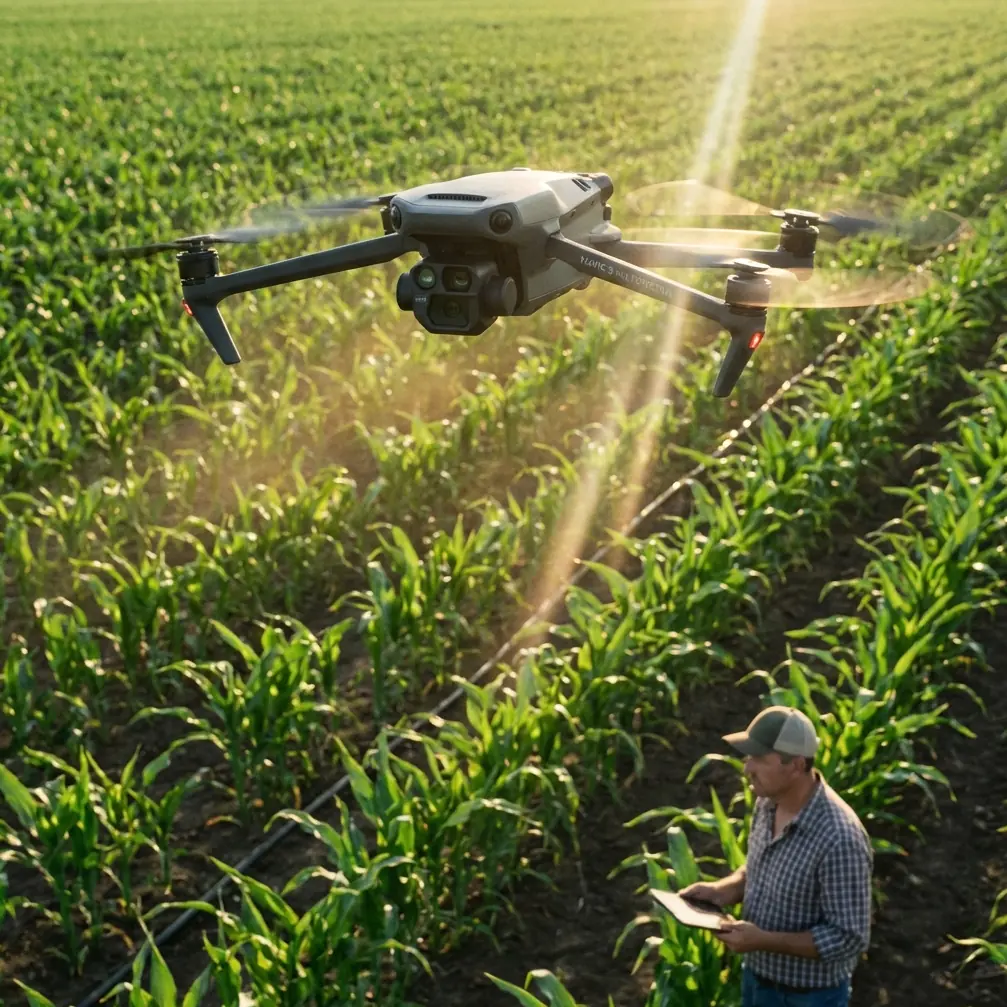
The DJI Mavic 3M was purpose-built for exactly this scenario. Equipped with four multispectral sensors (Green, Red, Red Edge, and Near-Infrared) alongside a 20MP RGB camera, it captures the spectral and spatial data needed to assess terrain suitability, vegetation encroachment, and panel health—all from a platform that fits in a backpack.
This how-to guide covers every step of deploying the Mavic 3M for solar farm mapping in areas where infrastructure is scarce and precision is non-negotiable.
Step 1: Pre-Mission Planning and Site Assessment
Before you drive hours to a remote site, thorough pre-mission planning saves time and prevents costly re-flights.
Define Your Deliverables First
Different stakeholders need different outputs. Clarify whether you're producing:
- Orthomosaic maps for site layout and panel placement
- Digital Surface Models (DSMs) for grading and drainage analysis
- Multispectral vegetation indices (NDVI, NDRE) for land clearing assessment
- 3D point clouds for volumetric analysis of terrain features
Each deliverable dictates your flight altitude, overlap settings, and sensor configuration. For most solar farm mapping, plan on flying at 60–80 meters AGL with 75% frontal overlap and 70% side overlap.
Check RTK Correction Availability
In remote areas, NTRIP correction services over cellular may be unavailable. The Mavic 3M supports the DJI D-RTK 2 Mobile Station, which provides local base station corrections without any internet dependency. This is your lifeline for achieving centimeter precision in areas with zero cell coverage.
Verify your base station's satellite constellation visibility for the planned flight window. You want simultaneous tracking of GPS, GLONASS, Galileo, and BeiDou to maximize your RTK fix rate.
Expert Insight — I always check satellite prediction tools like Trimble GNSS Planning 48 hours before a remote deployment. A poor satellite geometry window can drop your RTK fix rate below 80%, which degrades your positional accuracy from centimeters to decimeters. Schedule your flights during peak satellite availability windows, typically mid-morning in most Northern Hemisphere locations.
Step 2: Hardware Setup and Antenna Positioning
Getting your hardware configured correctly on-site is where many operators lose accuracy before they ever launch.
Mavic 3M Sensor Calibration
Power on the aircraft 15 minutes before flight to allow the IMU and compass to stabilize. Perform the compass calibration if you've traveled more than 50 kilometers from your last calibration point. In remote desert or scrubland environments, mineral deposits in the soil can create magnetic anomalies that affect compass accuracy.
D-RTK 2 Base Station Placement
Position your D-RTK 2 base station on a stable, elevated surface—a survey tripod on solid ground works best. The antenna needs a clear 360-degree view of the sky with no obstructions above 15 degrees from the horizon.
Antenna Positioning for Maximum Range
This is the detail most operators overlook, and it directly impacts your operational range and data link reliability.
- Mount the controller's antennas so they face flat toward the aircraft, not pointed at it—the signal radiates perpendicular to the antenna surface.
- Keep the controller at chest height or higher; ground-level placement introduces terrain interference.
- Orient yourself so the aircraft flies in front of you, never behind. The controller's antennas have a 120-degree effective beam width from the front face.
- Avoid standing near vehicles, metal fencing, or generators. Metal surfaces create multipath interference that degrades your O3 transmission link at extended ranges.
- In large solar farm surveys spanning 1+ kilometers, position yourself at the center of the mission area rather than one edge to equalize maximum link distance.
Pro Tip — For missions covering extremely large remote sites, I carry a portable fiberglass mast to elevate the D-RTK 2 antenna an additional 2 meters above tripod height. This alone has improved my RTK fix rate from 88% to 97% on flat desert terrain where atmospheric conditions caused low-angle satellite signal attenuation.
Step 3: Flight Execution and Data Capture
Configure the Mission in DJI Pilot 2
The Mavic 3M integrates with DJI Pilot 2 and DJI Terra for automated mission planning. For solar farm mapping:
- Flight mode: Mapping (2D area)
- Altitude: 70 meters AGL (balances GSD and coverage efficiency)
- Ground Sampling Distance (GSD): approximately 1.27 cm/px at 70m for the RGB sensor
- Speed: 8–10 m/s (reduces motion blur while maintaining efficiency)
- Gimbal angle: -90 degrees (nadir) for orthomosaic generation
- Swath width: approximately 120 meters at 70m altitude with the RGB sensor
Enable multispectral capture synchronization so all five sensors fire simultaneously. The Mavic 3M uses a mechanical global shutter on the multispectral sensors, eliminating rolling shutter distortion that plagues competing platforms.
Monitor RTK Status In-Flight
Watch the RTK indicator throughout the flight. You want a consistent "FIX" status, not "FLOAT" or "SINGLE." If the status drops to FLOAT:
- The aircraft is likely at the edge of correction data range
- Satellite geometry may have shifted
- Terrain obstruction is blocking base station signals
Log the timestamps of any FLOAT periods. You'll need to flag those image positions during post-processing as having degraded accuracy.
Battery Management for Remote Operations
The Mavic 3M delivers approximately 43 minutes of hover time, but mapping missions at 8–10 m/s with full sensor payloads typically yield 30–35 minutes of effective mission time per battery. For a 100-hectare solar farm site, plan on 4–6 batteries depending on overlap settings.
Carry at minimum 150% of your estimated battery requirement. In remote locations, there's no opportunity to recharge and return the same day.
Step 4: Post-Processing and Deliverable Generation
Software Workflow
| Processing Software | Best For | RTK Support | Multispectral Support |
|---|---|---|---|
| DJI Terra | Quick orthomosaics, point clouds | Native | Yes |
| Pix4Dfields | Agricultural and spectral analysis | Yes | Yes |
| Agisoft Metashape | High-accuracy photogrammetry | Yes | Yes |
| OpenDroneMap | Budget-friendly processing | Partial | Limited |
For solar farm applications, DJI Terra offers the fastest turnaround with native Mavic 3M support. For advanced multispectral analysis—especially vegetation stress indices around proposed panel locations—Pix4Dfields provides superior radiometric calibration tools.
Achieving True Centimeter Precision
Post-process your RTK data using Precise Point Positioning (PPK) if your real-time fix rate dropped below 95% during the mission. Most photogrammetry software accepts corrected camera positions as input, replacing the real-time tags with higher-accuracy post-processed coordinates.
Place ground control points (GCPs) at a density of 1 per 5 hectares as independent checkpoints, even when using RTK. This validates your absolute accuracy and provides confidence metrics for your deliverables.
Technical Comparison: Mavic 3M vs. Alternative Mapping Platforms
| Specification | Mavic 3M | Phantom 4 RTK | Matrice 350 RTK + MicaSense |
|---|---|---|---|
| Weight | 920g | 1391g | 6500g+ |
| Multispectral Bands | 4 + RGB | RGB only | 5 + RGB |
| GSD at 70m (RGB) | 1.27 cm/px | 1.89 cm/px | ~1.0 cm/px |
| RTK Positioning | Yes (D-RTK 2) | Yes (D-RTK 2) | Yes (D-RTK 2) |
| Flight Time | 43 min | 30 min | 55 min |
| Mechanical Shutter | Yes (MS sensors) | Yes | Yes |
| Portability | Backpack | Case | Vehicle required |
| Weather Resistance | IPX6K (controller) | Not rated | IP45 |
The Mavic 3M occupies a unique position: it's the only sub-1kg platform that combines multispectral imaging, RTK positioning, and a mechanical shutter. For remote solar farm mapping where you're hiking or using ATVs to access sites, this weight and portability advantage is decisive.
Common Mistakes to Avoid
1. Skipping the Radiometric Calibration Panel Every multispectral flight requires a reflectance calibration target captured before and after the mission. Without it, your NDVI and NDRE values are meaningless for temporal comparison. Carry a calibrated panel and photograph it at ground level with the multispectral sensors before each flight.
2. Ignoring Wind's Effect on Swath Alignment Wind pushes the aircraft off its planned track, creating irregular swath width and inconsistent overlap. In exposed remote sites, winds above 8 m/s at flight altitude cause strip misalignment. Check wind forecasts at your planned altitude, not just ground level.
3. Using Incorrect Coordinate Systems Solar farm engineering teams work in specific local coordinate reference systems. Exporting your data in WGS84 when the engineers need State Plane or a local grid causes alignment errors. Confirm the target CRS before processing, not after.
4. Neglecting Nozzle Calibration on Hybrid Operations Some operators use the Mavic 3M alongside agricultural spray drones for vegetation management around solar installations. If you're also conducting spray drift analysis with multispectral data, ensure your spray drone's nozzle calibration is current. Inconsistent spray patterns create artifacts in your spectral analysis that get misattributed to vegetation health issues.
5. Flying Without Backup Navigation Data Remote sites mean no internet for real-time satellite imagery in your flight app. Pre-cache all map tiles and terrain data before leaving cellular coverage. Arriving on-site with a blank map screen wastes precious field time.
Frequently Asked Questions
Can the Mavic 3M achieve survey-grade accuracy without ground control points?
With a properly functioning RTK connection and a fix rate above 95%, the Mavic 3M achieves horizontal accuracy of 1–2 cm and vertical accuracy of 1.5–3 cm without GCPs. However, best practice for solar farm engineering surveys is to place 3–5 independent checkpoints across the site to verify and document accuracy for your client. This provides the quality assurance documentation that engineering firms require.
How does the IPX6K rating affect operations in dusty remote environments?
The IPX6K rating on the Mavic 3M controller means it withstands high-pressure water jets, which translates to excellent dust resistance. The aircraft itself isn't formally IP-rated, but it performs reliably in the dry, dusty conditions typical of remote solar farm sites. Clean the multispectral sensor lenses between flights with a microfiber cloth and compressed air. Dust accumulation on the lens elements degrades radiometric accuracy progressively across a multi-battery mission.
What's the maximum site size the Mavic 3M can practically map in a single day?
With 6 fully charged batteries, flying at 70 meters AGL with standard overlap settings, a single operator can map approximately 150–200 hectares in a full field day. This accounts for battery swaps, calibration captures, and the inevitable troubleshooting that remote operations require. For sites exceeding 200 hectares, plan a two-day deployment or bring a second Mavic 3M with its own battery set to parallel the workload.
Ready for your own Mavic 3M? Contact our team for expert consultation.