Mavic 3M in Windy Forest Inspections: A Field Tutorial That
Mavic 3M in Windy Forest Inspections: A Field Tutorial That Starts With the Data
META: Practical Mavic 3M tutorial for windy forest inspections, covering multispectral workflows, RTK precision, flight-data analysis, and safer decision-making in complex canopy conditions.
Forests punish vague flying.
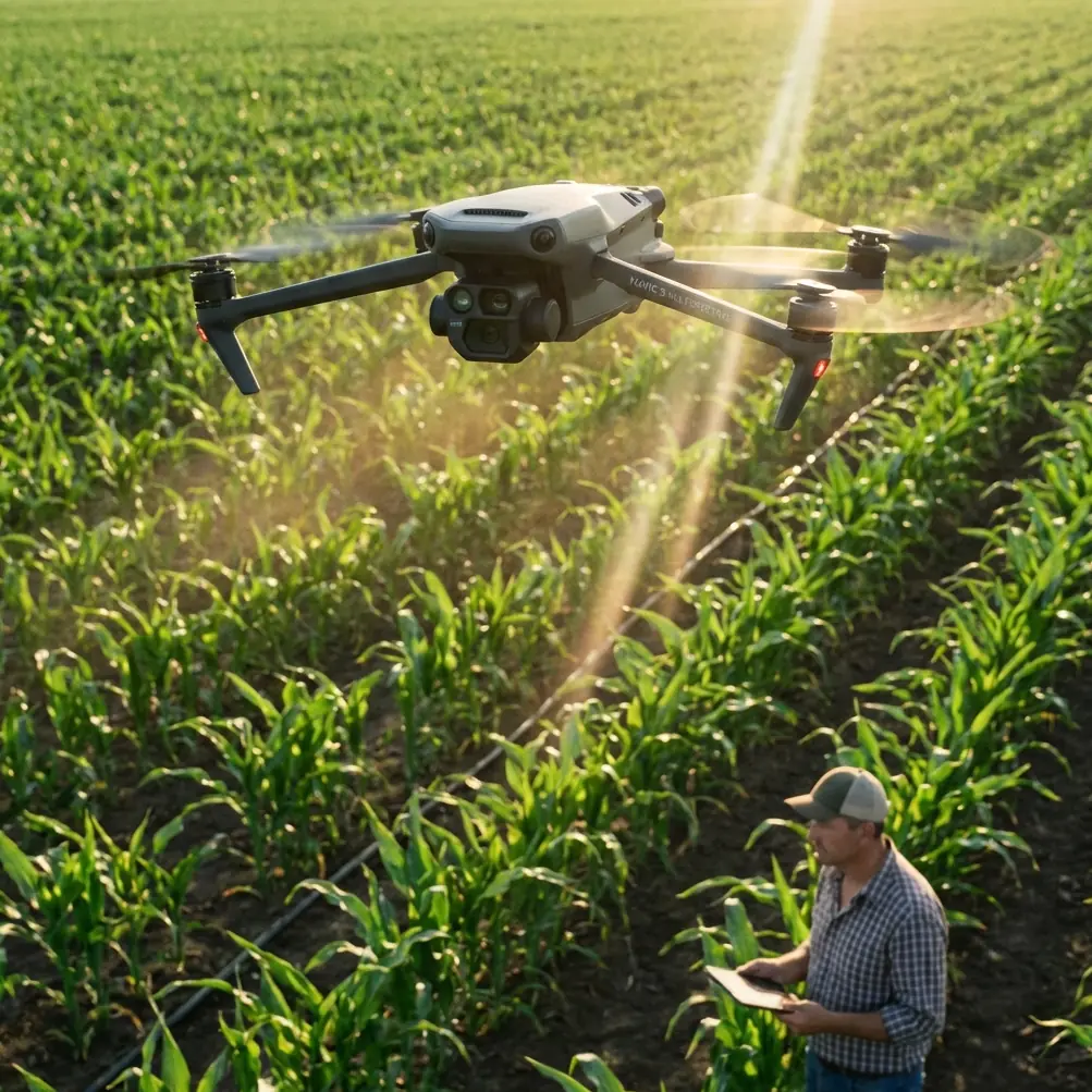
Open farmland gives you margin. A forest edge does not. Wind curls around trunks, climbs ridgelines, drops into gullies, and pushes a drone sideways when the mission plan still says everything is normal. That is exactly why the Mavic 3M earns attention in this niche. Not because “multispectral” sounds advanced, but because wooded inspections demand a workflow where imaging quality, flight discipline, and post-flight data interpretation all reinforce each other.
If I were briefing a team for a windy forest inspection with the Mavic 3M, I would not begin with camera settings. I would begin with how the aircraft will behave, what the data can prove afterward, and what kind of decisions we can trust from the output.
That approach is becoming more relevant across aviation, not less. A recent report from Tsinghua University noted the first successful flight of a large hybrid-powered tiltrotor passenger eVTOL, with deep participation from the university’s aero-engine institute. On the surface, that sounds far removed from a compact multispectral platform in the woods. It isn’t. The common thread is operational maturity: more aircraft categories are moving from experimental novelty to task-specific tools, and that shift always elevates one thing above hype—measurable flight data. When aircraft are used for real work, the question is never just “Did it fly?” The real question is “What does the data say about what happened, and can we repeat it safely?”
That is the right mindset for a Mavic 3M forest mission.
Why windy forest inspection is different from standard mapping
The Mavic 3M is often discussed in agricultural terms. Fair enough. Multispectral payloads naturally lead people toward crop vigor, drainage, stand counts, and treatment planning. But forests create a different operating geometry.
You are not just covering acreage. You are dealing with vertical clutter, inconsistent light, narrower launch zones, and airflow that changes over very short distances. A route that looks clean on a map can become unstable near a treeline if one side of the aircraft enters accelerated crosswind while the other side remains sheltered.
That matters because image quality in multispectral work depends on consistency. Variations in speed, attitude, and altitude can affect overlap, interpretability, and downstream confidence in the map. If your RTK fix rate is strong but your aircraft keeps fighting lateral gusts near canopy transitions, the mission may still be technically complete while analytically weaker than it appears.
So the first best practice is simple: in forests, don’t judge a mission by whether the drone came home with images. Judge it by whether the aircraft maintained stable geometry through the most turbulent segments.
The flight-data habit most Mavic 3M teams skip
One of the most useful educational takeaways from DJI TT training material has nothing to do with sensor glamour. It is the reminder that flight data can explain unexpected behavior after the fact. The training notes describe how drones operating outdoors, even beyond visual line environments, can encounter sudden unexplained faults, and that the answer often sits in the onboard flight-data modules rather than guesswork.
That matters for Mavic 3M operators in forests because “windy” is too often used as a lazy explanation.
Wind may be the trigger, but your logs tell you whether the aircraft was pitching aggressively, rolling harder than expected, losing height, seeing obstacle-distance changes ahead, or dipping toward lower battery margins during a difficult leg. The TT material specifically identifies flight data streams such as speed, acceleration, attitude angle, height, forward obstacle distance, and battery level, gathered through components including the IMU, TOF sensor, and barometric altitude sensor.
That list is operational gold.
After a forest mission, those data points help answer practical questions:
- Did the aircraft start fighting crosswind at a ridge break or near a canopy gap?
- Was the platform rolling repeatedly to one side before image overlap degraded?
- Did barometric height remain stable while terrain-relative conditions visually appeared unstable?
- Did battery consumption increase sharply during one return leg because of a headwind corridor?
- Was obstacle sensing reacting consistently when the route passed near protruding branches?
Teams that review these logs become better at planning repeatable missions. Teams that do not review them keep blaming “bad conditions” and repeat the same preventable mistakes.
Why roll angle deserves more attention in the woods
The TT education reference includes a specific technical detail many field teams ignore: the roll-axis attitude angle can range from -179° to 179°, and during a right tilt it changes from 0° through 90° toward 179°. That detail may sound like classroom material, but in windy forest inspection it has immediate value.
Roll tells you how hard the aircraft had to lean to hold track.
In open country, brief roll corrections are routine. In forests, sustained roll or repeated directional bias can reveal where airflow is structurally hostile. If the Mavic 3M consistently leans to compensate along the same corridor, you have identified a wind pattern, not a random event. That can lead to several practical decisions:
- Shift the flight line orientation on the next mission.
- Raise altitude slightly above the most turbulent canopy shear zone if the inspection objective allows.
- Change launch timing to avoid the period when valley heating starts producing stronger localized movement.
- Reduce expectations for edge-of-canopy data consistency on that side of the block.
This is where the Mavic 3M’s value becomes more than a sensor package. It becomes part of a disciplined evidence loop: capture, inspect, correlate, improve.
A field moment that proves why sensors and discipline both matter
On one windy woodland boundary inspection, a roe deer broke from cover and moved along a narrow opening just as the aircraft was crossing a patchwork of low crowns and taller pines. Wildlife itself was not the hazard; the real issue was pilot distraction at the exact moment the drone entered a rougher airflow band. The aircraft’s sensing and stabilization behavior helped prevent an overcorrection, and the mission stayed on line. But the bigger lesson came later in review.
The logs showed a sequence of attitude changes and speed corrections that matched the gust exposure, not the animal movement. Without that data, the pilot might have attributed the wobble to visual surprise alone. Instead, the team learned that the route segment was aerodynamically messy and needed a cleaner pass profile next time.
That is how mature operations improve. You do not just remember the wildlife encounter. You extract the flight truth behind it.
Building a Mavic 3M forest workflow that holds up in wind
1. Start with the canopy, not the property boundary
A legal boundary or management compartment is not necessarily a good flight boundary. In forest work, plan around canopy structure and wind behavior first. Note ridge edges, cut blocks, creek corridors, and any abrupt height transitions. These often create the turbulence pockets that matter more than parcel lines.
For multispectral collection, stable path geometry usually matters more than squeezing every meter into one sortie.
2. Use RTK as a confidence layer, not an excuse
Centimeter precision is extremely useful in repeat inspections, especially when comparing seasonal stress signatures, mortality spread, storm damage, drainage shifts, or replant performance. But RTK does not fix poor aircraft dynamics. A strong RTK fix rate helps positional consistency; it does not guarantee the aircraft flew a smooth photogrammetric profile through gusting air.
Treat RTK as one layer of integrity. The others are weather judgment, route orientation, overlap margin, and post-flight log review.
3. Expect edge zones to be the weakest data zones
Forest edges often combine the worst of both worlds: more light variation and more turbulent air. If the mission objective depends on clean multispectral interpretation near edges, build in extra overlap and fly with patience. Do not assume the whole map will be equally reliable just because the center block looked stable.
4. Watch battery behavior where headwinds hide
Battery percentage alone is too blunt. In wooded terrain, one return corridor may consume far more energy than the outbound leg because the terrain channels airflow against you. Reviewing power draw patterns after the mission helps refine future reserve thresholds.
The educational drone reference specifically highlights battery level as part of the flight-data picture. In practice, that means battery should be interpreted alongside speed, attitude, and route segment, not as a standalone number.
5. Use altitude discipline to protect the dataset
Barometric altitude data is useful, but forests can visually trick operators into making small manual corrections that reduce consistency. If the Mavic 3M is holding the mission profile within safe parameters, resist the urge to “help” it every time the canopy appearance changes beneath the aircraft. Manual fussing often creates more variability than it solves.
What the model-aircraft world still teaches professional operators
One of the more interesting reference documents here comes from radio-control aerobatic model training. At first glance, it seems unrelated to Mavic 3M inspection work. It isn’t. The value is not in the maneuvers themselves, but in the old-school obsession with attitude control, angle discipline, symmetry, and entry consistency.
That document repeatedly penalizes deviations in angle, height, heading, and alignment. A 45° climb that is not truly 45° is marked down. A roll that is not cleanly executed is marked down. A runway segment shorter than 5 meters before a soft liftoff is noted. That culture of precision is exactly what many commercial drone teams need more of.
Not because you should fly a Mavic 3M like an aerobatic model. Obviously not. The lesson is this: good aviation work comes from noticing small deviations before they become accepted sloppiness.
In a windy forest inspection, “close enough” is how operators end up with maps that look complete but compare poorly over time.
Interpreting multispectral output with humility
The Mavic 3M can produce extremely useful vegetation intelligence, but forests are not uniform crop rows. Mixed species, canopy shadowing, moisture differences, storm scars, and understory interference can all shape what you see. The smartest teams do not overclaim from a single pass.
Instead, they pair imagery with flight context:
- Was the aircraft attitude stable during the suspect area?
- Did crosswind increase over that segment?
- Was there a sudden obstacle-distance pattern change near taller trees?
- Was the sun angle or cloud behavior consistent?
- Did this anomaly persist across repeat flights with similar geometry?
This is where a forest operator separates signal from noise.
A practical pre-flight checklist for windy woods
Before launching a Mavic 3M into forested terrain, I recommend a short but disciplined check:
- Confirm the mission objective in plain language: stress detection, storm damage, drainage pattern, boundary health, disease spread, replant verification, or corridor condition.
- Review canopy transitions and likely gust zones.
- Decide which edges of the site deserve extra overlap.
- Verify your RTK setup and expected fix stability.
- Establish a conservative battery return point based on the hardest likely return leg, not the easiest outbound leg.
- Brief the team to note wildlife activity without allowing it to break pilot focus.
- Commit to post-flight log review before finalizing confidence in the map.
If you want a second set of eyes on route design or data interpretation, this direct field support channel is a practical place to start the conversation.
The bigger picture for Mavic 3M operators
The successful first flight of a large hybrid tiltrotor passenger eVTOL is a reminder that aviation is moving into more specialized and demanding forms. As aircraft become more capable, the standard for operators rises with them. The future does not belong to teams that simply own advanced platforms. It belongs to teams that can explain, with evidence, how those platforms behaved in real conditions.
That is why the Mavic 3M fits serious forest inspection work so well when used properly. Not because it removes difficulty, but because it gives you enough sensing, positioning, and flight traceability to turn difficult environments into manageable ones.
Windy forests will still challenge you. Canopy edges will still distort airflow. Wildlife will still surprise you. Light will still shift at the wrong moment.
The difference is whether your workflow is strong enough to catch the truth of the mission.
When the aircraft returns, do not just look at the map. Look at the attitude behavior. Look at the battery pattern. Look at height stability. Look at obstacle-distance context. Compare your suspect zones against your flight dynamics. Then decide what the imagery really means.
That is how a Mavic 3M mission stops being a flight and becomes a reliable inspection operation.
Ready for your own Mavic 3M? Contact our team for expert consultation.