Mavic 3M in Urban Solar Mapping: A Field Report on What
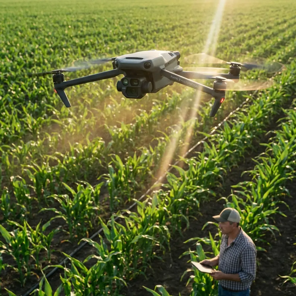
Mavic 3M in Urban Solar Mapping: A Field Report on What Actually Changed
META: A field report on using DJI Mavic 3M for urban solar farm mapping, with practical insight on multispectral workflows, weather awareness, and image interpretation in dense built environments.
The first urban solar site that made me rethink my workflow was not especially large. It was just unforgiving.
Rows of panels sat between service roads, reflective rooftops, HVAC clutter, fencing, and pockets of shade thrown by neighboring structures at different times of day. On paper, it looked simple: fly, map, classify anomalies, produce a clean surface model, move on. In practice, the visual data kept lying to us in small ways. Reflections mimicked defects. Shadow edges looked like performance issues. Even when the geometry was sound, interpretation took too long.
That is why the Mavic 3M matters in this niche. Not because “multispectral” sounds advanced, but because urban solar mapping is full of false positives and edge cases. The platform reduces ambiguity when the mission is built correctly.
What changed for me was not one dramatic feature. It was the combination of cleaner data capture, better environmental discipline, and more deliberate interpretation.
Urban solar mapping is an image problem before it becomes a mapping problem
A lot of operators approach solar inspections as if the hardest part is flight planning. In cities, that is only half true. The harder problem is separating what the camera sees from what the site is actually doing.
This is where an odd comparison helps. A recent discussion about smartphone large-aperture mode made a useful point: many users confuse it with portrait mode, even though they are not the same thing. One of the cited examples described a virtual, algorithm-based aperture effect that uses AI to simulate background blur, often with the blur strength adjustable after the photo is taken. Convenient, yes. Also prone to looking artificial when pushed too far.
That distinction is more relevant to Mavic 3M work than it may seem.
Urban solar surveys suffer when operators trust images that have been visually “helped” rather than physically grounded. In consumer photography, simulated blur can make a scene look better. In infrastructure mapping, algorithmic embellishment can hide context, flatten subtle transitions, or create confidence where caution is warranted. When you are trying to isolate panel condition, row consistency, encroaching vegetation at the perimeter, drainage patterns, or thermal follow-up targets, realism beats prettiness every time.
The Mavic 3M’s value is that it gives you data layers that are less dependent on aesthetic interpretation. You are not asking software to invent separation between subject and background the way a phone’s virtual aperture mode does. You are using sensor-driven capture to expose differences that matter operationally. On an urban solar farm, that means fewer arguments later about whether an anomaly was optical, environmental, or structural.
The past challenge: reflections, rooftop clutter, and inconsistent environmental context
One of my earlier urban projects involved a compact solar installation surrounded by mixed-height buildings. We captured acceptable orthomosaics, but review was slow because the site kept changing character across the day. A corridor that looked clean at one hour became partially shadowed later. A section near metallic rooftop equipment threw enough glare to contaminate visual confidence. We had data, but not enough certainty.
The lesson was obvious in hindsight: urban energy sites are not isolated fields. They are embedded in microclimates and built environments.
That is where weather intelligence stops being a box-checking exercise and starts becoming mission design.
The aviation meteorology reference in your source material frames weather facilities as an integrated system for collecting, transmitting, and analyzing meteorological data. It specifically names tools such as weather satellites, weather radar, lidar, wind profilers, microwave radiometers, and computer-based support systems. That matters because a drone mission over urban solar is influenced by far more than a basic surface wind reading.
Wind channels differently between structures. Heat shimmer can build over roofing surfaces. Thin cloud variation can change the consistency of reflected energy. Moisture and haze alter contrast. If the larger weather system or local boundary-layer behavior is not understood, your map may be technically complete yet operationally weak.
With Mavic 3M, I found the biggest improvement came from treating the flight as part of a broader sensing chain, not a standalone drone event. The aircraft captures the site. Meteorological context explains the site. That combination is what makes the output trustworthy enough for engineering decisions.
Why the Mavic 3M fits the urban solar use case
The Mavic 3M is often discussed in agriculture, and fairly so. But urban solar work benefits from the same core strength: layered sensing that reveals pattern, stress, and inconsistency across large surfaces with less guesswork.
For solar mapping in dense areas, three strengths stand out.
1. Multispectral context reduces visual traps
Standard RGB imagery is still useful, especially for geometry, layout confirmation, labeling, and obvious physical damage. But urban solar sites are full of surfaces that visually compete with each other. Concrete, white roofs, metal railings, drainage membranes, and neighboring facades can all distort first impressions.
Multispectral capture gives you another way to interrogate the site. Even when the mission’s primary deliverable is a map for maintenance planning rather than agronomic analysis, extra spectral separation can help classify non-panel surfaces, identify vegetation encroachment around fence lines or cable runs, and improve segmentation where RGB alone becomes messy.
This is operationally significant because time spent manually cleaning site layers is expensive in its own way. Better spectral separation upstream means less interpretive labor downstream.
2. Centimeter-level expectations change how defects are documented
In urban assets, precision is not just a bragging point. It is the difference between “somewhere near the northeast row” and “module cluster adjacent to access path B and inverter cabinet 2.”
If you are working with RTK-enabled workflows and maintaining a stable RTK fix rate, the map becomes easier to hand off to engineering, maintenance, and asset management teams. Centimeter precision helps when crews need to revisit exact locations without re-arguing the coordinates. In constrained urban sites, where rows may sit close to parapets, roadways, or rooftop obstructions, that location confidence matters.
This is where Mavic 3M earns its place. It shortens the path from captured anomaly to field action.
3. Efficient coverage without overflying the site repeatedly
Urban operators often work in shorter windows. Access permissions can be tight. Nearby activity can limit flight timing. Reflective conditions may be best only during a narrow slice of the day. If your swath width and overlap strategy are tuned correctly, Mavic 3M can cover enough ground to build a useful model without repeated passes that invite inconsistency.
That does not mean rushing. It means designing the mission so one disciplined flight does the work of several improvised ones.
The hidden skill is workflow discipline, not just hardware
One of the stranger truths about modern UAV work is that better aircraft expose weak thinking faster.
The educational DJI TT material in your references, though aimed at beginners, contains a principle that maps surprisingly well to field operations: different loop structures produce different outcomes. One module runs continuously, one repeats a set number of times, and one repeats until a condition is met. The source also gives a concrete timing example where LED colors cycle red, green, and blue, each for 0.5 seconds.
That sounds far removed from a Mavic 3M mission, but the operational significance is real.
Many urban mapping failures come from “continuous loop” habits. Operators keep flying because they can, not because the mission still needs data. They add passes, alter angles midstream, or revisit areas without a defined stop condition. The result is bloated capture sets, mismatched lighting conditions, and longer processing.
A stronger Mavic 3M workflow looks more like conditional logic:
- Repeat a path a set number of times if overlap verification requires it.
- Continue a segment until a coverage threshold or quality condition is met.
- Exit the loop once the dataset is sufficient.
That is not coding for its own sake. It is a mental model for clean acquisition. In urban solar mapping, restraint often improves output.
I now brief missions almost like a logic tree. If the RTK fix rate holds, proceed with the primary grid. If rooftop glare exceeds a threshold, shift timing rather than forcing capture. If wind behavior around structures destabilizes consistency, delay the second block. This is exactly the kind of repeat-until-condition mindset the TT material teaches in simple form, and it scales better to professional practice than many people expect.
Weather service data is not separate from drone data
The meteorology reference deserves more attention than UAV teams usually give it.
It defines weather facilities as a full ecosystem for detection, information transmission, and large technical support equipment. That matters because urban sites create local effects, but they sit inside regional systems. Weather radar may indicate approaching instability. Satellite imagery can reveal cloud field evolution. Wind profiler data, where available through service channels, adds context about vertical wind structure that surface observations miss.
No, you do not need a research lab to fly a Mavic 3M over a solar farm. But if the mission is intended to support maintenance decisions, warranty documentation, or recurring performance monitoring, then using available meteorological services is plain professionalism.
I have seen operators collect elegant maps under bad atmospheric conditions and then spend days explaining why results do not compare well against previous datasets. The aircraft did its job. The planning did not.
Urban solar mapping rewards consistency more than heroics.
A note on interpretation: do not let software beautify your evidence
This brings me back to the smartphone aperture reference.
The source points out that many users rarely use large-aperture mode well because they mistake it for portrait mode, and one common implementation relies on AI-generated blur that can be adjusted after capture. That flexibility is attractive in lifestyle photography. In technical fieldwork, it should make you cautious.
When reviewing Mavic 3M outputs, especially if ancillary tools are involved, avoid workflows that over-clean the scene. Sharpening, artificial background separation, aggressive contrast balancing, and automated anomaly highlighting all have their place, but only if they preserve physical truth.
For urban solar sites, I want review imagery that shows clutter honestly. Trees at the edge, rooftop penetrations, parapet shadows, conduit routes, standing water signatures nearby, reflective interferences — these are not distractions. They are site conditions. They explain performance context and help avoid bad calls.
If your output looks cinematic, ask whether it still looks forensic.
How the model made my work easier
The real improvement with Mavic 3M was not that it eliminated complexity. It organized it.
On a recent city-adjacent solar mapping job, we built the mission around a narrow environmental window, verified atmospheric stability beforehand, maintained a strong positioning solution, and captured a multispectral-first dataset with disciplined overlap. The result was not just a cleaner orthomosaic. It was faster confidence.
We spent less time debating whether a pattern was caused by reflection or a real site variable. We handed off map layers that maintenance teams could actually navigate. We reduced return flights. We also had a better record for repeat comparison later, which is where long-term asset management gains value.
That is the practical case for Mavic 3M in urban solar work. It is not simply a drone with more sensors. It is a platform that rewards methodical operators with datasets that stand up better under scrutiny.
If your team is working through urban site constraints and wants to compare mission planning approaches, you can message here for a practical discussion.
Final field takeaway
Urban solar mapping punishes assumptions. It punishes pretty pictures that hide reality, repeated flights that introduce inconsistency, and weather ignorance dressed up as operational speed.
Mavic 3M performs best when you use it as part of a disciplined evidence chain: sensor-driven capture, precise positioning, weather-aware timing, and conservative interpretation. The references behind this discussion may come from very different domains — smartphone imaging, educational programming logic, and meteorological infrastructure — but together they point to the same professional habit: trust grounded data, define your conditions, and stop pretending that all images mean the same thing.
That is exactly what made the difference for me in urban solar mapping.
Ready for your own Mavic 3M? Contact our team for expert consultation.