Mavic 3M in Extreme Vineyard Conditions: What Actually
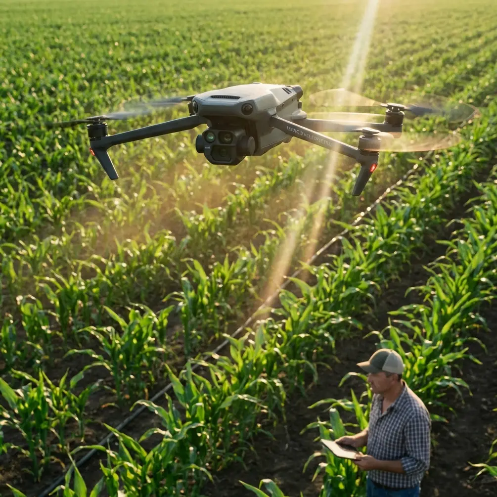
Mavic 3M in Extreme Vineyard Conditions: What Actually Matters in the Field
META: A technical review of Mavic 3M for vineyard work in extreme temperatures, with emphasis on multispectral workflows, RTK precision, GIS integration, and real operational lessons that matter.
When growers ask whether the Mavic 3M fits serious vineyard operations in punishing weather, the real question is not whether the aircraft can fly. Most modern drones can fly. The harder question is whether the entire workflow remains useful when temperature swings, terrain variation, and narrow decision windows start stacking up.
That is where the Mavic 3M deserves a more disciplined look.
I am approaching this as an operational review, not a glossy product summary. For vineyards, especially those dealing with heat spikes, cold morning launches, and tightly managed treatment windows, a drone only proves its value when three things hold together at once: data quality, positional confidence, and turnaround speed. If any one of those breaks, the mission becomes an academic exercise rather than a practical management tool.
Why vineyard work exposes weak drone workflows
Vineyards are deceptive. On paper, they look like orderly agricultural blocks. In practice, they are a demanding test environment.
Rows create repetitive visual patterns that can confuse weak mapping logic. Slope changes alter light response across the canopy. Morning moisture and afternoon heat create different crop signatures on the same day. Add extreme temperatures and the margin for error narrows fast. If you are using aerial data to guide irrigation stress assessment, canopy variability checks, or treatment planning, you do not need merely “good-looking imagery.” You need repeatable information.
This is why the Mavic 3M matters less as a flying camera and more as a compact sensing platform built around multispectral collection and precise georeferencing.
The vineyard operator is not buying pixels. The operator is buying confidence that one survey can be compared to the next without spending half a day correcting inconsistencies.
The stronger story is not hardware alone, but what happens after landing
One of the most useful ideas buried in the Esri reference material is that drone value matures when “human intelligence” becomes “platform intelligence.” That sounds abstract until you apply it to vineyards. In plain terms, it means the aircraft is only the front end. The real leverage comes from automatic collection, transfer, processing, and decision support.
That distinction is operationally significant.
A vineyard team working through extreme temperatures often has a short, stable window to fly. Maybe dawn is cool enough and calm enough for consistent capture. Maybe midday thermal shimmer ruins consistency. Maybe afternoon winds rise just when disease scouting was scheduled. If the drone can capture quickly but your downstream workflow stalls, the vineyard still loses time.
The Esri slides also point to a broader transition in the industry: automatic takeoff and landing, automatic charging, automatic data transfer, and automated result processing as part of an unattended service model. Even if a vineyard operation is not implementing full dock-based autonomy, the principle still applies to Mavic 3M deployment. The more tightly the aircraft integrates with GIS and repeatable processing, the more useful it becomes under weather pressure.
This is one reason Mavic 3M stands out in commercial agriculture conversations. It fits into a “light capture, heavy application” model. Another Esri point phrases this sharply: practical success comes from prioritizing application over collection for its own sake. That is exactly right for vineyards. Nobody gets paid for producing a pretty orthomosaic. They get paid for making a better decision on water, nutrition, canopy management, or targeted intervention.
Compact systems changed the threshold for useful field intelligence
An older assumption in agriculture was that serious aerial work required big airframes, cumbersome transport, and specialist crews. The Esri hardware snapshot shows how quickly that thinking broke down. One compact class system was described as roughly bottle-sized, carrying a 20-megapixel sensor package and around 31 minutes of endurance in a 2-kilogram setup. A larger notebook-sized class delivered similar 20-megapixel output with about 30 minutes in a 5-kilogram package, while a much bigger desktop-case-sized platform dropped to roughly 25 minutes at around 10 kilograms.
The exact products in that slide are less important than the trend line: smaller systems became good enough to do real work.
That matters directly to Mavic 3M users in vineyards. Extreme weather favors platforms that can be moved quickly, launched with minimal setup, and redeployed across blocks before conditions turn. A compact multispectral aircraft with RTK support is not just convenient. It changes mission economics. One person can move faster between parcels. Fewer handling steps mean fewer heat-exposure delays. If a valley block is still cool at first light and an upper slope warms too fast by mid-morning, a lightweight, quick-response platform preserves the mission.
In other words, portability is not a comfort feature. In vineyard operations, it is part of data integrity.
RTK is not a specification to admire; it is the backbone of comparison
Readers often fixate on sensor type first. For agriculture, that is understandable. Multispectral capture is central to crop analysis. But in vineyard programs that rely on repeat surveys, I would argue that centimeter-level positional performance and RTK Fix rate deserve equal attention.
Why? Because trend analysis lives or dies on alignment.
When you compare vine vigor over time, map stress zones after a heat event, or track recurring weak rows near an irrigation transition, misalignment creates false patterns. Centimeter precision reduces that risk. It also cuts the labor required for stitching, correction, and ground control dependence in many practical workflows.
The Esri material includes a revealing marker here: “1 square kilometer, 1:500” alongside “RTK” and “1 remote to 5.” The phrasing is presentation shorthand, but the significance is clear. Commercial drone mapping had already shifted toward precise, scalable field work where one operator could supervise a broader operational footprint. For vineyards, that means a drone like the Mavic 3M is not valuable because it is advanced in abstract terms. It is valuable because it supports map outputs usable enough for block-level decisions without turning each mission into a surveying project.
This becomes even more critical in extreme temperatures. Heat stress mapping loses value when you spend too long reconciling geospatial inconsistencies. The crop does not wait.
A wildlife encounter says more about sensor trust than a brochure ever will
On one vineyard edge survey, the aircraft approached a transition zone near scrub and low tree cover where feral deer had moved in before sunrise. They broke across the row ends just as the mission line advanced. It was not dramatic, and that is the point. The drone did not turn the moment into chaos. Its sensing and route logic handled the interruption cleanly, preserving both animal separation and mission continuity.
Why mention that in a technical review?
Because vineyard work is not done in sealed laboratory conditions. Wildlife, workers, trellis wires, service vehicles, and changing row-edge obstacles are ordinary realities. A drone that gathers elegant data only when the environment behaves perfectly is not much use in agriculture. The practical standard is different: can the aircraft maintain safe, stable, repeatable capture when the field does what fields do?
That same standard applies to temperature extremes. Morning cold can affect battery behavior and launch pacing. Afternoon heat can alter wind texture over slopes and bare soil. The right drone workflow is the one that keeps generating consistent agronomic outputs without forcing the team into constant manual rescue mode.
What Mavic 3M means for multispectral vineyard analysis
For vineyard managers, multispectral is not a decorative capability. It is a way to separate visual impression from plant response.
A standard RGB image may show a healthy-looking block that still hides developing stress patterns. Multispectral capture helps reveal canopy variation earlier, especially when the goal is to detect uneven vigor, irrigation issues, or microzone stress after sharp weather changes. In extreme heat periods, this can be the difference between broad corrective action and selective intervention.
That operational significance is easy to underestimate. Vineyards do not suffer uniformly. One slope shoulder might heat harder. One drainage edge may hold moisture longer. One section may reflect an emitter issue rather than a full-block problem. With reliable multispectral mapping and stable RTK positioning, the Mavic 3M gives agronomy teams a cleaner basis for zone-level action.
This also reduces guesswork around issues adjacent to treatment planning. Even though terms like spray drift, nozzle calibration, and swath width usually belong more directly to application platforms than to a mapping aircraft, the Mavic 3M still contributes upstream. Better maps produce better boundaries. Better boundaries improve where and how treatment assets are deployed. If a stress signature sits near a row-edge wind corridor, the mapping result can inform how conservatively operators approach later spray decisions.
So while Mavic 3M is not the spray aircraft, it can materially improve the quality of the decisions surrounding spray timing and pattern selection.
Logistics history explains why speed and repeatability now matter so much
The drone industry learned an early lesson from logistics testing, and agriculture benefits from it. Documented programs such as Matternet’s medical transport tests in Switzerland and Flirtey’s early delivery trials showed that unmanned operations succeed when they solve a specific time-and-access problem, not when they merely demonstrate flight. One source also cites a lobbying claim that each day without drone legislation cost the U.S. economy 27 million dollars. Whether one agrees with the framing or not, the figure captures something real: delay in practical deployment carries measurable operational cost.
For vineyard operators, that lesson translates cleanly. The purpose of Mavic 3M is not to prove that aerial sensing is possible. That argument ended years ago. The purpose is to reduce the cost of uncertainty in the field.
If a heatwave compresses your scouting schedule to one viable morning, speed matters. If a frost recovery assessment has to be geospatially trustworthy, RTK matters. If repeated block comparisons need to flow into GIS without friction, platform integration matters.
This is why broad industry movement away from unstable early fixed-wing concepts toward more practical multirotor designs is worth noting. The investment document references Google’s early Project Wing as a first-generation fixed-wing effort whose hover stability and payload capability were weak, eventually leading to a shift toward multirotor architecture. Operationally, that mirrors what agriculture users discovered on their own: controllability, hover precision, and deployment simplicity often beat conceptual elegance when real field work is on the line.
The Mavic 3M sits firmly in that practical lineage.
Where it fits best in a modern vineyard stack
The strongest use case is not replacing agronomists. It is making them faster and more accurate.
A sensible deployment model looks like this:
- frequent, repeatable block surveys during stress periods
- RTK-backed georeferencing for comparison over time
- GIS-linked interpretation rather than isolated image review
- targeted follow-up scouting on anomalies rather than blanket manual inspection
That is exactly in step with the Esri idea that new tools create new work modes. The Mavic 3M does not simply digitize an old walk-the-rows routine. It changes the order of operations. First, map. Second, isolate. Third, verify. Fourth, act.
When temperatures are extreme, that sequence protects labor and sharpens intervention.
If your team is trying to build a vineyard workflow around Mavic 3M, RTK consistency, GIS handoff, and repeatable mission design deserve more attention than cosmetic flight features. If you need a field discussion about integrating those elements, this direct vineyard UAV planning channel is useful: https://wa.me/85255379740
Final technical take
The Mavic 3M makes the most sense when viewed as a compact intelligence tool for vineyards, not as a generic drone with an agricultural label attached.
Its real value shows up in the overlap between multispectral sensing, centimeter-level positioning, and fast deployment under difficult weather windows. The reference material reinforces that broader trend. Smaller aircraft have become operationally serious. GIS-centered automation has become the real multiplier. Practical drone adoption succeeds when it solves a field problem with repeatable workflow discipline.
For vineyards in extreme temperatures, that is the standard that matters.
Ready for your own Mavic 3M? Contact our team for expert consultation.