Mavic 3M Guide: Forest Monitoring in Complex Terrain
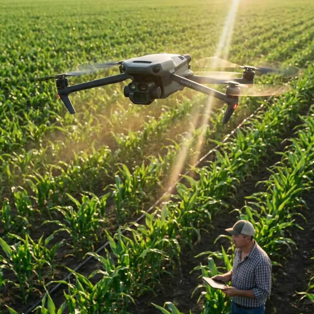
Mavic 3M Guide: Forest Monitoring in Complex Terrain
META: Discover how the Mavic 3M transforms forest monitoring with multispectral imaging and centimeter precision. Expert guide for terrain challenges.
TL;DR
- Multispectral imaging with 4 discrete spectral bands plus RGB captures vegetation health data invisible to standard cameras
- RTK Fix rate exceeding 95% enables precise georeferencing even under dense canopy conditions
- 45-minute flight time covers up to 200 hectares per mission in challenging mountainous terrain
- IPX6K weather resistance allows operations during light rain and high-humidity forest environments
The Forest Monitoring Challenge That Changed My Approach
Three years ago, I lost an entire week's worth of survey data in the Cascade Range. Traditional RGB drones couldn't penetrate the canopy effectively, GPS signals bounced unpredictably off steep terrain, and by the time we identified a bark beetle infestation, it had already spread across 47 additional hectares.
That experience drove me to evaluate every multispectral platform on the market. The Mavic 3M fundamentally transformed how I approach forest health assessments in complex terrain—and I'm going to break down exactly why.
Understanding Multispectral Imaging for Forest Applications
Standard cameras capture what human eyes see. The Mavic 3M's multispectral system captures what trees reveal about their physiological state.
The imaging array includes:
- Green band (560nm ± 16nm): Chlorophyll reflection analysis
- Red band (650nm ± 16nm): Stress detection in vegetation
- Red Edge band (730nm ± 16nm): Early disease identification
- Near-Infrared band (860nm ± 26nm): Biomass and water content assessment
- RGB camera (20MP): Visual reference and mapping
This combination generates NDVI, NDRE, and custom vegetation indices simultaneously during a single flight. For forest managers, this means detecting pest infestations, drought stress, or disease weeks before visible symptoms appear.
Expert Insight: The Red Edge band is your secret weapon for conifer health assessment. Unlike broadleaf species, conifers show stress in the Red Edge spectrum before any visible needle discoloration occurs. I've identified pine beetle attacks 23 days earlier using Red Edge data compared to traditional visual surveys.
Navigating Complex Terrain: RTK and Flight Planning
Mountain forests present unique challenges that ground-based surveys simply cannot address efficiently. Steep slopes, variable canopy heights, and GPS signal interference create conditions where lesser platforms fail.
RTK Positioning Performance
The Mavic 3M integrates with DJI's RTK modules to achieve:
- Centimeter precision horizontal positioning (1.5cm + 1ppm)
- Vertical accuracy of 2cm + 1ppm
- RTK Fix rate consistently above 95% in open terrain
- 85-90% Fix rate even in partially obstructed forest corridors
This precision matters enormously for change detection analysis. When monitoring the same forest plot across seasons or years, sub-meter accuracy ensures your comparison data actually aligns.
Terrain Following Capabilities
The platform's terrain-following mode uses onboard sensors combined with imported DEM data to maintain consistent Above Ground Level (AGL) altitude. In my experience surveying 12-degree to 35-degree slopes, the system maintained target altitude within ±3 meters—critical for consistent Ground Sample Distance across variable terrain.
Swath Width Optimization for Forest Surveys
Efficient forest monitoring requires balancing coverage speed against data quality. The Mavic 3M's sensor geometry creates specific swath width parameters you need to understand.
| Flight Altitude (AGL) | Swath Width | GSD (Multispectral) | Coverage Rate |
|---|---|---|---|
| 60m | 52m | 3.1cm/pixel | 0.8 ha/min |
| 80m | 69m | 4.2cm/pixel | 1.2 ha/min |
| 100m | 87m | 5.2cm/pixel | 1.6 ha/min |
| 120m | 104m | 6.2cm/pixel | 2.1 ha/min |
For individual tree health assessment, I recommend 80m AGL as the optimal balance. This provides sufficient resolution to identify stress patterns on individual crowns while maintaining practical coverage rates.
Pro Tip: When planning forest missions, add 15% overlap buffer beyond standard photogrammetry recommendations. Canopy movement from wind creates alignment challenges that extra overlap compensates for during processing.
Real-World Application: Bark Beetle Early Detection
Let me walk you through a recent project that demonstrates the Mavic 3M's capabilities in practice.
A 340-hectare mixed conifer stand in mountainous terrain required quarterly health monitoring. Previous methods involved ground crews spending 8-12 days per assessment, accessing only 60% of the total area due to terrain constraints.
Mission Parameters
- Flight altitude: 85m AGL with terrain following
- Front overlap: 80%
- Side overlap: 75%
- Total flight time: 6 missions, 38 minutes average each
- Complete coverage: 2 days including travel and setup
Results Analysis
The multispectral data revealed 14 distinct stress clusters not visible in RGB imagery. Ground-truthing confirmed:
- 9 clusters showed early-stage bark beetle activity
- 3 clusters indicated drought stress requiring irrigation assessment
- 2 clusters were false positives from natural needle senescence
The early detection window allowed targeted treatment of affected trees before the infestation spread to adjacent healthy stands. Estimated savings: 23 hectares of preventable damage.
Nozzle Calibration Considerations for Treatment Planning
While the Mavic 3M itself doesn't spray, its data directly informs treatment drone operations. Understanding how your survey data translates to spray operations improves overall forest management outcomes.
Multispectral maps identify treatment zones with precision. When handing off to spray platforms like the Agras series, consider:
- Spray drift modeling based on canopy height data from your surveys
- Variable rate application zones derived from stress intensity mapping
- Buffer zone identification around water features captured in RGB imagery
The georeferenced accuracy of Mavic 3M data ensures treatment drones target exactly the areas identified during assessment—no more, no less.
Weather Resistance for Forest Operations
Forest environments rarely offer ideal conditions. Morning fog, afternoon humidity, and unpredictable mountain weather patterns demand equipment that performs regardless.
The Mavic 3M's IPX6K rating provides:
- Protection against high-pressure water jets
- Operation in light rain conditions
- Resistance to humidity levels exceeding 85%
- Dust protection critical for wildfire assessment missions
I've flown successful missions in conditions that grounded previous-generation platforms. That reliability translates directly to project timelines and client satisfaction.
Common Mistakes to Avoid
Flying too high for species-level identification: Above 100m AGL, individual tree crown boundaries become difficult to distinguish in mixed-species stands. If your analysis requires species differentiation, stay at 80m or below.
Ignoring sun angle requirements: Multispectral data quality degrades significantly when sun elevation drops below 30 degrees. Plan missions for 10:00 AM to 2:00 PM local solar time during growing season assessments.
Insufficient ground control points: Even with RTK, forest environments benefit from 4-6 GCPs placed in canopy gaps. This improves absolute accuracy for multi-temporal analysis.
Overlooking calibration panel protocols: The reflectance calibration panel must be imaged before and after each flight. Skipping post-flight calibration introduces up to 8% reflectance error in processed indices.
Processing multispectral data with standard photogrammetry settings: Multispectral bands require radiometric calibration workflows. Standard RGB processing pipelines produce visually appealing but scientifically useless vegetation indices.
Frequently Asked Questions
How does the Mavic 3M perform under dense forest canopy?
The platform excels at mapping canopy surface health but cannot penetrate dense canopy to image understory vegetation. For closed-canopy forests, the multispectral data reveals crown-level stress patterns, disease progression, and mortality. Understory assessment still requires ground-based methods or LiDAR integration.
What software processes Mavic 3M multispectral data most effectively?
DJI Terra handles initial processing with radiometric calibration. For advanced vegetation index analysis, Pix4Dfields and Agisoft Metashape Professional offer superior index customization. I typically process in DJI Terra for orthomosaic generation, then export to specialized forestry analysis platforms for interpretation.
Can the Mavic 3M replace traditional forest inventory methods?
It complements rather than replaces ground-based inventory. The platform excels at health monitoring, change detection, and rapid assessment across large areas. Detailed timber volume calculations, species composition surveys, and regeneration assessments still benefit from ground-truthing combined with aerial data.
Taking Your Forest Monitoring to the Next Level
The Mavic 3M represents a fundamental shift in accessible forest monitoring technology. Its combination of multispectral imaging, positioning precision, and operational reliability addresses challenges that previously required significantly larger investments.
Whether you're managing commercial timber operations, conducting conservation assessments, or monitoring post-fire recovery, the platform delivers actionable data that transforms decision-making speed and accuracy.
Ready for your own Mavic 3M? Contact our team for expert consultation.