Mavic 3M for Remote Wildlife Surveying: A Practical Field
Mavic 3M for Remote Wildlife Surveying: A Practical Field Workflow That Actually Holds Up
META: Learn how to use the DJI Mavic 3M for remote wildlife surveying with a field-tested workflow focused on multispectral mapping, terrain context, coordinate planning, and efficient data capture.
Remote wildlife surveying looks simple on a whiteboard. Fly out, collect imagery, build a map, count animals, assess habitat, go home. In the field, it rarely behaves that way.
Distance breaks assumptions. Light shifts fast. Launch sites are imperfect. Terrain interferes with line of sight and return paths. And when the mission is habitat assessment rather than pure photography, image quality alone is not enough. You need repeatability, spatial confidence, and a workflow that turns raw aerial data into something biologists and land managers can trust.
That is where the Mavic 3M becomes interesting.
Not because it is the newest aircraft in the market. The more useful question is this: how does a compact multispectral platform fit into a drone industry that, in early 2025, is moving toward smarter industrial operations, deeper AI integration, and tighter links with low-altitude economic infrastructure? That broader shift matters. A recent industry roundup highlighted exactly that direction, noting that industrial drones are getting more intelligent while AI and lidar are accelerating applied use cases. It also pointed to DJI’s January 8 release of the Matrice 4 series, with upgrades in transmission, flight safety, AI, night vision, and thermal capability for industry users.
For a remote wildlife team using a Mavic 3M, that trend has an operational implication: expectations have changed. The aircraft is no longer judged only by whether it flies. It is judged by whether it fits a data workflow that is becoming more precise, more automated, and more defensible.
Why the Mavic 3M makes sense in remote wildlife work
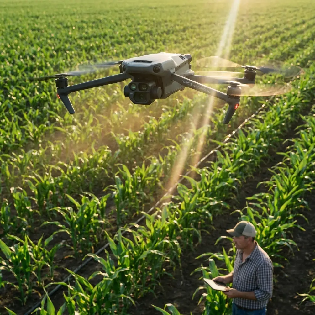
The Mavic 3M sits in a useful middle ground. It is small enough to move into remote areas without turning every survey day into a logistics exercise, yet capable enough to generate habitat intelligence that standard RGB-only drones often miss.
For wildlife teams, the real value is not just “multispectral” as a buzzword. It is the ability to separate vegetation condition, water stress, feeding zones, disturbed ground, and seasonal habitat variation in a way that supports field ecology. If you are surveying nesting corridors, grazing pressure, wetland edges, or post-disturbance recovery, spectral contrast often reveals patterns long before they are obvious from a visual image.
That matters even more in remote terrain, where every revisit costs time, vehicle access, permits, and staff fatigue.
Start with the mission geometry, not the drone settings
One mistake I see constantly is jumping straight into flight app options before defining movement in space. For wildlife survey work, especially in sensitive habitats, coordinate discipline is more important than people think.
An educational DJI flight reference offers a surprisingly useful reminder here. In one example, the aircraft hovers at roughly 80 centimeters and treats that hover point as the coordinate origin (0,0,0) before moving to (50,50,0) at 30 centimeters per second. On paper that is a beginner exercise. In practice, it captures a principle experienced crews should not ignore: every mission is easier to control when you define position changes relative to a clear origin and known vectors.
Why does that matter for a Mavic 3M in remote wildlife surveying?
Because field teams often launch from compromised spaces: a rocky turnout, a riverbank, a patch of dry scrub, the edge of a service track. If your team does not establish a consistent coordinate mindset around the launch point, your overlap, swath width, and return corridor can become messy fast. That increases the chance of gaps in habitat coverage or unnecessary flight over sensitive wildlife zones.
I recommend thinking of every survey in three layers:
- Launch geometry — where the aircraft starts, climbs, and recovers
- Survey geometry — the grid, corridor, or polygon that captures the actual ecological target
- Escape geometry — the clean path home if wind, visibility, or animal movement changes conditions
The TT educational reference also uses colored LEDs before and after coordinate movement to mark start and finish states. The Mavic 3M is obviously a different platform, but the operational lesson still stands: crews should use explicit visual and verbal markers for mission phase changes. In remote wildlife work, a clean callout such as “mapping leg active” or “return corridor active” reduces confusion, especially when the observer is tracking animal movement while the pilot manages terrain clearance.
Multispectral data is only useful if your route is repeatable
If you are trying to compare habitat conditions week over week, repeatability becomes more valuable than squeezing out one spectacular-looking map.
The temptation in remote areas is to improvise. The access road is blocked, weather rolls in, or the best launch site shifts. Improvisation is part of the job, but the survey pattern itself should remain disciplined. That is where a strong RTK fix rate and centimeter precision become meaningful, not as brochure language but as practical field insurance. If your goal is to compare vegetation vigor near water sources, migration routes, or grazing edges across multiple dates, small spatial inconsistencies can distort the interpretation.
For this reason, I advise wildlife teams to document these items for every Mavic 3M mission:
- launch point description and photo
- prevailing wind direction
- intended swath width
- overlap settings
- terrain notes
- RTK behavior during the mission
- any flight line deviations caused by birds, livestock, or changing weather
That last point is not trivial. Remote wildlife surveys often happen in living landscapes, not controlled industrial sites. Birds cross grids. Herds drift into recovery zones. A clean mission log helps analysts understand whether a vegetation anomaly is biological, environmental, or simply a capture inconsistency.
Add terrain context or your wildlife map stays shallow
A multispectral map tells you a lot. It does not tell you everything.
One of the most underused upgrades in remote wildlife workflows is adding terrain or structural context from a third-party sensor workflow. This is where the broader industry trend toward lidar matters. A technical reference in the source material describes 3D scanning applications ranging from terrain deformation monitoring to complex structural modeling, and notes that in one large facade upgrade project spanning 11 townships, roughly 100 kilometers of roadway, and around 4,000 houses, 3D scanning achieved 10 times the efficiency of conventional methods.
That project was not wildlife-focused, but the lesson translates cleanly: when the area is large, irregular, and costly to revisit, richer spatial capture pays for itself in fewer blind spots and less manual interpretation.
For Mavic 3M users, this opens a practical path. Pair the aircraft’s multispectral output with a third-party terrain-capture workflow where needed. That could mean integrating point-cloud context from a portable scanning system for breeding cliffs, erosion-prone wetlands, riparian corridors, or restored habitat with complex elevation changes. You are not replacing the Mavic 3M. You are giving its spectral maps a physical framework.
Operationally, that changes the quality of your decisions. Instead of saying, “vegetation stress appears along this section,” you can say, “vegetation stress clusters on this downslope edge where drainage cuts into the habitat and sediment movement is visible in the terrain model.” Those are very different levels of insight.
If you are trying to build that kind of combined workflow and want a field-oriented setup discussion, I usually suggest teams message a remote survey workflow specialist here before they commit to accessories and processing steps.
A field workflow for the Mavic 3M in remote habitat surveys
Here is the workflow I recommend most often.
1. Define the biological question first
Do not begin with camera settings. Start with the ecological outcome.
Are you:
- mapping forage quality
- identifying water stress
- monitoring habitat recovery
- tracing invasive spread
- checking buffer zones around nesting or denning areas
- estimating change after fire, flood, or grazing pressure
Each objective changes your altitude, revisit timing, and the importance of spectral consistency.
2. Walk the launch and recovery area
Even in open country, remote sites hide problems: dust plumes, slope, loose gravel, radio shadowing, and awkward approaches for hand-catch or ground recovery.
Use a simple coordinate logic around the launch point. The TT training example’s origin-based movement is a good mental model. If crews know exactly where “zero” is, they manage route offsets better and recover more safely.
3. Plan for clean overlap, not heroic coverage
A mission that covers everything badly is less useful than one that captures the critical habitat correctly.
Think carefully about swath width relative to terrain variation and canopy texture. In scrubland or mixed wetland edges, overly aggressive line spacing can leave weak transitional data that later complicates habitat classification. If you need repeatable ecological comparisons, slightly conservative overlap is usually the better trade.
4. Use a third-party accessory where it truly extends the platform
The prompt asked for a capability-enhancing accessory, and there is one I see making a real difference in the field: a high-gain third-party antenna solution for operations in challenging remote topography. I am not talking about gimmicks. I mean an accessory chosen to stabilize control confidence and transmission margin where ridges, tree lines, or long linear corridors can degrade situational awareness.
This does not turn the aircraft into something it is not. It simply makes the data mission less fragile. In remote wildlife surveying, that can mean the difference between completing a planned transect and aborting before the area of interest is fully covered.
5. Record habitat behavior during flight
Multispectral maps are strongest when paired with live field notes. Have the observer log:
- visible animal movement
- flocking or dispersal response
- water presence
- grazing intensity
- human disturbance
- sudden weather changes
That contextual layer often explains outliers in post-processing.
6. Build outputs that non-pilots can use
A strong Mavic 3M mission does not end with an orthomosaic. Wildlife managers usually need:
- habitat condition maps
- change detection across dates
- clear polygons for action areas
- terrain-linked interpretation
- simple summaries for field crews
This is another place where lessons from 3D scanning workflows help. The lidar reference emphasizes not just capture, but conversion into useful models, sections, and measurable outputs. Drone teams in conservation should think the same way. Deliverables matter as much as flights.
What about AI, and why should Mavic 3M users care?
The 2025 product landscape is pushing toward smarter industrial systems. DJI’s Matrice 4 series is a signal of where the industry is heading: more AI support, stronger transmission, stronger safety features, and better low-light or thermal capabilities for enterprise users.
Even if you are flying a Mavic 3M rather than a newer Matrice platform, that shift affects how you should build your operations today. It means:
- field teams should standardize data collection now
- analysts should prepare for more automated interpretation workflows
- organizations should design missions around repeatable evidence, not one-off flights
In wildlife surveying, AI is only as good as the consistency of the capture. A badly planned multispectral mission will not become rigorous just because software labels it quickly.
A final word on crossover mistakes
The LSI hints in your brief included terms like spray drift and nozzle calibration. Those belong to agricultural application workflows, not remote wildlife surveying. That distinction matters. The Mavic 3M is often discussed around crop analysis, but wildlife users should resist importing agricultural assumptions wholesale. Habitat survey work is not about application rates or treatment passes. It is about observation quality, disturbance minimization, and temporal comparability.
So the real question is not whether the Mavic 3M can “do wildlife.” It can. The better question is whether your team is using it in a way that respects the realities of remote survey operations.
When crews combine disciplined coordinate planning, reliable RTK performance, sensible swath-width decisions, multispectral interpretation, and—where needed—third-party terrain context, the aircraft becomes far more than a flying camera. It becomes a compact evidence tool for habitat decisions that have to stand up long after the propellers stop.
Ready for your own Mavic 3M? Contact our team for expert consultation.