Mavic 3M in Dusty Construction Environments
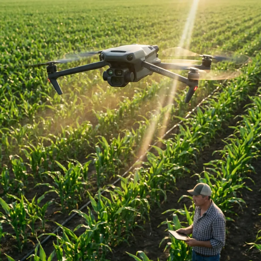
Mavic 3M in Dusty Construction Environments: A Field Case Study on Light, Surface Detail, and Reliable Capture
META: A field-based look at how the Mavic 3M can document dusty construction sites more effectively by using side light angles, sharper texture rendering, and practical battery discipline.
Dust changes everything on a construction site.
It softens edges, flattens surfaces, hides defects, and turns an otherwise useful aerial record into a vague layer of beige atmosphere. Teams often assume the answer is higher resolution, more flights, or heavier post-processing. In practice, the first fix is usually simpler: stop fighting the light and start using it correctly.
This case study is built around a surprisingly practical imaging principle: side light, especially when it hits the subject from roughly 45° to 90°, reveals texture, depth, and surface detail far better than flat front lighting. That idea comes from flower photography, but the operational lesson transfers extremely well to a Mavic 3M workflow for dusty construction documentation. The subject may be graded soil, aggregate stockpiles, concrete formwork, trench edges, or material staging zones rather than petals, yet the visual physics is the same. Texture appears when light has somewhere to cast a small shadow.
As someone who approaches UAV operations from a research and field-method perspective, I find this kind of cross-domain lesson more useful than another generic aircraft overview. The Mavic 3M is often discussed through its multispectral credentials, mapping outputs, and data products. Those are legitimate strengths. But in real project conditions, the value of the aircraft depends just as much on whether the pilot understands when visual detail will actually separate from the dust-filled background.
The assignment: documenting a dusty site without losing actionable detail
A contractor asked for recurring aerial coverage of an active earthworks and structural phase on a dry site. The brief sounded straightforward: capture progress, identify material movement, and create clean visual records for coordination meetings. The site, however, presented the common problems that ruin many drone flights:
- suspended dust from vehicle movement
- low-contrast ground surfaces
- reflective hardscape patches mixed with loose fill
- long workdays that tempt crews to fly at the wrong time simply because batteries are available
The Mavic 3M was selected because the operation needed more than pretty overheads. The team wanted a platform capable of producing consistent data products over time, with the option to support multispectral interpretation in adjacent environmental and vegetation management zones while still delivering practical site imagery. That flexibility matters when one aircraft may be asked to support progress tracking one day and edge-condition assessment the next.
Yet the biggest improvement did not come from a menu setting. It came from timing flights around the light.
Why side light works so well in dusty conditions
The reference material behind this article makes one point with admirable clarity: side light is effective because it strengthens texture, layering, and three-dimensional form. In the source example, it helps flower petals show finer surface detail. On a construction site, the same principle exposes things that flat overhead light tends to hide:
- rutting on temporary access roads
- uneven compaction patterns
- washout beginnings on slopes
- aggregate segregation
- roughness changes on concrete or fill surfaces
- berm shape and trench edge definition
When light comes in from the side at about 45° to 90°, minor height differences produce visible micro-shadowing. That creates separation. On a dusty site, separation is everything. Dust already lowers contrast by scattering light back into the lens. If the sun is too frontal, the entire image becomes visually “flat.” The ground reads as one broad tonal field, and the details a project manager actually cares about disappear.
With side light, the image gains structure.
That is the operational significance of the lighting angle. It is not a stylistic preference. It improves interpretability. If your goal is to inspect grade transitions, edge conditions, stockpile faces, or disturbance patterns, side lighting can do more for clarity than simply flying lower.
Applying a flower-photography lesson to the Mavic 3M
This may sound unexpected at first: a technique described for photographing flowers is genuinely useful for industrial drone work. The reason is that both subjects rely on surface relief.
Petals have texture. Dusty sites have texture too, but often at a larger scale and with lower natural contrast. The source notes that side light gives the strongest sense of layering and three-dimensionality, and that it is also simple and direct to use. That second point matters as much as the first. Good field methods survive because crews can apply them without slowing down the job.
For Mavic 3M operators, the translation is straightforward:
- Schedule visual documentation passes when the sun is not directly overhead.
- Align portions of the flight path so the sun strikes key surfaces from the side.
- Use those passes to capture defect-sensitive areas: haul roads, trench lines, spoil piles, and disturbed slopes.
- Keep a separate mapping routine if uniform illumination is needed for orthomosaic consistency.
This distinction is crucial. A single mission plan should not be expected to solve every imaging problem. If you want analytical mapping consistency, you may prioritize even coverage. If you want the visual record to reveal texture and construction surface condition, side light often wins.
The Mavic 3M fits this split-role approach well because it is not limited to one kind of output. A disciplined operator can run a repeatable mapping workflow and then add targeted low-angle observational passes for problem areas.
The dusty-site reality: visual capture versus data capture
One of the mistakes I see in the field is treating all drone flights as if they serve the same audience. They do not.
A surveyor may care most about positional repeatability, RTK fix rate, and centimeter precision. An environmental manager may focus on multispectral signatures. A superintendent reviewing a dusty excavation wants to know whether the slope toe is holding, whether haul-road wear is accelerating, and whether material staging has drifted outside the planned zone.
These are related objectives, but they are not identical.
The Mavic 3M becomes more useful when operators separate them intentionally:
- Mapping/data pass: prioritize consistency, overlap, and positional integrity.
- Texture/inspection pass: prioritize light direction, oblique viewing options where appropriate, and visual relief.
This is where the side-light principle becomes more than a camera tip. It becomes a mission-planning decision.
A surface captured under poor light may still be georeferenced accurately, but it can remain visually uninformative. A textured side-lit image, by contrast, can help site teams interpret what they are seeing much faster. That speed matters on active projects where decisions are made in short morning meetings, not after hours of image enhancement.
A practical field note on batteries in dust
The most useful battery advice rarely sounds sophisticated.
On dusty sites, crews often burn flight time in avoidable ways: waiting in hover while radios catch up, repositioning repeatedly because the sun angle was not considered before launch, or conducting “just one more pass” after the useful light has already gone. That is not only inefficient. It also tends to heat batteries unnecessarily in harsh field conditions.
My rule from experience is simple: use your best light window for your most texture-dependent captures, and protect a fresh battery for that window rather than spending it on mediocre mid-day visuals.
In one project cycle, we kept one battery set specifically reserved for late-afternoon side-light runs over haul routes and stockpiles. Earlier batteries handled general mapping and overview tasks. The result was better imagery and less rushed decision-making. We were not trying to squeeze every minute from every pack. We were matching battery quality to imaging value.
That discipline matters even more in dust, where every extra landing, takeoff, and unnecessary hover increases contamination risk for aircraft surfaces and operational delays between flights. Better planning reduces pointless aircraft exposure.
What side light revealed that top-down noon flights missed
Once the team shifted to side-lit capture windows, several patterns became easier to identify:
1. Surface disturbance along access routes
What looked like uniformly compacted haul paths from overhead began to show subtle ridging and wheel-track depth variation. Those details matter because they often correlate with drainage behavior and maintenance timing.
2. Stockpile geometry
Under flatter light, stockpiles often read as simple masses. Under side light, their faces showed clearer slope transitions and irregular loading patterns. That improved volume-review discussions and site logistics planning.
3. Early erosion cues
Side light made small wash lines and edge breakdown more visible on disturbed ground. These details are often missed until they become larger remediation items.
4. Material boundary clarity
Dust tends to visually merge neighboring surfaces. Side lighting restored local contrast and made boundaries between fill types, graded sections, and temporary work zones easier to interpret.
Again, none of this depends on cinematic ambition. It is about making the aerial record more truthful.
Where Mavic 3M fits beyond standard site photography
Because the Mavic 3M sits in a workflow space that includes multispectral capability, it can support more than visual progress reports. On mixed-use project sites, nearby vegetation buffers, drainage corridors, and rehabilitation zones may also need monitoring. That is where a platform capable of moving between conventional visual documentation and spectral analysis becomes especially practical.
The relevant point for this article is not to force every buzzword into the mission. It is to recognize that one aircraft can support very different site questions if the operator respects the imaging conditions for each.
Visual texture capture benefits from side light. Repeatable mapping benefits from disciplined geometry. Vegetation or environmental review may benefit from multispectral planning. Precision workflows depend on stable RTK performance and consistent process control.
Those are not competing ideas. They are separate tools inside one operating framework.
A note on training crews to see light, not just fly drones
The source material describes the technique as simple, direct, and easy to apply. That may be the most underappreciated lesson here.
Many UAV training programs spend plenty of time on checklists, airspace, batteries, and software. They spend less time teaching crews how to read light in relation to the surface they are documenting. On a dusty construction site, that gap shows up quickly. Operators collect “complete” flights that are technically acceptable but visually weak.
Teaching a pilot to ask one question before launch can improve results immediately:
Where will side light reveal the most surface information on this site today?
That habit changes route design, launch timing, and image usefulness.
If your team is refining Mavic 3M workflows for active projects and wants to compare mission design approaches, this field discussion can continue here: message our operations desk.
The broader lesson
The most effective Mavic 3M workflow in dusty construction conditions may not begin with aircraft settings at all. It begins with understanding how light shapes information.
The reference fact that side light arrives from approximately 45° to 90° is not just a photography detail. It is a practical operating cue. And the related point that this lighting strengthens texture, detail, layering, and three-dimensional form is exactly why it matters on construction sites where dust strips away contrast.
For crews documenting grade, material movement, access routes, and disturbed ground, this is one of the highest-value adjustments available because it is low-cost in effort and high-yield in image quality. It also scales well. A solo operator can use it. A larger inspection program can build it into standard operating procedures.
When paired with sound battery discipline, repeatable RTK-backed workflows, and the Mavic 3M’s broader multispectral utility, the result is a more credible aerial record. Not just cleaner images. Better decisions.
Ready for your own Mavic 3M? Contact our team for expert consultation.