Mavic 3M for Forest Scouting: Why Timing, Weather
Mavic 3M for Forest Scouting: Why Timing, Weather, and Endurance Matter More Than Ever
META: A technical review of Mavic 3M forest scouting strategy, using new reporting on landscape photography timing and a four-hour hydrogen UAV demo to explain smarter mission planning in complex terrain.
Forest scouting with a DJI Mavic 3M is rarely limited by the camera alone. In dense canopy, broken ridgelines, and irregular light, the real constraint is decision-making before takeoff. The latest reporting from two very different corners of the aerial world sharpens that point. One focuses on landscape photography and argues that time of day and weather are decisive. The other documents a hydrogen-powered UAV in Shenzhen that stayed airborne for four hours straight during a low-altitude power systems seminar. Put together, those facts say something useful for Mavic 3M operators working in forests: the best data does not come from flying more casually. It comes from matching aircraft capability to environmental windows with discipline.
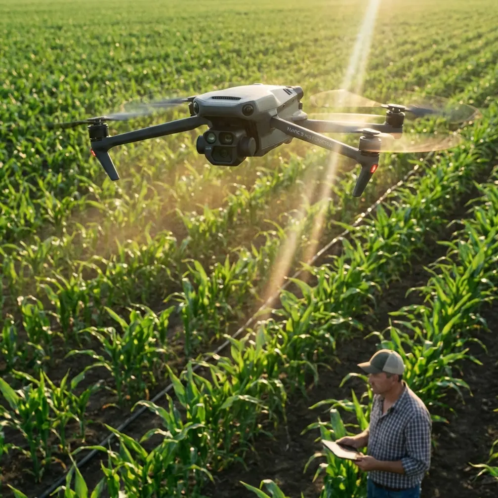
That matters because the Mavic 3M sits in a peculiar and valuable position. It is not a heavy-lift endurance platform, and it is not just a visual drone for attractive scenery. It is a multispectral aircraft built for decision support. In forest environments, that means identifying stress patterns, canopy inconsistency, stand density changes, access corridors, storm impact, waterlogging signatures, and edge effects before crews enter difficult ground. A mission succeeds when the imagery is consistent enough to trust, the positional data is tight enough to align, and the pilot adapts to weather fast enough to avoid collecting misleading maps.
The first reference item, a recent Chinese piece on landscape photography, may sound far removed from technical UAV work. It is not. Its central point is blunt: outdoor image making is, to a meaningful extent, “weather-dependent,” and the choice of shooting time and conditions becomes a determining factor. That is not artistic fluff. For a Mavic 3M user scouting forests, it is operational doctrine.
Multispectral work lives or dies on repeatability. If you are comparing a drainage corridor on a cloudy afternoon with a ridge on a bright mid-morning flight from another day, your data may still be useful, but it becomes harder to separate true vegetation response from lighting variance. Forests make this worse. Sun angle changes shadow penetration, crown separation, understory visibility, and contrast at stand edges. Wind shifts leaf orientation and branch movement. Mist and humidity alter apparent surface response. Even if the aircraft is holding a strong RTK fix rate and delivering centimeter precision, weak timing decisions can still contaminate interpretation.
This is where operators often underestimate “golden timing,” borrowing the photography term but applying it in a more technical sense. In forests, the best flight window is not automatically sunrise or sunset just because photographers like warm light. For scouting, the right window depends on the mission objective. If the goal is corridor definition or visual route planning through mixed terrain, low-angle light can help reveal surface relief and trail interruptions. If the goal is multispectral consistency over a test block, a stable lighting period with manageable shadows may be better than dramatic oblique light. The recent photography report gets one thing exactly right: time and weather are not secondary variables. They are mission design inputs.
The second reference item adds another dimension. At a low-altitude hydrogen power systems seminar held on January 16 in Shenzhen’s Yantian eastern low-altitude integration demonstration base, a hydrogen UAV reportedly took off in front of attendees, flew continuously for four hours, and landed safely at the close of the event. That is a concrete demonstration, not a vague promise. Four hours of continuous flight changes how people think about airborne work, especially in sectors that need long endurance and heavier payload support.
Now, the Mavic 3M is not a hydrogen UAV. It does not compete on that duration class. But the significance for Mavic 3M users is still real. The Shenzhen demonstration is a signal that the wider low-altitude ecosystem is pressing hard toward longer endurance and larger operational envelopes because users need them. According to the same report, industry participants raised urgent demand for long-endurance, heavy-payload power. That demand exists because aerial work increasingly revolves around persistent coverage, not isolated snapshots.
For forest scouting teams using the Mavic 3M today, the practical lesson is not to wait for hydrogen. It is to build workflows that respect endurance limits while taking advantage of the aircraft’s speed, sensor integration, and deployment simplicity. A short-endurance aircraft can outperform a long-endurance platform on real jobs when the task is tightly scoped, launch points are chosen intelligently, and capture windows are selected with discipline. In steep or obstructed woodland, moving the team 400 meters to a smarter launch site can matter more than squeezing a few extra minutes from a battery. So can trimming the survey polygon to the actual decision area rather than mapping impressive but unnecessary acreage.
I saw this firsthand during a scouting exercise in mixed conifer forest where a small herd of deer broke cover near a drainage cut just as the aircraft crossed from an open patch into a darker stand edge. The Mavic 3M’s live feed did not just help avoid startling the animals. It forced a route adjustment around a low branch line that was nearly invisible from our original pilot position because the canopy was eating contrast. That is the sort of moment that exposes the difference between theoretical planning and actual fieldwork. Forests do not present clean geometry. They shift. Wildlife moves. Shadows erase depth cues. Sensors help, but only if the operator is already thinking in terms of light, weather, and escape paths.
This is also why visual habits from traditional landscape photography deserve more respect in multispectral operations than many industrial users give them. The recent photography article notes that different scenic subjects need different approaches, even though some methods carry across categories. Forest scouting is similar. A wet riparian corridor, a post-storm blowdown zone, and a healthy plantation block are all “forest,” but they do not reward identical flight logic. In a damp valley after changing weather, you may prioritize stable hover checks, conservative speed, and cross-angle passes to verify canopy openings. On a uniform stand with minimal relief, you may emphasize swath width efficiency and repeatable overlap. Same drone. Different subject behavior.
That kind of adjustment is where the Mavic 3M earns its place. Its multispectral capability is most valuable when users avoid treating it as an autopilot box that magically turns flights into agronomic truth. In forests, spectral signatures can be influenced by species mix, canopy height, moisture variation, recent weather, and shadow density. A disciplined operator pairs the data with visual context, terrain awareness, and positional confidence. Strong RTK performance improves map registration. Centimeter precision helps when comparing access tracks, tree lines, or recurring survey blocks. But precise bad data is still bad data. If wind-driven canopy movement creates inconsistency across passes, or if cloud transitions alter scene balance mid-mission, the mapping stack may look clean while the interpretation stays muddy.
Some of the most useful Mavic 3M habits in forests come from industries that care deeply about consistency, such as spraying operations, even though the aircraft itself is not a spray platform. Think in terms of nozzle calibration logic, not because you are dispersing liquid, but because precision work depends on known output under known conditions. In spraying, poor calibration leads to uneven application and spray drift. In forest scouting, the equivalent failure is collecting imagery under unstable conditions and then over-trusting the map. The principle is the same: if the environment is changing faster than your workflow accounts for, the finished result can mislead confident people.
That is why weather monitoring should be treated as a live operational loop, not a preflight checkbox. In complex terrain, local wind can split from forecast behavior. Valleys funnel air. Clearings create turbulence. A ridge that looks manageable from the road can push the aircraft harder than expected once it crests the tree line. Humidity can build under canopy pockets and soften contrast. Broken cloud can produce alternating brightness bands across adjacent swaths. A forest scouting mission on the Mavic 3M should include at least three weather decisions: whether to launch, whether to maintain the original route, and whether the captured data is trustworthy enough to act on without a repeat pass.
The broader significance of the Shenzhen hydrogen demonstration lies here. A four-hour flight in a public technical setting is evidence that endurance is becoming a strategic variable in the low-altitude industry, not an aspirational talking point. As longer-endurance systems mature, mission segmentation will improve. Heavy platforms may handle wide persistent overwatch, while drones like the Mavic 3M remain the fast-response layer for targeted, high-value sensing. That division already makes sense in forestry and environmental work. One aircraft class watches the whole theater. Another goes in quickly for the details that support field decisions.
For current Mavic 3M users, that future does not reduce relevance. It clarifies it. The aircraft is strongest when used for focused reconnaissance in places where deploying larger systems is excessive, delayed, or operationally awkward. Forest managers, ecologists, and land teams do not always need hours aloft. Often they need 20 to 30 disciplined minutes over the right block, under the right sky, with a flight plan built around terrain rather than convenience. If the mission objective is to identify stressed patches after a weather event, validate a suspected access obstruction, or compare canopy condition between management zones, a well-run Mavic 3M sortie can answer the question before a larger aviation workflow is even mobilized.
That leads to a practical framework for complex forest terrain.
Start with the question, not the map. Are you checking storm damage, drainage stress, trail access, or stand health? Then select the weather window that best supports that question. If visual structure matters, prioritize light that reveals relief. If multispectral consistency matters, prioritize stable illumination and low volatility. Use RTK wherever possible to protect repeatability. Keep swath width realistic for the terrain and the objective; broader is not always better when slope, canopy height, and variable shadowing are in play. Build contingency routes for wildlife, branch hazards, and line-of-sight interruptions. Most importantly, review the data with the same skepticism you would apply to any field instrument operating in unstable conditions.
Operators who want to tighten this process can compare mission plans and forest scouting workflows with other field teams through this direct planning channel: message a flight specialist. Not for a generic sales pitch, but to benchmark how others are handling lighting windows, terrain segmentation, and repeat-pass consistency.
The recent photography guidance and the Shenzhen hydrogen story may seem unrelated at first glance. One is about image-making craft. The other is about propulsion and endurance. But for Mavic 3M work in forests, they connect cleanly. Better timing produces better sensing. Better endurance across the industry raises the standard for how aerial tasks are divided and executed. If you understand both trends, you stop asking only what the drone can do and start asking whether the mission design makes the output worth trusting.
That is the real threshold between recreational flying habits and professional scouting. Not more buttons. Not more jargon. Better judgment under real conditions, where weather, terrain, wildlife, and aircraft limits all show up at once.
Ready for your own Mavic 3M? Contact our team for expert consultation.