Mavic 3M in High-Altitude Vineyards: What Camera Discipline
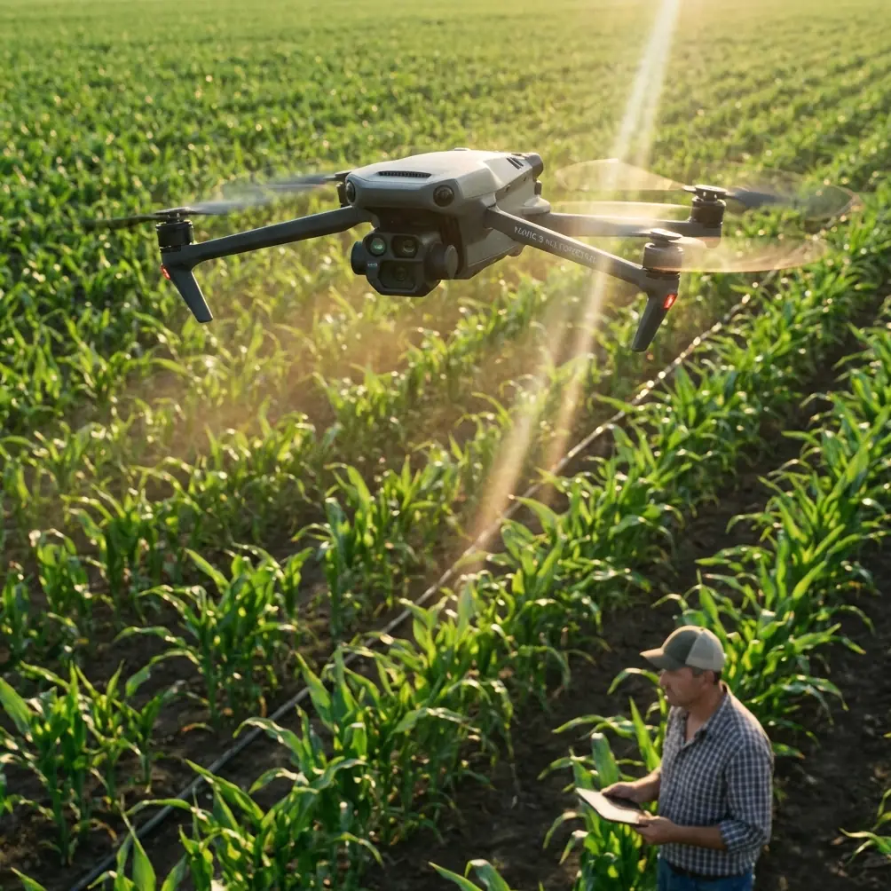
Mavic 3M in High-Altitude Vineyards: What Camera Discipline Still Matters When the Weather Turns
META: A field-focused look at using the Mavic 3M in high-altitude vineyards, with practical insight on exposure control, multispectral capture, and staying productive when conditions shift mid-flight.
High-altitude vineyards can make even experienced drone operators look ordinary.
The problem is not simply terrain. It is the way light changes faster than most crews expect, the way wind moves across rows unevenly, and the way a beautiful mountain vineyard can fool an operator into trusting automatic settings for too long. With the Mavic 3M, the hardware is capable. That part is rarely the real bottleneck. The harder question is whether the pilot and imaging workflow are disciplined enough to turn difficult conditions into usable data and clean visual outputs.
That is where an old photography truth becomes surprisingly relevant.
A recent photography piece published on April 10, 2026 framed skill development as a gradual progression across three core dimensions: technique, aesthetics, and practice. That sounds broad, but in vineyard operations it translates into something very practical. If you are flying a Mavic 3M over elevated blocks, technical control comes first, visual judgment follows, and repeatable field habits hold the whole thing together. The drone may be advanced, but the image still depends on how well the operator manages exposure, motion, and intent.
The real problem in high-altitude vineyard capture
At altitude, vineyard imaging becomes unstable in subtle ways.
Sun angles shift quickly as ridgelines cast moving shadows. Reflected brightness from pale soil can push the camera toward underexposing the canopy. Gusts can appear without warning as air rolls over slope breaks. If you are capturing vine vigor patterns with multispectral workflows or documenting crop conditions visually for growers and consultants, these changes matter. They affect consistency across rows, and consistency is what makes one flight comparable to the next.
Many operators start in full auto because it feels efficient. In a flat test field, that can be fine. In a mountain vineyard, auto often becomes the reason the dataset is harder to trust. One pass is exposed for bright sky. The next is weighted toward dark canopy. By the time you review the mission, the changing conditions have introduced enough variation that interpretation becomes slower and less certain.
The photography reference gets this exactly right when it urges users to move beyond automatic mode and learn aperture-priority or manual control. That advice was written for photography improvement in general, but it has direct operational significance for Mavic 3M work. The step from “recording” to “creating,” as the source puts it, is also the step from casual capture to defensible field documentation.
Why exposure fundamentals still matter on the Mavic 3M
Drone operators in agriculture sometimes talk as if sensor sophistication can replace camera discipline. It cannot.
The same source emphasizes the interdependence of the three exposure variables: aperture, shutter speed, and ISO. For Mavic 3M users, that triangle is not a classroom concept. It determines whether your imagery is stable enough to support crop assessment, stakeholder reporting, and repeatable vineyard monitoring.
Two details from that reference deserve attention.
First, it notes that smaller f-numbers increase background blur, while larger f-numbers keep more of the scene in focus. In a vineyard environment, that matters differently depending on the task. If you are creating visual storytelling assets for an estate, selective depth can help isolate clusters, trellis lines, or stress symptoms in a way that communicates clearly. But if the mission is broader documentation across slope and row geometry, greater scene clarity matters more than aesthetic blur. The operational significance is simple: your aperture choice should serve the decision you need to make after the flight, not just the look of the footage.
Second, the source highlights the role of shutter speed, specifically noting that fast shutter speeds of at least 1/200s are suited to moving subjects. That threshold becomes highly practical in high-altitude vineyard flying because the subject is not the only thing moving. Leaves flicker in gusts. The aircraft can experience brief attitude adjustments. Even if the drone is holding position well, canopy texture can smear when shutter speed is too slow. For row-level vineyard analysis, that loss of edge definition can reduce confidence when you are comparing subtle changes in vine health or canopy uniformity.
In other words, a number as ordinary as 1/200s becomes a field decision, not a trivia fact.
A mid-flight weather shift is where weak workflows show up
One of the clearest examples came during a vineyard mission on a high block where the weather changed halfway through the flight.
The first section of the mission was almost ideal. Thin morning light, stable air, long row shadows that still preserved canopy detail. Then conditions turned. A crosswind developed from the exposed side of the slope, and the cloud cover thickened enough to flatten contrast. Nothing dramatic. No storm. Just the kind of ordinary shift that ruins consistency if the operator is relying on the drone to guess everything correctly.
This is where the Mavic 3M earned its keep, but not by magic. The aircraft stayed composed enough to keep the mission productive, and the multispectral workflow remained relevant because the flight plan itself was sound. But what saved the output was not the drone alone. It was the decision to treat the camera as a controlled instrument rather than a passive recorder.
Instead of letting auto chase the changing light, exposure strategy was adjusted with intent. Shutter speed stayed high enough to protect detail in the moving canopy. ISO was watched closely rather than allowed to float aimlessly. The result was not perfect sameness across every frame, because mountain weather rarely allows that, but it was consistent enough to preserve analytical value.
That distinction matters.
When weather changes mid-flight, many teams think only in terms of aircraft survivability or mission completion. Those are necessary concerns, but imaging integrity is the real business issue. If your vineyard advisor or operations manager cannot compare the data cleanly from one block to another, the mission becomes harder to justify.
The Mavic 3M advantage is strongest when paired with operator intent
The Mavic 3M is often discussed for its multispectral utility, and rightly so. In vineyard settings, that is one of its defining strengths. Multispectral data can reveal row-by-row variation that would be difficult to read from standard visual capture alone. In high-altitude sites, where microclimates can shift noticeably across elevation and exposure, that capability becomes especially valuable.
Still, the most useful Mavic 3M flights are rarely the ones where the pilot assumes the system will solve every variable. They are the ones where the operator understands how to preserve data quality under field pressure.
That is why the photography article’s framework of technique, aesthetics, and practice fits this product so well, even though the article itself is not about drones. Technique is your command of exposure and mission settings. Aesthetics is your ability to interpret the landscape and understand what visual structure helps communicate vineyard condition. Practice is the repetition required to make good decisions when conditions stop being friendly.
In mountainous vineyards, practice also sharpens something less obvious: judgment about when to continue and when to reset. A pilot chasing perfect efficiency can easily push through a weather transition that should have triggered a revised pass plan. A more experienced operator recognizes that consistency across critical rows may be worth more than brute-force completion of the entire block in one attempt.
High-altitude vineyard capture is not only about the image
There is a second layer to this conversation, and it is operational.
Readers researching Mavic 3M often arrive from broader agricultural drone topics: spray drift concerns, nozzle calibration, swath width, RTK fix rate, centimeter precision, weather resistance, and mission reliability. Those are all legitimate concerns in ag tech planning, even if they do not all apply equally to an imaging platform in the same way they would to a spraying aircraft. What matters for vineyard teams is understanding the chain of trust from flight execution to field decision.
For example, when people talk about centimeter precision, they are really talking about repeatability. In a vineyard, repeatability is what allows one dataset to mean something against another. If you are monitoring the same steep parcels over time, stable mission geometry matters. If your team is pairing drone imagery with field scouting, irrigation review, or nutrition planning, then alignment and consistency are not luxury features. They are what make the imagery operationally useful.
The same applies to weather handling. High-altitude blocks are notorious for conditions that change between takeoff and final pass. The aircraft has to remain dependable enough to maintain mission confidence, but the crew also needs a method for adjusting capture parameters without losing the dataset. That is where field experience separates polished output from expensive noise.
If you are working through those setup decisions with your team, this direct WhatsApp line can help clarify practical Mavic 3M deployment questions in vineyard conditions: https://wa.me/85255379740
From “nice footage” to useful vineyard intelligence
A lot of drone content treats image quality as if it were mostly artistic. In commercial vineyard work, that is too narrow.
Good imagery has to survive scrutiny from multiple people who care about different things. The vineyard manager wants to identify variability. The consultant wants confidence in the pattern. Ownership may want visual proof tied to site conditions. The operations team may need documentation that aligns with future flights. Suddenly, exposure choices that seemed minor during the mission become central to whether the flight created value.
This is why moving beyond automatic mode is not just a creative upgrade. It is a business discipline.
The April 2026 photography reference calls technical mastery the foundation of photography. In Mavic 3M vineyard work, that foundation becomes measurable. If you understand the relationship among aperture, shutter speed, and ISO, you can protect data quality when mountain light shifts. If you know when a shutter speed of 1/200s or faster is necessary, you are less likely to return with motion-softened canopy detail. If you practice enough to recognize how visual structure changes across steep rows and broken light, you stop reacting and start planning.
And once that happens, the Mavic 3M becomes more than a capable aircraft with multispectral credentials. It becomes a reliable imaging system for complex vineyards where conditions rarely stay stable long enough for lazy technique.
The practical takeaway for Mavic 3M operators
If your target environment is a high-altitude vineyard, the biggest mistake is assuming the mission challenge is primarily about terrain. Terrain matters, but unstable light and shifting weather are the real stress tests.
The solution is not complicated, though it does require skill.
Learn the camera deeply enough to leave auto mode behind when conditions demand it. Treat the exposure triangle as an operating tool, not photography theory. Preserve shutter speed when wind introduces movement into leaves and aircraft attitude. Use the Mavic 3M’s strengths for structured vineyard capture, especially where multispectral comparison can reveal patterns hidden to the naked eye. And practice until weather changes mid-flight feel like a manageable variable rather than a mission-ending surprise.
That is the difference between flying over a vineyard and actually learning something from it.
Ready for your own Mavic 3M? Contact our team for expert consultation.