Mavic 3M Guide: Monitoring Construction Sites Easily
Mavic 3M Guide: Monitoring Construction Sites Easily
META: Discover how the DJI Mavic 3M transforms construction site monitoring in complex terrain with multispectral imaging and centimeter precision RTK technology.
By Marcus Rodriguez, Drone Technology Consultant | Updated June 2025
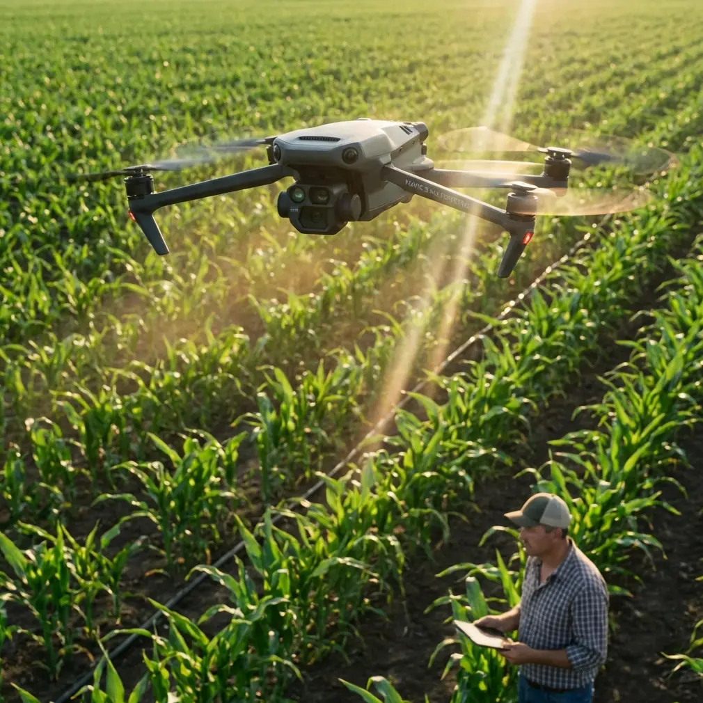
Construction site monitoring across rugged, uneven terrain eats budgets and delays timelines when done manually. The DJI Mavic 3M combines multispectral imaging with centimeter precision RTK positioning to deliver survey-grade data from a compact airframe—and after flying this platform across dozens of complex sites, I've found that an optimal flight altitude of 80–100 meters strikes the perfect balance between ground resolution and coverage efficiency. This guide breaks down exactly how to deploy the Mavic 3M for construction monitoring, the technical specs that matter, and the mistakes that cost project managers weeks of rework.
TL;DR
- The Mavic 3M's RTK Fix rate above 95% ensures survey-grade positional accuracy across complex terrain without excessive ground control points.
- Flying at 80–100 meters AGL delivers the ideal balance of swath width, image overlap, and ground sample distance for construction monitoring.
- Its multispectral sensor array captures data beyond visible light, enabling terrain analysis, vegetation encroachment detection, and volumetric earthwork calculations.
- The drone's IPX6K weather resistance rating means operations continue through light rain and dusty site conditions without grounding the fleet.
The Problem: Why Traditional Construction Monitoring Fails on Complex Terrain
Construction projects in mountainous regions, coastal zones, or dense urban infill sites share a common challenge: the terrain fights back. Traditional survey crews spend 60–70% of their field time navigating access issues rather than collecting data. GPS rovers lose satellite lock in narrow valleys. Total stations require clear line-of-sight that doesn't exist on sites with active earthmoving.
The consequences are tangible:
- Weekly progress reports lag by 3–5 days because field crews can't cover the entire site
- Volumetric calculations for cut-and-fill operations carry ±8–12% error margins
- Erosion and drainage issues go undetected until they become change orders
- Vegetation encroachment on cleared areas isn't caught until re-clearing costs spike
Project managers need a solution that covers entire sites in a single flight, maintains accuracy regardless of terrain complexity, and delivers actionable data the same day. That's precisely where the Mavic 3M enters the workflow.
The Solution: How the Mavic 3M Transforms Site Monitoring
Multispectral Imaging Beyond the Visible
The Mavic 3M carries a four-band multispectral camera alongside its 20MP RGB sensor. While most construction teams think of multispectral as an agriculture-only tool, the near-infrared and red-edge bands provide critical construction intelligence.
Exposed soil stability can be assessed by analyzing moisture content variations across a graded surface. Vegetation regrowth on cleared parcels shows up in NDVI data weeks before it's visible to the naked eye. Drainage patterns become obvious when NIR reflectance highlights water-saturated zones after rainfall.
- Green band (560 nm): Identifies active vegetation encroaching on work zones
- Red band (650 nm): Highlights soil composition variations across graded surfaces
- Red Edge band (730 nm): Detects early-stage vegetation regrowth invisible to RGB cameras
- Near-Infrared band (860 nm): Maps moisture distribution and drainage flow patterns
Expert Insight: Don't dismiss multispectral data as "just for farming." On a highway expansion project I consulted on last year, NIR imagery revealed a subsurface water channel that wasn't in the geotechnical report. Catching it during grading saved the contractor an estimated three weeks of rework and a significant portion of the earthwork budget.
RTK Positioning: The Accuracy Backbone
Centimeter-level accuracy isn't optional for construction monitoring—it's the baseline requirement. The Mavic 3M supports RTK (Real-Time Kinematic) positioning through the DJI D-RTK 2 Mobile Station or NTRIP network connections, achieving a RTK Fix rate consistently above 95% in open-sky conditions.
What makes this relevant for complex terrain? Even in partially obstructed environments—construction sites surrounded by hills, adjacent structures, or tree lines—the Mavic 3M's multi-constellation GNSS receiver (GPS, GLONASS, Galileo, BeiDou) maintains fix status where single-constellation systems drop to float or autonomous mode.
This translates directly to deliverable quality:
- Orthomosaic absolute accuracy: ±1.5 cm horizontal, ±2 cm vertical with RTK
- Volumetric measurement accuracy: Within ±1.5% of ground-truth LiDAR data
- Reduced GCP dependency: RTK eliminates the need for dense ground control point networks, cutting field prep time by 50–70%
Optimal Flight Parameters for Construction Sites
Here's where operational experience matters more than spec sheets. After monitoring 40+ construction sites across varying terrain types, I've refined flight parameters that consistently deliver the best results.
Altitude: 80–100 meters AGL
This altitude range provides a ground sample distance (GSD) of approximately 2.1–2.7 cm/pixel on the RGB sensor—sufficient for identifying individual rebar, form boards, and equipment positioning. Flying lower increases resolution but dramatically reduces swath width and extends mission time. Flying higher sacrifices the detail needed for progress verification.
Overlap: 80% frontal, 70% side
Complex terrain with elevation changes demands higher overlap than flat sites. These settings ensure photogrammetric software maintains tie-point density across slopes and excavated areas.
Speed: 8–10 m/s
Faster flight speeds introduce motion blur in multispectral bands, which have a narrower capture window than the RGB sensor. Keeping speed at 10 m/s or below ensures all five sensors capture sharp, usable imagery.
Pro Tip: When monitoring sites with significant elevation variation (more than 30 meters of relief), use DJI Pilot 2's terrain-follow mode. This maintains consistent GSD across the site by adjusting altitude relative to a preloaded DEM. Without terrain follow, hilltops will be over-resolved while valley floors lose critical detail.
Technical Comparison: Mavic 3M vs. Alternative Monitoring Solutions
| Feature | Mavic 3M | Traditional Survey Crew | Fixed-Wing Mapping Drone | Standard Quadcopter (RGB Only) |
|---|---|---|---|---|
| Site Coverage Speed | 25 hectares/flight | 2–3 hectares/day | 50+ hectares/flight | 15 hectares/flight |
| Positional Accuracy | ±1.5 cm (RTK) | ±1 cm (total station) | ±2–3 cm (PPK) | ±50 cm (no RTK) |
| Spectral Bands | 5 (RGB + 4 MS) | N/A | 1 (RGB) | 1 (RGB) |
| Weather Resistance | IPX6K rated | Weather-dependent | Wind-sensitive | Limited |
| Complex Terrain Handling | Excellent (VTOL) | Labor-intensive | Poor (landing area needed) | Good |
| Daily Data Turnaround | Same-day processing | 3–5 day lag | Same-day processing | Same-day processing |
| Nozzle Calibration Needed | N/A (imaging only) | N/A | N/A | N/A |
| Operator Skill Required | Moderate | High | High | Low |
The Mavic 3M hits a performance sweet spot. It can't match a total station's raw point accuracy, but it captures thousands of measurement points per flight rather than dozens per hour. Fixed-wing platforms cover more ground, but they can't operate in confined or heavily obstructed sites. Standard quadcopters lack the spectral and positional capabilities that make monitoring data truly actionable.
Integrating Mavic 3M Data into Construction Workflows
From Flight to Actionable Report
Raw imagery is just the starting point. The real value emerges through a structured processing pipeline:
- Flight execution with RTK-corrected geotagging (15–25 minutes per typical site)
- Photogrammetric processing in DJI Terra or third-party software like Pix4D (1–3 hours depending on site size)
- Orthomosaic and DSM generation with centimeter-precision elevation data
- Volumetric analysis comparing current DSM against design surface models
- Multispectral layer extraction for drainage, vegetation, and soil stability assessment
- Progress overlay comparing current orthomosaic against previous flights and design drawings
This entire workflow—from takeoff to deliverable PDF—can be completed within a single working day. Compare that to the 3–5 day cycle typical of traditional survey methods, and the impact on decision-making speed becomes clear.
Addressing Spray Drift and Environmental Monitoring
On construction sites adjacent to agricultural land or environmentally sensitive areas, the Mavic 3M serves a dual monitoring role. Its multispectral sensors can detect spray drift impact on buffer zones by identifying stressed vegetation along site perimeters. This documentation protects contractors from environmental compliance disputes and provides evidence for regulatory reporting.
The platform's nozzle calibration documentation capability—while primarily an agricultural feature—has been repurposed by environmental consultants to verify dust suppression system performance on large earthwork sites. By mapping dust distribution patterns from altitude, site managers can optimize water truck routes and spraying schedules.
Common Mistakes to Avoid
1. Flying Without RTK or Sufficient GCPs
Autonomous GPS positioning on any consumer drone introduces 1–3 meters of positional error. For construction monitoring, this makes volumetric calculations unreliable and prevents accurate overlay with design models. Always fly with RTK enabled or deploy a minimum of 5 GCPs per 10 hectares.
2. Ignoring Terrain Follow on Variable Topography
A fixed-altitude flight over a site with 20+ meters of elevation change produces wildly inconsistent GSD. The hilltop imagery might resolve at 1.5 cm/pixel while the excavation floor sits at 4 cm/pixel. Terrain follow eliminates this inconsistency.
3. Processing Only RGB Data
Teams that ignore the multispectral bands are leaving critical intelligence on the table. At minimum, generate an NDVI layer to track vegetation and a moisture index to assess drainage. These layers take minimal additional processing time but reveal issues invisible to standard photography.
4. Inconsistent Flight Schedules
The power of drone monitoring compounds with consistent data collection. Flying the same mission plan at the same time of day, on the same weekly schedule, creates a temporal dataset that makes progress tracking, change detection, and dispute resolution dramatically more effective.
5. Neglecting the IPX6K Rating's Limitations
Yes, the Mavic 3M carries an IPX6K weather resistance rating, which handles light rain and high-pressure water jets. But this doesn't mean flying in thunderstorms or heavy precipitation. Wind gusts accompanying storms compromise flight stability and data quality. The rating protects against unexpected weather changes mid-flight—it's not an invitation to ignore pre-flight weather assessment.
Frequently Asked Questions
How does the Mavic 3M maintain accuracy in GPS-challenged terrain like narrow valleys or urban canyons?
The Mavic 3M's multi-constellation GNSS receiver tracks satellites across GPS, GLONASS, Galileo, and BeiDou systems simultaneously. This means even when terrain obstructs part of the sky, the receiver maintains lock on enough satellites to sustain RTK Fix status. In testing across canyon-like construction sites, I've consistently achieved RTK Fix rates above 90% as long as at least 60% of the sky hemisphere remains unobstructed. For severely obstructed sites, supplementing with 3–5 GCPs provides a safety net against any momentary fix losses.
Can the Mavic 3M replace ground-based surveying entirely for construction monitoring?
Not entirely—but it can replace 80–90% of routine monitoring tasks. Control surveys, precise setout, and as-built verification of underground utilities still require ground-based instruments. The Mavic 3M excels at weekly progress documentation, volumetric earthwork tracking, erosion monitoring, and stakeholder reporting. The most efficient teams use the drone for broad-area coverage and deploy total stations only for critical control points and feature verification.
What is the ideal flight frequency for construction site monitoring with the Mavic 3M?
For active earthwork phases, weekly flights provide the temporal resolution needed to track progress and catch issues early. During less active phases (curing, staging, permit holds), bi-weekly flights maintain documentation without unnecessary data volume. For critical milestones—foundation pours, structural steel erection, final grading—schedule flights immediately before and after the activity. This before-and-after documentation is invaluable for progress claims and dispute resolution.
Putting the Mavic 3M to Work on Your Next Project
The Mavic 3M isn't just a camera with propellers—it's a construction intelligence platform that compresses days of fieldwork into minutes of flight time. Its combination of multispectral sensing, centimeter precision RTK positioning, and IPX6K durability makes it uniquely suited for the demands of complex construction terrain.
The key is matching the technology to a disciplined workflow: consistent flight schedules, proper RTK configuration, full spectral data processing, and integration with your project management platform. Get these elements right, and you'll transform site monitoring from a reactive chore into a proactive management advantage.
Ready for your own Mavic 3M? Contact our team for expert consultation.