Mavic 3M in Remote Forest Work: A Field Note on Seeing
Mavic 3M in Remote Forest Work: A Field Note on Seeing Structure, Not Just Canopy
META: A field report on using the Mavic 3M in remote forest filming and mapping, with practical insights on vertical composition, multispectral workflow, RTK reliability, and handling interference in dense terrain.
Remote forest work punishes vague technique.
That becomes obvious the first time you try to document a stand of trees, vine-heavy edges, flowering branches, or regeneration zones with a drone and come home with footage that looks busy but says nothing. The Mavic 3M is often discussed for multispectral data collection, vegetation analysis, and centimeter-level positioning. All of that matters. But in real field conditions, especially in forests, useful results depend just as much on how you frame vertical subjects as on what sensors you carry.
I’ve been thinking about that while reviewing recent notes on photographing flower branches with vertical composition. The core idea is simple: when the subject has strong upward lines, a vertical frame strengthens those lines and increases visual impact. Pair that with a dark background and intentional negative space, and the subject’s shape becomes easier to read. Mood improves too. That principle may sound like pure photography theory, but in remote forest operations with the Mavic 3M, it has very practical value.
Forests are built from vertical information. Trunks. Saplings. Single stems rising through undergrowth. Blossoming branches cutting through shadow. If you insist on wide horizontal framing every time, you flatten those cues. You get canopy context, yes, but often lose the line structure that tells a viewer what they’re actually looking at. Vertical framing can recover that structure.
For Mavic 3M users, this matters in two distinct ways. First, it improves visual documentation for stakeholders who still make decisions from images, not only from maps. Second, it helps bridge the gap between aesthetic capture and operational clarity. That gap is where many forest projects either gain traction or stall.
Why vertical framing belongs in a forest workflow
The source reference focused on flower branches, not drones. That’s exactly why it’s useful. It isolates a visual truth that applies directly to forest imaging: a vertical composition gives more force to vertical lines and can make the image feel more distinctive. In the field, that means a flowering branch at a forest edge, a diseased stem standing above lower vegetation, or a narrow corridor cut through dense growth can be rendered with more legibility.
With the Mavic 3M, operators often prioritize coverage efficiency. Understandably so. Swath width, overlap, route completion, RTK fix rate, and battery rotation dominate planning. But once the aircraft reaches site and starts collecting material, visual storytelling still matters. If your audience includes ecologists, forestry consultants, landowners, grant reviewers, or remote clients, they often need a fast, intuitive read of site conditions before they ever open a vegetation index layer.
A well-executed vertical shot can do that faster than a broad panorama.
The branch-photography reference also highlighted two details that are operationally significant for drone crews:
- vertical framing emphasizes the subject’s line tension and shape
- dark background plus appropriate negative space strengthens mood and readability
Those are not small artistic flourishes. In a forest environment, they translate into practical capture decisions.
When a branch, stem, or isolated crown is framed against darker canopy recesses rather than a cluttered, bright sky, edge separation improves. That makes the subject easier to evaluate for vigor, bloom density, stress signatures, and physical structure. Negative space serves a similar role. It prevents adjacent vegetation from swallowing the subject.
That’s especially relevant when creating paired deliverables from a Mavic 3M mission: one analytical set for multispectral review, and one visual set for reporting or client communication.
The Mavic 3M’s real strength in remote forest jobs
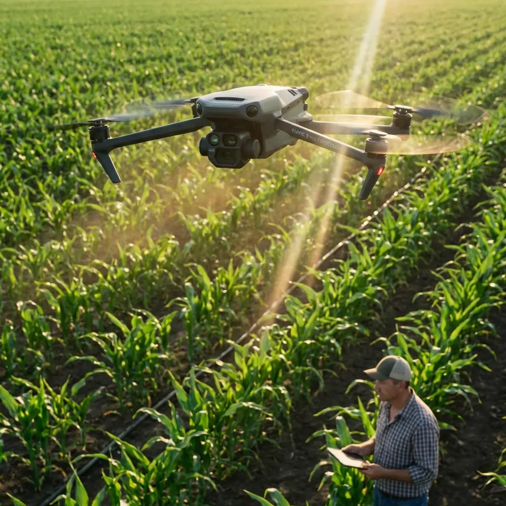
The Mavic 3M is not just a camera platform with multispectral capability bolted on. In remote forests, its value is that it allows one operator to move between precise mapping and targeted documentation without changing aircraft classes.
That flexibility matters when terrain is uneven, launch zones are constrained, and weather windows are short.
In a typical remote forest deployment, I may need three outputs from one visit:
- a georeferenced map of the area
- multispectral captures to compare vegetation variation
- close visual documentation of selected features such as flowering branches, canopy gaps, edge stress, or regeneration patches
This is where the aircraft’s multispectral system and RTK-supported positioning become more than spec-sheet items. Multispectral data helps reveal vegetation differences that standard RGB can miss. Centimeter precision helps align flights, revisit locations, and compare time-series data with confidence. If you identify an anomaly in one pass, you want to know you can come back to nearly the same place and observe it again under repeatable geometry.
That repeatability is often more valuable than dramatic footage.
And yet, remote forests rarely behave like ideal test sites. Terrain blocks signal. Moisture changes contrast. Dense canopy creates visual confusion. In some sites, nearby infrastructure or geological conditions can complicate navigation and communications. This is where field discipline matters as much as hardware.
Handling electromagnetic interference without losing the mission
One issue operators underestimate is electromagnetic interference at edge zones near remote utility routes, repeater installations, or concealed infrastructure. It can show up where you least expect it. Not in the middle of obvious industrial activity, but near a ridge, at a clearing, or on a service road beside dense timber.
When I start seeing irregular compass behavior, unstable heading response, or inconsistent positioning confidence, I don’t push through blindly. A small antenna adjustment can make a meaningful difference. Changing pilot orientation, elevating the controller slightly, or moving laterally a short distance to clear a localized interference path can stabilize the link. In practice, that may be the difference between preserving a high RTK fix rate and spending the rest of the flight with degraded confidence.
That matters because forest mapping is not forgiving of sloppy geospatial integrity. If your aim is centimeter precision, intermittent signal compromise can ripple through the dataset. A map that looks acceptable at first glance may become much less useful when overlaid with previous missions or ground truth points.
So yes, antenna adjustment sounds minor. In remote operations, it’s not. It is one of those field habits that separates controlled data capture from “good enough” flying.
My rule is simple: if interference appears, stop trying to fly around the problem and first optimize the signal environment around the operator. That includes antenna angle, controller orientation, launch point relocation, and sometimes waiting a few minutes for a cleaner lock before restarting the route.
A note on composition for forest filming with the M3M
Most Mavic 3M discussions focus on agronomy, stand analysis, and survey logic. Fair enough. But when you are filming forests in remote areas, the visual side should not be treated as secondary.
The flower-branch reference gets something right that many drone pilots miss: vertical subjects deserve a vertical frame. In the woods, that applies constantly.
Think about these common examples:
- a flowering branch extending upward from a dark understory
- a lone sapling in a burned or thinned area
- a straight trunk carrying visible disease or bark damage
- a narrow band of regrowth climbing along slope contours
- lianas or vine structures rising through shadow
When shot horizontally from too far back, each of these gets buried in context. The viewer sees “forest” but not the specific structural story. When framed vertically with room above or below, the line becomes readable. The image breathes. The subject separates.
The reference also recommended using dark backgrounds with suitable negative space. In forest work, that can mean adjusting altitude and angle so the subject sits against recessed canopy, shaded timber, or a darker understory pocket rather than a bright clearing. The goal is not drama for its own sake. The goal is contrast that clarifies the subject’s form.
That is a reporting advantage.
A clean vertical image of a flowering branch over a dark background can reveal bloom distribution, branch architecture, and environmental context in one shot. If you are documenting phenology, habitat edges, restoration progress, or species-specific visual markers, this kind of capture is often more useful than another broad scenic sweep.
Integrating visual and multispectral thinking
One of the best habits with the Mavic 3M is to let your visual captures answer questions raised by multispectral patterns.
Suppose a multispectral pass shows variation along a forest margin. Before you leave the site, use targeted visual framing to interpret what that variation might mean. Is it species change? Shade transition? Moisture difference? Flowering intensity? Partial stress? Dense competition?
This is where composition stops being an artistic afterthought and becomes an interpretation tool.
A vertical image of a branch or narrow vegetation strip can show structure that helps explain index behavior. Likewise, dark-background separation can expose crown edges or branch geometry that gets lost in flatter lighting. You are essentially creating a human-readable companion layer for your data products.
For teams building reports for clients, NGOs, researchers, or land managers, that dual approach is powerful. The map tells you where. The structured image helps explain what.
Field discipline in remote sites
Remote forest missions reward crews who keep the workflow tight.
Before launch, I want a clear sense of:
- canopy density and likely GPS visibility
- terrain-induced link issues
- probable interference zones
- whether the site needs broad coverage, targeted visuals, or both
- what subjects are better expressed in vertical orientation
Once airborne, I avoid overcollecting random scenic material. Every pass should support an outcome.
For the Mavic 3M, that usually means separating the mission into two mental modes. First: precision capture. Maintain route integrity, overlap, and fix quality. Second: interpretive capture. Use the aircraft’s mobility to isolate features that deserve tighter visual treatment. That is where the branch-photography lesson fits perfectly. If a subject is defined by line and upward form, compose accordingly.
This sounds obvious on paper. In the field, many operators rush. They finish the mapping block, notice a visually interesting patch, grab a quick horizontal clip, and move on. Later they realize the image does not actually communicate anything. A deliberate vertical shot with negative space would have been far more useful.
Why this matters to real forest stakeholders
Forest clients rarely need more images. They need better evidence.
A site manager may want to compare regeneration between seasons. A conservation group may need clear documentation of flowering behavior near a corridor. A consultant may need to explain why one zone merits follow-up sampling. Broad aerial scenes establish setting, but they don’t always carry the argument.
That is why the compositional detail from the reference is more than a creative tip. It is an operational choice with downstream value. Emphasizing vertical lines makes structurally important subjects easier to read. Using darker backgrounds and measured empty space improves subject isolation and mood, which in practical terms means less visual noise and clearer communication.
For a drone like the Mavic 3M, built around informed fieldwork rather than casual flying, those decisions fit naturally. The platform’s multispectral capability supports analysis. Its precision supports repeatability. Its mobility supports targeted visual capture. Put together, those strengths make it well suited to remote forest assignments where data and documentation must reinforce each other.
If your team is refining that workflow and wants to compare notes from real deployments, you can reach me here: message Marcus from the field.
The Mavic 3M earns its place in forests when the operator stops thinking in terms of generic aerial coverage and starts seeing structure, signal quality, and subject separation as one connected job. Sometimes that means checking the RTK status before every pass. Sometimes it means shifting your controller angle to get out of an interference pocket. And sometimes it means remembering that a branch rising through shadow should be framed vertically because the subject itself is already telling you how it wants to be seen.
Ready for your own Mavic 3M? Contact our team for expert consultation.