Mavic 3M on Extreme-Temperature Construction Sites
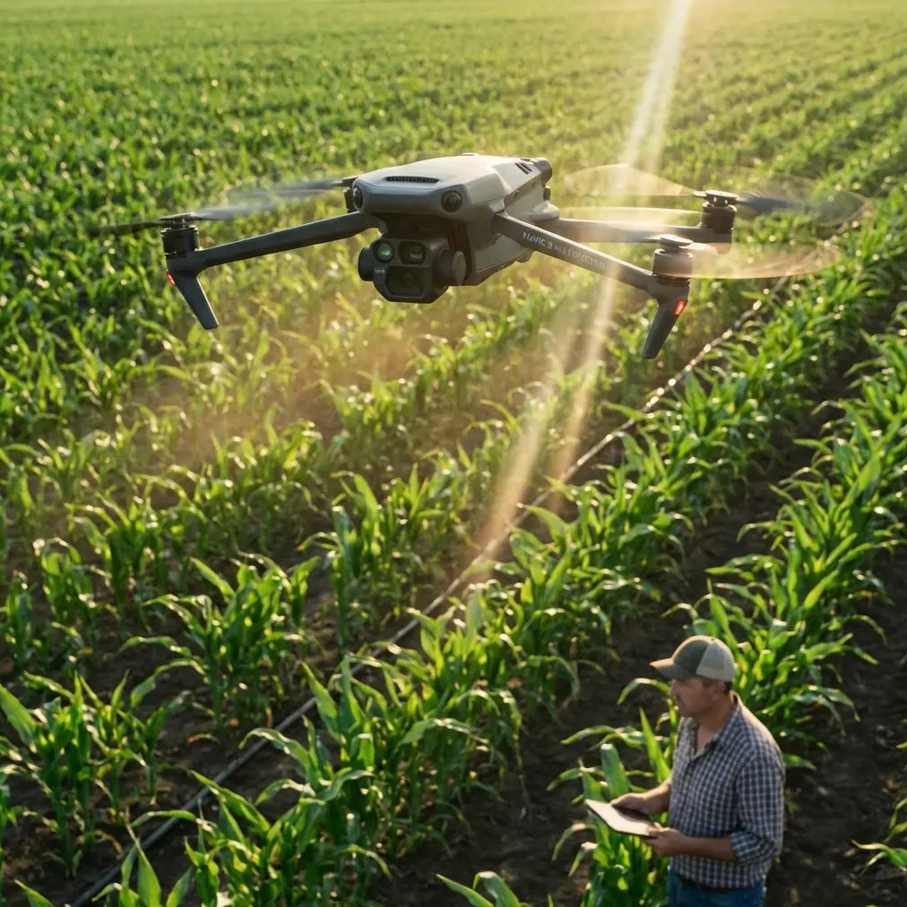
Mavic 3M on Extreme-Temperature Construction Sites: A Practical Field Method That Holds Up
META: A field-focused guide to using the DJI Mavic 3M for construction site inspection in extreme temperatures, with RTK workflow, antenna positioning, flight discipline, and data interpretation tips.
Construction sites punish weak workflows.
Heat shimmer bends your visual judgment. Winter wind drains batteries faster than expected. Dust, reflective surfaces, steel, concrete, temporary structures, and changing access routes all add friction. The Mavic 3M is often discussed through its multispectral capabilities, but on a construction site in extreme temperatures, the real differentiator is not the brochure feature list. It is how consistently you can collect usable, repeatable data when the environment is working against you.
That is where disciplined operating method matters.
I approach the Mavic 3M less as a flying camera and more as a compact measurement system. For site inspection, that means three priorities: stable positioning, clean flight geometry, and trustworthy onboard data. If any one of those slips, your outputs become harder to compare across days, crews, and weather windows.
Why this matters now
The low-altitude economy in China continues to mature, and the capital flowing into the sector is a useful signal of what operators should expect next. In the first quarter of 2025, multiple companies in the sector completed financing rounds spanning counter-UAS, eVTOL, hydrogen electric control, and unmanned cargo aircraft. One detail stands out: on March 28, 2025, Zhidao Technology completed an A+ round worth tens of millions of RMB, led exclusively by Shanghai Yichen Capital, while expanding beyond Beijing and Tianjin with a new base in Rizhao, Shandong.
That matters even if your daily work is a Mavic 3M over a building site rather than a factory floor or logistics corridor. Financing and new base expansion point to a broader truth: drone operations are moving from isolated pilot skill to regionalized, system-level delivery capacity. Clients will increasingly expect repeatable inspection standards, not just airborne imagery. The Mavic 3M fits that shift well, but only if operators use it with procedural rigor.
The extreme-temperature problem is usually not what people think
Most pilots assume temperature mainly affects endurance. It does, of course. But the larger operational problem is that extreme heat or cold exposes weak planning.
In hot conditions, a crew may rush to launch before thermal turbulence worsens. In cold conditions, they may abbreviate setup to reduce time on the ground. Both habits create the same outcome: poor reference discipline and avoidable data inconsistency.
A useful lesson comes from classic flight training rather than modern enterprise marketing. One training text on model aircraft emphasizes two habits that remain surprisingly relevant for commercial drone work: first, survey the flying environment carefully; second, choose ground reference markers before the maneuver, not during it. The text explains that beginners often start correcting their line after the action begins, while experienced pilots ensure the aircraft is already on the correct path before the maneuver starts.
That principle transfers directly to Mavic 3M site inspection.
If you wait until the mission is underway to decide where your visual references are, where your signal shadows may occur, or where your clean approach line should be, you are already behind the aircraft. In extreme temperatures, that delay costs more because you have less margin for repeated flights.
Start with a site geometry check, not the aircraft
Before powering the Mavic 3M, walk the inspection corridor.
Identify three things:
Your visual reference line
Choose fixed ground markers that help you maintain a consistent path parallel to the inspection target. On a construction site, these may be a fence line, slab edge, crane pad boundary, stacked materials row, or haul road stripe.Your signal obstruction zones
Temporary office containers, steel framing, scaffold wraps, and concrete cores can degrade your command link or GNSS reliability. Mark these mentally before takeoff.Your thermal distortion zones
Midday paved surfaces, rooftop mechanical areas, and fresh concrete can create turbulence and shimmer. If possible, avoid collecting your baseline inspection run over those areas at peak heat.
This is not just pilot neatness. It improves repeatability. The old training logic was simple: a good line at entry reduces the need for correction later. For Mavic 3M inspections, that means straighter image overlap, more consistent swath width, and fewer data gaps when comparing orthomosaics or multispectral layers over time.
RTK fix rate is only useful if your flight path is disciplined
The Mavic 3M’s value rises sharply when you are trying to detect change, not just document existence. That is why centimeter precision and RTK Fix rate get so much attention. But a strong fix alone does not rescue a sloppy mission.
A site team may brag about achieving excellent RTK lock, then fly inconsistent lines with variable altitude over stockpiles, partial scaffold shading, and abrupt yaw corrections near structures. The resulting map may still georeference well, yet the inspection quality degrades because the scene was captured with unstable geometry.
For construction monitoring in extreme temperatures, I recommend treating RTK as a stabilizer for a disciplined plan, not a substitute for one.
Operationally, that means:
- keep your launch area open and stable
- verify the RTK status before entering the main capture corridor
- avoid unnecessary pauses over heat-plume areas
- maintain a consistent relationship to the structure under review
- re-fly only clearly defined segments instead of improvising a second pass
The point is consistency. If your centimeter precision is real, then your mission design should honor it.
Antenna positioning advice for maximum range
This is one of the simplest ways to improve field performance, and crews still neglect it.
When inspecting a long construction corridor or multi-block site, your controller antenna orientation should be set to preserve the strongest broadside relationship with the aircraft rather than pointing the tips directly at it. In plain terms: present the antenna faces toward the aircraft’s operating area, and keep your body from becoming part of the obstruction. If you are moving around trucks, barriers, or rebar bundles, even small changes in your own position can affect link quality.
On complex sites, I advise selecting a pilot station with these characteristics:
- slightly elevated if available
- clear forward line of sight
- away from parked plant and steel stacks
- not directly under roof overhangs or netting
- positioned so the aircraft spends most of the mission in front of the controller, not off your shoulder
Range is not just about hardware. It is about geometry. The same is true for mapping quality.
If your team wants a site-specific antenna and setup checklist for Mavic 3M operations, you can request one here: https://wa.me/85255379740
Use onboard data like an investigator, not a spectator
One of the most underused ideas in drone operations comes from educational drone telemetry training: battery percentage, speed, acceleration, barometric altitude, and TOF distance data can all help reconstruct what happened during flight. That source makes a practical point. Battery level can help determine whether a crash or forced descent was tied to low power or battery fault. Speed and acceleration can help indicate whether an impact occurred before the loss event. Barometric altitude logs record flight elevation, while TOF modules can provide obstacle-related distance information during the mission.
For Mavic 3M construction work, this is operationally significant in two ways.
1. It improves incident diagnosis
Extreme temperatures raise the odds of ambiguous events: abrupt return-to-home decisions, short-duration signal interruptions, obstacle alerts near façade edges, and battery behavior that feels “off” without being catastrophic. If your workflow includes post-flight log review, you can separate pilot error from environmental effect much faster.
Suppose the aircraft descended earlier than expected near a partially enclosed upper deck. If the battery percentage remained healthy, but speed and acceleration changed sharply just before the event, that points you toward collision or evasive input rather than power limitation. If TOF records indicate proximity changes near obstructions, you gain further context.
2. It strengthens repeatable inspection planning
The same telemetry is not only for troubleshooting. It helps optimize future runs. If barometric altitude and obstacle-distance data show repeated vertical corrections over one section of the site, that is a clue your route design is unstable there. In heat or cold, those corrections often increase battery strain and reduce image consistency. A better line or different pilot position can solve the root problem.
This is where serious operators separate themselves. They do not merely archive flights. They read them.
Multispectral on construction sites: useful, but only with purpose
The Mavic 3M is associated with multispectral work for obvious reasons. Yet on construction sites, that capability should be applied carefully rather than performatively.
Multispectral data can support surface condition review, drainage pattern interpretation, disturbed-ground tracking, revegetation compliance around site boundaries, and broader land-management context around active development zones. It can also help where standard RGB imagery struggles to show subtle pattern differences across large disturbed areas.
Still, if your inspection brief is structural progress, earthwork volume change, façade condition, or temporary access verification, the real value may come from your ability to pair multispectral collection with disciplined spatial control and repeatable route design. Good data capture logic matters more than collecting every mode because the aircraft can.
That is also why terms borrowed from agricultural operations, such as spray drift or nozzle calibration, should not be forced into a construction narrative. They belong to different mission classes. What does transfer is the precision mindset behind them: if an industry learns to care about exact application width and repeatable coverage, construction inspection teams should care just as much about swath width, overlap consistency, and route repeatability.
A practical hot-weather workflow for Mavic 3M
Here is the method I recommend for site teams working in severe heat:
1. Build the route around the cleanest air window
Launch earlier, before reflective surfaces amplify turbulence.
2. Preselect visual references on the ground
Borrowing from proven flight training logic, do not start the line and then try to fix it. Pick your reference markers first.
3. Confirm RTK and hold a disciplined first pass
Your first pass often becomes the comparison baseline. Protect it.
4. Watch battery behavior with more skepticism than usual
Do not rely on a generic percentage expectation from mild-weather flying. Use actual mission behavior and keep reserve margin.
5. Minimize hover indecision
Hovering while discussing the next move wastes thermal margin and endurance. Decide on the ground.
6. Review telemetry after the mission
Check battery trend, altitude variation, and any sharp speed or acceleration anomalies.
A practical cold-weather workflow for Mavic 3M
Cold creates a different failure pattern.
1. Shorten the first mission segment
Treat the initial flight as a validation pass rather than the full workload.
2. Avoid overcorrecting around structures
Cold fingers and layered gloves can produce abrupt control inputs. Straight entry lines matter even more.
3. Use obstacle-rich sections as separate blocks
Do not combine your most constrained section with the longest route if temperatures are severely low.
4. Compare battery performance against prior winter logs
Telemetry trends are more useful than memory.
5. Keep the pilot station simple
In cold conditions, complexity invites mistakes. A clear line of sight and stable stance beat constant repositioning.
What makes a Mavic 3M inspection program credible
Not the aircraft alone.
Credibility comes from a workflow that can explain itself. If a client asks why one week’s data aligns better than another’s, you should be able to answer with specifics: pilot station selection, reference-line planning, RTK stability, battery trend review, and environmental constraints. If a flight anomaly occurs, you should have telemetry-based reasoning rather than guesswork.
That is where the source material behind this discussion becomes surprisingly relevant. On one side, the 2025 financing activity in the low-altitude sector shows an industry scaling toward infrastructure, capacity, and industrial seriousness. On the other, training and telemetry references remind us that operational excellence still depends on fundamentals: choose reference markers before flight, maintain the proper line early, and use flight data to reconstruct what actually happened.
The Mavic 3M is a capable platform. On extreme-temperature construction sites, its advantage is realized when those fundamentals are applied with consistency. Centimeter precision only matters if the route is repeatable. Multispectral capability only matters if the data capture is intentional. Maximum range only matters if antenna orientation and pilot position preserve the link.
That is the difference between flying a drone and running an inspection system.
Ready for your own Mavic 3M? Contact our team for expert consultation.