Mavic 3M for Windy Solar Farm Scouting: What Actually
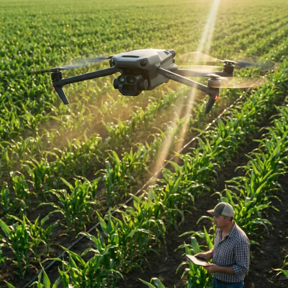
Mavic 3M for Windy Solar Farm Scouting: What Actually Matters in the Field
META: A field-focused look at using Mavic 3M for windy solar farm scouting, with lessons from AI wall inspection, quadcopter flight behavior, and practical workflow choices that improve usable data.
Wind changes everything on a solar site.
Not in the abstract. In the most practical sense possible. It changes how steadily the aircraft can hold line, how consistently your overlap stays intact, how much trust you can place in edge-of-array imagery, and whether your inspection run produces clean, actionable data or a folder full of maybes. For teams looking at the Mavic 3M for solar farm scouting, that matters far more than spec-sheet theater.
The interesting part is that some of the best clues about how to think about this job do not come from generic “drone for solar” marketing. They come from a few very grounded places: a student-developed AI inspection system for building walls, a technical explanation of how quadcopters actually move, and even a long-endurance aircraft experiment that reminds us what platform design is really about. Put together, they tell a useful story about where the Mavic 3M fits, and where an operator needs to be smarter than the aircraft.
The old inspection mindset breaks down fast
One recent innovation story from Hebei Building Materials Vocational and Technical College centered on a simple pain point: building wall quality checks have traditionally relied on “human eyes plus a hammer.” Their team developed an infrared-and-visual dual-modal AI detection system for finding wall hollowing and water leakage, shifting the process from manual inspection to AI plus drone.
That story is about walls, not solar arrays. But the operational lesson lands directly on a windy solar farm.
Manual inspection methods fail first where coverage is large, surfaces are repetitive, and defects are easy to miss in inconsistent conditions. Solar projects check all three boxes. Hundreds or thousands of modules create a visual pattern that exhausts human attention. Wind adds motion, time pressure, and sometimes the temptation to lower standards just to finish the route. You can walk rows. You can use handheld tools. But once the site is large enough, the inspection bottleneck is not effort alone. It is the mismatch between manual perception and the scale of the asset.
That is exactly why a platform like the Mavic 3M is interesting. Not because it magically solves every inspection problem, but because it shifts scouting from selective observation to structured collection. The value starts with repeatability.
Why the Mavic 3M makes sense for solar scouting
The Mavic 3M sits in a useful middle zone. It is portable enough to deploy quickly across multiple arrays, but advanced enough to support disciplined mapping and multispectral workflows. For solar-farm scouting, that combination matters more than brute size. Large fixed-wing systems can cover more acreage in a single flight, but solar sites often demand tighter operational control around rows, access roads, fencing, inverter pads, and variable terrain. A compact multirotor is often the more realistic instrument.
This is where the basic physics of a quadcopter become more than training-manual trivia.
A DJI educational document explains that a four-rotor drone controls flight attitude by adjusting the speed of all four motors, changing lift and counter-torque to produce vertical movement, pitch, roll, yaw, and even flipping if the differential becomes extreme. It also notes that when all four propeller speeds increase together, total lift rises and the aircraft climbs. When the front two motors slow while the rear two increase, the aircraft pitches forward.
For a windy solar farm, those details are operationally significant.
They explain why gusty conditions show up in your data long before you feel the mission is “unsafe.” The aircraft is constantly modulating motor output to maintain track and attitude. Every correction has consequences: slight changes in ground speed, subtle camera-angle variation, and small inconsistencies in overlap or apparent target geometry. That matters if you are trying to compare thermal or multispectral anomalies across rows with confidence.
In other words, wind is not just a flight comfort issue. It is a data quality issue.
Wind doesn’t ruin missions. Unmanaged compensation does.
Operators often think of wind in simple terms: Can the drone handle it? The better question is: Can your workflow handle what the drone has to do in order to handle it?
On a windy solar farm, the Mavic 3M’s scouting performance depends on three things:
- Path discipline
- Positional confidence
- Sensor consistency
If your route planning is loose, wind amplifies the weakness. If your positional solution is weak, a gust becomes a mapping problem. If your capture settings are not tuned for the site, the aircraft may still finish the mission while quietly degrading the output.
This is where terms like RTK fix rate and centimeter precision stop being buzzwords and start becoming time savers. On a large energy site, your team often needs to return to the exact section of array that triggered concern on a previous pass. A strong RTK workflow reduces the “which panel string was that?” problem. When wind pushes the aircraft into constant micro-corrections, reliable positioning helps preserve a coherent map even if the air was less than cooperative.
A poor fix rate in those conditions is expensive in a subtle way. You may still get images. You may still get a stitched result. But when the operations manager asks for a revisit on a specific anomaly, your confidence shrinks.
Multispectral has a place, but only if the mission is designed around it
The Mavic 3M attracts attention because of its multispectral capabilities, and rightly so. But on solar farms, operators sometimes overestimate what the sensor mix can do without rigorous mission design. The real strength is not simply that multiple bands exist. It is that they can be captured in a structured, georeferenced workflow across a large site and compared over time.
That is useful for broader land and vegetation context around the solar asset: encroachment near perimeter areas, drainage changes, surface conditions along service tracks, and site-management patterns that affect maintenance planning. If vegetation management intersects with nearby agronomic land, discussions around spray drift, nozzle calibration, and boundary assessment can become relevant to the wider property workflow, even if they are not core solar diagnostics. The Mavic 3M is valuable in those mixed-use environments because it allows one aircraft program to support more than one operational question.
But wind still dictates whether the multispectral data is genuinely useful. If your flight altitude and swath width are selected only for efficiency, not for the day’s air conditions, you risk collecting broad coverage with inconsistent interpretability. Wider swaths save time, yes. They also leave less room for alignment drift and edge distortion to hide.
A good windy-day operator usually makes the unglamorous choice: shorten the mission blocks, tighten the overlap, and accept that total site coverage may require an extra sortie.
That decision is often the difference between a map the client can defend and one they only use as a visual reference.
The fixed-wing endurance fantasy is not the answer here
There is a temptation in large-area energy work to assume that longer endurance is always the better answer. A technical report on MIT’s “Jungle Hawk” is a good reminder that platform design is a trade study, not a race. That aircraft reportedly had a 7.3-meter wingspan, weighed 68 kilograms, carried 4.5 to 9 kilograms of equipment, and stayed airborne for 5 days at about 4,500 meters using a 5-horsepower gasoline engine.
Impressive. Also beside the point for most solar scouting missions.
The significance of that case is not that solar sites need multi-day gasoline aircraft. It is that endurance gains come with design consequences. MIT’s team moved away from solar power partly because seasonal and latitude limits made the concept less practical. They chose a different propulsion and glide-oriented approach because the mission demanded it.
That same principle applies when choosing the Mavic 3M. The right aircraft is not the one with the biggest theoretical coverage number. It is the one whose deployment pattern matches the job: rapid setup, precise low-altitude work, dependable repeat passes, and tight maneuvering in operational spaces.
For windy solar farms, a compact multirotor can be the more productive system precisely because it can be repositioned quickly, relaunched from closer staging points, and used to inspect problem areas immediately after a mapping run. Endurance is useful. Mission agility is often better.
A small accessory can make a disproportionate difference
One detail that gets overlooked in field planning: third-party accessories can meaningfully improve the Mavic 3M’s practicality when the wind picks up.
A simple example is a high-visibility landing pad with weighted edges or ground stakes. That may sound minor compared with sensors and RTK, but on gravel service roads, dry grass margins, and dusty inverter areas, it solves two recurring problems at once: cleaner takeoff/landing and safer, faster redeployment. In gusty conditions, rotor wash can pull dust and debris into the workflow at exactly the moment you need a reliable relaunch. Better launch discipline protects the payload environment and reduces delays between site sections.
I have also seen teams gain real efficiency from third-party tablet hoods and rugged controller mounts. Not glamorous. Very effective. If your pilot is fighting glare while trying to assess line integrity, overlap, and telemetry in bright reflective conditions around solar modules, the mission quality suffers before the aircraft even reaches the far row.
If you want to compare practical field accessories and deployment setups with someone who understands commercial drone workflows, this WhatsApp field-support line is a sensible place to start.
A better problem-solution workflow for Mavic 3M solar scouting
Here is the cleaner way to think about the Mavic 3M on a windy solar site.
Problem: Visual checks are too slow and too selective
Walking arrays catches obvious issues, but it does not scale well. Repetitive assets create inspection fatigue. Wind shortens the useful window for manual work.
Solution: Structured aerial collection
Use the Mavic 3M to create repeatable missions that document the site the same way each time, so deviations stand out instead of hiding inside memory and field notes.
Problem: Wind compromises consistency before it compromises safety
The drone may remain flyable while your data quietly becomes less defensible.
Solution: Build missions around control margins
Reduce block size, manage swath width conservatively, prioritize RTK stability, and preserve enough overlap that gust-induced corrections do not break the final product.
Problem: Operators chase acreage instead of decision quality
Trying to finish the entire site in one pass often produces weaker outputs than splitting the work.
Solution: Treat windy-day productivity as a sequencing problem
Cover the highest-priority arrays first. Revisit edge cases with targeted flights. Use the Mavic 3M’s portability as an advantage, not a compromise.
Problem: Teams confuse platform capability with workflow maturity
A good aircraft cannot compensate for sloppy mission planning.
Solution: Standardize deployment
Use repeat launch zones, consistent battery rotation logic, accessory setups that reduce dust and glare, and post-flight naming conventions that tie anomalies back to exact array sections.
What this means for real operators
The most useful way to evaluate the Mavic 3M for windy solar farm scouting is not “Can it fly in wind?” It can. The sharper question is this:
Can your team still produce clean, repeatable, positionally reliable site intelligence when the aircraft is working harder to maintain attitude and track?
That brings us back to the two most valuable reference lessons.
First, the Hebei wall-inspection project shows why inspection industries move from manual judgment toward AI-enabled, dual-modal aerial workflows. The gain is not just speed. It is the ability to detect patterns at scale with more consistency than traditional “eyes and tools” methods.
Second, the quadcopter flight explanation matters because it tells you what the aircraft is physically doing every second in gusty air: constantly redistributing motor output to hold the mission together. Once you understand that, you stop treating wind as a simple go/no-go factor and start managing it as a variable in data acquisition.
That shift in mindset is where better solar scouting starts.
The Mavic 3M is not interesting because it replaces judgment. It is interesting because, in the hands of a disciplined operator, it gives judgment something more reliable to work with.
Ready for your own Mavic 3M? Contact our team for expert consultation.