Mavic 3M in Windy Vineyards: A Field Report on Seeing More
Mavic 3M in Windy Vineyards: A Field Report on Seeing More Than the Leaves
META: Practical Mavic 3M field report for vineyard inspection in wind, covering multispectral workflow, RTK discipline, battery handling, image judgment, and why pilot technique matters as much as hardware.
Wind exposes bad habits fast.
That is especially true in vineyards, where rows funnel airflow, leaf movement tricks your eye, and the margin between a useful map and a misleading one can be smaller than a few centimeters. I’ve spent enough time around vineyard blocks to know that most disappointing Mavic 3M missions are not caused by the aircraft itself. They usually come from the same mistake photographers make with their phones: assuming the tool will do the thinking for them.
A recent photography piece made that point well. Two people can stand in front of the same scene with the same device and come back with completely different results, not because one has magical hardware, but because one understands composition, lighting, and editing. That idea translates directly to Mavic 3M operations. In vineyard inspection, the difference between mediocre output and operationally valuable output rarely starts with the sensor sheet. It starts with flight discipline, light awareness, and how the data is interpreted afterward.
That matters in windy conditions more than most operators expect.
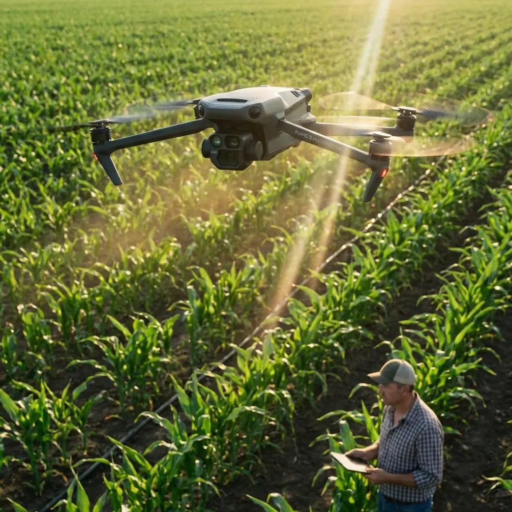
The Mavic 3M is not just collecting images
The Mavic 3M earns its place in viticulture because multispectral data can reveal variation that the naked eye often misses from the ground. But if you fly a windy site like a casual camera mission, the data can still end up looking technically complete while being agronomically weak.
In practice, vineyard inspections are rarely just about “finding stressed vines.” You’re trying to answer narrower questions:
- Is stress patterning aligned with irrigation zones?
- Is vigor dropping on row ends where exposure and wind desiccation are stronger?
- Is there a directional signature that suggests spray drift rather than uniform disease pressure?
- Are weak areas repeating with terrain or drainage?
That is why the pilot’s job is part image capture, part pattern control.
The aircraft can deliver centimeter-level positioning when conditions and workflow support it, and RTK discipline plays a bigger role here than many crews admit. If the RTK fix rate is inconsistent, row-to-row comparison becomes less trustworthy, especially when you revisit the same block to monitor change. In a vineyard, where narrow rows demand clean spatial alignment, “close enough” tends to become “expensive guesswork” later.
Wind changes what “good coverage” means
On a calm morning, a vineyard mapping mission can feel routine. In crosswinds, the same block becomes a test of consistency.
Leaves are moving. Shadows are shifting. The aircraft may still hold track well, but the canopy surface you are imaging is no longer static. That doesn’t mean you stop flying. It means you adjust your standard for what counts as usable capture.
The first operational significance is overlap quality. In vineyards, wind-driven canopy motion can create subtle differences from image to image that reduce consistency in stitched outputs or complicate vegetative index interpretation. The map may still process, but the confidence behind edge-level anomalies drops. I tell crews to stop thinking only about “did the mission finish?” and start asking “did the vine structure present consistently enough to support a decision?”
The second is swath planning. Wider swath assumptions may look efficient on paper, but in gusty corridors between rows, they can increase the visual instability of the canopy across frames. A slightly more conservative mission geometry often gives you better interpretability later, which matters more than shaving a few minutes from flight time.
A vineyard lesson borrowed from flight training
One of the more useful references I’ve seen recently wasn’t about multirotors at all. It came from aerobatic model aircraft training and described how a full Cuban Eight is really built from two half maneuvers, with emphasis on rhythm, symmetry, and starting from the correct line. The text makes a sharp point: if you do not establish a path parallel to the runway before beginning, even a small error at the start can grow until the aircraft ends up badly displaced by the end.
That is exactly how Mavic 3M work in vineyards should be thought about.
A mapping mission is also a rhythm problem. Each leg sets up the next. If your initial line is not truly aligned with the rows, if your speed is not matched to the wind, or if your altitude choice does not fit canopy density and row spacing, the error compounds. What looked like a minor deviation in the first pass becomes visible row drift, uneven sampling, or messy edge data later.
The aerobatic reference also notes that some maneuvers take at least twice as long as earlier practice figures and include two changes in direction. Vineyard blocks in wind behave the same way from a workload standpoint. A mission that seems simple on a screen can demand much more pilot attention in the field when the airflow shifts around slopes, trellis ends, and access roads. That is why experienced crews do not rush the first leg. They establish the line first, then trust the rhythm.
If you want help comparing row alignment strategies for difficult sites, you can message our field team here.
Light is not a background variable
Another transfer from the photography world is even more relevant than people think: lighting changes the story.
The phone-photography article broke image quality into three practical elements—composition, lighting, and editing. That framework is surprisingly useful for Mavic 3M vineyard operations.
1. Composition becomes mission design
For a drone, composition is not artistic framing. It is row angle, flight direction, altitude, and coverage boundaries. In a vineyard, the best mission is often the one that makes variability easiest to compare, not the one that covers the largest area in one go. When the rows are the structure, your “composition” should respect them.
2. Lighting becomes data stability
When the article says ordinary scenes improve when light is understood, the same applies to multispectral work. Windy vineyards often tempt operators to fly whenever there is a break in the schedule, but changing light can exaggerate apparent differences across blocks. If your mission starts under one cloud condition and finishes under another, you may introduce interpretation noise that gets mistaken for vine response.
3. Editing becomes agronomic judgment
For a phone image, editing helps reveal intent. For Mavic 3M, processing and layer interpretation play the same role. Good output is not the raw map alone. It is the ability to separate real canopy variation from artifacts caused by motion, shadow, border effects, or uneven reflectance conditions.
The tool does not replace judgment. It rewards it.
What windy vineyards actually demand from the operator
In broad-acre work, wind is often discussed in terms of whether the aircraft can fly safely. In vineyards, there is a second question: can the crop still be read cleanly?
Here is what I look for before trusting a mission set.
Stable RTK behavior
If you are counting on centimeter precision for repeat monitoring, watch the RTK fix rate before launch and during the first segment, not just in the post-flight summary. In vineyards, a few centimeters matter because rows are narrow and management decisions are spatially specific. A weak fix can blur the comparison between canopy response and field operations like irrigation passes or localized treatment areas.
Controlled relation to row direction
If wind is crossing the rows hard, I may still keep the mission aligned with the row structure because interpretation usually benefits from spatial coherence. But I will review whether groundspeed, turn behavior, and overlap are still giving me a clean dataset. The row is the reference language of the vineyard. Break that language casually and the map becomes harder to trust.
Awareness of spray context
Growers often want vineyard drone inspections close to treatment windows. That is useful, but it also creates a trap. If you’re evaluating irregular vigor after a spray event, remember that apparent stress bands can reflect spray drift, uneven deposition, or nozzle calibration issues rather than plant health alone. This is where drone data becomes more powerful when paired with operator memory and field notes. A map without operational context can send a crew to the wrong conclusion.
A battery management habit that saves return flights
Here is one field habit I wish more Mavic 3M crews learned early: never treat battery percentages as if all vineyard terrain consumes power equally.
In windy vineyard work, I mentally divide the mission into “easy legs” and “expensive legs.” The expensive legs are the ones facing headwind during the return side, climbing over a rise, or crossing the most turbulent edge of the block. If I know those are coming late in the mission, I do not wait for a low-state warning to make the decision. I land early and swap.
That sounds conservative until you have watched a battery drop faster than expected on the down-block return because the canopy corridor is acting like a wind tunnel. The practical benefit is not just safety. It protects data continuity. A rushed final segment flown under battery anxiety usually has worse consistency, sloppier oversight, and weaker edge discipline.
The best crews build battery handling into block strategy. They do not ask, “Can this battery finish?” They ask, “Can this battery finish while preserving the standard of data we need?”
Why training culture matters more than feature lists
One of the educational drone references in the source material described a 220-page learning approach built around flight principles, flight safety, remote control, programming flight, formation flight, and scenario applications. That is a smart model for why some Mavic 3M operators outperform others even with identical equipment.
The point is not whether a vineyard crew will practice formation routines or educational programming. The point is that structured training produces better field judgment. People who understand flight principles and safety discipline tend to fly cleaner missions. People who think in scenarios tend to adapt faster when wind, terrain, or canopy conditions change.
In vineyard operations, that difference is visible.
A lightly trained pilot may see the Mavic 3M as a data collection shortcut. A well-trained pilot sees it as a precision platform whose value depends on repeatability. That mindset changes everything from preflight checks to route adjustments to how borderline data is handled after processing.
The Mavic 3M’s real advantage in vineyards
The strongest Mavic 3M results I’ve seen in vineyards do not come from dramatic one-off discoveries. They come from repeatable block intelligence.
You fly the same property across the season. You maintain row-consistent mission logic. You keep RTK behavior clean. You control for wind and light as much as conditions allow. You interpret anomalies with knowledge of spray drift, irrigation layout, and field operations.
Then the maps start telling a believable story.
That story may show exposed rows on a ridge losing vigor before the rest. It may reveal that a low-performing strip follows an emitter issue, not disease pressure. It may suggest that one block’s variability aligns suspiciously well with application direction, sending the team back to nozzle calibration instead of blaming nutrition. Those are useful findings because they connect airborne data to operational action.
And that, really, is the dividing line.
The Mavic 3M is not valuable because it can look at a vineyard from above. Plenty of aircraft can do that. It is valuable when the operator understands that image quality, spatial discipline, and agronomic context all have to meet in the same mission. Hardware opens the door. Technique decides whether anything meaningful walks through it.
Ready for your own Mavic 3M? Contact our team for expert consultation.