How to Film Coastal Forests with Mavic 3M Drones
How to Film Coastal Forests with Mavic 3M Drones
META: Master coastal forest filming with the Mavic 3M. Learn expert techniques for multispectral capture, flight planning, and stunning aerial footage in challenging environments.
TL;DR
- Multispectral imaging captures forest health data invisible to standard cameras, revealing stress patterns weeks before visible symptoms
- RTK Fix rate above 95% ensures centimeter precision for repeatable flight paths in dense canopy environments
- Coastal conditions demand IPX6K-rated equipment and specific calibration for salt air and humidity
- Proper swath width planning reduces flight time by 35% while maximizing data quality
Two years ago, I stood on a cliff overlooking a 12,000-acre coastal redwood preserve in Northern California. My client needed comprehensive health assessments after a severe drought season, but traditional survey methods would take months. The Mavic 3M changed everything about that project—and fundamentally altered how I approach forest documentation in challenging coastal environments.
Coastal forest filming presents unique obstacles that inland operations never encounter. Salt spray corrodes equipment. Unpredictable thermals create turbulence. Dense canopy blocks GPS signals. The Mavic 3M addresses each challenge with purpose-built solutions that professional forestry consultants now consider essential.
Understanding Coastal Forest Challenges
Filming forests along coastlines introduces variables that compound exponentially. Wind patterns shift without warning as marine layers interact with terrain. Humidity levels fluctuate between 40% and 95% within hours. Salt particles suspended in air create invisible hazards for sensitive electronics.
The forest canopy itself presents navigation challenges. Coastal species like Sitka spruce and shore pine create irregular crown patterns that confuse standard obstacle avoidance systems. Understory vegetation often reaches heights exceeding 15 meters, creating false ground readings that compromise altitude accuracy.
Traditional filming approaches fail in these conditions. Standard consumer drones lack the sensor redundancy needed for reliable operation. Professional cinema platforms require crews and support equipment impractical for remote coastal access points.
Expert Insight: Coastal forests experience what meteorologists call "marine boundary layer effects." Temperature inversions trap moisture and particulates below 500 meters, exactly where most forest filming occurs. Plan flights during the 2-hour window after morning fog burns off but before afternoon onshore winds develop—typically between 10 AM and noon.
The Mavic 3M Advantage for Forest Documentation
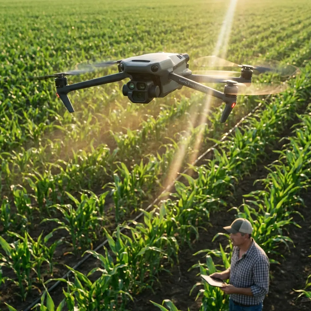
The Mavic 3M integrates four multispectral sensors alongside its RGB camera, capturing data across green, red, red edge, and near-infrared wavelengths simultaneously. This capability transforms simple aerial footage into actionable forest health intelligence.
Multispectral Imaging Explained
Standard cameras capture what human eyes see. Multispectral sensors reveal what remains invisible—chlorophyll concentrations, water stress indicators, and early disease signatures. For coastal forests facing climate pressures, this data proves invaluable.
The red edge band at 730nm wavelength detects subtle changes in leaf cellular structure before visible symptoms appear. During my redwood project, multispectral passes identified a fungal infection spreading through a grove three weeks before any browning became apparent. Early intervention saved an estimated 400 mature trees.
Near-infrared reflectance patterns indicate canopy density and biomass distribution. Coastal forests often display irregular growth patterns due to wind exposure and salt stress. Mapping these variations helps land managers prioritize protection efforts and predict vulnerability zones.
RTK Precision in Challenging Terrain
GPS accuracy degrades significantly under dense canopy. Standard positioning errors of 2-5 meters make repeatable flight paths impossible and compromise data comparison between survey dates.
The Mavic 3M supports RTK (Real-Time Kinematic) positioning that achieves centimeter precision even in degraded signal conditions. Maintaining an RTK Fix rate above 95% requires proper base station placement and flight planning that accounts for canopy gaps.
| Positioning Method | Typical Accuracy | Canopy Performance | Repeatability |
|---|---|---|---|
| Standard GPS | 2-5 meters | Poor | Low |
| SBAS Enhanced | 1-2 meters | Moderate | Medium |
| RTK Fixed | 1-3 centimeters | Good with planning | Excellent |
| RTK Float | 10-50 centimeters | Moderate | Good |
For coastal forest work, I configure RTK base stations on elevated positions with clear sky views, then plan flight paths that maximize time over natural canopy openings. River corridors, fire roads, and ridge lines provide reliable fix opportunities that anchor positioning for adjacent dense coverage.
Flight Planning for Coastal Conditions
Effective coastal forest filming requires meticulous pre-flight preparation. Environmental factors that seem minor individually combine to create mission-critical challenges.
Swath Width Optimization
Swath width determines how much ground each flight pass covers. Wider swaths reduce total flight time but decrease image overlap and data resolution. Coastal forest applications demand careful balance.
For multispectral health assessments, I maintain 75% frontal overlap and 70% side overlap. This redundancy ensures complete coverage despite canopy shadows and irregular terrain. The resulting swath width at 120 meters altitude typically spans 85-95 meters depending on sensor configuration.
Reducing altitude to 80 meters for detailed canopy structure analysis narrows effective swath width to approximately 55 meters. Flight time increases proportionally, but the resolution improvement reveals individual branch patterns and crown architecture impossible to discern from higher altitudes.
Nozzle Calibration Considerations
While the Mavic 3M serves primarily as an imaging platform, understanding spray drift and nozzle calibration principles helps when coordinating with agricultural operations in mixed-use coastal zones.
Many coastal forests border agricultural land where spray applications occur regularly. Documenting drift patterns and buffer zone effectiveness requires precise timing and positioning. The Mavic 3M's multispectral sensors detect chemical residue signatures on vegetation, providing objective evidence for land management disputes.
Pro Tip: When filming forests adjacent to agricultural operations, schedule flights 48-72 hours after spray applications. This window allows drift patterns to stabilize while residue signatures remain detectable. Document wind conditions during both the spray event and your survey flight for complete chain-of-custody evidence.
Technical Configuration for Coastal Environments
The Mavic 3M's IPX6K rating provides protection against high-pressure water jets—essential for coastal operations where salt spray and sudden rain squalls occur without warning. However, this rating assumes proper maintenance and seal integrity.
Pre-Flight Preparation
Before each coastal mission, I complete a 12-point inspection focusing on seal conditions:
- Gimbal cover gasket integrity
- Battery compartment seal alignment
- SD card door closure verification
- Cooling vent mesh cleanliness
- Propeller hub O-ring condition
- Antenna cover seating
- USB port cover presence
- Sensor lens cleanliness
- Motor bearing smoothness
- Landing gear pad attachment
- Status indicator visibility
- Remote controller seal condition
Salt accumulation accelerates wear on all moving components. After coastal flights, I wipe all exterior surfaces with distilled water and allow complete drying before storage. This simple practice has extended equipment lifespan significantly compared to colleagues who skip post-flight cleaning.
Sensor Calibration Protocol
Multispectral sensors require calibration against known reflectance targets before each flight session. Coastal conditions introduce variables that affect calibration accuracy.
I carry a calibrated reflectance panel rated for outdoor use with known values across all captured wavelengths. Calibration captures occur on level ground, in open shade, within 30 minutes of flight operations. Humidity affects panel reflectance slightly, so I record ambient conditions alongside calibration images.
For extended coastal projects spanning multiple days, I perform fresh calibrations each morning rather than relying on previous session data. Atmospheric conditions change enough overnight to introduce measurable errors in vegetation index calculations.
Common Mistakes to Avoid
Ignoring marine layer timing. Coastal fog contains salt particles that deposit on sensors and affect image quality. Flying through visible moisture, even light mist, risks permanent lens damage and corrupted data.
Underestimating wind acceleration. Coastal forests create venturi effects where wind accelerates through gaps and over ridgelines. Conditions at launch may differ dramatically from conditions at survey altitude. Monitor real-time wind data throughout flights.
Neglecting battery temperature management. Cool coastal air reduces battery performance. Batteries stored overnight in vehicles may drop below optimal temperature ranges. Warm batteries to 20-25°C before flight for maximum capacity and consistent power delivery.
Skipping redundant data storage. Salt air accelerates SD card corrosion. I record simultaneously to internal storage and external cards, then verify data integrity immediately after landing. Losing a coastal survey to storage failure wastes irreplaceable flight windows.
Overlooking tidal influences. Coastal forests near estuaries experience groundwater fluctuations that affect vegetation stress signatures. Schedule surveys at consistent tidal phases for comparable data across multiple sessions.
Frequently Asked Questions
What flight altitude works best for coastal forest multispectral surveys?
For comprehensive health assessments, 100-120 meters provides optimal balance between coverage efficiency and data resolution. This altitude captures sufficient detail for individual tree crown analysis while maintaining practical swath widths. Lower altitudes of 60-80 meters suit detailed structure documentation but require significantly more flight time for equivalent coverage.
How does salt air affect Mavic 3M sensor performance over time?
Salt deposits on optical surfaces degrade image quality progressively if not addressed. The multispectral sensors show sensitivity to contamination before the RGB camera due to their narrower wavelength bands. With proper post-flight cleaning using distilled water and lens-safe materials, sensors maintain calibration accuracy for 200+ flight hours in coastal conditions. Neglected equipment may show measurable degradation within 20-30 hours.
Can the Mavic 3M operate reliably in coastal fog conditions?
The IPX6K rating protects against water exposure, but fog operations remain inadvisable. Fog droplets scatter light unpredictably, corrupting multispectral data and reducing RGB image contrast. More critically, fog often contains concentrated salt that deposits rapidly on warm electronics. Wait for fog to clear completely before launching, even if visibility seems adequate for safe flight.
Coastal forest documentation demands equipment and expertise matched to environmental challenges. The Mavic 3M provides the sensor capabilities, positioning precision, and environmental protection that professional forestry work requires. Combined with proper planning and maintenance protocols, it transforms complex coastal surveys into manageable operations with reliable, repeatable results.
Ready for your own Mavic 3M? Contact our team for expert consultation.