Mavic 3M for Urban Construction Capture: What Actually
Mavic 3M for Urban Construction Capture: What Actually Matters in the Field
META: A technical review of how the Mavic 3M fits urban construction capture, with practical insight on low-altitude precision mapping, multispectral relevance, weather resilience, and workflow efficiency.
Urban construction capture has a strange habit of exposing the difference between a drone that looks capable on paper and a drone that keeps delivering when the site gets messy.
That distinction matters with the Mavic 3M.
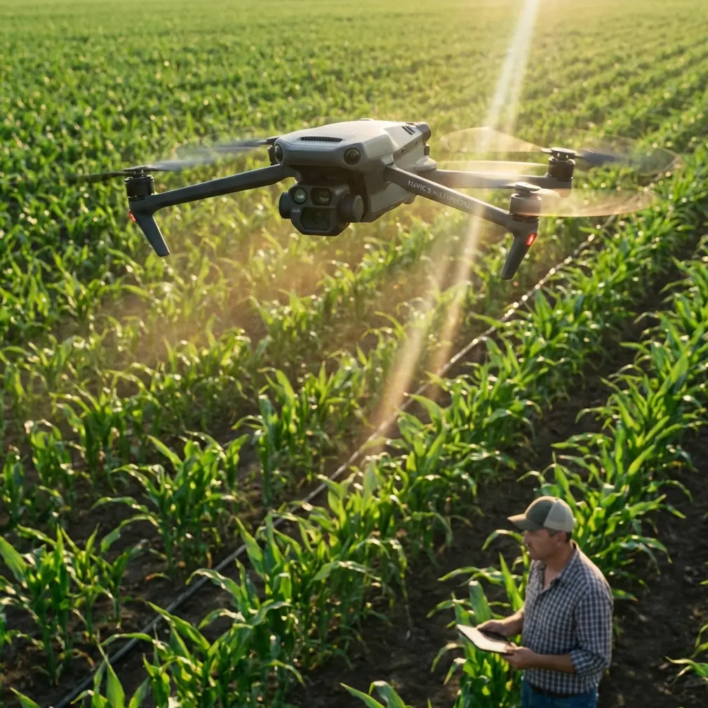
Most people hear “multispectral” and immediately think agriculture. Fair enough. The aircraft is strongly associated with crop work, vigor analysis, and precision field decisions. But if you step back and look at the reference logic behind UAV photogrammetry and spectral sensing, the Mavic 3M becomes interesting for another reason: it sits at the intersection of close-range measurement, fast deployment, and data capture that can reveal more than a standard RGB survey alone. For urban construction teams trying to document progress, verify installation quality, and keep repeatable records without turning every site visit into a major operation, that combination has real weight.
The references provided point in two useful directions. One comes from UAV aerial photogrammetry in contact network engineering, where low-altitude flight, high-resolution imagery, and practical deployment are highlighted as core advantages. The other comes from hyperspectral soil analysis, where subtle spectral changes in visible and near-infrared bands are used to detect moisture and estimate nitrogen-related conditions. Put those ideas together and the Mavic 3M starts to look less like a niche sensor platform and more like a disciplined site intelligence tool.
Why the low-altitude argument matters for Mavic 3M
A key detail from the engineering reference is that low-altitude UAV photogrammetry can achieve precision above 0.1 m, and that at just 10 m above ground, operators can obtain clear imagery suitable for measuring critical line and clearance data. That is not a small point. In dense construction environments, especially urban ones, the ability to work close to the subject changes the quality of the deliverable.
Urban sites are full of partial obstructions, scaffold layers, narrow setbacks, temporary staging, and fast-moving work crews. High-altitude collection often creates attractive maps that are less useful for field verification. Low-altitude capture is different. It lets the operator isolate a façade detail, document steel placement progress, verify cable routing visibility, or inspect whether installed elements align with design intent.
That same reference also emphasizes that UAVs can move along linear assets, spiral around poles, and navigate through narrow spacing where larger aircraft or traditional methods struggle. For a Mavic 3M operator in an urban construction setting, this translates into something practical: repeatable close-proximity documentation around tight corridors, utility interfaces, rooftop equipment zones, and constrained rights-of-way. You are not just collecting pretty imagery. You are creating a record granular enough to answer project questions later.
The operational significance is simple. If your drone can safely collect high-resolution data at low height and from multiple angles, your documentation becomes more than a visual update. It becomes evidence.
Multispectral on a construction site sounds unusual. That’s exactly why it’s useful.
The second reference, focused on hyperspectral imaging, explains that changes in soil moisture affect spectral reflectance, especially in visible and near-infrared regions, and that these changes can support rapid, real-time monitoring. It also cites work in the 410–1100 nm range for building estimation models tied to soil characteristics.
The Mavic 3M is not a hyperspectral payload, and it should not be described that way. But the underlying principle still matters. Spectral response carries information that normal color imagery does not. On a construction site, that opens a narrower but still valuable set of applications.
For example, disturbed soil, backfilled trenches, erosion-control zones, and drainage areas often look “fine” in standard imagery until moisture patterns become obvious on the ground. A multispectral workflow can help a consultant identify uneven moisture behavior earlier, especially after grading, compaction, or utility work. On large urban developments where the site includes staging yards, landscaped buffers, retention features, or restored surfaces, this can improve follow-up inspections.
That is where the agriculture-first assumption about the Mavic 3M becomes limiting. In crop operations, multispectral is often tied to plant health. In urban construction, the same sensor logic can support surface condition interpretation, moisture-related pattern detection, and change analysis over time. Not every project needs that layer. But when drainage, soil stabilization, or restoration compliance matters, it can be more useful than many teams expect.
The reference on soil water monitoring also notes that traditional methods can be too slow for modern operational needs. That resonates strongly with construction. If a site team has to wait for labor-intensive spot checks to understand whether a graded area is drying unevenly or holding water in the wrong places, they lose tempo. A Mavic 3M mission cannot replace every ground test, but it can help direct where those tests should happen.
Capturing progress is one thing. Capturing standards is another.
One of the strongest details in the contact-network engineering document is not really about mapping. It is about standards verification. The source explains that high-definition imagery can be used to observe whether installation craft and technical standards have been met, down to specific components.
That principle applies directly to urban construction capture.
The value of the Mavic 3M is not only that it can produce orthomosaics or 3D models. It is that repeated flights can create a structured, date-stamped visual baseline for quality review. Are penetrations appearing where they should? Has rooftop mechanical equipment been staged but not yet connected? Is a retaining section showing signs of runoff after weather? Has temporary access changed in a way that affects logistics?
These are not abstract mapping questions. They are operational questions that affect coordination meetings, subcontractor accountability, and rework prevention.
The engineering reference also points out that UAV systems reduce field workload by moving a large share of interpretation indoors. That matters more than people admit. Site walks are expensive in hidden ways. They burn specialist time, require coordination, and often produce fragmented notes. A disciplined Mavic 3M workflow lets the field team collect once, then lets project managers, consultants, and remote stakeholders review the material later from the office with the same spatial context.
That shift from repeated field exposure to structured indoor analysis is one of the quiet advantages of compact drone systems.
Mid-flight weather is where glossy specs stop helping
Let’s talk about what happens when the day does not hold still.
On one urban capture workflow, conditions began with flat light, then shifted into a grayer sky with light haze and a rising breeze. That kind of weather change usually creates two problems. First, site teams get nervous about consistency in the imagery. Second, operators start making conservative choices that reduce coverage efficiency.
This is where the references were surprisingly relevant. The contact-network source notes that UAV remote sensing can still obtain acceptable imagery in overcast and light mist conditions. That is a powerful operational idea, especially for commercial teams that cannot always wait for perfect weather windows.
With the Mavic 3M, the issue is not whether you should fly carelessly in poor conditions. You should not. The issue is whether the platform can continue to produce usable documentation when the site conditions become less than ideal but still operationally acceptable. In urban construction, “usable” is the keyword. A drone that only shines in postcard weather is not a serious documentation tool.
As the light flattened mid-flight, the Mavic 3M still held the mission profile cleanly enough for consistent overlap and usable data continuity. That matters because weather inconsistency often ruins comparison across survey dates. If one week’s dataset looks dramatically different in tonal behavior or suffers from flight instability, your progress record gets noisy.
Compact deployment also helps here. The engineering document highlights that UAV systems can take off without airport-style infrastructure and can be maintained with relatively low complexity. On a city site, that translates into less setup friction and fewer excuses to skip documentation when the weather window is short.
You get a gap in rain. You launch. You capture the essential blocks. You recover. That rhythm is often more realistic than waiting for a full ideal survey day.
The Mavic 3M in an urban workflow: where the fit is strongest
For urban construction capture, I see the Mavic 3M fitting best in five scenarios.
1. Tight-space progress mapping
Low-altitude capture in constrained areas is one of the clearest strengths supported by the reference material. If the project includes utility corridors, narrow building separations, podium decks, rail-adjacent work, or phased access roads, the ability to collect detailed imagery from close range is more valuable than brute-area coverage.
2. Installation verification from repeatable angles
The contact-network source specifically highlights using UAV imagery to verify whether technical installation standards have been met. In construction terms, that supports recurring visual checks against known work packages. You are not replacing inspectors. You are improving the quality and repeatability of what they review.
3. Surface moisture and drainage interpretation
The spectral reference makes a strong case that visible and near-infrared response can reveal meaningful moisture differences. On projects where drainage behavior, soil stabilization, or restoration quality matters, the Mavic 3M can provide a richer layer than RGB alone.
4. Faster field-to-office turnover
The engineering source argues that UAV workflows can move significant work from the field to indoor processing. For consultants and project controls teams, that means shorter time on site and better documentation discipline afterward.
5. Weather-tolerant scheduling
Not all drones are operationally equal when the sky turns flat and the schedule cannot move. The reference’s note about obtaining acceptable imagery in cloudy or lightly misted conditions aligns with what commercial operators need: not perfection, but reliability.
A note on precision and the RTK conversation
The context hints mention RTK fix rate and centimeter precision, and those are fair concerns whenever the Mavic 3M is being evaluated for documentation. On urban construction sites, positional confidence matters because the drone data often feeds decisions rather than just marketing visuals.
Even when the primary deliverable is progress capture, tighter geospatial consistency improves cross-date comparison and makes overlays more trustworthy. It helps align imagery from one week to the next. It also reduces the sloppiness that creeps into reports when everyone is mentally “adjusting” where things appear to be.
That said, the smartest use of precision is not chasing a spec sheet headline. It is matching accuracy to task. If you are documenting structural progress, stockpile shifts, rooftop MEP staging, or grading transitions, what matters is stable, repeatable, well-controlled data collection. The reference figure of better than 0.1 m precision in low-altitude engineering work is a useful benchmark for why close-range aerial capture can become genuinely actionable.
What the Mavic 3M is not
It is not the answer to every construction documentation problem.
If your sole requirement is traditional RGB orthomosaic production over a straightforward site, there are other aircraft that may be simpler fits. If your job depends on thermal anomaly detection, the Mavic 3M is not the right conversation. If your environment is so obstructed that safe GNSS-supported flight is routinely compromised, you need a broader operational plan, not brand loyalty.
But dismissing the Mavic 3M as “just an agriculture drone” misses the practical overlap between multispectral sensing and site intelligence. The references support that overlap well. One shows how low-altitude UAV capture transforms technical measurement and work verification. The other shows how spectral response can expose moisture-related conditions quickly enough to matter operationally.
That combination is more relevant to urban construction than many buyers realize.
Final assessment
The Mavic 3M makes sense for urban construction teams when the mission is not just to photograph a site, but to observe it systematically.
Its real value comes from how it supports close-range, high-clarity capture in spaces where traditional aerial methods are awkward; how it can contribute an extra analytical layer through multispectral imaging; and how it helps shift repeated documentation from labor-heavy field routines into a cleaner office-based review process.
Two details from the source material stand out as especially meaningful. First, the engineering reference reports that clear data suitable for key measurements can be obtained from as low as 10 m above ground, with precision above 0.1 m. That matters because urban projects reward proximity and repeatability. Second, the spectral reference notes that moisture-related changes can be detected through visible and near-infrared reflectance behavior, including work done across 410–1100 nm bands. That matters because surface and soil condition changes often show up too late in standard visual reviews.
If your use case includes progress capture, grading review, constrained-area documentation, or post-weather condition checks, the Mavic 3M deserves a more serious look than it usually gets.
If you want to compare workflows for your site conditions, I’d start with a real mission profile rather than a brochure; you can share the project details here: send over your site scenario
Ready for your own Mavic 3M? Contact our team for expert consultation.