Field Report: Using the Mavic 3M to Scout Complex Urban
Field Report: Using the Mavic 3M to Scout Complex Urban Sites With Mapping Discipline, Not Guesswork
META: A field-tested look at how the Mavic 3M can support urban site scouting by borrowing proven emergency mapping and crop-survey workflows, with practical detail on coverage, resolution, team size, and operational decision-making.
Urban site scouting sounds simple until you actually do it.
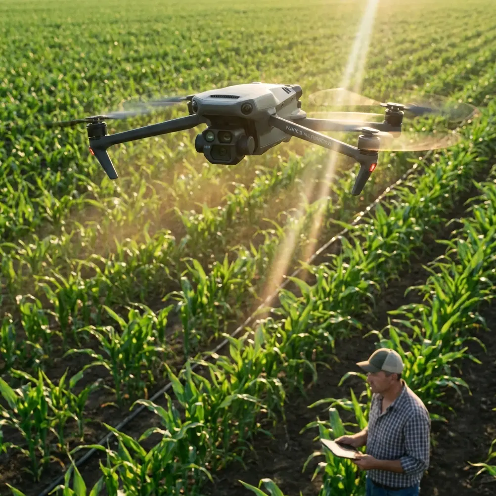
On paper, you need a quick aerial look before crews mobilize. In the field, you’re dealing with signal shadows between buildings, narrow takeoff choices, overhead wires, mixed ground textures, traffic constraints, and the constant pressure to get usable data on the first visit. That is exactly where the Mavic 3M becomes interesting—not because it is marketed as a multispectral platform, but because its value on urban construction reconnaissance comes from disciplined data capture.
I’ve been thinking about that a lot lately while reviewing two very different Chinese drone references: one on emergency mapping and another on lightweight UAV crop survey workflows. At first glance, they have nothing to do with an urban construction scout. One discusses flood response and the need for fast geographic intelligence. The other goes deep into small-team flight planning, image resolution, and a 400 meter by 400 meter mission block. But put those together and you get a practical operating logic for the Mavic 3M in city environments: respond fast, fly methodically, and collect imagery that supports decisions rather than just pretty screenshots.
That distinction matters.
What emergency mapping gets right for urban scouting
One of the strongest points in the emergency mapping solution is brutally simple: UAV aerial survey works in urgent scenarios because it combines speed, resolution, and adaptability to difficult environments. That is not just disaster-language. It applies directly to urban pre-construction scouting.
A downtown lot, a redevelopment parcel, a constrained logistics yard, or a rooftop retrofit site often behaves like a miniature emergency-mapping scene. Access is limited. The ground view is fragmented. Conditions may change by the hour. You may not have ideal launch space, and you definitely do not want to rely only on handheld inspection notes.
The emergency mapping document highlights operational benefits that translate cleanly: the aircraft can reach the area quickly, does not require runway infrastructure, and can generate high-resolution situational data for dispatch and decision-making. Replace “dispatch” with “project manager, estimator, survey coordinator, or safety lead,” and you have the modern urban scouting workflow.
The flood-monitoring section is especially relevant. It notes that aerial monitoring can clearly show water coverage, help define warning boundaries, and provide geographic information products for response teams. On a construction site, the same mapping discipline helps you define stockpile zones, drainage trouble spots, access corridors, temporary fencing lines, excavation extents, and material staging conflicts. Different mission. Same logic: collect an overhead dataset that turns ambiguity into boundaries.
That is where the Mavic 3M earns its place. Multispectral tends to dominate the conversation around this aircraft, but on urban scouting jobs its broader strength is repeatable intelligence gathering. If you need to revisit a parcel after rainfall, compare soil disturbance, spot vegetation encroachment around a perimeter, or document ground conditions before heavy equipment moves in, repeatable overhead capture has more value than most teams expect.
The crop survey workflow is surprisingly useful in the city
The ArcGIS-based crop survey document contains one of the most useful truths in small-drone operations: even when a sample area is defined at 200 meters by 200 meters, the actual capture area often needs to be expanded to 400 meters by 400 meters so the final orthomosaic fully covers all relevant ground.
That lesson carries over perfectly to urban site scouting.
If a construction manager tells you the site is “just this block,” don’t build your mission around the legal boundary line alone. Urban jobs spill outward. Truck approach routes, crane swing concerns, neighboring rooflines, drainage paths, laydown possibilities, tree lines, and utility interfaces rarely stop neatly at the parcel edge. A Mavic 3M operator who copies that 400 meter by 400 meter thinking is usually the operator who comes back with context instead of holes.
The same document gives another highly practical benchmark: with a 12-megapixel camera flying at 100 meters, the resulting orthophoto can reach about 5 centimeter resolution, which is better than a 10 centimeter requirement. That number matters because it anchors expectation. In urban scouting, 5 centimeter class data is often enough to evaluate pavement condition patterns, spoil placement, curb lines, temporary structures, stockpile shapes, rooftop congestion, and access obstructions. It will not replace every ground survey task, but it often answers the first wave of planning questions with far more confidence than conventional site photos.
And then there’s the overlap setting. The document cites 60% forward and side overlap for that mission profile. Again, this is not just an agricultural note. In urban settings, overlap is your insurance policy against partial obstructions, shadow-heavy corridors, and reflective surfaces that can reduce image consistency. When a site is surrounded by vertical structures, corners and margins become data risk zones. Strong overlap makes the reconstruction more forgiving.
A small team is enough—if they know their jobs
The crop survey reference recommends a compact crew of 2 to 3 people for lightweight rotary UAV operations: typically 1 to 2 field operators and 1 office processor. That is one of the most realistic staffing models for Mavic 3M site scouting I’ve seen documented anywhere.
Too many companies either under-resource the mission or overcomplicate it.
For urban recon, the sweet spot is usually:
- one pilot responsible for aircraft control and airspace awareness,
- one visual observer or site liaison managing perimeter awareness and takeoff safety,
- and one person handling post-processing, GIS export, annotations, and map packaging.
That’s it.
The field operator does not need to be a cinematic pilot. They need to be strong in orthomosaic capture, basic oblique collection where useful, and consistent mission execution. The office lead does not need to produce ornate deliverables. They need to move efficiently from images to usable map layers and simple decision-ready outputs.
The reference also points out that operators should understand orthophotos, oblique models, low-altitude sample points, and video capture, while office staff should be able to process those datasets and work within GIS tools. That operational split is exactly right for Mavic 3M use on construction scouting. Urban projects do not just need flight data; they need interpretation.
A raw image folder does not solve a site problem.
Why the Mavic 3M fits this style of work
The Mavic 3M is often discussed through the lens of multispectral agriculture, and that is fair. But for urban scouting, its real advantage is that it supports a disciplined, lightweight, repeatable field workflow.
The “M” in Mavic 3M changes what you can notice. On city-edge sites, redevelopment tracts, utility corridors, or greened parcels awaiting civil work, multispectral data can reveal vegetation vigor patterns, wetness indicators, and disturbed-ground contrasts that standard RGB sometimes flattens. If runoff, drainage retention, or erosion-prone edges are part of early planning, that extra layer can be useful.
This is where some of the LSI language around multispectral and centimeter precision deserves a grounded explanation. Centimeter precision is only meaningful if your workflow holds together—stable mission planning, reliable overlap, consistent takeoff reference, and clean post-processing. RTK Fix rate discussions often dominate procurement conversations, but in practice the larger question is whether your team can repeatedly generate aligned outputs that support site comparison over time. For an urban scout, repeatability beats gadget obsession.
The same goes for swath width. People like big numbers. What matters in a city is not maximum theoretical coverage, but useful coverage. A wider effective pass helps, but not if building edges, trees, towers, and odd-shaped parcels force irregular geometry. The best Mavic 3M missions I’ve seen are not the biggest. They are the cleanest.
One wildlife moment that proved the point
On a recent urban-fringe scouting assignment, we had a half-cleared parcel bounded by fencing, utility poles, and a retention edge dense with reed growth. It looked straightforward from the road. It wasn’t.
Just after mission start, a large heron lifted out of the drainage swale and crossed near the outer edge of the planned flight box. That single moment changed the sequence. Instead of pushing straight through the original path, we paused, reassessed spacing, and adjusted the edge passes to keep the aircraft clear while still preserving coverage around the wet zone.
That is one reason I like using the Mavic 3M for this kind of work. Its sensor-driven workflow encourages deliberate flying. You stop treating the mission as a casual visual sweep and start treating it as a structured collection event. The bird encounter was not dramatic. It was operationally useful. It reminded the team that “urban” does not mean sterile. Drainage channels, rooftop ledges, vacant lots, and edge habitats regularly introduce wildlife into construction-adjacent airspace.
A good scout mission respects that and adapts without losing the dataset.
Borrowing the takeoff logic from difficult field environments
Another standout detail in the crop-survey reference is the site selection method for takeoff. In a hilly area with wires, houses, and signal interference, the team chose a launch point about 100 meters from the sample boundary where vegetation was lighter, line of sight was more open, and obstacles were reduced.
That is exactly how experienced crews should think in dense urban scouting.
The best launch point is often not inside the project footprint. It may be offset to improve visibility, reduce multipath effects, avoid pedestrian conflict, or keep clear of reflective curtain walls and rooftop obstructions. The reference describes only one suitable vehicle-accessible road and notes signal blockage from vegetation and buildings. If that sounds agricultural, it shouldn’t. Swap the hill and farmhouses for loading docks and adjacent towers, and the problem is identical.
The Mavic 3M does not rescue poor launch discipline. It rewards good launch discipline.
From spectacle to service: a lesson from the drone show business
The Guizhou drone-show report might seem unrelated, but it contains a useful business lesson for anyone building Mavic 3M services. The article says the real significance of independent operation is a shift in service model—from creative planning and formation programming to on-site execution as a one-stop capability—and that this can support normalized operations in performance, tourism night tours, city promotion, and sports events.
The operational significance is larger than drone entertainment.
The winning drone businesses are moving away from isolated flight tasks and toward complete service chains. For Mavic 3M urban scouting, that means clients should not have to assemble their own workflow from pilot, mapper, and analyst fragments. The value is in delivering one coherent package: preflight planning, structured capture, annotated outputs, repeat-visit comparability, and a briefing that connects the imagery to site decisions.
That service-model shift is why some teams thrive while others remain “guys with drones.”
If you are building an internal workflow or selecting a field consultant, this is the standard to look for. If you need to compare notes on building that workflow, this direct field coordination line is the sort of fast path that saves a week of back-and-forth when a site visit is time-sensitive.
What urban teams should actually copy from these references
Not the labels. The discipline.
From emergency mapping, copy the bias toward speed, mobility, and actionable geographic output. The source emphasizes that UAVs can rapidly reach difficult areas and provide high-resolution incident data for command decisions. In urban construction scouting, that translates to reducing uncertainty before crews, equipment, and subcontractors start making assumptions.
From the crop-survey document, copy the hard numbers and workflow structure:
- build around a small, competent 2 to 3 person team,
- extend capture beyond the nominal site boundary when context demands it,
- use repeatable mission parameters rather than improvised wandering,
- and target image quality that supports mapping, not just viewing.
The figures are not theoretical. A 400 meter by 400 meter capture block, a 100 meter flight altitude, and roughly 5 centimeter output resolution create a realistic benchmark for many scouting assignments where the goal is fast site understanding. That is a concrete, transferable method.
The bottom line on Mavic 3M for urban scouting
The Mavic 3M is at its best when it is used less like a gadget and more like a compact data-collection system.
Urban construction scouting rewards that mindset. You need fast deployment, clean coverage, enough resolution to answer practical questions, and a workflow that can be repeated after weather, grading, demolition, or utility work changes the scene. The references here—one rooted in emergency mapping, one in agricultural survey planning, and one in mature drone-service delivery—point in the same direction. Good UAV operations are not defined by the aircraft alone. They are defined by how reliably the team turns a flight into a decision.
That is the standard the Mavic 3M can meet.
Ready for your own Mavic 3M? Contact our team for expert consultation.