Mavic 3M Highway Inspection Tips in Windy Conditions
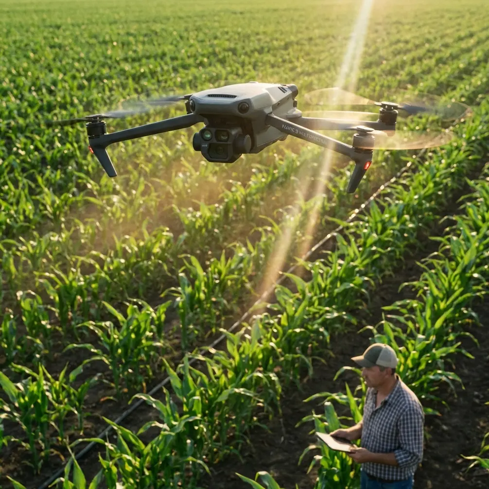
Mavic 3M Highway Inspection Tips in Windy Conditions: A Field Method That Actually Holds Up
META: Practical Mavic 3M highway inspection tips for windy conditions, with a structured workflow covering flight planning, visual discipline, multispectral capture, and operator training.
Highway inspection in wind exposes every weak habit a drone team has.
You notice it fast. A pilot rushes the setup because the weather window is narrow. The camera operator starts collecting “just in case” shots with no visual logic. The data comes back usable in parts, messy overall. You can still salvage deliverables, but the efficiency is gone.
That was the pattern I kept seeing before teams started treating the Mavic 3M less like a flying camera and more like a measurement tool with a disciplined workflow behind it.
For highway work, especially along exposed corridors where crosswinds and turbulence roll off embankments, that distinction matters. The Mavic 3M’s value is not simply that it carries a multispectral payload. It’s that the aircraft becomes much easier to use well when the crew adopts a method built around structure, repeatability, and deliberate observation.
This article is about that method.
Start with a cleaner visual objective, not a longer flight list
One of the smartest ideas from photography training has nothing to do with drones on the surface, yet it applies perfectly here: order comes from subtraction.
In plain terms, when a scene is visually busy, the operator should extract the pattern and strip away distractions. That advice was originally framed around mobile photography, with emphasis on line, geometry, and reducing clutter. For highway inspection, it becomes operational gold.
A highway is full of ordered elements: lane markings, barriers, drainage lines, expansion joints, shoulders, median edges, sound walls, and repeating light poles. In wind, your aircraft may be working harder to maintain position, so your imaging decisions need to get simpler, not more complex.
Instead of trying to document everything in one pass, identify the specific geometry that tells the story of the asset:
- edge deformation along a shoulder
- repeated drainage failures across a swale
- barrier alignment changes after impact or settlement
- pavement heat or vegetation anomalies near culverts and embankments
- linear intrusion patterns along right-of-way zones
The Mavic 3M is particularly effective here because multispectral data becomes more useful when the mission has a defined visual question. If you are looking for vegetation stress around drainage infrastructure or recurring moisture patterns near road edges, the sensor suite has context. Without that context, you are just collecting layers.
That is where many inspections go wrong.
Think in lines and planes when you frame the corridor
Another useful imaging principle is to abstract the scene into lines and surfaces. In photography, that means seeing buildings, streets, and staircases as geometry rather than objects. Along highways, that same mindset helps the Mavic 3M operator stabilize the inspection logic even when wind is adding workload.
Why does this matter?
Because highways are not random environments. They are engineered corridors. If you frame them as geometry, defects become easier to isolate.
A shoulder should run clean and consistent. A barrier line should remain regular. Drainage paths should read as predictable channels. Vegetation bands adjacent to pavement should reveal pattern changes, not just color changes. The moment a pattern breaks, you have a lead worth validating.
With the Mavic 3M, this way of seeing improves both RGB and multispectral interpretation. It also reduces wasted sorties. Instead of flying broad, unfocused loops, you can design a route that follows the corridor’s structural logic.
In practice, I advise teams to divide a highway inspection into “planes”:
- Pavement plane – surface continuity, striping, edge integrity
- Drainage plane – ditches, culverts, runoff paths, standing moisture indicators
- Vertical safety plane – guardrails, walls, signage supports, poles
- Vegetation transition plane – verge stress, overgrowth, erosion-linked growth differences
The aircraft is the same. The results are not. Crews that organize the mission this way produce far more consistent outputs.
Use perspective on purpose when wind limits your time
A photography reference I often borrow for pilot briefings is the idea that a wide lens, used close to the subject, exaggerates perspective and drives the eye into the frame depth. On a phone, that helps create order and direction. On the Mavic 3M, the principle is just as useful for corridor inspection.
When wind shortens your useful flight window, perspective has to work for you.
For instance, a slightly lower and more deliberate approach angle along a barrier line or drainage run can reveal convergence, displacement, and misalignment much more clearly than a collection of generic overheads. You are not trying to make the image dramatic. You are making the structure legible.
That matters in three ways:
- It helps the field crew recognize whether a suspected issue is isolated or repeating.
- It improves communication with non-pilot stakeholders reviewing the findings later.
- It reduces the need for return flights caused by visually weak documentation.
There is a discipline to this. If every image is captured from a different height, offset, and angle, the data becomes harder to compare. Wind already introduces enough variability. Your framing should reduce it.
Build the mission like a training sequence, not a one-off flight
One of the strongest lessons from flight training literature is simple: progress becomes measurable when you practice combinations, not isolated tricks.
That idea translates beautifully to Mavic 3M highway inspection. Good inspection teams do not just know how to launch, map, hover, and grab a few close shots. They know how to execute a sequence repeatedly under changing field conditions.
A productive windy-condition workflow might look like this:
- Initial corridor scan to confirm wind behavior, turbulence pockets, and visual priorities
- Planned mapping segment for structured coverage
- Targeted low-altitude verification on anomaly zones
- Cross-angle confirmation pass to rule out perspective error
- Data review before leaving site to confirm the objective was actually met
That sequence is far more valuable than telling a crew to “go inspect the highway.”
The reason is the same as in structured flight training: if you only judge isolated actions, you never really know whether the operator is improving. If the crew can run a repeatable inspection sequence and produce stable outputs each time, their capability is real.
I’ve seen this change project outcomes. Teams that train around combinations recover faster from gusts, reposition more intelligently, and make better decisions when the aircraft is burning battery faster than planned.
Ground control discipline still decides whether the aircraft performs well
People love to talk about aircraft features. Fewer people talk enough about the ground segment. That is a mistake.
An educational drone reference makes a point that remains true across classes of aircraft: the ground control system is central to mission planning, path adjustment, live monitoring, image display, parameter handling, and direct manual intervention when needed. That document also notes how a training platform using WiFi video transmission should generally stay within about 50 meters of the ground end to avoid degraded image transmission or even disconnection.
Now, the Mavic 3M is obviously not a toy-class educational unit, and highway inspections are not conducted under those same constraints. But the operational lesson carries over perfectly: link quality, control discipline, and deliberate path management matter more in wind than many crews admit.
For Mavic 3M teams, that means:
- set the mission from a stable ground-control position with clear situational awareness
- monitor not just image quality but aircraft behavior trends
- be ready to modify the route rather than forcing the original plan through worsening gusts
- keep manual takeover skills fresh, because automation is not a substitute for judgment
Wind reveals weak ground-station habits quickly. If the pilot and observer are not aligned on route logic and anomaly priorities, the mission becomes reactive.
If your team wants to compare corridor workflows or review a site-specific setup, you can message us directly here: https://wa.me/85255379740
Multispectral only pays off when the anomaly has a job to do
The Mavic 3M’s biggest advantage in highway inspection is often misunderstood.
Multispectral data is not inherently useful just because it exists. It becomes valuable when it helps explain a maintenance question the RGB view cannot answer cleanly.
Along highways, that often involves the shoulders, drainage zones, retention edges, and vegetated embankments. Subtle moisture retention, stressed growth near culverts, recurring runoff paths, or abnormal plant vigor can point to infrastructure issues that are easy to miss in standard visuals.
This is where the “order from subtraction” idea returns. You should not ask the multispectral payload to solve every problem. Ask it to clarify a pattern.
For example:
- Is vegetation stress tracing a blocked drainage line?
- Is unusual vigor indicating chronic water presence near pavement edges?
- Is a repeating anomaly aligned with a buried feature or grading inconsistency?
- Is a suspected issue confined to one segment, or does it continue along the corridor?
The Mavic 3M is strongest when these questions are defined before takeoff.
Wind changes altitude strategy more than most crews expect
In calm conditions, teams often get lazy with altitude choices. Wind punishes that.
A higher pass may smooth out local turbulence from roadside structures, but it can also reduce the visibility of smaller edge defects. A lower pass may improve verification but become unstable near embankments, retaining walls, overpasses, or cut sections where airflow curls unpredictably.
So the answer is not “fly low” or “fly high.” The answer is to sequence altitude based on objective:
- higher, more stable pass for corridor continuity
- moderate altitude for structured capture of the inspection plane
- lower confirmation only where a suspected issue needs direct validation
That sequence prevents the common mistake of spending too much battery fighting low-level turbulence over non-critical areas.
Use repeatability as the standard for operator skill
A lot of teams overestimate competence because they can complete a mission once.
That is not the test.
The better test is whether the crew can reproduce a planned inspection sequence, in wind, while maintaining image logic and data quality. This mirrors the flight-training principle that real progress appears when an operator can connect multiple actions smoothly and intentionally, rather than simply pulling off individual maneuvers.
For Mavic 3M operations, I recommend training crews on fixed corridor drills:
- same route category
- same anomaly checklist
- same framing rules
- same review process
- same post-flight annotation standard
Once those repetitions become routine, the aircraft’s strengths show up more clearly. The Mavic 3M is a capable platform, but consistency is what turns capability into reliable field output.
A past mistake that changed how I brief crews
Years ago, on a windy roadside inspection, we came back with plenty of images and not enough evidence. The pilot had flown safely. The camera operator had been busy the entire time. The client still needed another visit.
The failure was not flight skill. It was structure.
We had not defined the corridor as a set of visual patterns. We had not built the sortie as a sequence. We had not agreed which anomalies required multispectral confirmation versus simple visual documentation.
That experience is why I now brief highway teams around three ideas:
- simplify the scene
- follow the geometry
- train the sequence
The Mavic 3M makes this easier because it gives you enough sensor capability to move beyond surface-level observation. But the aircraft only becomes truly efficient when the crew applies discipline to how they see, how they plan, and how they verify.
For windy highway inspections, that is the difference between collecting footage and producing decisions.
Ready for your own Mavic 3M? Contact our team for expert consultation.