Mavic 3M for Vineyard Work in Extreme Temperatures
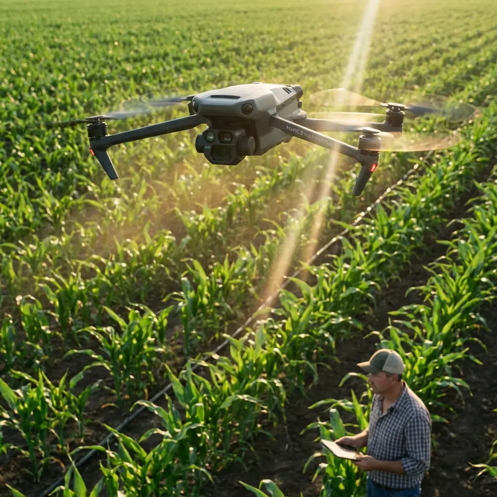
Mavic 3M for Vineyard Work in Extreme Temperatures: What Actually Matters in the Field
META: A field-focused look at using the DJI Mavic 3M for vineyard inspection in extreme temperatures, with practical insight on multispectral workflow, RTK precision, battery management, and terrain data strategy.
Vineyards make small problems expensive.
A weak irrigation block, a patch of heat stress, an uneven canopy, a drainage issue hiding between rows—none of these stay small for long, especially when temperature swings are severe. That is exactly where the Mavic 3M starts to earn its place. Not because it is simply “good at mapping,” but because vineyard work in heat, cold, and variable terrain demands reliable plant-level visibility and repeatable spatial accuracy.
I’ve seen crews lose half a day trying to confirm whether a vine block was showing nutrient deficiency, water stress, or simply a thermal response from a punishing afternoon. Walking rows has its place. But when the problem is spread across slope transitions, changing soil texture, and different trellis exposures, you need a structured aerial dataset rather than a few educated guesses.
The Mavic 3M fits that need well, particularly when the job is crop intelligence rather than spraying. For vineyard managers operating in extreme temperatures, the real value comes from three things working together: multispectral sensing, precise positioning, and disciplined field workflow.
The vineyard problem: temperature extremes distort what you think you’re seeing
Extreme temperatures create noisy visual conditions.
In hot weather, vines can look stressed for reasons that are temporary, localized, or structural. Afternoon wilt may not mean irrigation failure. A row edge near reflective soil can appear worse than the interior canopy. In colder periods, reduced vigor may be tied to drainage, frost pocket behavior, or delayed development rather than disease pressure. If your only tool is standard RGB imagery or a windshield-level view from an ATV, interpretation gets messy fast.
That is why multispectral data matters on the Mavic 3M. It gives vineyard teams a way to look beyond color and into vegetation response patterns that are harder to judge with the naked eye. In practical terms, this helps separate “something is wrong” from “this is where to inspect first.”
For vineyards, that distinction saves labor and narrows intervention zones. You are not trying to admire a pretty orthomosaic. You are trying to decide whether Block C on the south-facing slope needs a valve check, a soil probe, a tissue sample, or simply another day before action.
Why centimeter-level consistency matters more than most operators admit
A lot of people talk about aerial precision as if it only matters for surveyors. In vineyard operations, it matters because the same row needs to mean the same row every time.
If you are comparing canopy condition week to week during heat events, or checking whether stress expands outward from a known irrigation issue, drift in your geospatial alignment creates bad conclusions. This is where the Mavic 3M’s RTK-based workflow becomes more than a nice spec sheet detail. A strong RTK Fix rate helps repeat flights line up closely enough that plant-response changes can be interpreted with more confidence rather than blamed on mapping inconsistency.
That matters even more in vineyards with tight row geometry. A meter of positional error can move your attention from one vine line to another. Centimeter precision keeps your observations tied to the correct physical plants, which is what makes follow-up scouting efficient.
And this point connects to a broader remote sensing truth found in LiDAR and mapping workflows: platform position and attitude data directly shape the quality of the final spatial output. In airborne LiDAR systems, the reference stack typically combines the scanner with GPS and an IMU to compute three-dimensional coordinates accurately. The principle is the same at the operational level for vineyard mapping with the Mavic 3M. If your positioning and flight attitude are stable, your map is far more useful for repeat agronomic decisions.
Terrain is the hidden factor in vineyard data quality
Most vineyard sites are not flat enough to forgive lazy flight planning.
This is where a lot of otherwise competent drone work starts to break down. Operators fly with fixed assumptions, then wonder why edge rows look inconsistent or overlap is weaker than expected on slope transitions. In extreme temperature conditions, you cannot afford low-confidence data because the whole purpose of the mission is to detect subtle canopy variation.
A useful technical reminder comes from airborne LiDAR practice. One referenced case discusses UAV-borne LiDAR being used for 1:1000 topographic mapping, which tells you something important: terrain-aware data capture is not just for engineering projects. Accurate landform understanding feeds directly into how vegetation data should be interpreted. LiDAR workflows also rely on a processing chain that includes design, point cloud handling, strip adjustment, and output products such as DSM and DEM. In vineyard terms, this means elevation and surface context are not optional extras—they explain why one row dries out faster, why another captures cold air, and why vigor bands often follow microtopography.
The Mavic 3M is not a LiDAR platform, but the operational lesson still applies. If you inspect vineyards in extreme temperatures, you should think in layers. Multispectral tells you where the canopy response changes. Terrain data helps explain why.
On sites with repeated stress patterns, I often advise operators to compare plant-response maps against elevation behavior and drainage logic before making irrigation or nutrition calls. It reduces false positives.
A battery management tip that matters more in vineyards than in open fields
Here is the field lesson I wish more teams learned early: in extreme temperatures, do not rotate batteries by charge percentage alone. Rotate them by thermal condition and mission role.
In a vineyard, flights are rarely just a straight out-and-back over a uniform surface. You are climbing over trellis patterns, adjusting to terrain, and often relaunching after reviewing a quick field output. In very hot conditions, a battery that is technically “ready” can still be carrying too much heat from the previous cycle. In cold conditions, a battery that looks fine on paper may sag faster during the first few minutes over a breezy slope.
My habit is simple. Label packs by sequence, let each one rest out of direct sun, and assign the coolest stable pack to the most critical mapping run—the one you need for your cleanest comparative dataset. Save less critical visual checks for packs that are warm but still within acceptable operating behavior. In cold weather, I avoid launching the key mission with a pack that has been sitting in a vehicle overnight without conditioning.
That sounds basic. It is not. I’ve watched good multispectral missions become harder to trust because the operator rushed turnaround in summer heat and accepted small instabilities that could have been prevented with a better battery rhythm.
Extreme-temperature vineyard work rewards discipline.
Wind, row direction, and why flight behavior still matters for data integrity
Even with a highly capable platform, the aircraft’s attitude in flight affects data quality. One of the educational references highlights a useful concept: “maximum attitude angle” changes depending on movement direction and speed, including diagonal paths and circular motion. That may sound academic, but it has direct field relevance.
When a drone flies left-front, left-rear, or right-rear at different speeds, its pitch and roll demands are not identical. In a vineyard environment with crosswinds funneling through rows or over ridgelines, those attitude changes can influence consistency in image capture, overlap, and the repeatability of your mission. The same source also explores the relationship between impact, X-axis acceleration, and pitch angle during a low-speed wall collision, using a reference speed of 50 centimeters per second. No, that is not a vineyard procedure. But it does underline a practical truth: aircraft dynamics show up quickly when the platform encounters abrupt disturbances or poor planning.
Operationally, that means three things for Mavic 3M users in vineyards:
- Don’t push speed just because the block is small.
- Respect wind direction relative to row alignment.
- Re-fly critical zones if attitude behavior looked less stable than expected.
I would rather see a team capture one slower, cleaner dataset than two rushed flights that produce questionable vigor comparisons.
Multispectral is only useful if you connect it to action
This is where many vineyard programs stall. They collect data, generate plant health layers, and then stop at “interesting map.”
A vineyard manager needs action thresholds.
For example, if a multispectral pass identifies a narrow corridor of reduced vigor along a slope break, the next question is not whether the color palette looks severe. The question is whether that corridor aligns with emitter underperformance, shallow root-zone moisture, compaction, or disease pressure. The Mavic 3M helps you narrow the search area. It does not replace agronomic judgment.
The best workflows are the ones that connect aerial outputs to specific field checks:
- suspect low-vigor strip -> inspect irrigation uniformity
- repeated weak canopy at lower elevation -> assess cold-air drainage and root-zone saturation
- patchy decline near row ends -> check pressure consistency, runoff behavior, and soil variability
- expanding stress signature after hot spell -> compare with previous mission and scout for water deficit
This is also where adjacent operational terms like spray drift, nozzle calibration, and swath width become relevant, even if the Mavic 3M itself is not the spraying aircraft. A strong scouting dataset can influence how another aircraft or ground rig is later deployed. If your map shows stress concentrated along a narrow edge, that may change how you think about treatment zones, drift risk near boundaries, or whether your application pattern needs refinement. Good scouting should sharpen downstream decisions, not sit in a folder.
Where terrain-heavy operations may need a second data layer
There are vineyards where multispectral alone answers most questions. Then there are sites with complex relief, tree lines, terraces, or surrounding vegetation where the landform itself drives much of the crop response.
This is where lessons from UAV LiDAR become especially useful. One technical reference notes that LiDAR is an active remote sensing system, built to emit laser pulses and calculate distance from return timing, then combine that with positional and attitude data to derive 3D coordinates. It also points out that LiDAR can support fast, high-accuracy acquisition of digital surface and elevation models, with strong performance in difficult terrain and reduced dependence on large numbers of ground control points. Some workflows can be completed in roughly 30 to 40 percent of the time associated with traditional spatial data acquisition methods.
For vineyard operations, the takeaway is not that every grower needs a LiDAR mission tomorrow. It is that when heat stress patterns keep repeating and simple agronomic explanations fall short, elevation structure and canopy-surface relationships deserve serious attention. The Mavic 3M can identify the symptom pattern. A terrain-focused dataset can reveal the physical cause.
That combination is powerful in vineyards located on broken ground.
Sustainability is becoming part of procurement logic
One detail from the reference material may seem unrelated at first: Lingkong Technology was named in Shaanxi Province’s sixth batch of “Green Factory” certified companies, and this was not its first related recognition. Why does that matter in a discussion about Mavic 3M vineyard operations?
Because the UAV ecosystem is maturing. Buyers are paying closer attention not only to airframe performance, but also to the production culture around drone technology—manufacturing standards, environmental stewardship, and whether suppliers can support long-term commercial use responsibly. In agriculture, especially export-facing sectors like wine grapes, sustainability is no longer a side conversation.
For vineyard businesses building a modern remote sensing program, this broader industry trend matters. The tools used to document crop condition increasingly sit inside sustainability reporting, resource efficiency planning, and input reduction efforts. A drone mission is no longer just a flight. It can become part of how a vineyard documents water use discipline, targeted interventions, and reduced unnecessary passes through the field.
A practical operating model for Mavic 3M in extreme-temperature vineyards
If I were setting up a disciplined Mavic 3M inspection routine for vineyards dealing with heat spikes or cold stress, I’d keep it simple:
- fly at repeatable times whenever possible
- prioritize strong RTK consistency for comparison missions
- monitor battery temperature, not just state of charge
- adjust flight planning for slope and row orientation
- use multispectral results to direct targeted ground truthing
- bring in terrain context when stress patterns repeat without a clear explanation
That last point is often the difference between reactive scouting and a useful decision system.
If you are trying to refine a vineyard workflow around multispectral mapping, RTK behavior, or how to structure missions in difficult field conditions, you can send operational questions directly here: message Marcus with your vineyard scenario.
The bottom line
The Mavic 3M is most effective in vineyards when it is treated as a precision diagnostic tool, not a flying camera.
Extreme temperatures expose every weakness in field process. They also magnify the value of good data. Multispectral imagery helps isolate where vine response is changing. RTK-supported repeatability helps ensure you are comparing the right locations over time. Terrain-aware thinking explains why stress appears where it does. And disciplined battery handling keeps your best mission from being compromised by preventable field habits.
That is the real story with the Mavic 3M in vineyard inspection. Not hype. Not generic mapping promises. Just better decisions, made faster, in conditions where visual intuition alone often fails.
Ready for your own Mavic 3M? Contact our team for expert consultation.