Filming Fields with M3M in Wind | Pro Tips
Filming Fields with M3M in Wind | Pro Tips
META: Learn how to film agricultural fields with the DJI Mavic 3M in windy conditions. Expert tips on multispectral imaging, RTK precision, and wind management.
By Marcus Rodriguez | Agricultural Drone Consultant
TL;DR
- Wind speeds above 10 m/s distort multispectral data—but the right flight settings on the Mavic 3M compensate effectively
- Achieving a consistent RTK fix rate above 95% is critical for repeatable field surveys in gusty conditions
- Adjusting your swath width and overlap settings prevents data gaps caused by wind-induced drift
- The M3M's IPX6K rating handles sudden weather shifts, but lens moisture remains the hidden threat
The Problem: Wind Destroys Agricultural Survey Data
Every precision agriculture operator has faced it. You launch a perfectly planned multispectral survey over a 200-acre wheat field, and halfway through the mission, gusts roll in at 8–12 m/s. The drone compensates physically—tilting, adjusting, fighting the air—but your data tells a different story. Stitching artifacts. NDVI inconsistencies between flight lines. Positional offsets that make variable-rate prescription maps unreliable.
Wind doesn't just slow your Mavic 3M down. It systematically degrades the centimeter precision that makes multispectral imaging valuable in the first place. And if you're correlating your aerial data with ground-truth soil samples or integrating it into a spray drift management plan, those errors cascade downstream into bad agronomic decisions.
This guide breaks down exactly how to configure, fly, and post-process Mavic 3M missions in windy field conditions—so your data stays scientifically defensible even when the weather doesn't cooperate.
Understanding How Wind Affects the Mavic 3M's Sensor Array
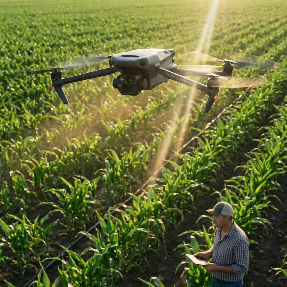
The DJI Mavic 3M carries a four-band multispectral sensor (green, red, red edge, near-infrared) alongside an RGB camera with a mechanical shutter. Each band captures independently, and the system relies on precise georeferencing to align those captures into a single, analyzable composite.
The Tilt Problem
When the M3M compensates for wind, the aircraft body tilts. The gimbal stabilizes the camera, but at extreme correction angles—typically beyond 15 degrees of pitch—the gimbal reaches its mechanical limit. At that point:
- Ground sampling distance (GSD) becomes inconsistent across the frame
- The multispectral bands may experience slight misalignment
- Shadow angles shift between adjacent flight lines, corrupting reflectance values
The Drift Problem
Even with RTK positioning enabled, wind creates lateral drift between planned waypoints and actual capture positions. If your planned swath width assumes perfect lateral spacing, wind-induced offsets of even 0.3–0.5 meters can create gaps or excessive overlap that throws off your orthomosaic.
Expert Insight: I monitor the RTK fix rate in real time during every windy mission. If the RTK fix rate drops below 95%, I pause the mission. A float or single solution during gusty conditions means your positional accuracy has degraded from centimeters to decimeters—and that's the difference between usable prescription maps and expensive noise.
Flight Configuration: Settings That Survive the Wind
Speed and Altitude Adjustments
The instinct is to fly faster to "get ahead" of the wind. That's exactly wrong. Here's what works:
- Reduce flight speed to 4–6 m/s in winds above 8 m/s (the M3M's default survey speed of 10–15 m/s becomes problematic)
- Increase altitude by 10–15% above your standard AGL—this reduces the impact of ground-level turbulence caused by crop canopy and field edges
- Fly perpendicular to the prevailing wind direction so that crosswind drift is consistent and predictable across all flight lines
Overlap Settings for Wind Compensation
Standard multispectral survey overlap of 75% frontal / 70% side is insufficient in gusty conditions. Wind-optimized settings:
- Frontal overlap: 80–85%
- Side overlap: 75–80%
- Swath width reduction: 15–20% narrower than calm-condition plans
Yes, this increases flight time and battery consumption. A field that takes two batteries in calm air may require three in wind. Plan accordingly.
Shutter and Exposure
The M3M's RGB camera features a mechanical shutter, which eliminates rolling shutter distortion. The multispectral bands, however, use electronic shutters with a capture time that can be affected by motion blur at higher speeds.
- Set multispectral exposure to auto but cap the maximum exposure time at 1/1000s
- Use the DJI calibration reflectance panel before and after each flight—wind can shift cloud cover rapidly, changing ambient light conditions between the start and end of a mission
The Wildlife Factor: When Nature Tests Your Sensors
During a spring wheat survey near the Platte River corridor last season, I encountered a situation that tested the M3M's obstacle avoidance in ways I hadn't anticipated. Flying at 40 meters AGL over an emerging canopy, a red-tailed hawk dove directly into the drone's flight path—likely defending a nearby nest.
The M3M's omnidirectional obstacle sensing detected the bird at approximately 12 meters and triggered an automatic braking event. The drone halted, hovered, and the hawk circled twice before departing. The mission resumed automatically from the exact waypoint where it paused, with the RTK fix rate holding steady at 98.7% throughout the interruption.
What struck me wasn't just that the sensors prevented a mid-air collision. It was that the positional data remained intact. There was no drift during the hover, no loss of RTK fix, and the stitched orthomosaic showed zero artifacts at the interruption point. That's the kind of reliability that matters when you're delivering data to agronomists making nutrient application decisions.
Pro Tip: If you're surveying near riparian zones, tree lines, or wetland margins, expect bird encounters—especially during nesting season (March through July in most North American regions). The M3M handles these events gracefully, but always enable Return-to-Home at 25% battery rather than the default 20%. The extra buffer accounts for unplanned hovers and obstacle avoidance maneuvers that consume power rapidly in windy conditions.
Technical Comparison: Mavic 3M Wind Performance vs. Alternatives
| Feature | DJI Mavic 3M | Competitor A (Fixed-Wing) | Competitor B (Multirotor) |
|---|---|---|---|
| Max Wind Resistance | 12 m/s | 15 m/s | 10 m/s |
| Multispectral Bands | 4 + RGB | 5 + RGB | 4 + RGB |
| RTK Precision | 1 cm + 1 ppm (horizontal) | 2.5 cm | 1.5 cm |
| Weather Rating | IPX6K | IP43 | IP44 |
| Hover Accuracy (RTK) | ±0.1 m | N/A (fixed-wing) | ±0.3 m |
| Mechanical Shutter (RGB) | Yes | Yes | No |
| Swath Width at 40m AGL | ~45 m | ~120 m | ~35 m |
| Field Portability | Backpack-ready | Vehicle-launched | Case-required |
The M3M occupies a specific niche: it combines multirotor flexibility with centimeter-precision RTK and robust weather resistance. Fixed-wing platforms cover more ground but can't pause, hover for inspection, or handle complex field geometries with internal obstacles like pivot towers and tree islands.
Post-Processing: Salvaging Wind-Affected Data
Even with optimized flight settings, wind introduces variability. Your post-processing workflow needs to account for it.
Radiometric Calibration
- Always process with the calibration panel images captured pre- and post-flight
- If cloud conditions changed significantly during the mission, use the M3M's onboard sunlight irradiance sensor data to normalize reflectance values across all captures
- Reject any captures where the sun irradiance reading varies more than 30% from the mission median
Point Cloud Density Checks
Before generating your final orthomosaic:
- Verify that point cloud density is uniform across the entire field—wind-caused gaps will appear as low-density zones
- If gaps exist, fly a targeted supplemental mission over those areas rather than interpolating
Integration with Spray Operations
If you're using M3M multispectral data to generate variable-rate spray prescriptions, wind data matters doubly. The same wind that affected your survey will affect spray drift during application. Document wind speed and direction during your survey flights—this metadata becomes valuable when calibrating nozzle selection and calculating buffer zones for sensitive areas.
Nozzle calibration for variable-rate applications should always reference the wind conditions present during the aerial survey, not just during the spray operation itself. A reflectance map captured in 10 m/s gusts may have subtle directional bias that correlates with—and should be corrected against—wind direction.
Common Mistakes to Avoid
- Flying at default survey speeds in wind above 8 m/s—this is the single most common cause of poor multispectral stitching results
- Ignoring RTK fix rate during flight—a "float" solution can introduce 10–30 cm of positional error that compounds across hundreds of captures
- Using calm-weather overlap settings—the standard 75/70 overlap leaves data gaps when wind pushes the drone off its planned track
- Skipping the calibration panel after flight—light conditions change rapidly in windy weather due to moving cloud cover, and post-flight calibration captures are essential for accurate reflectance
- Launching without checking the IPX6K seals and lens surfaces—wind carries dust, pollen, and moisture; a dirty multispectral lens introduces spectral error that no software can correct
- Forgetting to log wind data for downstream spray drift calculations—your aerial survey and your spray application are linked; treat them as a single data chain
Frequently Asked Questions
What is the maximum wind speed for reliable Mavic 3M multispectral surveys?
The Mavic 3M is rated for flight in winds up to 12 m/s. However, for scientifically reliable multispectral data, I recommend a practical limit of 10 m/s sustained with gusts no higher than 12 m/s. Beyond that threshold, gimbal compensation limits are reached more frequently, and the multispectral band alignment degrades. Always check both sustained wind speed and gust forecasts before launching.
How does RTK fix rate affect agricultural mapping accuracy?
The RTK fix rate represents the percentage of time your drone maintains a full carrier-phase RTK solution with centimeter-level accuracy. A fix rate of 95% or higher means nearly all your geotagged images have precise positioning. When the fix rate drops—degrading to a "float" solution—positional accuracy falls to the decimeter range. For variable-rate prescription mapping, this error margin can mean applying fertilizer or crop protection products to the wrong zones. Monitor fix rate in real time and pause missions if it drops below the 95% threshold.
Can I fly the Mavic 3M in rain during field surveys?
The M3M's IPX6K rating means it can withstand high-pressure water jets from any direction—significantly more protection than a typical rain shower. Physically, the drone handles rain well. However, water droplets on the multispectral sensor lenses introduce refractive errors that corrupt spectral data. Light mist is manageable if you check and wipe lens surfaces at each battery swap. Active rainfall should be avoided entirely for any survey where data accuracy matters. The drone will survive; your data won't.
Ready for your own Mavic 3M? Contact our team for expert consultation.