Monitoring Remote Fields with Mavic 3M | Pro Tips
Monitoring Remote Fields with Mavic 3M | Pro Tips
META: Learn how to monitor remote agricultural fields with the DJI Mavic 3M. Expert tips on multispectral imaging, RTK setup, and battery management for precision farming.
Author: Marcus Rodriguez, Agricultural Drone Consultant Last Updated: July 2025
TL;DR
- The DJI Mavic 3M combines a multispectral imaging system with an RGB camera to deliver actionable crop health data from remote field locations.
- Achieving a reliable RTK fix rate above 95% is critical for centimeter precision mapping in areas with limited infrastructure.
- A single battery management mistake can cost you an entire day of fieldwork—plan thermal conditioning and charge cycles before you leave base.
- This guide walks you through a complete field monitoring workflow, from pre-flight RTK setup to post-processed vegetation index maps.
Why Remote Field Monitoring Demands a Specialized Drone
Crop scouts covering remote acreage face a brutal math problem. Walking 640 acres of farmland on foot takes days. Driving ATVs along muddy access roads eats fuel and still leaves gaps between rows. Meanwhile, early-stage nutrient deficiencies, pest pressure, and irrigation failures spread silently across sections you never physically reach.
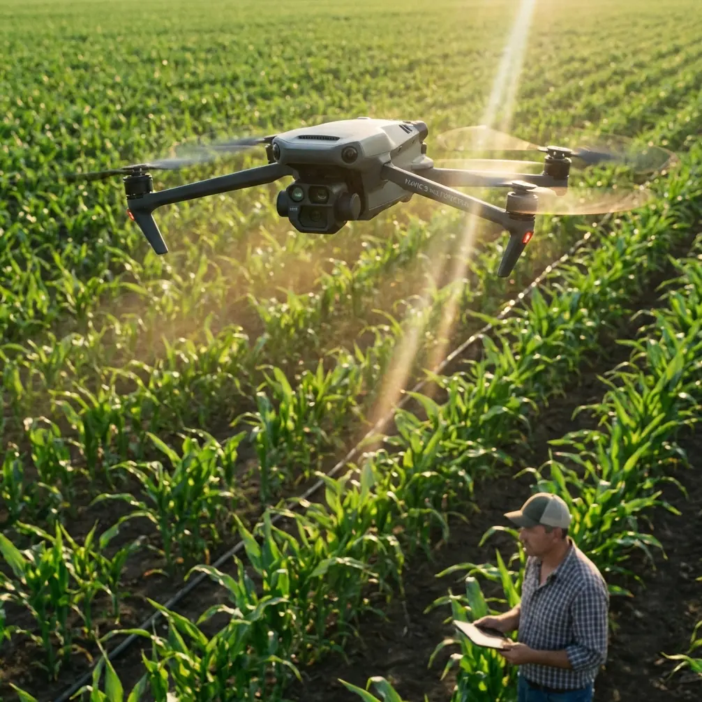
The DJI Mavic 3M was engineered to close that gap. Its four multispectral sensors (green, red, red edge, and near-infrared) capture data invisible to the human eye, while its compact form factor lets you launch from a truck tailgate at the field's edge. This how-to guide gives you the exact workflow Marcus Rodriguez uses to monitor 3,000+ acres of remote grain and cotton fields each season.
Step 1: Pre-Mission Planning for Remote Locations
Assess Connectivity and RTK Coverage
Remote fields often sit outside cellular RTK network coverage. Before driving two hours to a site, verify whether your NTRIP service reaches the area. If it doesn't, you have two options:
- DJI D-RTK 2 base station: Set it up on a known survey point or let it self-survey for ~3 minutes to establish a local coordinate frame.
- PPK (Post-Processed Kinematic) workflow: Fly with raw GNSS logs and correct them against the nearest CORS station after returning to your office.
A consistent RTK fix rate above 95% ensures your vegetation index maps align season over season with centimeter precision. Anything below that introduces positional drift that makes multi-temporal comparison unreliable.
Map Your Flight Blocks
Break large fields into flight blocks of 150–200 acres. The Mavic 3M's flight time of approximately 43 minutes (under ideal conditions) allows coverage of roughly 200 acres per battery at a 65 m AGL altitude with 75/75 overlap. Map these blocks in DJI Pilot 2 or DJI Terra before arriving on-site.
Pro Tip: Save your flight routes as templates. When you return to the same field four weeks later for a second pass, identical flight paths ensure pixel-level alignment between your early-season and mid-season NDVI maps. This consistency is what turns raw data into prescriptions.
Step 2: Battery Management in the Field — A Lesson Learned the Hard Way
Here's a story from my third season that changed how I operate permanently. I drove 90 minutes to a remote cotton field in west Texas during a late-October scouting run. Temperatures at dawn hovered around 4°C. I had six fully charged Mavic 3M batteries in a hard case in the truck bed—exposed to ambient air the entire drive.
The first battery powered on but reported only 78% capacity despite showing full charge the night before. Cold lithium cells deliver reduced voltage under load, and the drone's battery management system de-rates capacity accordingly. I burned through my first three batteries covering ground I should have covered with two. By battery four, I was rationing flight blocks and ultimately left 400 acres unscanned.
The Fix: Thermal Conditioning Protocol
Now I follow a strict battery protocol for remote missions:
- Transport batteries inside the cab, not in the truck bed or toolbox. Keep them between 20°C and 28°C.
- Use an insulated battery bag with a hand warmer pouch during cold-weather operations below 10°C.
- Cycle batteries through a warm-up hover for 60 seconds before sending the drone on its automated route.
- Carry a minimum of two spare batteries beyond your calculated need. Remote sites offer no charging infrastructure unless you bring an inverter.
- Label each battery with a number and log cycle counts. Retire any battery exceeding 200 cycles or showing swelling.
This protocol has eliminated surprise capacity losses on every remote mission since.
Step 3: Configuring the Mavic 3M's Multispectral Sensors
Sensor Calibration Panel
Before every flight—every single one—place the calibrated reflectance panel on flat ground and capture a reference image. The Mavic 3M's multispectral sensors need this baseline to convert raw digital numbers into reflectance values. Skipping this step means your NDVI or NDRE maps will shift based on sun angle and atmospheric haze rather than actual plant health.
Optimal Flight Parameters for Crop Monitoring
| Parameter | Recommended Setting | Notes |
|---|---|---|
| Altitude (AGL) | 50–70 m | Lower for early-season bare soil; higher for mature canopy |
| Ground Sample Distance | ~2.5 cm/px at 65 m | Sufficient for plant-level analysis |
| Front Overlap | 75% | Ensures stitching accuracy |
| Side Overlap | 75% | Critical for multispectral band alignment |
| Speed | 10–12 m/s | Prevents motion blur on multispectral bands |
| White Balance | Sunny (fixed) | Never use auto WB for multispectral missions |
| File Format | TIFF | Required for radiometric processing |
Understanding Swath Width
At 65 m AGL, the Mavic 3M achieves an effective swath width of approximately 48 m per pass with the multispectral array. Your side overlap setting determines how many passes are needed. A 75% side overlap means each pass advances roughly 12 m laterally. This sounds slow, but the data density is what separates actionable prescriptions from decorative maps.
Step 4: Field Execution and Weather Awareness
IPX6K and Environmental Limits
The Mavic 3M does not carry a formal IPX6K ingress protection rating—that specification applies to certain DJI agricultural spraying platforms. However, understanding water and dust resistance ratings matters when you're operating in remote environments where sudden weather changes are common.
- Do not fly in rain. Moisture on the multispectral lens array corrupts reflectance data.
- Wind limits: sustained winds below 10 m/s. The compact airframe handles gusts well, but excessive wind reduces battery endurance and introduces geometric distortion in your orthomosaic.
- Optimal solar window: 10:00 AM – 2:00 PM local solar time. This minimizes shadow length and maximizes consistent illumination across your flight blocks.
Expert Insight: Overcast days are actually excellent for multispectral data collection. Cloud cover acts as a natural diffuser, eliminating harsh shadows and hotspot reflections from glossy leaf surfaces. Your reflectance panel calibration accounts for the reduced irradiance. Some of my cleanest NDRE maps have come from uniformly cloudy days.
Step 5: Post-Processing and Actionable Outputs
Software Pipeline
After landing, transfer your TIFF files and GPS logs to your processing workstation. Common pipelines include:
- DJI Terra – Generates NDVI, GNDVI, and NDRE index maps directly from Mavic 3M data with minimal configuration.
- Pix4Dfields – Offers advanced zone management and variable-rate prescription export.
- OpenDroneMap – Open-source option for teams with processing expertise and budget constraints.
From Maps to Prescriptions
The real value of multispectral monitoring emerges when you translate index maps into variable-rate application prescriptions. A well-calibrated NDRE map can identify nitrogen-deficient zones 10–14 days before symptoms become visible to the eye. That prescription file feeds directly into precision application equipment.
For teams also operating DJI Agras spraying drones, the monitoring-to-application loop tightens considerably. Your Mavic 3M identifies a pest hotspot; your Agras T40 treats only that zone, with optimized nozzle calibration settings that control spray drift and minimize chemical waste. This targeted approach can reduce input costs by 15–30% compared to blanket applications.
Technical Comparison: Mavic 3M vs. Alternative Monitoring Platforms
| Feature | DJI Mavic 3M | Competitor A (Fixed-Wing) | Competitor B (Multirotor) |
|---|---|---|---|
| Spectral Bands | 4 MS + 1 RGB | 5 MS + 1 RGB | 6 MS + 1 RGB |
| Flight Time | ~43 min | ~59 min | ~27 min |
| RTK Support | Yes (D-RTK 2 / NTRIP) | Optional module | Yes |
| Portability | Foldable, ~951 g | Requires assembly, ~3.5 kg | Non-foldable, ~1.8 kg |
| Ground Sample Distance (50 m) | ~2 cm/px | ~3.5 cm/px | ~1.8 cm/px |
| Autonomous Mission Planning | DJI Pilot 2 / Terra | Proprietary software | Third-party required |
| Ideal Use Case | Rapid field scouting, 100–500 acre blocks | Large acreage (500+ acres) | Small, high-detail plots |
The Mavic 3M occupies a unique middle ground: portable enough for a single operator working from a truck, yet capable enough to deliver research-grade multispectral data across commercial acreage.
Common Mistakes to Avoid
1. Skipping the reflectance panel calibration. This is the single most common error among new operators. Without calibration, your NDVI values are meaningless numbers that cannot be compared across dates or fields.
2. Flying too high to save time. Pushing altitude to 100 m+ covers more ground per battery but reduces your ground sample distance to the point where individual plant stress signatures blur together. Stay at 50–70 m for actionable resolution.
3. Ignoring battery temperature. As detailed above, cold batteries in remote locations will cut your coverage short. Thermal conditioning is non-negotiable.
4. Using auto white balance for multispectral capture. Auto WB shifts color rendering between frames. Lock white balance to a fixed setting to ensure radiometric consistency.
5. Processing multispectral data as standard photos. TIFF files from the Mavic 3M's multispectral sensors contain radiometric metadata. Processing them through a standard photo stitcher discards this data. Use agriculture-specific software like DJI Terra or Pix4Dfields.
6. Neglecting nozzle calibration on downstream spraying operations. Your monitoring data is only as valuable as the precision of the application it informs. If spray drift from poorly calibrated nozzles spreads chemical beyond the target zone, your variable-rate prescription loses its advantage.
Frequently Asked Questions
How many acres can the Mavic 3M cover on a single battery?
At 65 m AGL with 75/75 overlap and a flight speed of 10 m/s, expect approximately 150–200 acres per battery under moderate wind conditions. Cold weather, strong headwinds, or lower altitudes with tighter overlap will reduce this number. Always plan with a 20% buffer on estimated battery consumption.
Does the Mavic 3M require an RTK base station for agricultural mapping?
Not strictly, but it is strongly recommended for precision agriculture applications. Without RTK, the onboard GNSS provides positional accuracy of roughly 1.5 m CEP. With a solid RTK fix rate, you achieve centimeter precision positioning, which is essential for multi-temporal field comparison, variable-rate prescription alignment, and integration with auto-steer application equipment.
Can I use the Mavic 3M in light rain or heavy dew conditions?
The Mavic 3M is not rated for wet-weather operation. While the aircraft can tolerate light morning dew on its frame, moisture on the multispectral lens elements will corrupt your reflectance data and produce unreliable index maps. Wait until dew has evaporated from both the crop canopy and the air column before launching. Wet foliage also alters spectral signatures, making vegetation indices less accurate even if your equipment stays dry.
Ready for your own Mavic 3M? Contact our team for expert consultation.