Mavic 3M in Mountain Venue Inspection: What Actually
Mavic 3M in Mountain Venue Inspection: What Actually Matters When Conditions Shift
META: A technical field review of the Mavic 3M for mountain venue inspection, covering multispectral workflows, data transmission priorities, cloud-connected operations, and how changing weather affects real missions.
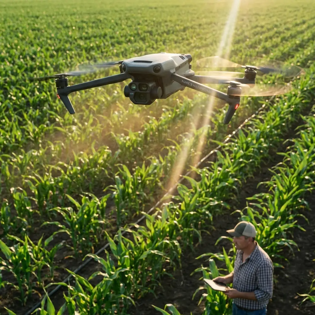
Mountain venues punish weak drone workflows. Wind comes over a ridge in one direction, light changes in minutes, and a site that looks simple on a map turns into a layered inspection problem the moment you launch. For operators evaluating the Mavic 3M, that is the real question: not whether it can collect images, but whether it can keep producing usable information when terrain, communications, and weather start working against you.
The Mavic 3M is usually discussed through an agriculture lens because its multispectral capability is the headline feature. That framing is too narrow. In mountain venue inspection, especially for camps, eco-tourism properties, ski infrastructure zones, remote event grounds, terraced developments, forestry-adjacent sites, or high-elevation utility access corridors, the aircraft’s value comes from something more practical: it can gather several layers of site intelligence in one sortie without forcing the operator to overbuild the payload stack.
That matters because one of the clearest principles from UAV agricultural sensing research still applies here. The source material points out that different field information types often require specialized acquisition methods: spectral sensing for soil and nutrient conditions, shape-feature sensing for weed recognition, and multi-temporal imaging for crop growth monitoring. The larger takeaway is not about crops alone. It is about operational efficiency. When an aircraft can consolidate information gathering instead of relying on separate sensors and repeated flights, you save payload mass, preserve battery budget, improve collection efficiency, and reduce overall data capture cost. In mountain inspection work, where access windows can be short and launch points awkward, that operational compression is often more valuable than any single camera spec.
Why multispectral is useful beyond farming
A mountain venue rarely fails in one obvious way. Surface drainage shifts. Temporary access roads soften. Vegetation stress reveals irrigation leaks or altered runoff. Repeated foot traffic changes surface compaction near gathering zones. Standard RGB imagery shows visible conditions well, but it does not always expose subtle environmental transitions soon enough to support maintenance decisions.
This is where the Mavic 3M’s multispectral workflow becomes more than a crop-health tool. The platform is capable of supporting comparative assessment across a changing site, which is exactly what mountain operators need when they are trying to understand whether a venue is stable, drying out, oversaturated, or degrading after weather swings. If you inspect a mountainside event area over several intervals, the useful output is not one beautiful orthomosaic. It is the ability to compare conditions over time and spot emerging patterns before they become costly field issues.
The reference material specifically highlights multi-temporal image acquisition as a core approach for monitoring crop growth. Translate that to venue inspection and the lesson is straightforward: don’t treat each Mavic 3M mission as a one-off. Build repeatable capture schedules and matching flight geometry so the imagery becomes trend data. On mountain sites, trend data often tells the real story.
The mid-flight weather problem is where weak operations break
On a recent mountain-style inspection scenario, the weather shift was textbook. Launch conditions were stable enough for a planned perimeter and upper-slope pass. About halfway through the mission, a cooler gust front pushed across the ridge line. Nothing dramatic on the ground. In the air, it changed everything. Light flattened, contrast dropped, and the aircraft began dealing with more active lateral corrections than it had during the first leg.
This is where operators often overreact and either abort too early or keep flying the original profile as if nothing changed. A better Mavic 3M workflow is to shift priorities immediately.
The source data on UAV information systems offers a useful framework here. It notes that unmanned aircraft may need to transmit several categories of information, including flight attitude data, route-captured imagery, and sensor data. It also makes a critical distinction: information that is not highly time-sensitive can be stored locally, while data with stronger real-time requirements, such as flight information, should be transmitted promptly to support control adjustment.
That distinction becomes operationally significant in mountain weather.
When the ridge wind picked up, the most important data in the moment was not every image frame. It was aircraft state, link stability, and the information needed to keep the flight profile under control. The Mavic 3M handled the transition well because the mission logic shifted from “collect everything exactly as planned” to “preserve aircraft stability and maintain the integrity of the core dataset.” Some portions of the visual record can be reviewed from onboard storage later. Real-time flight awareness cannot.
This sounds obvious until you watch teams treat every mission as a live media stream instead of an aerial inspection operation. In uneven terrain, prioritizing timely flight data over less urgent payload transfer is not just good practice. It is one of the main reasons missions remain safe and recoverable when conditions turn.
Cloud-connected operations are not just administrative overhead
Another underappreciated detail in the reference material is the concept of the UAV cloud system: a dynamic database for light civil drone operations that provides services such as navigation and weather support while monitoring operational data in real time, including position, altitude, and speed. It also notes that connected aircraft should upload flight data promptly, and that the system can warn when drones intrude into electronic geofencing areas.
For Mavic 3M operators inspecting mountain venues, this matters for two reasons.
First, mountain sites often sit near layered access restrictions, visitor infrastructure, conservation buffers, or temporary operating boundaries. Real-time monitoring of position, altitude, and route compliance is not a paperwork exercise. It is a practical control layer that reduces the chance of wandering into the wrong airspace or crossing a venue boundary that looked farther away from the launch point.
Second, weather in elevated terrain is local and unstable. Any workflow that strengthens situational awareness around navigation services and weather support gives the aircraft an advantage before a problem becomes visible from the ground. The mountain environment does not reward operators who rely on a single preflight weather check and then assume the next 25 minutes will behave the same way.
If your venue inspection program is becoming more formalized, it is worth building procedures around cloud-synced mission logging, route review, and post-flight traceability. That is especially true if your teams are operating repeatedly in the same corridor and need defensible records of where the aircraft flew, how high it flew, and how conditions evolved.
Altitude discipline matters more in mountain terrain than on flat sites
One detail in the regulatory source deserves more attention than it usually gets: a relative altitude figure of no more than 120 meters. In flat terrain, operators often treat altitude limits as a simple ceiling. In mountain terrain, relative altitude is trickier. Terrain climbs toward the aircraft, ridges compress operating space, and a route that looked conservative from the launch zone can become far less forgiving once the aircraft crosses a contour break.
That makes terrain-aware mission planning essential for the Mavic 3M. If you are inspecting a venue spread across an elevation gradient, your route should reflect topographic reality, not just map geometry. This affects image consistency, safety margins, and your ability to preserve multispectral comparability across the mission.
It also affects operator workload. When the aircraft is flying along a mountain face, maintaining stable relative height while preserving overlap and sensor usefulness is a more demanding task than running a grid over flat agricultural land. Anyone marketing mountain inspection as “basically the same as mapping a field” has not spent enough time correcting weak datasets.
EVLOS and observer logic are highly relevant on mountain sites
The regulatory document also distinguishes EVLOS, or extended visual line of sight, as a form of beyond visual line of sight operation in which the pilot or observer uses visual extension methods to operate outside normal direct sight. That distinction matters in mountain venue inspection because ridges, treelines, structures, and slope reversals can interrupt clean visual continuity even when the aircraft is not far away.
The practical lesson for Mavic 3M teams is simple: observer placement is part of mission design, not an afterthought. If a venue sits across broken terrain, you may need staging positions that preserve situational awareness as the aircraft moves from one side of the site to another. Even a compact and capable platform benefits from a smarter human layout around the operation.
This is especially relevant for inspections involving temporary installations, mountain access roads, retaining features, or large open-air event footprints. The aircraft can do the flying. The team still has to do the seeing.
Why integrated sensing reduces compromise
One sentence from the agricultural reference stands out because it captures a design truth many drone operators learn the hard way: integrating multidisciplinary sensing into a unified payload is a key path toward saving onboard space and weight while improving acquisition efficiency and lowering collection costs.
That principle maps cleanly onto the Mavic 3M.
In mountain venue inspection, every extra flight is a cost. Every payload swap creates friction. Every repeated route under different light or wind conditions introduces comparability problems. An aircraft that can collect multiple useful data layers in one operational cycle reduces those penalties.
This is why the Mavic 3M can be so effective when the mission objective is not just “look at the venue,” but “understand environmental condition, identify subtle change, and document it in a way that supports action.” The best inspection aircraft are not always the ones with the biggest sensor list. They are the ones that reduce tradeoffs between access, consistency, and information quality.
Build your workflow around what changes fastest
For mountain inspection teams, the smartest way to use the Mavic 3M is to separate mission variables into three categories:
Stable data requirements
Basemap-quality imagery, repeatable multispectral comparison, and route documentation can usually be structured in advance.Fast-changing environmental variables
Wind shifts, light changes, cloud movement, localized moisture, and slope turbulence need in-flight judgment.Control-critical telemetry
Aircraft attitude, position, altitude, speed, and route integrity should remain top priority whenever conditions degrade.
This hierarchy aligns closely with the source material’s distinction between data that can be stored for later and data that must move quickly for control purposes. Operators who understand that hierarchy tend to produce better results from the Mavic 3M, especially in terrain where “just finish the route” is often the wrong instinct.
The real verdict on the Mavic 3M for mountain venue inspection
If your work involves mountain venues, the Mavic 3M is most compelling when used as a disciplined data-collection platform, not a general-purpose eye in the sky. Its strength lies in efficient information fusion. The source material supports that logic clearly: integrated sensing improves collection efficiency and reduces payload burden, while robust transmission priorities and cloud-linked operational monitoring support safer, more controlled missions.
Those are not abstract ideas. They affect what happens when the weather changes halfway through a sortie, when a slope blocks visibility, when a route crosses multiple surface conditions, or when you need to compare the same venue over time instead of merely photographing it once.
That is the difference between a drone flight and an inspection program.
If you are refining a Mavic 3M workflow for terrain-heavy sites and want to compare mission layouts, observer positioning, or multispectral capture strategy, you can message Marcus directly here to discuss practical field setups.
Ready for your own Mavic 3M? Contact our team for expert consultation.