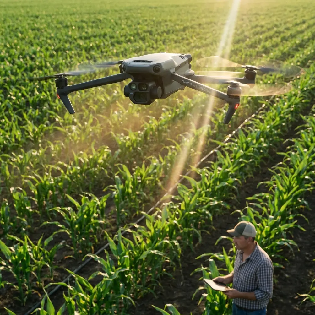
Scouting Urban Power Lines With Mavic 3M
Scouting Urban Power Lines With Mavic 3M: Practical Field Tips for Signal Stability, Mapping Quality, and Safer Data Capture
META: Learn how to use Mavic 3M for urban power line scouting, with practical advice on interference management, device setup, temporary communications, and multispectral workflow decisions.
Urban power-line scouting looks simple until you actually launch.
The aircraft is dealing with reflective rooftops, narrow streets, glass facades, RF clutter, and a corridor full of conductive infrastructure that does not forgive sloppy planning. For teams evaluating the DJI Mavic 3M in this environment, the real question is not whether the platform can fly the route. It can. The question is whether the data stays usable when signal conditions are messy and operators are working under time pressure.
That is where field method matters more than spec-sheet confidence.
As Dr. Sarah Chen, I tend to judge drone workflows by one standard: do they still hold up when the environment is imperfect? For urban utility scouting, the answer depends on three things working together: stable control links, practical ground-device choices, and a survey logic that respects what multispectral sensing can and cannot do near power infrastructure.
Why the Mavic 3M discussion changes in a power-line corridor
The Mavic 3M is often introduced through agriculture, and that makes sense. Multispectral imaging naturally fits crop vigor mapping, drainage interpretation, and stand variability analysis. But a utility corridor in a city creates a different operational puzzle.
You are no longer surveying an open field where the horizon is clean and the geometry is forgiving. Instead, the aircraft may move between trees, concrete, parked vehicles, rooftop equipment, and power assets that can complicate reception and situational awareness. The pilot may also need to stop, hover, reframe, and rescan short segments repeatedly rather than simply execute a long, uniform grid.
That change in context makes one overlooked topic especially important: communications resilience.
A recent low-altitude communications showcase from China Unicom described a drone-carried ad hoc networking system that does not rely on ground base stations. Once airborne, the drone can quickly establish a temporary aerial communications network for low-altitude emergency or temporary coverage needs. That detail matters operationally far beyond telecom exhibitions. It points to a wider truth for utility teams: in difficult urban zones, communication architecture should be treated as part of mission planning, not an afterthought.
Even if your Mavic 3M mission is not carrying a communications payload, the principle still applies. If one layer of connectivity weakens, you need redundancy in the workflow: preloaded maps, stable mobile hardware, clear antenna discipline, and a route plan that does not assume perfect network coverage.
Start with the ground device, because weak screens ruin good flights
Drone operators love discussing aircraft, sensors, and RTK behavior. In practice, many urban inspection mistakes begin with the display.
One of the reference field documents on lightweight UAV crop survey operations highlighted something that remains surprisingly relevant today: device choice in the field changes mission quality. That document noted that smaller iPhone-class devices were convenient to carry and easier to hold for long periods, but their brightness became a weakness outdoors. Under strong field light, the screen could become difficult to read, and when brightness was pushed to maximum, overheating could force the display to dim in as little as a little over 10 minutes. On the other hand, iPad Air-class devices offered much longer working endurance, with measured continuous operation exceeding 6 hours, and a larger display that made handling easier.
This is not a trivial comfort issue. In an urban power-line corridor, poor screen visibility can lead to three concrete problems:
- Missed framing errors when the pilot thinks the line is centered but is actually clipping poles, insulators, or crossing vegetation.
- Delayed reactions when obstacle context is harder to read in glare.
- Weak map interpretation if the base layer, route overlays, or inspection notes are difficult to view quickly.
For Mavic 3M teams, the lesson is simple. If the mission includes extended corridor work, annotation, or repeated close review of image coverage, use a larger high-visibility device where practical. If mobility is the higher priority and a phone is still preferred, treat glare control as mandatory, not optional. A physical sun hood is not glamorous, but it often does more for inspection quality than a new accessory on the aircraft.
The same reference also mentioned the value of a cellular-capable tablet for downloading imagery basemaps in the work area in real time. In a city, that becomes especially useful when route adjustments are needed on the fly because of access restrictions, parked equipment, or temporary no-go zones.
Antenna adjustment is not superstition
Urban power-line scouting exposes a common bad habit: operators keep the controller pointed vaguely at the aircraft and hope the link behaves.
Hope is not a strategy.
Electromagnetic clutter near utility infrastructure is rarely the same from one block to the next. You may have interference sources from building-mounted systems, dense consumer wireless traffic, metallic reflections, and the corridor itself. When the image feed starts to stutter, many pilots assume the problem is distance. In city work, geometry is often the bigger culprit.
A practical antenna routine helps:
- Keep the controller antennas oriented for broadside exposure to the aircraft, not with the antenna tips pointing at it.
- Reposition your body before signal quality drops badly. A small step into a clearer line of sight can matter more than fiddling with settings.
- Avoid standing directly beside large vehicles, metal cabinets, or utility boxes if another safe launch position is available.
- When scanning along a line, pause and reassess antenna orientation after turns, because the aircraft-to-controller angle changes quickly in corridor work.
- If EMI appears concentrated around one segment, shorten the leg and break the run into smaller pieces instead of forcing a continuous pass.
This sounds basic. It is also the sort of basic discipline that separates a clean survey from a salvage job.
The mention of a low-altitude self-organizing aerial network that does not depend on ground base stations is useful here because it reinforces the same principle: communications in low-altitude operations should be designed for disruption. Even when using a standard Mavic 3M field kit, pilots should think in layers—air link, mobile device stability, pre-cached maps, observer coordination, and fallback procedures.
Multispectral value in utility scouting: use it where it is strong
Power-line readers may ask the obvious question: why bring a multispectral platform into this mission at all?
Because line scouting in urban areas is rarely only about the conductor. Vegetation encroachment, stressed roadside trees, disturbed ground near support structures, drainage issues, and corridor edge conditions all influence maintenance planning. A multispectral workflow can help identify plant stress patterns and site irregularities that are less obvious in standard visible imagery.
The reference material on hyperspectral applications provides useful context. It explains that modern spectral analysis has become valuable because it is fast, convenient, and non-destructive. It also notes that spectral data in the 350–2,500 nm range can reveal subtle differences in soil physical and chemical properties. At the same time, the same source warns that derivative processing, while useful for identifying inflection points and extrema, can amplify noise and reduce modeling accuracy if applied carelessly.
That warning is highly relevant for anyone trying to over-interpret corridor data from a drone mission.
Here is the practical takeaway: use multispectral data to support decisions, not to manufacture certainty where the environment is noisy. Urban utility corridors are full of mixed materials, shadow transitions, narrow targets, and background contamination from pavement, rooftops, and water surfaces. If you push the analytics too hard, especially with aggressive processing methods, you may end up treating noise as a maintenance signal.
A better approach is staged interpretation:
- Use RGB and corridor geometry first to confirm asset visibility, vegetation proximity, and access constraints.
- Use multispectral layers second to flag suspicious vegetation stress zones or changing ground conditions near structures.
- Ground-truth selective anomalies rather than assuming every spectral outlier has operational meaning.
This is where an academic mindset helps. Not every measurable difference is a useful difference.
What temporary communications capability means for urban field teams
The China Unicom exhibit described a drone-enabled temporary communications network built in the air without reliance on ground base stations. That capability was presented for low-altitude emergency or temporary communications, but the underlying lesson for civilian infrastructure teams is broader.
Power-line scouting often intersects with communication bottlenecks:
- temporary dead zones between dense structures,
- overloaded public networks during major events,
- field teams split across several blocks,
- rapid response after weather disruptions.
Even when the Mavic 3M is not the node creating that network, utility organizations should think in terms of communication elasticity. A good urban drone team has a workflow that still functions when ordinary connectivity becomes unstable.
That means:
- offline mission basemaps loaded before deployment,
- image review procedures that do not depend on constant cloud access,
- clear observer-to-pilot comms protocols,
- contingency points where the aircraft can safely loiter or return if the link degrades.
If your team is building a more robust urban low-altitude workflow around Mavic 3M operations, you can message our technical team here to compare field communication setups and device options.
Flight duration is useful only if the mission design respects it
A legacy field document cited the Mavic Pro’s 27-minute theoretical flight time and 5 km theoretical control range, with a full operating kit around 2 kg including aircraft, bag, three batteries, and controller. Those are older platform figures, not Mavic 3M performance numbers, but they still illustrate a point many teams miss: portability and endurance only become advantages when the operation itself is segmented intelligently.
Urban line scouting should not be planned around maximum theoretical figures. It should be planned around interruption points.
Use short, deliberate route sections tied to:
- street crossings,
- tower or pole intervals,
- visibility changes,
- likely interference zones,
- takeoff and landing options.
That gives you cleaner data blocks and reduces the temptation to keep pushing through a deteriorating link just because the aircraft still has battery margin.
A portable kit also matters more in city work than in open land surveys. Operators may need to walk rooftops, navigate stair access, move between parking setbacks, or reposition around buildings. The older crop-survey reference praised lightweight systems partly because even climbing terrain did not become a burden. The same operational advantage applies here. Urban inspection efficiency is often won on the ground, between flights.
Don’t force agricultural jargon into utility work
The keyword universe around Mavic 3M often includes terms like spray drift, nozzle calibration, swath width, RTK fix rate, and IPX6K because the broader drone ecosystem overlaps with spraying and precision agriculture. For urban power-line scouting, some of those terms simply do not belong in the core workflow.
What does belong is disciplined positioning and repeatability.
If you are using RTK-supported workflows, centimeter-level positioning helps most when you need:
- repeat visits to the same support structures,
- comparable vegetation condition mapping across time,
- accurate corridor-edge change detection.
The value is not bragging rights about precision. The value is that the second survey can answer the same question as the first survey from nearly the same spatial reference.
That is what makes maintenance planning defensible.
A field method that works
For readers who want a practical template, this is the approach I recommend for Mavic 3M urban line scouting:
1. Build the mission around communication failure, not communication success
Assume some signal degradation will happen. Preload maps. Define fallback positions. Brief the observer.
2. Choose the display before you choose the route
If the task involves long review sessions or detailed map interaction, a larger tablet-class display with strong battery life is often the safer professional choice.
3. Treat antenna angle as an active control input
Adjust for corridor direction changes and body position. Maintain line of sight whenever possible.
4. Use multispectral data with restraint
Let it identify patterns worth checking. Do not oversell weak anomalies in cluttered urban scenes.
5. Break the corridor into inspection cells
Short blocks produce cleaner datasets, easier relaunch decisions, and better incident control if signal quality changes.
6. Review while still on site
Urban conditions are expensive to recreate. Confirm that poles, spans, vegetation margins, and any ground-disturbance areas were captured before leaving.
The bigger takeaway
What the reference materials show, when read together, is not a random collection of facts. They reveal a pattern.
One source highlights airborne temporary communication networks that can function without ground base stations. Another shows that field-device choice, screen visibility, and long-duration usability directly shape mission success. A third reminds us that spectral analysis is powerful but vulnerable to noise and over-processing.
Put together, they form a sharp lesson for Mavic 3M users in urban power-line scouting: the limiting factor is rarely the aircraft alone. It is the discipline of the entire field system.
Fly with a communication mindset. See the screen clearly. Respect interference. Use multispectral intelligence where it genuinely adds insight. And never confuse more data with better judgment.
Ready for your own Mavic 3M? Contact our team for expert consultation.