Mavic 3M Case Study: What New Drone Rules Mean for Coastal
Mavic 3M Case Study: What New Drone Rules Mean for Coastal Survey Work in Dusty, Shifting Conditions
META: Expert case study on how new FCC conditional approvals, China’s first mandatory drone liability policy, and low-altitude credit reforms could affect Mavic 3M coastal surveying operations in dusty, weather-changing environments.
When people talk about drone regulation, they usually flatten it into a yes-or-no question: allowed or restricted, compliant or grounded. That is not how field operations actually feel when you are standing on a windy coastline with a Mavic 3M, trying to capture usable multispectral data before light, dust, and salt haze wreck the mission.
What matters in practice is whether the rules are becoming more workable for real operators.
That is why three recent developments deserve attention from anyone running or planning Mavic 3M missions. In the United States, the FCC has created a new case-by-case pathway by formally adding a conditional approval category to its Covered List framework, with four drone systems receiving time-limited approvals. In China, Chongqing has reportedly landed the country’s first mandatory drone liability insurance policy. And on March 17, five national departments jointly issued guidance to expand credit-based consumption scenarios for low-altitude transport and logistics, explicitly putting low-altitude logistics alongside rental cars, yacht leasing, self-drive tourism, and e-commerce delivery.
At first glance, that sounds far removed from a compact multispectral aircraft used for mapping vegetation stress, shoreline change, or reclamation corridors. It is not. For Mavic 3M operators, these moves point to a market that is getting more structured, more risk-scored, and more selective about what kinds of drone use can scale.
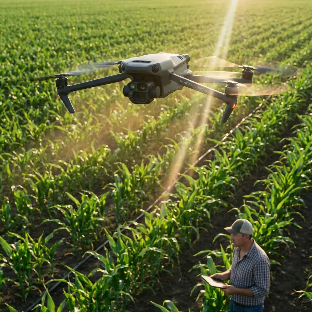
A field reality check: coastal mapping is where policy becomes operational
A few weeks ago, I was reviewing a coastal survey scenario built around the Mavic 3M for a team working in dusty, wind-shifting conditions near exposed embankments and access roads. The mission profile was straightforward on paper: collect repeated multispectral passes over a coastal strip, maintain consistent overlap, preserve geospatial integrity, and return with data tight enough to support comparison across previous flights.
Then the weather changed mid-flight.
The first leg was manageable. Visibility held, light was stable, and the aircraft tracked cleanly. By the second segment, gusts started pushing dust off the road surface and across the shoreline edge. That matters more than many non-specialists realize. Dust does not just challenge visibility; it also affects confidence in image consistency, target clarity, and the operator’s willingness to stretch a flight line to finish a block. In a coastal environment, that can combine with salt-laden air and shifting glare to narrow the useful data window fast.
This is where the Mavic 3M earns its place. Not because regulation suddenly disappears, and not because any single aircraft solves every field problem, but because a multispectral platform with disciplined mission planning can still deliver usable layers when conditions stop being ideal. If your workflow depends on centimeter precision, your success is rarely about one dramatic feature. It comes down to how reliably the aircraft holds the mission geometry when the environment starts fighting back.
That operational reality is why the latest policy signals matter. Regulators and market institutions are no longer treating drones as novelty hardware. They are starting to divide the market by trust, accountability, and controlled access.
The FCC move is bigger than a headline about four approvals
The FCC update is easy to misread if you only skim the summary. The key fact is not simply that four systems received time-limited approvals. The deeper significance is that the agency has now formally incorporated a category for devices granted conditional approval by federal agencies.
That is a structural change.
For operators, integrators, and fleet planners, a formal case-by-case pathway changes the conversation from blanket assumptions to documented exceptions with boundaries. Time-limited approvals are not broad clearance. They are controlled permission. But controlled permission is still meaningful because it creates a framework for evaluating systems on specific facts rather than leaving every edge case in a fog.
If you are focused on the Mavic 3M, this matters in two ways.
First, procurement decisions increasingly live downstream from communications policy, not just flight rules. Survey operators often think in terms of payload quality, RTK fix rate, site access, and deliverables. Procurement officers and compliance teams think differently. They ask whether a platform can be deployed repeatedly under evolving federal scrutiny without creating a procurement dead end six months later. A case-by-case pathway does not remove uncertainty, but it does make the uncertainty more legible.
Second, it raises the value of mission-specific justification. Coastal surveying is not the same as urban public safety overwatch or industrial security patrol. If regulators are building narrower pathways, operators who can articulate a specific operational need, controlled use case, and documented risk posture will be better positioned than those relying on generic claims about drone efficiency.
For Mavic 3M users, that means your field practice and your paperwork are becoming part of the same system. The cleaner your operational discipline, the easier it is to defend the aircraft’s role in a real program.
China’s first mandatory drone liability policy signals a new threshold for professionalism
The Chongqing development may look local, but the symbolism is national. A reported first mandatory drone liability insurance policy is not just an insurance story. It is a signal that drone activity is being pushed into a more mature accountability framework.
That matters for anyone watching where the drone market is heading, especially in sectors that depend on repeatability and public trust.
Insurance requirements reshape operator behavior. They force clearer distinctions between recreational flying, experimental commercial work, and standardized professional operations. Once liability becomes formalized, the market starts asking tougher questions: Who is trained? Who is documenting maintenance? Who is operating inside defined mission parameters? Who can show they assessed risk before taking off in unstable weather?
In coastal survey work, those questions are not theoretical.
Suppose your Mavic 3M mission begins under acceptable conditions and then crosswinds increase while suspended dust rises from a service road. The aircraft may still be capable of completing a shortened run. The real decision is whether the operator can justify continuing, revising, or terminating the mission based on a defensible risk standard. Insurance-backed ecosystems tend to reward exactly that kind of judgment. They penalize vague improvisation.
This is one reason I expect serious Mavic 3M operators to lean harder into formal preflight documentation over the next cycle. Weather thresholds, route edits, battery reserve rules, emergency landing points, and data-priority hierarchy will become more important, not less. A multispectral mission over a coastline can tolerate some operational adjustments. It cannot tolerate casual decision-making when evidence collection is the product.
Five ministries, one message: low-altitude aviation is being woven into mainstream access models
The March 17 policy document from five Chinese departments is arguably the most commercially consequential of the three news items, even for readers who do not operate in China.
The reason is simple: it treats low-altitude transport and logistics as a real consumer and service category rather than a futuristic side note.
The Ministries involved include the Ministry of Transport, the National Development and Reform Commission, the National Railway Administration, the Civil Aviation Administration of China, and the State Post Bureau. That is not symbolic coordination. It is cross-system signaling. The guidance explicitly calls for expanding credit consumption scenarios for low-altitude transport and logistics. It also places low-altitude logistics in the same priority expansion set as car rental, charter transport, yacht rental, self-drive tourism, and e-commerce parcel services.
Operationally, that means low-altitude activity is being groomed for easier transaction flow and lower friction. The document also encourages optimized credit-consumption environments at hubs such as railway stations, airports, and highway service areas, with mechanisms like deposit-free access, credit-based discounts, and use-first-pay-later models.
Why should a Mavic 3M survey operator care?
Because once low-altitude operations are normalized through finance and service infrastructure, supporting missions become easier to launch. Surveying is not isolated from logistics. Coastal work often depends on quick mobilization, temporary access, flexible transport links, and local service coordination. When the wider low-altitude ecosystem gains financial and procedural support, the support chain around data-collection missions improves too.
There is also a second-order effect. Credit-backed access models reward traceable operators and predictable workflows. That aligns well with Mavic 3M deployments that are tightly planned, data-driven, and outcome-specific. It does not favor sloppy operators who cannot define swath width, overlap discipline, georeferencing method, or return-to-home contingencies when weather shifts.
Why this matters specifically for Mavic 3M, not just drones in general
The Mavic 3M sits in an interesting spot. It is compact enough to be deployed quickly, yet specialized enough that nobody serious buys it for casual aerial photography. Its value comes from targeted data capture, especially multispectral work where repeatability matters as much as image acquisition itself.
In coastal surveying, that creates a very different operational profile from broader enterprise drones.
You are not simply trying to get airborne. You are trying to preserve data quality across environmental variability. If the morning starts clear and mid-flight conditions begin throwing dust through the lower corridor, the mission may still be salvageable if you maintain disciplined track spacing, reassess light consistency, and protect your most critical coverage first. That is where experience counts.
It is also where the policy news connects directly back to the aircraft:
- The FCC’s formal conditional approval category points toward a future where platform eligibility may depend on documented context, not broad assumptions.
- Chongqing’s mandatory liability milestone suggests that drone work is being pulled into a stronger responsibility regime.
- The five-department guidance shows low-altitude aviation being integrated into finance, logistics, and service design at a higher level.
Taken together, those signals favor professionalized, evidence-based operations. That is exactly the environment where a Mavic 3M makes sense: specialized mission, measurable output, controlled workflow.
The mid-flight weather turn is the real test
Let’s return to that coastline.
The day started with a fairly ordinary plan: maintain repeatable passes, support multispectral analysis, and use RTK-backed positioning discipline to reduce downstream correction burdens. Then the wind changed and dust began moving laterally across sections of the route.
That is the moment when good operators separate essential coverage from nice-to-have coverage. You shorten the objective, protect the highest-value data blocks, and avoid forcing the aircraft through a deteriorating segment just to preserve the original map footprint. If your RTK fix rate is healthy and your control workflow is sound, you can often preserve the mission’s analytical value even after reducing the total captured area.
That matters because coastal clients do not pay for heroic flying. They pay for defensible data.
And that is exactly why these regulatory and market shifts deserve attention. They are not abstract policy noise. They are pressure toward a more mature drone economy where hardware choice, mission discipline, insurance posture, and access models all connect.
For Mavic 3M users, the takeaway is not panic and it is not blind optimism. It is preparation.
Know your mission profile. Document your thresholds. Fly with enough procedural rigor that a compliance review, insurance question, or client audit does not become the weakest part of your operation. If you are refining that process for coastal work or multispectral deployments, it helps to compare notes with teams dealing with the same field realities; I often point operators to this direct planning channel for practical discussion: https://wa.me/example
What smart operators should do next
If you run Mavic 3M missions in environments where conditions can shift within a single battery cycle, the best response to this news is operational, not rhetorical.
Review your regulatory exposure. Reassess your insurance assumptions. Tighten your field documentation. Build flight plans that assume conditions may degrade halfway through the second grid, not after landing when it no longer matters. And if your survey scope includes dusty coastal corridors, remember that multispectral success depends on disciplined execution more than raw endurance.
The market is moving toward narrower permissions, stronger accountability, and more integrated low-altitude service frameworks. Operators who understand that early will have a clearer path forward than those still treating professional drone work like an improvised camera run.
The Mavic 3M is well suited to that next phase, but only in the hands of teams that think beyond the aircraft.
Ready for your own Mavic 3M? Contact our team for expert consultation.