Monitoring Dusty Venues With the Mavic 3M
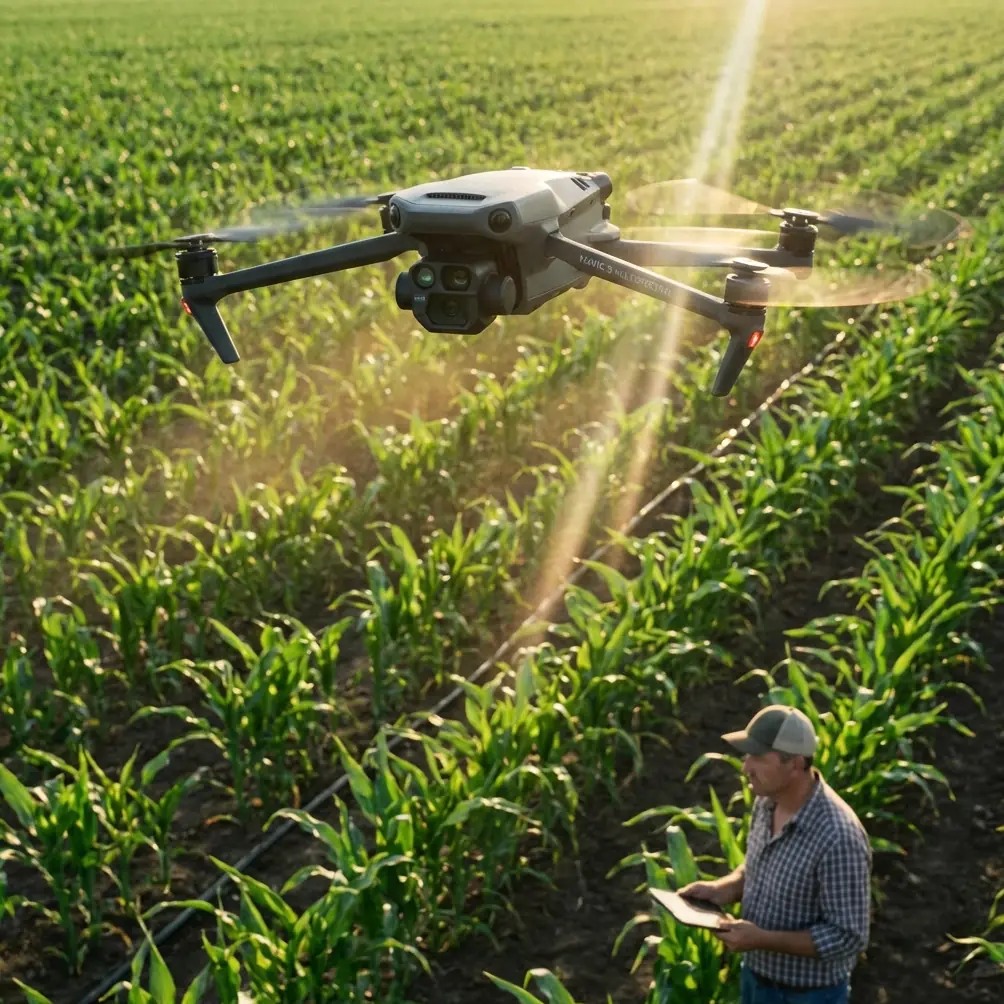
Monitoring Dusty Venues With the Mavic 3M: A Technical Field Review
META: Practical technical review of using the DJI Mavic 3M for monitoring dusty venues, with flight altitude guidance, multispectral relevance, RTK precision context, and field workflow insights.
Dust changes everything.
It softens edges, hides rutting, dulls contrast, and turns a clean aerial inspection plan into a problem of visibility, repeatability, and timing. If you are using the DJI Mavic 3M to monitor a dusty venue—whether that means a large outdoor event ground, an equestrian site, an unpaved logistics yard, a quarry-adjacent work zone, or a broad agricultural staging area—the aircraft’s value is not just in getting images from above. The value is in getting measurements and comparisons you can trust when the ground is actively fighting your sensors.
That is where the Mavic 3M becomes more interesting than a standard camera drone.
Most people hear “Mavic 3M” and immediately think agriculture. Fair enough. Its multispectral payload was built with plant analysis in mind. But in dusty venues, the same strengths that matter in crop scouting—consistent data capture, repeatable missions, and spatial accuracy—also matter for monitoring surface conditions, movement corridors, drainage behavior, temporary layout changes, and recurring dust generation points. The aircraft is not a magic answer. It is a precision tool. And dusty environments reward precision.
Why Dusty Venue Monitoring Is Harder Than It Looks
A dusty venue creates three persistent technical issues.
First, reduced visual clarity. Fine suspended particles flatten image contrast and make subtle ground features harder to interpret. Wheel tracks, erosion beginnings, pooled water margins, and surface compaction boundaries can disappear in midday haze.
Second, poor consistency between flights. Dust concentration changes by hour, traffic load, wind direction, and moisture level. If you fly once at 10 a.m. and again at 3 p.m., the difference in what you see may reflect atmospheric conditions more than actual site change.
Third, positioning matters more than operators expect. If your goal is trend monitoring—comparing one map to another over several days or weeks—small location offsets can distort conclusions. A dusty yard that appears to have widened traffic wear may simply have been mapped from a slightly different geometry.
This is why Mavic 3M operations should be built around repeatability, not just coverage.
The Mavic 3M Advantage in This Scenario
The Mavic 3M’s strongest contribution in dusty venue work is not raw speed. It is disciplined data collection.
A multispectral platform encourages operators to think like surveyors rather than casual pilots. You predefine overlap, altitude, ground sampling needs, and route geometry. That mindset is essential when dust creates variable visibility. Even if you end up relying heavily on RGB outputs for reporting, the structured workflow behind a multispectral mission improves the reliability of the end product.
The second operational advantage is RTK-based positioning. In a dusty venue, “close enough” navigation is rarely enough if your purpose is ongoing monitoring. Centimeter precision changes the conversation. It allows repeated missions over the same haul roads, pedestrian corridors, storage pads, or staging lanes with much tighter alignment. If you are comparing dust source hotspots or examining whether a watering routine actually reduced particulate generation along a route, RTK fix rate becomes a meaningful field metric rather than a marketing bullet.
A poor fix or inconsistent correction state can quietly undermine your comparison set. A stable RTK workflow keeps each pass anchored to the same real-world geometry. In practical terms, that means fewer arguments later when someone asks whether a problem area truly expanded.
The Best Flight Altitude for Dusty Venue Monitoring
If I had to give one field recommendation for this scenario, it would be this: start around 50 to 70 meters above ground level for most dusty venue monitoring missions, then adjust based on the type of detail you need.
That range tends to balance three competing needs:
- enough height to maintain a useful swath width and efficient coverage,
- enough closeness to preserve fine surface detail,
- enough distance from active dust plumes to reduce the worst local interference.
Fly too low—say in the very low-altitude range over active traffic—and you often end up inside the problem. Rotor wash can interact with loose dust, and your imagery can become more inconsistent from one pass to another. You also lose coverage efficiency fast, which matters on larger sites.
Fly too high and the venue starts to look deceptively clean. Dust-softened textures become less legible, shallow washboarding disappears, and subtle edge failures blend into the background. For temporary venues or logistics compounds, that can mean missing the exact places where operational degradation begins.
The sweet spot is not universal. If you are inspecting fine cracking, nozzle calibration test zones, or localized spray drift deposition near treatment areas, you may need lower targeted passes after a broader mapping run. But for baseline monitoring in dusty conditions, 50 to 70 meters is usually the altitude band where the Mavic 3M delivers the best compromise between clarity and repeatability.
Why Multispectral Still Matters Even Outside Pure Crop Work
Some site managers assume the multispectral payload is wasted unless you are counting plant stress. That is too narrow a view.
At dusty venues that border landscaped areas, irrigation strips, trial plots, revegetation buffers, or managed vegetation used for erosion control, multispectral data can reveal environmental side effects that ordinary RGB imaging misses. This is especially relevant where dust suppression and liquid application practices intersect. If a venue uses water trucks, misting lines, or adjacent spray programs, you need to watch more than the roadway itself.
Spray drift and uneven coverage often show up first in vegetated margins. If your venue includes planted boundaries or test strips, the Mavic 3M can help document whether treatment patterns are consistent or whether roadside edges are receiving unintended deposition. That is where the overlap between venue monitoring and agronomic workflow becomes useful. The same discipline used for crop analysis can flag pattern irregularities around non-crop operational zones.
Nozzle calibration also belongs in this conversation. In mixed-use sites where liquid suppression or application equipment is part of the routine, calibration errors can create visible asymmetry in surface darkening, runoff behavior, or vegetation response. The drone will not calibrate the nozzle for you, of course. But it can make the consequences of poor calibration obvious over time, especially when repeated missions are geospatially aligned.
The Human Factor: Good Drone Work Starts Before Takeoff
One overlooked truth about drone operations is that mature flying systems were built on lessons much older than drones themselves.
A training document cited in the reference material traces the line from early flight concepts to the Wright brothers’ successful fixed-wing flight on December 17, 1903. That date matters symbolically, but the operational takeaway matters more: controlled powered flight only became useful when lift, propulsion, and control were treated as one system. Dusty venue monitoring with the Mavic 3M is the same kind of problem. Sensor, mission design, and pilot decision-making have to work together. If one part is weak, the result degrades quickly.
That same educational source also frames unmanned aircraft as aircraft controlled through radio equipment and programmed procedures. Again, basic on paper. But in the field, this is the difference between a casual reconnaissance flight and a monitoring workflow you can defend. Programmed routes, fixed overlaps, standard altitude bands, and repeat launch geometry are what turn drone images into operational evidence.
If your team is still improvising flight lines every time the aircraft goes up, the issue is not the drone. It is the method.
Dust, Controls, and the Value of Predictable Workflow
Another reference source, a technical BLHeli manual, includes something most Mavic 3M users will never directly work with: the audible logic of programming mode entry on PWM systems. On power-up, one beep. Throttle-up detected, one beep. Full throttle to begin programming mode, then an infinite tone. Return to zero throttle, another continuous confirmation. That sequence is from a very different category of UAV hardware, but it points to a principle that remains relevant in professional operations: reliable aircraft behavior depends on unambiguous control states.
Why bring that up in an M3M field review?
Because dusty venues punish vague process. If your launch checklist, mission profile, or data handling routine is sloppy, dust will magnify every weakness. The exact ESC beep logic from legacy PWM-oriented systems is not part of Mavic 3M operation, but the mindset behind it is worth carrying forward. Aircraft systems need clear state transitions. So do human workflows. Before launch, your team should know whether the mission is for orthomosaic comparison, hotspot inspection, multispectral margin review, or drift verification. Those are different jobs. They should not share the same casual setup.
The professionals who get the most from the Mavic 3M in dusty sites are usually the ones who reduce ambiguity before the props spin.
Recommended Field Workflow for Dusty Venues
A sound Mavic 3M monitoring routine usually looks like this:
1. Fly early, if the venue allows it
Dust density often drops when traffic is lighter and surface moisture is slightly higher. Early flights usually produce cleaner baselines.
2. Use one standard altitude for trend monitoring
Pick a repeatable baseline, ideally in that 50 to 70 meter range, and stick to it for regular comparison missions. Change altitude only when there is a specific inspection reason.
3. Watch RTK fix quality before accepting the mission as comparable
A map is only as useful as its repeatability. If the RTK fix rate is unstable, your “change detection” may be mostly alignment error.
4. Separate broad mapping from detail passes
Use a wider swath width mission to map the entire venue, then run lower targeted flights over loading points, corners, water application areas, or high-traffic bottlenecks.
5. Record weather and surface conditions every time
Wind direction, visible dust plume intensity, moisture status, and operational traffic level should be logged with the flight. Otherwise, image differences can be misread.
6. Review margins, not just central lanes
Dust drift, overspray, and runoff problems often appear at the edges first. The center of a road may look acceptable while shoulders are failing.
What the Mavic 3M Is Actually Best At Here
The Mavic 3M is strongest when the question is not “What does the venue look like today?” but “What changed, exactly, and where?”
That distinction matters.
For one-off publicity imagery, almost any capable camera drone can produce attractive overheads. For disciplined monitoring in dusty conditions, you need more. You need repeatable geometry, consistent mission planning, and the ability to inspect both hard surfaces and adjacent vegetation or treatment zones in one workflow. That is where the Mavic 3M earns its keep.
If your venue operations involve dust suppression, temporary layouts, route wear, edge vegetation stress, or recurring drift concerns, the aircraft can act as a measurement platform rather than a flying camera. That is a much higher-value role.
A Consultant’s Practical Take
If I were setting up a client’s Mavic 3M program for a dusty venue tomorrow, I would not start by asking how far the drone can fly. I would ask three things:
- What site changes are you trying to prove over time?
- How often do dust conditions become operationally significant?
- Which areas need centimeter-level repeatability rather than general visual awareness?
Those answers shape everything—altitude, mission frequency, overlap, and post-processing expectations.
And if your team needs a second set of eyes on workflow design, mission templates, or data interpretation, you can reach out here for a direct field discussion: message Marcus Rodriguez on WhatsApp.
The Mavic 3M is not at its best when used like an ordinary photo drone. In dusty venue monitoring, its real strength shows up when you treat the aircraft as part of a controlled measurement system. That idea is older than modern UAVs. The Wright brothers understood that control matters as much as lift. Modern UAV training still defines drones through programmed control and remote operation. Even old ESC programming logic reminds us that clean state changes produce reliable outcomes.
Dusty sites reward operators who think that way.
Ready for your own Mavic 3M? Contact our team for expert consultation.