Urban Power Line Surveying Guide: Mavic 3M Best Practices
Urban Power Line Surveying Guide: Mavic 3M Best Practices
META: Master urban power line surveying with the Mavic 3M. Learn RTK setup, flight planning, and data processing techniques for centimeter precision results.
TL;DR
- RTK Fix rate above 95% ensures centimeter precision for detecting power line sag and clearance violations
- Multispectral imaging identifies vegetation encroachment before it becomes a hazard
- Optimal urban flight parameters: 50m AGL, 8m/s speed, 80% front overlap
- Proper nozzle calibration of thermal sensors prevents false readings near heat-generating infrastructure
Why Urban Power Line Surveying Demands Specialized Equipment
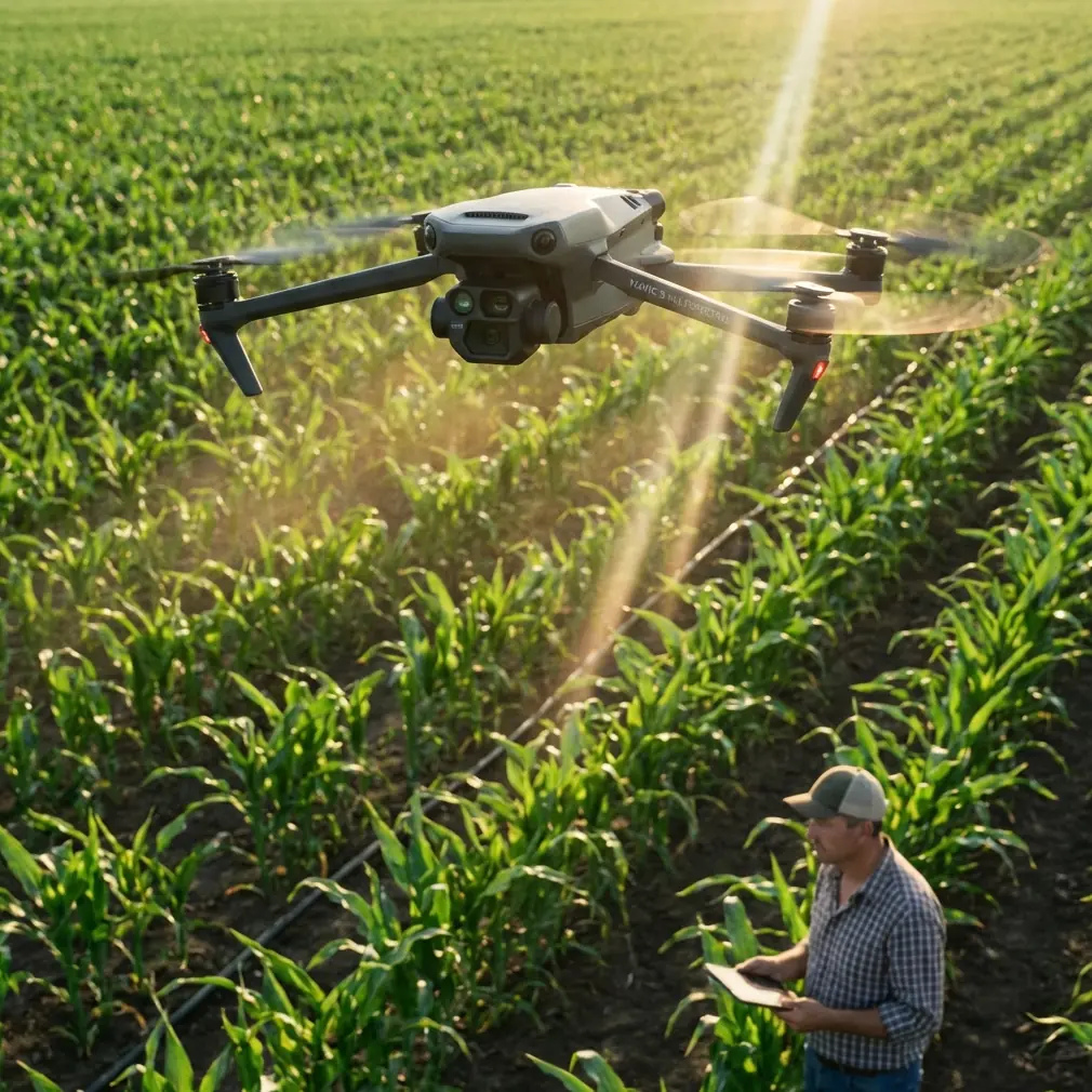
Traditional helicopter inspections cost utilities 15-20 times more than drone-based alternatives. The Mavic 3M transforms this equation with its integrated RTK module and multispectral sensor array, delivering survey-grade accuracy in environments where GPS signals bounce between buildings and electromagnetic interference runs rampant.
Urban corridors present unique challenges. Reflective surfaces, radio frequency congestion, and complex airspace restrictions require equipment that adapts in real-time. During a recent inspection along a metropolitan transmission corridor, the Mavic 3M's obstacle avoidance system detected and navigated around a red-tailed hawk nest positioned just 3 meters from the primary conductor—a hazard that would have caused a collision with less sophisticated equipment.
Pre-Flight Planning for Urban Environments
Establishing Ground Control Points
Centimeter precision starts on the ground. Place a minimum of 5 GCPs per kilometer of transmission line, with additional points at every direction change exceeding 30 degrees.
Position GCPs according to these specifications:
- Minimum 10m clearance from metallic structures
- Visible from at least 3 planned flight positions
- Recorded coordinates in the local projection system
- Marked with high-contrast targets measuring 40cm x 40cm minimum
RTK Base Station Configuration
The Mavic 3M achieves its advertised centimeter precision only when RTK Fix rate remains consistently high. Urban environments challenge this through multipath interference and signal obstruction.
Configure your base station with these parameters:
- Elevation mask: 15 degrees (higher than rural settings to reject reflected signals)
- PDOP threshold: 2.0 maximum
- Minimum satellites: 12 (using GPS + GLONASS + Galileo constellations)
- Update rate: 5Hz for kinematic applications
Expert Insight: Mount your RTK base station on a non-metallic tripod at least 50m from transmission infrastructure. Steel lattice towers create electromagnetic shadows that degrade correction signals, causing RTK Fix rate to plummet below usable thresholds.
Flight Path Optimization
Urban power line corridors rarely follow straight paths. The Mavic 3M's mission planning software accommodates this reality, but optimal results require manual refinement.
Calculate your swath width using this formula: Swath = (2 × AGL × tan(FOV/2))
For the Mavic 3M's 84-degree field of view at 50m AGL, this yields approximately 92m swath width. However, urban obstructions typically reduce usable coverage to 60-70m, requiring tighter flight line spacing.
Sensor Configuration for Infrastructure Assessment
Multispectral Band Selection
The Mavic 3M captures data across four discrete spectral bands plus RGB. Each serves specific inspection purposes:
| Band | Wavelength (nm) | Primary Application |
|---|---|---|
| Green | 560 | Vegetation health baseline |
| Red | 650 | Chlorophyll absorption detection |
| Red Edge | 730 | Early stress identification |
| NIR | 860 | Biomass and moisture content |
| RGB | Visible | Visual documentation |
For vegetation encroachment analysis, the NDVI calculation (NIR - Red)/(NIR + Red) identifies plants approaching conductors weeks before visual symptoms appear.
Thermal Calibration Considerations
While the Mavic 3M's primary strength lies in multispectral imaging, understanding thermal limitations prevents misinterpretation. Urban environments contain numerous heat sources—HVAC units, vehicle exhaust, reflective surfaces—that create thermal noise.
Nozzle calibration principles apply to thermal sensor maintenance. Just as agricultural operators verify spray drift patterns, infrastructure inspectors must validate thermal readings against known reference temperatures before each mission.
Pro Tip: Carry a portable blackbody calibration source set to ambient temperature plus 20°C. Capture a reference image at mission start and end. Drift exceeding 2°C indicates sensor recalibration is necessary before data processing.
Executing the Urban Survey Mission
Launch Site Selection
Urban environments restrict launch options. Identify locations meeting these criteria:
- Minimum 30m × 30m clear area
- No overhead obstructions within 45-degree cone
- Ground surface suitable for RTK base station stability
- Legal access with appropriate permissions documented
- Line of sight to first waypoint
Real-Time Monitoring Parameters
During flight, continuously monitor these indicators:
- RTK Fix status (must show "FIX" not "FLOAT")
- Battery temperature (optimal range: 20-40°C)
- Obstacle avoidance system status
- Image capture confirmation
- Wind speed relative to IPX6K rating limitations
The IPX6K rating protects against water ingress, but wind-driven rain at speeds exceeding 10m/s can still affect sensor clarity. Abort missions when conditions approach these thresholds.
Handling Signal Degradation
Urban canyons cause predictable RTK degradation. When Fix rate drops below 90%, the Mavic 3M automatically increases image overlap to compensate. This behavior consumes battery faster and extends mission duration.
Mitigate signal issues through:
- Pre-planned waypoint holds at high-visibility positions
- Secondary NTRIP correction sources as backup
- Post-processed kinematic (PPK) workflow preparation
- Mission segmentation at known problem areas
Post-Processing Workflow
Data Organization Structure
Organize captured data immediately upon landing:
Project_Name/
├── Raw_Images/
│   ├── RGB/
│   ├── Multispectral/
│   └── Metadata/
├── GCP_Data/
├── Flight_Logs/
└── Processed_Outputs/
Point Cloud Generation
The Mavic 3M's 20MP RGB sensor combined with RTK positioning generates point clouds with sub-centimeter relative accuracy. Process using these parameters:
- Tie point density: High
- Depth filtering: Aggressive (removes power line ghosting)
- Point cloud densification: Ultra High
- Coordinate system: Match local utility standards
Vegetation Analysis Protocol
Calculate NDVI across the entire corridor, then apply threshold filtering:
- NDVI > 0.6: Healthy vegetation requiring monitoring
- NDVI 0.3-0.6: Stressed vegetation, potential die-off
- NDVI < 0.3: Non-vegetated or dead material
Flag any vegetation with NDVI > 0.4 within 3m horizontal distance of conductors for immediate field verification.
Common Mistakes to Avoid
Ignoring multipath effects on RTK accuracy. Urban surveyors often trust RTK Fix indicators without verifying actual precision. Always validate against known GCP coordinates—discrepancies exceeding 3cm indicate compromised data.
Flying during peak electromagnetic interference. Rush hour traffic, industrial operations, and broadcast schedules create RF noise that degrades both RTK corrections and command links. Schedule missions during low-activity windows when possible.
Underestimating battery consumption in urban environments. Constant obstacle avoidance calculations, frequent altitude adjustments, and signal searching drain batteries 20-30% faster than rural operations. Plan missions for 65% of rated flight time maximum.
Neglecting to verify swath width assumptions. Building shadows, trees, and infrastructure reduce effective coverage. Always capture test images at mission altitude before committing to flight line spacing.
Processing multispectral data without radiometric calibration. Atmospheric conditions, time of day, and sensor temperature affect spectral readings. Capture calibration panel images within 15 minutes of each flight segment.
Frequently Asked Questions
What RTK Fix rate is acceptable for utility-grade surveys?
Utility companies typically require 95% minimum RTK Fix rate for regulatory compliance. However, this threshold applies to the final deliverable, not raw capture. Post-processed kinematic corrections can recover data captured during brief Float periods, provided base station logs are complete and satellite geometry remained favorable.
How does the Mavic 3M handle electromagnetic interference near high-voltage lines?
The Mavic 3M's shielded compass and redundant IMU systems maintain orientation accuracy within 5m of energized conductors up to 500kV. Closer approaches require de-energized conditions. The multispectral sensors show no measurable degradation from electromagnetic fields at any distance where safe flight is possible.
Can multispectral data detect conductor damage, or only vegetation issues?
While primarily designed for agricultural applications, the Mavic 3M's multispectral sensors detect surface oxidation and corrosion on aluminum conductors through altered reflectance patterns. This capability supplements but does not replace dedicated thermal or corona detection equipment for comprehensive conductor assessment.
Achieving Consistent Results
Urban power line surveying with the Mavic 3M requires methodical preparation and disciplined execution. The platform's centimeter precision capabilities only manifest when operators respect environmental limitations and follow calibration protocols rigorously.
Document every mission parameter. Conditions that produced excellent results in one corridor may fail in another due to subtle differences in RF environment, building geometry, or atmospheric conditions. Build a location-specific knowledge base that informs future planning.
The combination of RTK positioning, multispectral imaging, and robust obstacle avoidance makes the Mavic 3M uniquely suited for urban infrastructure work. Operators who master its capabilities deliver data that transforms utility maintenance from reactive emergency response to predictive asset management.
Ready for your own Mavic 3M? Contact our team for expert consultation.