Mavic 3M Field Report: What New Drone Insurance
Mavic 3M Field Report: What New Drone Insurance and Enforcement Signals Mean for Coastal Forest Missions
META: A field-based expert analysis of how new drone insurance rules, a high-voltage accident, and commercial UAS market expansion affect Mavic 3M operations in coastal forest mapping.
By Marcus Rodriguez, Consultant
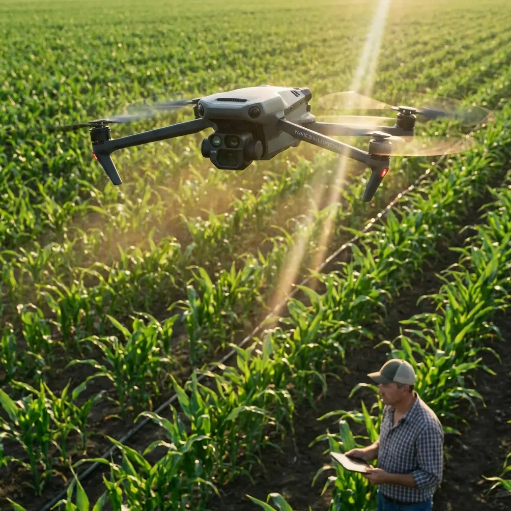
The Mavic 3M sits in an interesting place in the drone market. It is not built for spectacle. It is built for decisions. That matters in coastal forest work, where a flight is rarely just about collecting imagery. It is about producing defensible data under pressure from weather, terrain, safety rules, and increasingly, insurance and liability expectations.
That is why three recent drone industry developments deserve more attention from Mavic 3M operators than they may appear to at first glance. On March 20, 2026, Volatus Aerospace moved up to the Toronto Stock Exchange under the ticker FLT, a signal that large-scale commercial and government drone operations are maturing fast. In Chongqing, the first compulsory drone liability insurance policy reportedly landed in what was described as a national first. And in Sichuan, a timber-lift operation went badly wrong when a drone’s towing line became entangled with high-voltage power lines, causing a localized outage, an 8000 yuan compensation outcome for the company involved, and 5 days of administrative detention for the pilot tied to rule-breaking flight conduct.
None of those stories is specifically about the Mavic 3M. All of them matter to anyone flying one in demanding environments.
For coastal forestry teams, the takeaway is clear: the market is rewarding scalable, disciplined drone operations, while regulators and law enforcement are becoming less tolerant of sloppy field execution. The Mavic 3M can absolutely thrive in that environment, but only when it is treated as part of a professional workflow rather than a clever flying camera.
Why this matters in the field
Let’s place this in a real mission profile.
You are mapping a coastal forest block after a week of high winds and salt-heavy marine air. The goal is to capture multispectral data for canopy vigor, stress detection, access route assessment, and early signs of washout near timber roads. The light changes quickly. The tree line is uneven. Moisture hangs low over the understory. On one edge of the site, power infrastructure runs close enough to matter. On another, marsh birds are active at first light.
This is where the Mavic 3M earns its keep. Its multispectral payload is useful because forest managers are rarely asking for pretty pictures. They want measurable variation. They want to see where health is declining before that decline becomes obvious from the ground. In coastal conditions, that can mean identifying stress tied to salt exposure, waterlogging, or uneven recovery after storm events. Multispectral capture helps separate apparent greenness from actual vegetation performance.
But the aircraft alone does not make the mission professional. The operating framework does.
The recent Sichuan incident is a sharp example. A towing line wrapped around a high-voltage wire during a wood-lifting operation and caused a power outage. That is not the same use case as a Mavic 3M mapping flight, of course. Still, the operational lesson is directly relevant: once drone work overlaps with critical infrastructure, the cost of poor judgment escalates quickly. In that case, the aftermath reportedly included both financial liability and personal detention. For forest operators working in coastal corridors where utility lines often cut through access roads and harvest blocks, this is not abstract risk. It is route planning, altitude discipline, and buffer management.
A Mavic 3M mission should never drift into the improvisational habits common in lower-discipline operations. No suspended loads. No casual rerouting near wires. No assumption that a licensed pilot is automatically a compliant pilot. The report makes that point brutally well. Certification does not cancel consequences.
The insurance story is bigger than it looks
The Chongqing development may prove just as important over time. A first compulsory drone liability insurance issuance, especially when framed as a national first, suggests a broader direction of travel: more drone operations will be expected to sit inside formal risk-transfer systems rather than informal operator responsibility.
For Mavic 3M users, this changes the planning conversation. Insurance is not only about post-incident recovery. It changes who gets approved to fly, who wins contracts, and which operators are viewed as credible by landowners, forestry managers, utilities, and public-sector clients.
In coastal forest work, there are plenty of ways a mission can create downstream exposure even without a crash. A takeoff area near public trails. A survey line crossing adjacent private land boundaries. Wildlife disturbance complaints. An emergency landing in a marsh access corridor. Data collection near infrastructure. If mandatory liability products spread, operators who already document procedures well will have an advantage.
That means your field pack should include more than batteries and reflectance panels. It should include a mission method that stands up to outside scrutiny:
- documented preflight risk review
- clear operating boundaries around lines, roads, and sensitive zones
- airspace and local restriction checks
- crew role assignment, even on small teams
- incident logging and postflight traceability
This is where a Mavic 3M program can separate itself. Because the aircraft is often deployed for analytical work rather than casual imaging, it naturally fits a more disciplined operating model. Operators who embrace that now will be better positioned if insurance expectations harden in more regions.
What the Volatus listing tells us about your next client
The Volatus Aerospace move to the Toronto Stock Exchange under FLT is a capital markets story on the surface. For the field operator, it is really a market validation story.
The company’s stated direction centers on scaling integrated uncrewed systems and autonomy solutions for commercial and government customers. That matters because it reflects where institutional buying is heading. Large customers are not looking for isolated drone flights anymore. They want repeatable outcomes, documented safety culture, and systems that connect aircraft, data, compliance, and decision support.
For a consultant running Mavic 3M missions in coastal forests, this is good news if you are prepared correctly. It means the market is becoming more favorable to operators who can explain not just how they fly, but how their flights fit into a broader management system. Multispectral outputs become more valuable when paired with repeatability, positional confidence, and usable interpretation.
That is also why terms like RTK fix rate and centimeter precision matter in conversations that are supposedly about forestry. A stressed stand mapped in March only becomes operationally useful if it can be compared with April and June with enough positional consistency to trust the change signal. Coastal forests are messy environments. Sloped canopy, variable wind, reflective water edges, and patchy access all challenge consistency. When your positional performance is tight, your analysis carries more weight.
The broader commercial trend represented by Volatus suggests clients will increasingly ask harder questions:
- Can this dataset be repeated at the same standard?
- How do you document mission risk?
- What is your liability coverage position?
- Can your results support regulatory or insurance-facing decisions?
- How do you handle operations near infrastructure or public exposure zones?
If your Mavic 3M workflow answers those questions cleanly, you are aligned with where the industry is going.
A coastal forest example that brings this together
On a recent early-morning reconnaissance pattern along a coastal stand edge, the aircraft picked up movement near a drainage cut where the canopy opened into reeds. Through the live feed and situational awareness cues, it was clear a large heron had moved into the corridor and was tracking the aircraft’s position. That changed the flight immediately. We widened the stand-off, adjusted the pass direction, and delayed one segment until the bird cleared the area.
This kind of moment rarely makes it into marketing copy, but it should shape real mission planning. Coastal forests are not sterile work zones. They are active habitats. A sensor platform like the Mavic 3M helps because it gives the crew the situational awareness to adapt without sacrificing the mission, but only if the operator is disciplined enough to react properly.
That same mindset applies to infrastructure hazards. If a drainage channel, roadside span, or utility crossing compresses your safe flight envelope, the mission plan must bend before the risk does. The Sichuan case shows what happens when that hierarchy is reversed.
What Mavic 3M operators should change now
The immediate lesson is not panic. It is maturity.
If you are flying the Mavic 3M for coastal forest capture, tighten the parts of your operation that clients do not see but regulators, insurers, and investigators absolutely will.
Start with site segmentation. Break the mission area into zones based on hazard profile, not just map efficiency. A block near power lines should not be treated the same as an interior canopy section. A shoreline edge with bird activity should not be flown like a stable inland corridor.
Next, treat repeatability as a deliverable. Multispectral missions live or die on consistency. Maintain stable altitude logic over changing canopy, preserve overlap discipline, and watch the RTK fix rate closely if your workflow depends on high positional confidence. Centimeter precision is not just a spec-sheet talking point. In forestry, it affects whether trend analysis is credible or noisy.
Then revisit your documentation stack. Insurance developments like the Chongqing first-policy event suggest the administrative side of drone work is becoming part of operational competence. If a client, authority, or underwriter asks how you manage risk, your answer should exist in writing before the question arrives.
That includes emergency planning. Coastal conditions can deteriorate quickly. Wind shear at the canopy top, moisture ingress risk, and changing visibility all affect mission margins. While the Mavic 3M is a sophisticated platform, no professional operator should let aircraft confidence outrun environmental judgment.
And finally, be honest about mission creep. The Sichuan story involved aerial lifting, not mapping, but the underlying behavior pattern appears familiar across the industry: once teams get comfortable with drones, they start stretching operational boundaries. A mapping aircraft gets asked to inspect a structure more closely than planned. A survey route gets pushed nearer to energized assets. A forest mission adds improvised tasks because the drone is already airborne.
That is exactly how preventable incidents begin.
The bigger picture for Mavic 3M in 2026
These three developments form a coherent signal.
One signal says capital is flowing toward serious, integrated drone operations serving commercial and government clients. Another says regulators are formalizing financial accountability through insurance structures. The third says enforcement can become very personal, very quickly, when operators ignore boundaries around safety-critical environments.
For Mavic 3M users in coastal forestry, that combination should sharpen strategy. This aircraft remains one of the most practical tools for gathering multispectral intelligence in difficult terrain, but its real value grows when paired with process discipline. The future belongs to operators who can produce reliable vegetation data and prove that they flew responsibly to get it.
That is the difference between simply capturing a forest and delivering information a client can trust.
If your team is refining coastal forest workflows, building multispectral capture standards, or pressure-testing compliance procedures around infrastructure and liability, you can share your mission profile here: message me directly on WhatsApp.
Ready for your own Mavic 3M? Contact our team for expert consultation.