How to Map Venues with Mavic 3M in Extreme Temps
How to Map Venues with Mavic 3M in Extreme Temps
META: Master venue mapping in extreme temperatures with the Mavic 3M. Expert techniques for thermal management, RTK accuracy, and reliable data capture in harsh conditions.
TL;DR
- Extreme temperatures between -10°C to 40°C require specific pre-flight protocols and battery management strategies for reliable venue mapping
- RTK Fix rate drops significantly in temperature extremes—learn antenna positioning techniques that maintain centimeter precision
- Electromagnetic interference at large venues demands systematic antenna adjustment procedures covered in this guide
- Multispectral imaging calibration shifts with temperature; proper compensation ensures accurate orthomosaic outputs
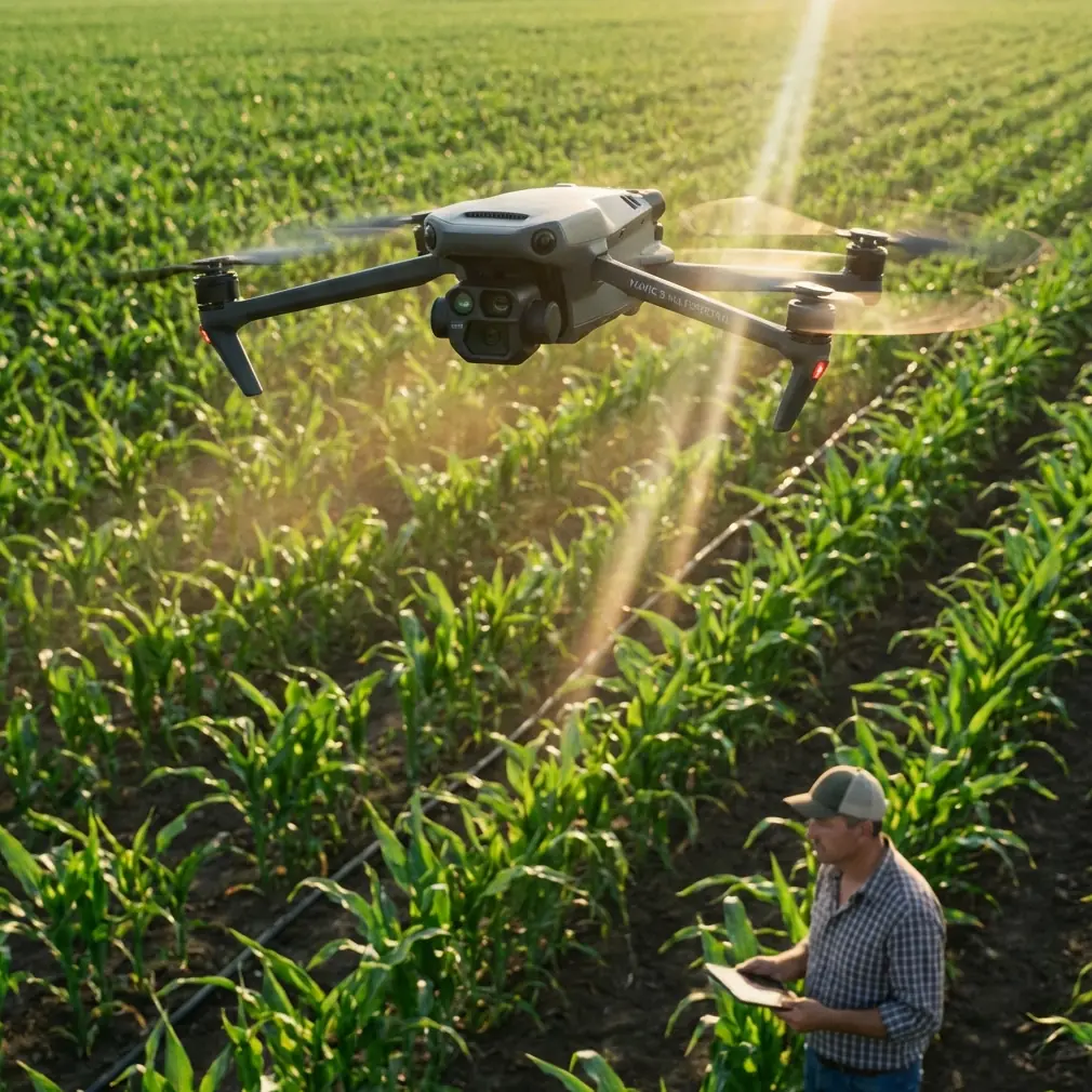
Large-scale venue mapping in extreme temperatures exposes every weakness in your workflow. The Mavic 3M handles thermal stress better than most enterprise platforms, but only when operators understand its environmental limits and compensation techniques. This guide breaks down the exact protocols I use for stadium, arena, and outdoor venue mapping when temperatures push equipment to the edge.
Understanding Thermal Challenges in Venue Mapping
Venue mapping presents unique challenges that compound in extreme temperatures. Stadiums create thermal microclimates—concrete structures absorb and radiate heat differently than surrounding areas, creating unpredictable air currents that affect flight stability.
The Mavic 3M's operating temperature range of -10°C to 40°C provides a workable envelope, but optimal performance occurs between 5°C and 35°C. Outside this sweet spot, you'll encounter battery capacity reduction, sensor calibration drift, and potential RTK signal degradation.
Cold Weather Considerations
Below 0°C, lithium-polymer batteries lose approximately 10-15% capacity for every 10-degree drop. The Mavic 3M's intelligent battery system provides some thermal management, but pre-flight warming remains essential.
Cold air density increases lift efficiency, allowing slightly longer flight times despite reduced battery capacity. However, propeller flexibility decreases, making pre-flight inspections critical for detecting micro-cracks that could propagate during operation.
Hot Weather Considerations
Above 35°C, the primary concern shifts to processor thermal throttling and sensor noise. The Mavic 3M's multispectral imaging system generates significant heat during continuous capture, and ambient temperatures compound this thermal load.
Heat shimmer from venue surfaces—particularly artificial turf, metal roofing, and parking structures—creates image distortion that no amount of post-processing can fully correct. Flight timing becomes your primary mitigation strategy.
Handling Electromagnetic Interference at Large Venues
Stadium and arena environments present some of the most challenging electromagnetic landscapes for drone operations. Broadcasting equipment, LED display systems, security infrastructure, and mobile device concentrations create interference patterns that shift throughout the day.
During a recent mapping project at a 45,000-seat stadium, I encountered RTK signal dropouts that initially seemed random. Systematic antenna adjustment revealed the pattern—the venue's distributed antenna system for cellular coverage created interference zones that moved as the system load-balanced throughout the day.
Antenna Positioning Protocol
The Mavic 3M's integrated antennas perform well in typical environments, but venue mapping requires deliberate positioning strategies:
- Maintain minimum 30-degree elevation from major RF sources during takeoff and landing
- Position the remote controller with clear sky view, avoiding overhead structures that create multipath interference
- Orient the aircraft's nose toward the controller during critical RTK acquisition phases
- Establish RTK lock before entering high-interference zones rather than attempting acquisition within them
Expert Insight: When RTK Fix rate drops below 95% during venue mapping, don't immediately blame the base station. Check for newly activated venue systems—LED walls, broadcast trucks, and event lighting often operate on frequencies that interact with GNSS signals. A 15-minute delay while systems stabilize often resolves persistent float conditions.
Swath Width Optimization for Interference Zones
Electromagnetic interference rarely distributes uniformly across venues. Mapping flight paths that minimize time in high-interference zones while maintaining adequate swath width overlap requires pre-mission RF surveys.
I use a simple protocol: fly a perimeter reconnaissance flight while monitoring RTK status. Mark zones where Fix rate drops below 98%, then design primary mapping missions that cross these zones perpendicular to their longest axis, minimizing exposure time.
Temperature-Compensated Multispectral Calibration
The Mavic 3M's multispectral imaging capabilities make it exceptional for venue vegetation assessment, surface condition analysis, and thermal mapping. However, sensor response curves shift with temperature, affecting data accuracy.
Pre-Flight Calibration Protocol
Standard reflectance panel calibration assumes stable temperatures. In extreme conditions, implement this modified protocol:
- Allow the aircraft to reach ambient temperature equilibrium before calibration—minimum 10 minutes in cold conditions, 5 minutes in heat
- Capture calibration images with the multispectral sensor, not just RGB
- Record ambient temperature at calibration time for post-processing compensation
- Re-calibrate if ambient temperature shifts more than 8°C during the mission
Sensor-Specific Temperature Effects
Each spectral band responds differently to temperature changes:
| Spectral Band | Cold Sensitivity | Heat Sensitivity | Compensation Priority |
|---|---|---|---|
| Green (560nm) | Low | Moderate | Standard |
| Red (650nm) | Low | Low | Standard |
| Red Edge (730nm) | Moderate | High | Critical |
| NIR (860nm) | High | Moderate | Critical |
The Red Edge and NIR bands require the most attention in extreme temperatures. These bands drive most vegetation indices, making their accuracy essential for turf condition assessment and landscape health monitoring.
Pro Tip: For venue turf mapping in temperatures above 35°C, schedule flights for the first two hours after sunrise. Surface temperatures remain manageable, heat shimmer stays minimal, and the low sun angle actually improves multispectral contrast for stress detection.
RTK Configuration for Centimeter Precision
Venue mapping demands centimeter precision for construction verification, as-built documentation, and change detection over time. The Mavic 3M's RTK module delivers this accuracy, but extreme temperatures affect both the aircraft and ground station components.
Cold Weather RTK Protocol
Below 5°C, implement these RTK-specific procedures:
- Pre-warm the RTK module by powering the aircraft 15 minutes before flight
- Use network RTK (NTRIP) when available—ground-based base stations suffer similar cold-related drift
- Increase observation time at ground control points by 50% to compensate for slower signal acquisition
- Monitor RTK Fix rate continuously; cold-induced receiver drift often manifests as gradual Fix rate degradation rather than sudden loss
Hot Weather RTK Protocol
Above 30°C, thermal expansion affects antenna phase centers and receiver electronics:
- Shade the remote controller and any ground base station equipment
- Allow 5-minute thermal stabilization after powering on before accepting RTK Fix
- Reduce continuous flight time to 20-minute segments with cooling breaks
- Position ground control points on thermally stable surfaces—avoid dark pavement that may shift during the survey
Nozzle Calibration Considerations for Agricultural Venues
Some venue mapping projects involve agricultural components—golf courses, equestrian facilities, and multi-use complexes with maintained turf areas. While the Mavic 3M isn't a spray platform, understanding nozzle calibration and spray drift patterns helps interpret multispectral data from recently treated areas.
Chemical applications create spectral signatures that persist for 24-72 hours depending on product type and environmental conditions. Scheduling mapping flights outside this window prevents false positives in vegetation stress analysis.
For facilities that use the Mavic 3M alongside agricultural spray drones, coordinate mapping and treatment schedules to capture pre-treatment baselines and post-treatment efficacy data at consistent intervals.
IPX6K Weather Resistance in Practice
The Mavic 3M's IPX6K rating provides protection against high-pressure water jets, but this rating applies to specific test conditions that don't perfectly translate to field operations.
What IPX6K Actually Means for Venue Mapping
The rating covers protection against 100 liters per minute water projection from 3 meters at pressures up to 1000 kPa. In practical terms, this handles:
- Heavy rain during emergency recovery flights
- Morning dew accumulation on aircraft surfaces
- Spray from irrigation systems during active mapping
- Condensation from rapid temperature transitions
What IPX6K Doesn't Cover
The rating doesn't address:
- Prolonged submersion (don't land in puddles)
- Salt water exposure (coastal venues require post-flight cleaning)
- Fine particulate intrusion (dust storms, sandblasting)
- Chemical exposure (fertilizers, cleaning agents, de-icing compounds)
Common Mistakes to Avoid
Ignoring battery temperature warnings: The Mavic 3M provides thermal warnings for good reason. Pushing past these limits doesn't just risk the current flight—it permanently degrades battery capacity and creates safety hazards.
Calibrating once for multi-day projects: Temperature-sensitive calibration data expires faster than you'd expect. Re-calibrate at minimum every 4 hours during extreme temperature operations, and always after significant ambient temperature shifts.
Trusting RTK Fix without verification: A reported Fix doesn't guarantee accuracy. Verify against known control points before committing to production mapping, especially when electromagnetic interference is present.
Overlooking thermal expansion in GCPs: Ground control point markers on dark surfaces can shift several millimeters during a mapping session as thermal expansion affects the underlying material. Use light-colored, thermally stable marker materials.
Flying maximum mission duration: In extreme temperatures, plan missions at 70-80% of theoretical maximum duration. This buffer accounts for increased power consumption, provides emergency reserves, and reduces thermal stress on all components.
Frequently Asked Questions
How do I maintain RTK Fix rate above 95% at venues with active broadcasting equipment?
Schedule mapping during broadcast equipment downtime when possible. When that's not feasible, conduct an RF survey flight to identify interference zones, then design flight paths that minimize time in these areas. Maintain higher altitude over interference sources—the inverse square law works in your favor. Consider network RTK over local base stations, as the distributed correction network often provides more stable solutions in complex RF environments.
What's the minimum temperature for reliable multispectral data collection?
The Mavic 3M's multispectral sensor operates down to -10°C, but data quality degrades below 0°C due to increased sensor noise and calibration drift. For critical vegetation analysis, maintain ambient temperatures above 5°C. If cold-weather mapping is unavoidable, increase image overlap to 80/80 front/side and plan for extended post-processing to compensate for noise.
How often should I recalibrate the multispectral sensor during extreme temperature operations?
Recalibrate whenever ambient temperature changes by more than 8°C from your last calibration, or every 4 hours during continuous operations. In rapidly changing conditions—morning operations that extend into midday heat—consider mid-mission calibration breaks. The time investment pays dividends in data accuracy and reduces post-processing correction requirements.
Ready for your own Mavic 3M? Contact our team for expert consultation.